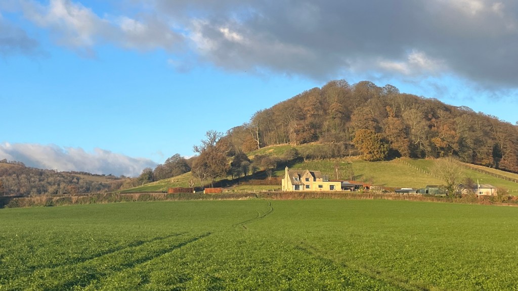
The Cotswold Way meanders through a timeless landscape of rolling fields, golden-stone villages and old forest woodlands, offering a quieter and more immersive way to experience the beauty and character of this popular tourist region. The trail weaves together quintessential English history and culture: from Iron Age hill forts to medieval churches, market towns and stately homes. Best of all, each stage ends in a village where a warm pub meal and equally warm local hospitality await.
I section-hiked the trail between November and December 2023. For a closer look at the on-the-ground experience, head over to my Cotswold Way: Trail Journal post for my stats, budget, photos and story.
- Quick Facts
- Map & Elevation Profile
- Preparation
- On-Trail Practicalities
- Side Missions & Connecting Trails
- Hiking as a Solo Woman
- Want More?
Quick Facts
| Distance | 164 km |
| Elevation gain & loss | 3,800 m |
| Days to complete | 7-10 |
| Best season | May to October |
| Trailheads | Chipping Camden; Bath |
| Recommended direction | SOBO |
Map & Elevation Profile
Preparation
Trailheads & getting there
The traditional start to the Way is in the market town of Chipping Camden, which can be reached from London by train to Moreton-in-Marsh, followed by a local bus. The trail ends in the historic city of Bath, which is connected by train to London, Bristol and other major cities. Both trailheads boast large, round bronze plaques set into the pavement to mark the start and end of the trail: at Chipping Camden, keep an eye out near the Market Hall; in Bath, look a few metres from the main (west) door to the Abbey.
Direction to Walk
You can choose to walk in either direction. SOBO hikers will have the advantage of building their trail legs before tackling the harder climbs, and fantastic, rewarding views over Bath on the final day. Hiking NOBO has its advantages, too: the biggest being that you won’t be walking with the sun in your face.
Season to Walk
Walk at any time of year; it’s beautiful here year-round. The main season is usually May to October, peaking in July-August. Spring will boast wildflowers, while autumn will bring beautiful foliage. I had a great time walking at the tail end of autumn, it felt like I was watching the seasons change.

Accommodation
Beds & Bunks
The Cotswold Way is well served by a mix of accommodations including hotels and B&Bs. Hostels are really only available in Bath. To get the true trail experience, look into staying at local pubs, many of which offer “rambler rooms”, together with hearty meals, local beers, and friendly hospitality. Given the popularity of the region, booking ahead is advised, especially during the warmer months.
Camping
Wild camping is not permitted in England, but is sometimes tolerated when performed in small numbers in remote stretches if done respectfully. Commercial campsites are few and far between; it would be a challenge to complete the entire trail relying only on these.
Gear List
Unless you’re attempting to camp this trail, you can take a very light pack. I took:
- 35L pack (smaller very do-able, this is just what I had)
- Trail runners or hiking shoes
- 2 sets hiking clothes
- 3x socks and underwear
- PJs
- Hat / beanie / buff
- Sunglasses
- Optional: town clothes and shoes
- Warm layers
- Rain layers (this is England)
- Toiletries
- Electronics
- Trekking poles – recommended for stability in muddy sections!
Possible Stages
The following table summarises the stages set out by National Trails. But the trail also passes through or close to several other villages and towns, so it’s fairly easy to find additional accommodation options. I find the easiest way to do this is to download a Google Maps version of the trail, and then search for accommodations nearby.
| Place | Distance from previous (km) (SOBO) |
|---|---|
| Chipping Camden | 0 |
| Broadway | 9.5 |
| Wood Stanway | 10.5 |
| Winchcombe | 8.8 |
| Cleeve Hill | 9 |
| Dowdeswell | 8.9 |
| Leckhampton Hill | 7.6 |
| Birdlip | 9 |
| Painswick | 13.9 |
| King’s Stanley | 12.6 |
| Dursley | 11.6 |
| Wotton-under-Edge | 11.8 |
| Hawkesbury Upton | 11.9 |
| Tomarton | 12.4 |
| Cold Ashton | 10.6 |
| Bath | 16.5 |
On-Trail Practicalities
Finding Your Way
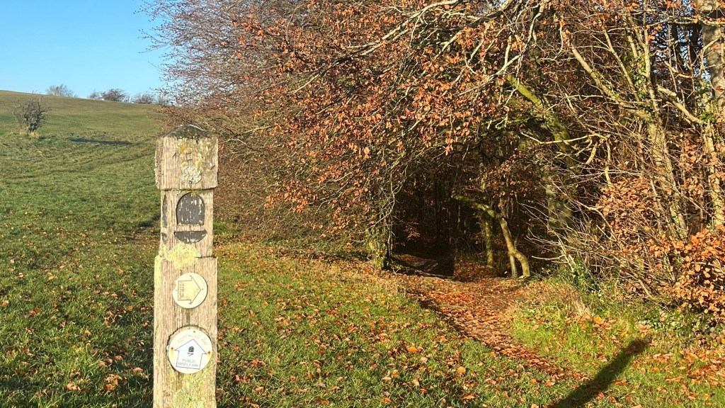
Trail Markings
Keep an eye out for the National Trails’ upside down acorn, which is the main form of trail marker. There are occasional directional signs on wooden posts, and a couple of great, old-fashioned markers, like a large stone that marks the halfway point. Trail marking is generally good throughout, although there were a few times when I had to resort to the map to check I was heading in the right direction, especially at crossroads or when trying to figure out where a gate or stile was on the opposite side of a field.
Maps & GPX
For paper maps, go with Ordnance Survey; or for those who prefer digital, check out the OS Maps app. Other digital options include the National Trails’ GPX file.
Guidebooks & Resources
There are plenty of guidebooks available for this trail, including those published by Cicerone and Trailblazer, as well as the official National Trail guide by Anthony Burton. I didn’t use a guidebook for this trail, and felt no need for one.
Food & Water
Because the trail passes through villages so often, it’s fairly easy to rely on local pubs, cafes and shops for all meals, including lunch. Most villages have at least a small convenience store; larger supermarkets are found on-trail in Winchcombe and Dursley or just off-trail in Cirencester, Gloucester, and Stonehouse / Stroud.
There are very few natural water sources on trail: if you’re tempted to rely on them, make sure you bring a filter as much of the land is used for farming. Otherwise, refills are easy in villages, just ask at the local pub.
On-Trail Transport
The trail deliberately winds through several historic Cotswold villages, where bus connections to larger villages and towns are available but infrequent – check the timetable in advance.
The trail is very accessible for those looking to section hike it from London in weekend-sized chunks. Expect one-way transit times of between 2.5-4 hours, often a combination of a local bus to a nearby train station such as Cheltenham, Gloucester, Stroud and Yate, and then a train to the city.
Money Matters
You won’t need to use cash on this trail; card is accepted everywhere.
For an idea of how to budget for the trail, check out my spending breakdown in my Cotswold Way: Trail Journal.
Side Missions & Connecting Trails
The trail is rich in accessible detours for historical and cultural interest, as well as scenic views. These are all well-signposted on trail. The area is very popular with hikers, so the opportunity for alternates and additions abound.
If you’re looking to extend your path, look into connecting with the Heart of England Way near Chipping Camden, the Macmillan Way near Broadway, or the Oxfordshire Way near Bath.
Hiking as a Solo Woman
The Cotswold Way was my first solo hike in the UK, and I loved it. I completed it in November when temperatures were dropping, so it wasn’t too busy although there were still plenty of day hikers around, all of whom were very friendly. The frequency with which it went through towns and villages gave me comfort; and mobile service was generally good throughout, although there were a couple of patchy sections. I felt perfectly safe at all times on the trail.
Want More?
Check out my Cotswold Way: Trail Journal for stats, stories and snapshots from the trail.

Leave a comment