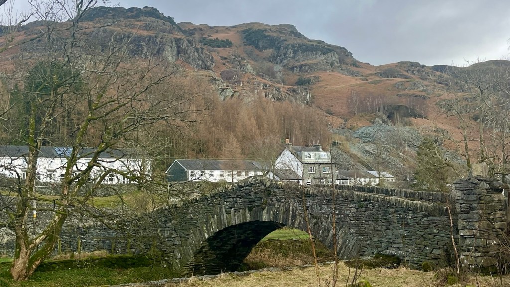
For a quieter way to experience the tourism hotspot of the Lake District, consider the Cumbria Way. The trail was developed in the 1970s by the local Ramblers Association, and traces a relatively low route through the mountains. You’ll follow a mixture of footpaths and farm tracks through some of the best landscapes the region has to offer.
I thru-hiked the trail in February 2024. For a closer look at the on-the-ground experience, head over to my Cumbria Way: Trail Journal post for my stats, budget, photos and story.
- Quick Facts
- Map & Elevation Profile
- Preparation
- On-Trail Practicalities
- Side Missions & Connecting Trails
- Hiking as a Solo Woman
- Want More?
Quick Facts
| Distance | 112 km |
| Elevation gain | + 2,900 m |
| Days to complete | 5-8 |
| Best season | Spring (April) to Autumn (October) |
| Trailheads | Ulverston; Carlisle |
| Recommended direction | Either way! |
Map & Elevation Profile
Preparation
Trailheads & getting there
The southern terminus in Ulverston and the northern terminus in Carlisle are both well connected by train from London and other major UK cities.
Direction to Walk
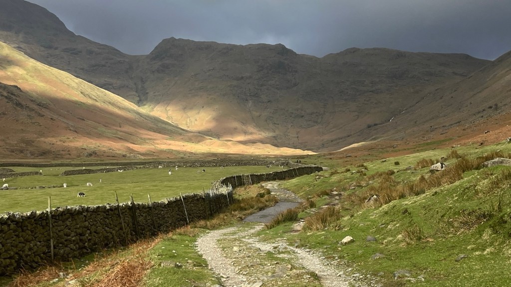
The trail can be hiked in either direction, although some say that NOBO offers better views of the landscape and a more gradual way to tackle the trail’s elevation profile. I hiked NOBO but was often turning around to look at the views behind me, so I think heading SOBO would be just as rewarding.
Season to Walk
The trail can be walked year round, although it can snow in winter so make sure you’re properly equipped if hiking in the colder months. Most people will tackle the trail’s elevation profile when it’s slightly warmer, between April and October. Summer is likely to be very busy in the Lake District; even if the trail itself isn’t crawling with thru-hikers, it runs through several of the Lake District’s most popular villages so expect lots of foot traffic.
Accommodation
Beds & Bunks
The trail runs through or close to many Lake District towns and villages. Most of these will have at least one accommodation option, whether it’s a hotel, pub stay or B&B. Some of the larger towns like Keswick, Ambleside (slightly off-trail) and Carlisle also have hostels if you’re on a budget. Many accommodation options cater to hikers, as the Lake District is a very popular outdoor destination. This also means that advance booking is wise, especially if you’re hiking between Spring and Autumn. You should also be aware that many accommodation providers will close over winter, due to the reduced tourism.
Camping
Although technically not permitted in England, wild camping is generally tolerated in much of the Lake District. Make sure you follow the Lake District National Park’s guidance. There are also several commercial campsites along the route if you’d like to stay in a tent but don’t want to flex your wild camping skills; but if you’re hiking in winter you might like to check they are open.
Gear List
For a late winter version of this trail I took:
- 35L backpack (this was just what I had; you could go smaller)
- 1 set hiking clothes (merino top and winter athletic leggings)
- 1 set spare clothes (for washing / wearing on transport)
- 3x socks and underwear
- Trail runners or hiking boots
- PJs
- Warm layers: fleece and puffer jacket
- Rain layers: jacket, pants and poncho
- Sunglasses, hat and/or buff/beanie
- Electronics
- Toiletries
- Lightweight towel (if your accommodation doesn’t provide towels, or you fancy a mid-hike swim)
- Water carrying capacity and snacks
Even in summer, it’s worth bringing rain gear and at least one warm layer: this is England, after all.
If you’re camping, of course you’ll also need your tent and sleep system. A cooking system is also a good idea, but if you’re staying in commercial campsites you could use their facilities to save yourself some weight.
Possible Stages
| Place | Distance from previous (km) (NOBO) | Distance from previous (km) (SOBO) |
|---|---|---|
| Ulverston | 0 | 24 |
| Coniston | 24 | 18 |
| Langdale | 18 | 11 |
| Rosthwaite | 11 | 13 |
| Keswick | 13 | 23 |
| Caldbeck | 23 | 23 |
| Carlisle | 23 | 0 |
In addition, there are several YHA hostels on the route or accessed by only a short detour, which don’t sit within the above villages and towns. Some of these are closed in the off-season, though. If accommodation is in short supply, you could also consider staying in a village slightly off-route. Visit Keswick’s Cumbria Way maps are a good starting place for checking out these options.
On-Trail Practicalities
Finding Your Way
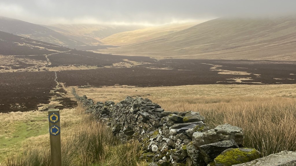
Trail Markings
The Cumbria Way is not a National Trail, so you’ll be looking for markers which say “Cumbria Way” or “CW” on them. There’s no trail symbol. These are usually attached to fences or posts. Although fairly well marked, it does get patchy in some sections so bring a map or app.
Maps & GPX
It’s a good idea to bring a map for this trail. The Ordnance Survey paper maps or app are good options, and some others are listed on cumbriawaywalk.info here.
Guidebooks & Resources
If you like guidebooks, you have plenty of options: see a list here. Notably, if you like mountain views, Cicerone has developed an alternate high route which is described in detail in its guidebook. You might also be able to find some information about the trail in regional hiking guides for Cumbria / the Lake District.
If you want to find out more about the trail Without committing to a guidebook, check out this page on Visit Keswick.
Food & Water
Pretty much every village and town along the way will boast at least a tea shop and/or a pub. A small local convenience store is also likely to be available, but your resupply options here may be limited. Keswick is the only large town directly on trail that has several shopping options, although Ambleside is only slightly off-trail and offers similar amenities.
There are several natural water sources along trail, from the famous lakes to several small rivers. If you plan to use these, bring a filter as much of the area is used for farming.
On-Trail Transport
Much of the trail winds through or close to villages and towns, most of which are connected by a local bus service to a larger hub. Check timetables, as services can be infrequent. Getting along the trail by public transport could involve some complicated logistics in certain sections. Train stations are only available at the trailheads in Ulverston and Carlisle.
Money Matters
Card is accepted everywhere; no need to bring any cash.
Side Missions & Connecting Trails
The Lake District is a hiking mecca; there’s no shortage of possible side trips from trail. The major ones include:
- Summiting the Old Man of Coniston, for views over Coniston water and surrounding fells;
- Bag a couple of Wainwrights: Rossett Pike and Castle Crag can both be accessed via detours from the trail;
- Other peak bagging including Skiddaw and Catbells; and
- Castlerigg Stone Circle, a famous prehistoric site just outside Keswick.
Less intrepid options involve detouring to or spending more time in some of the Lake District’s most iconic villages, including Ambleside, Grasmere, Windermere and Derwentwater, all rich in local culture, cafes, shops and day-hiking trails.
If you’re interested in making your trail longer, consider linking up with the Coast to Coast Path near Keswick, or the Dales Way between Ulverston and Coniston.
Hiking as a Solo Woman
I completed the Cumbria Way with a friend at the tail end of winter. It was a very quiet trail at that time of year; we rarely saw other hikers, although there were usually at least a couple of day walkers each day. Locals were friendly and welcoming, and I felt safe the entire trip, even when we came across a fox hunting party and their accompanying protestors. Mobile service was pretty good, but can be somewhat patchy, especially in the valleys. I’d be comfortable doing this hike alone, although if its your first hike the distances between villages could be challenging, so you may want to train accordingly and/or hike in the summer when the days are longer.
Want More?
Check out my Cumbria Way: Trail Journal for stats, stories and snapshots from the trail.

Leave a comment