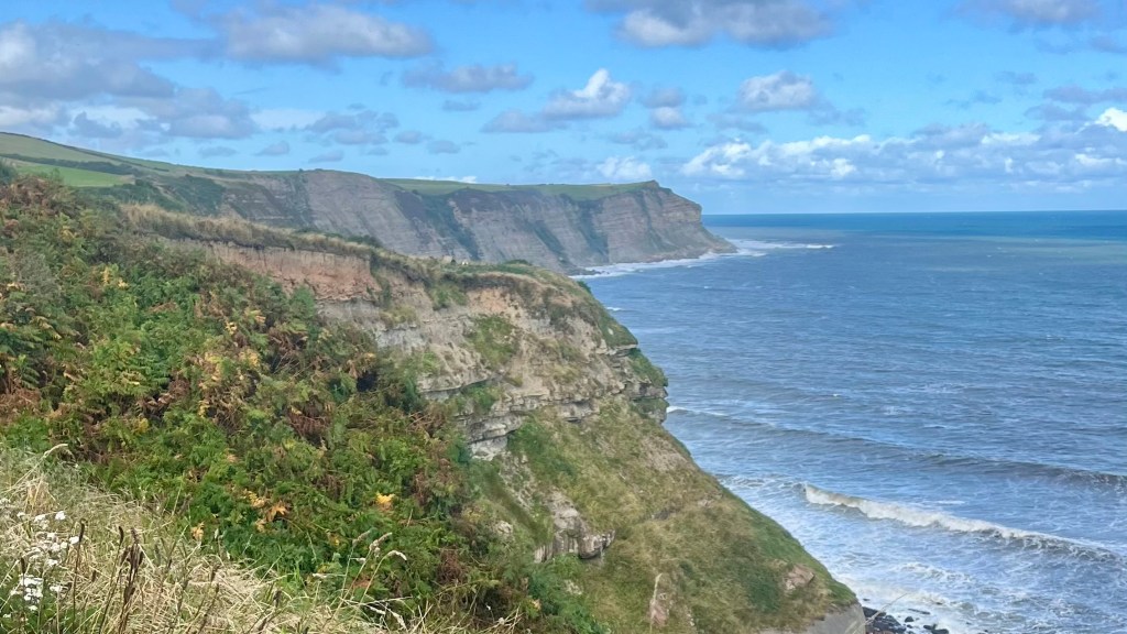
From the rugged fells of the Lake District to the windswept moors of Yorkshire, the Coast to Coast Path links some of England’s most spectacular landscapes. Developed by Alfred Wainwright in the early 1970s, it was never meant to be a single fixed route, but rather a challenge for walkers to chart their own line across the country using existing footpaths and rights of way. Fifty years on, the Coast to Coast has become one of England’s most popular long-distance walks, and in 2022 it was officially announced as the next member of the UK’s National Trails network. The decision stirred some debate amongst those who wanted the original spirit of Wainwright’s challenge to be preserved, but others will welcome the new access rights, defined route and dedicated waymarking. Its formal opening is currently planned for Spring 2026.
I thru-hiked the trail between August and September 2024. For a closer look at the on-the-ground experience, head over to my Coast to Coast Path: Trail Journal post for my stats, budget, photos and story.
- Quick Facts
- Map & Elevation Profile
- Preparation
- On-Trail Practicalities
- Side Missions & Connecting Trails
- Hiking as a Solo Woman
- Want More?
Quick Facts
| Distance | 309 km |
| Elevation gain & loss | + 8,000 m / – 8,000 m |
| Days to complete | 12-16 |
| Best season | May to September |
| Trailheads | St Bees; Robin Hood’s Bay |
| Recommended direction | Either way! |
Map & Elevation Profile
Preparation
Trailheads & getting there
The village of St Bees, located on the Irish Sea in Cumbria, is the “official” beginning of the trail: this is where Wainwright himself began the route he published in 1973, and most guidebooks follow his lead and head east. The village is connected by train; but if you’re travelling from outside the Lake District you’ll need to switch trains at a larger hub like Carlisle of Whitehaven.
The trail terminus, including a hiker logbook and end plaque located at The Bay Hotel, is found in the picturesque village of Robin Hood’s Bay, on the North Sea in North Yorkshire. To get there, or away, take a train to the nearby town of Whitby and then a bus to Robin Hoods Bay.
Direction to Walk
The trail can, of course, be walked in either direction. I chose to hike it east-bound simply for the joy of the pub finish; other people say that this direction also gives you the best light to hike in, and you’ll largely be walking with the wind rather than against it. Hiking west-bound would offer a memorable finale to the trail, and a fantastic excuse to spend more time exploring the sights and villages of the Lake District.
Season to Walk
The trail can be completed year-round, but in winter you’ll need to be prepared for potential snow and generally poorer weather conditions. Many accommodation providers also shut or offer limited services during the off-season, so logistics may be more challenging.
Most people complete the walk between May and September, when daylight hours are longest and the weather is milder.
Accommodation
Beds & Bunks
Almost every village along the route, or just slightly off it, will have at least a hotel, B&B, pub or hostel you can stay in. There’s an option to suit every budget, and many places will cater to walkers with robust meals included or available.
Camping
Officially, wild camping is not permitted in England. However, discreet, low-impact wild camping is usually possible: just make sure to follow Leave No Trace principles, and move on if the landowner asks you to. Check out this guidance from the Lake District National Park for more on where and how to wild camp.
There are also several commercial campsites along the route, as well as local farms and pubs who are happy to let you camp for a small fee: it’s entirely possible to camp the complete route. You don’t need to book these ahead of time during the main hiking season; you can simply turn up.
Gear List
Whether you’re camping or staying in accommodation, you’ll need:
- Backpack (25L for accommodation; 40-50L for camping)
- Hiking clothes (consider bringing an extra set, for washing/drying)
- PJs
- 3x socks and underwear
- Hiking shoes or trail runners
- Water capacity – at least 2L
- Electronics
- Toiletries
- First aid
- Optional but recommended: town clothes and shoes
- Optional: trekking poles
Campers will obviously need to add their tent, sleep system and cooking system. Note that not all campsites along the route offer cooking facilities, so it’s worth bringing your entire set up.
Possible Stages
In addition to those in the following table, there are a number of additional small villages within a stone’s throw of the trail which have additional accommodation options. I find the best way to research these is to download a Google Map of the route, and then search for accommodation options that suit your needs.
* Commercial or small-fee campsite available. There may be other campsites available as well, eg I passed several farms offering camp spots.
| Place | Distance from previous (km) (W2E) |
|---|---|
| St Bees* | 0 |
| Cleator | 14.5 |
| Ennerdale Bridge* | 9.7 |
| Black Sail Hostel | 14.5 |
| Rosthwaite / Seatoller / Stonethwaite* | 8 |
| Grasmere* | 12.9 |
| Patterdale* | 12.9 |
| Shap* | 24.1 |
| Orton | 12.9 |
| Kirkby Stephen* | 20.9 |
| Keld* (note there are three route options to reach Keld; distance varies between them) | 18 |
| Reeth* | 19.3 |
| Richmond* | 16.1 |
| Danby Wiske* | 24.1 |
| Ingleby Cross | 12.9 |
| Osmotherly* | 14.5 |
| Clay Bank Top / Chop Gate* | 12.9 |
| Blakey Ridge* | 14.5 |
| Glaisdale | 14.5 |
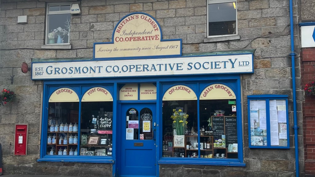
| Grosmont* | 6.4 |
| Robin Hood’s Bay* | 24.1 |
On-Trail Practicalities
Finding Your Way
Trail Markings
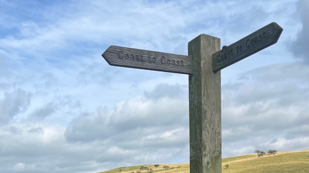
Given that up until recently the trail has been an informal route, waymarking is not complete and you will definitely need an app or map to find your way. Some of the more popular sections have occasional waymarkers; occasionally, locals have taken this into their own hands with homemade signs. As the opening of the path as a National Trail nears you can expect more waymarkers to appear; but even then it will be worth carrying that map or app with you.
Maps & GPX
You’ll need a map to complete this route. Your best bet will be the Ordnance Survey paper maps and / or app, or a GPX file. I used the GPX file included with the purchase of the Cicerone guidebook, which I added to my Garmin Explore app.
Guidebooks & Resources
The popularity of this trail means there is no shortage of guidebooks available. There’s also a wealth of information available online, so it may be possible to complete the trail without purchasing a guidebook – especially once its official National Trails opening has taken place.
I purchased the Cicerone Walking the Coast to Coast Walk: St Bees to Robin Hood’s Bay by Terry Marsh (4th ed, 2021 reprint) because I wasn’t willing to do too much research and wanted a convenient list of all paid campsites on the trail. It delivered.
Food & Water
Pubs, cafes and small village convenience stores are available in most villages, but it’s generally wise to carry your day’s lunch, water and snacks with you. Larger towns offer a wider variety of restaurants and take away options, as well as well-stocked supermarkets.
Refilling your water in villages, at pubs and public facilities, is your best bet. There are some natural water sources along the trail, but it largely passes through farmland so you’ll want to bring a filter.
On-Trail Transport
The trail often spits the walker out in, or very close to, villages and towns. Many of these will have local bus services to larger nearby towns, but services are often infrequent and seasonal. If you’re trying to skip ahead a section or two, you might be facing a few interchanges.
Money Matters
Card is accepted pretty much everywhere, but it might be worth bringing a little small change for honesty boxes. Some campsites are also cash only, so a few small notes are also probably worth bringing.
For a breakdown of what I spent in 15 days on trail, head over to my Coast to Coast Path: Trail Journal.
Side Missions & Connecting Trails
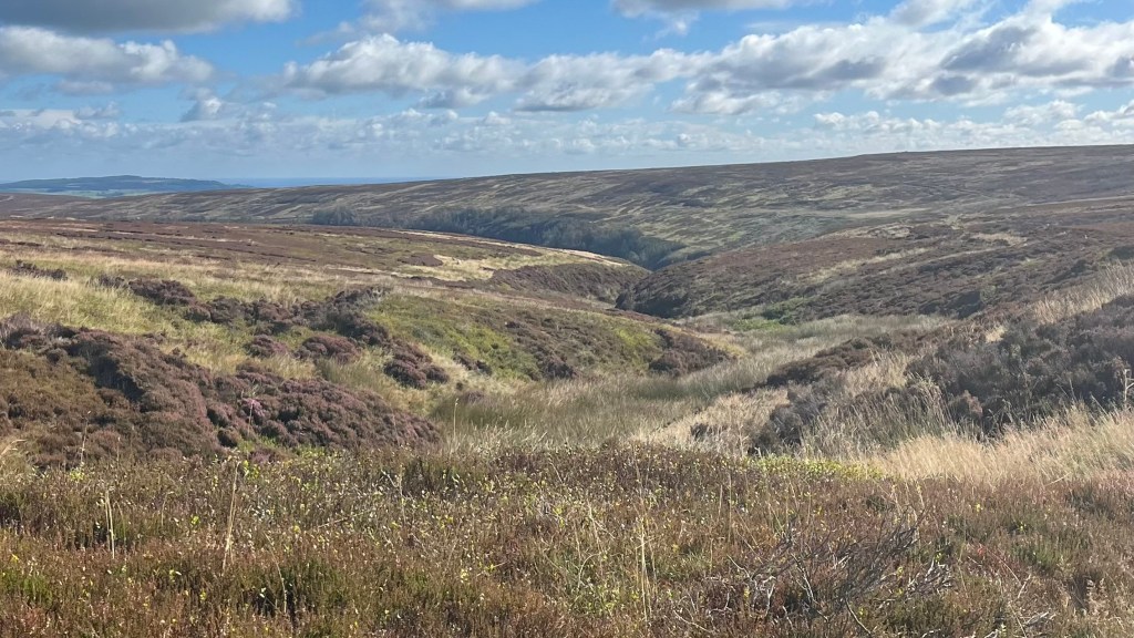
The diverse landscapes the trail traverses means there’s no shortage of potential side missions from this trail. The trail itself includes some alternates, designed for different weather situations, hiking abilities and personal interest. Peak baggers have many temptations in the Lake District, including Helm Crag near Patterdale, and High Rigg near Threlkeld; while the opportunity to tackle Ingleborough, one of the Yorkshire Three Peaks, will also tempt.
Rest days will never be boring, as the trail winds into several historic towns and villages. Stops like Grasmere, Patterdale, Richmond and Whitby offer museums, heritage sites, and many refuelling options.
Those interested in extending their hike could link up with some other long distance trails, including the Cleveland Way, which overlaps with much of the Coast to Coast in the North York Moors. Or detour off the Coast to Coast on the Pennine Way (near the Yorkshire Dales) or the Dales Way or Cumbria Way (check out my Trail Journal and How-To) in the Lake District.
Hiking as a Solo Woman
The trail is popular, and crosses many popular day-hiking spots especially in the Lake District. Hikers, and northerners, are a friendly bunch and you can expect to have many pleasant conversations on the trail. I hiked alone and always felt safe on this trail, even approaching or in the larger towns. Mobile reception can be limited in places, as the trail does pass through some remote sections.
Want More?
Check out my Coast to Coast Path: Trail Journal for stats, stories and snapshots from the trail.

Leave a comment