15 days, 310 kilometres, 8,310 metres of elevation gain. I thru-hiked the trail in August and September 2024: here’s the journey, day-by-day.
Thinking about tackling the trail yourself? Check out my Coast to Coast Path: How-To post.
- The Stats
- Trail Journal
- Day 1 – 29 August 2024: St Bees to Ennerdale Bridge
- Day 2 – 30 August 2024: Ennerdale Bridge to Borrowdale
- Day 3 – 31 August 2024: Borrowdale to Grasmere
- Day 4 – 1 September 2024: Grasmere to Patterdale
- Day 5 – 2 September 2024: Patterdale to Shap
- Day 6 – 3 September 2024: Shap to Kirkby Stephen
- Day 7 – 4 September 2024: Kirkby Stephen
- Day 8 – 5 September 2024: Kirkby Stephen to Keld
- Day 9 – 6 September 2024: Keld to Reeth
- Day 10 – 7 September 2024: Reeth to Richmond
- Day 11 – 8 September 2024: Richmond
- Day 12 – 9 September 2024: Richmond to Osmotherly
- Day 13 – 10 September 2024: Osmotherly to Blakey Ridge
- Day 14 – 11 September 2024: Blakey Ridge to Littlebeck
- Day 15 – 12 September 2024: Littlebeck to Robin Hood’s Bay
- Want More?
The Stats
Trip Summary
- Start date: 29 August 2024
- Days hiked: 13
- Zero days: 2
- Total days (hiked + zero): 15
- End date: 12 September 2024
Distance & Elevation
- Total distance: 310.36 km
- Average distance / day (hiking days only): 23.87 km
- Average distance / day (including zeros): 20.69 km
- Total elevation gain & loss: + 8,313 m / – 8,349 m
- Average elevation gain & loss / day (hiking days only): + 639 m / – 642 m
Time & Pace
- Total moving time: 73h 21m
- Average moving time / day (hiking days only): 5h 39m
- Average moving pace: 14:11/km
- Average speed: 4.23km/hr
Budget (ex gear)
| Category | Total (£) | Breakdown |
|---|---|---|
| Accommodation | 208.90 | Day 0 campsite (10); Day 1 campsite (12.5); Day 2 hostel (18); Day 3 campsite (10); Day 4 campsite (12); Day 5 campsite (7); Day 6 & 7 campsite (25); Day 8 campsite (9); Day 9 campsite (10); Day 10 & 11 campsite (20); Day 12 campsite (14.5); Day 13 campsite inc dinner and breakfast (33.9); Day 14 campsite (15); Day 15 campsite (12) |
| Food | 240.06 | Pre-departure supermarket haul (51.26); Day 1 pub (11.45); Day 3 snack (4.8); Day 4 pub (7.55); Day 5 pub (16.7); Day 6 tea + scone (8.2); Day 7 resupply (21.25); Day 7 tea + scone (6.7); Day 9 snacks (4.4); Day 9 pubs (26.20); day 9 pub (19.85); Day 10 resupply (26.9); Day 10 cafe (7.10); Day 13 snack (4.5); Day 15 pub (23.80) |
| Trailhead transport | 72.60 | Train London to St Bees (36.50); bus Robin Hood’s Bay to Scarborough (3); train Scarborough to London (33.10) |
| Other | 22.16 | Camping gas (6); guidebook (16.16) |
| TOTAL | 543.72 | Average / day: 36.25 |
Trail Journal
Day 1 – 29 August 2024: St Bees to Ennerdale Bridge
Distance: 24.28 km | Elevation gain: 789 m | Moving time: 5h 53m | Average pace: 14:32/km | Average speed: 4.13km/hr
I wake early in my tent in St Bees, my body still carrying the residue of travel: trains, planes, tents pitched in the dark. But the sea is just there and the sun promises to reveal itself, and that’s enough to keep me going.
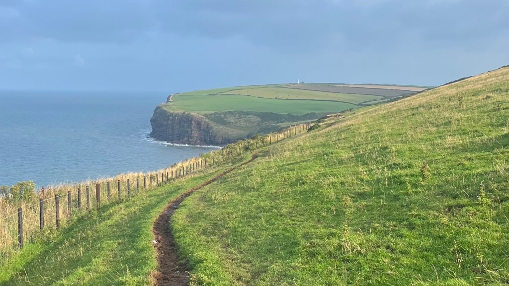
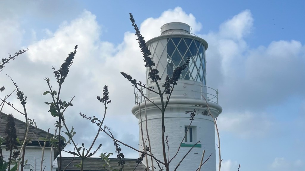
After the usual photos at the trailhead and a friendly chat with a local, I climb up along the coast. A lighthouse soon reveals itself, becoming my first goal of the day: make it there in time for a scheduled work call.
Mission accomplished, I’m on trail again, following the coast a little longer before the path swings inland through fields and farmland. Horses graze quietly and plants sway in the breeze. A pair of emus, of all things, appear unexpectedly behind a gate.
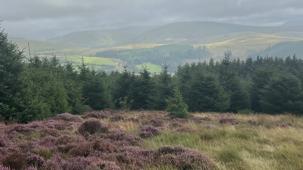
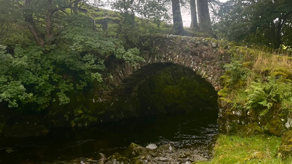
Gentle hills begin to roll out ahead, framed by tall pines and the last faded blooms of the summer heather. Clouds move in, but it’s perfect walking weather: cool and calm. The little valley at Kirk Beck is the highlight of my day: water babbling beside the path, muted purples and greens on the hillsides, everything feels hushed and peaceful.
The final kilometres into Ennerdale Bridge follow road. I pitch my tent in the garden of the Fox & Hounds pub and reward myself with a hiker-sized pub meal, before crawling into my sleeping bag early.
Day 2 – 30 August 2024: Ennerdale Bridge to Borrowdale
Distance: 23.99 km | Elevation gain: 685 m | Moving time: 6h 23m | Average pace: 15:58/km | Average speed: 3.76km/hr
I take my time this morning, easing into the day after last night’s rain. The path leads me through forest toward Ennerdale Water, where swimmers who’ve already braved the steel-grey lake are moseying back towards their cars. The light is moody and beautiful, I feel like I’m in an indie film.
I choose the route along the south bank of the lake, despite warnings that it’s tough. It looks gentle to me, and it begins gently; but eventually it does sharpen into some narrow, rocky sections that require focus when you have a full pack and tired legs. It’s slow going but manageable, although I’m relieved when the path gives way to a wide road and an easy gradient.
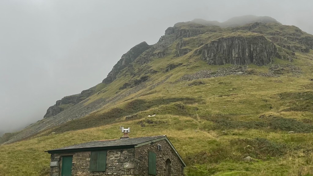
I’m tired when I reach Blacksail Hostel, and tempted to stop there for the night even though they don’t take campers and I don’t have a booking. The warden isn’t there yet, though; so instead I drop some coins into the honesty box and make myself a cup of tea, then sit in the sun chatting with other walkers and cyclists drifting through. The pause is restorative, and I decide I can push on after all.
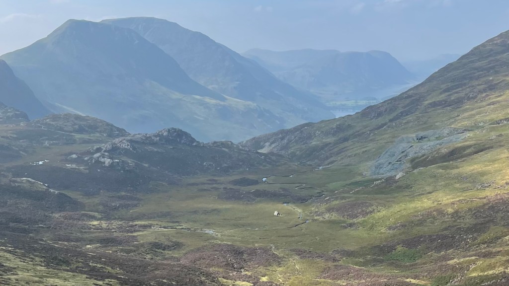
I almost immediately lose the trail, only finding it by spotting some other hikers climbing the hill ahead of me and straight lining over to where I assume the trail must be. A long climb follows, quite a challenge in the rising heat of the afternoon. But the reward at the pass is wide views that more than make up for the effort.
From there, the descent is kind: a contour line across the hilltops, then road, then more path which finally delivers me to the side of the Derwent and to Borrowdale YHA. I don’t have a campsite booking, and apparently they’re all taken; but a dorm bed for not much more than a campsite, plus access to the huge dry room, feels like a fantastic luxury.
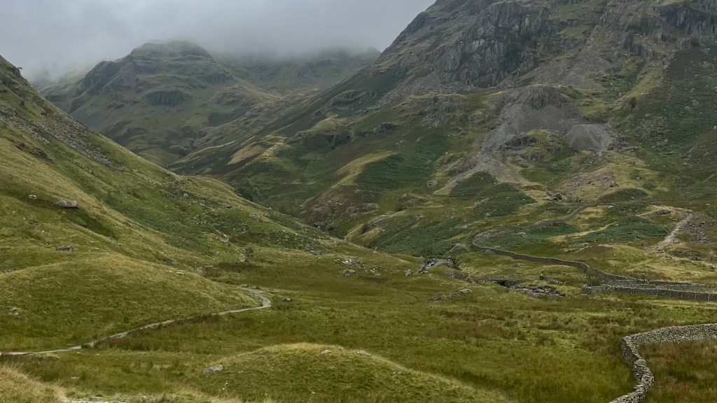
Day 3 – 31 August 2024: Borrowdale to Grasmere
Distance: 14.53 km | Elevation gain: 608 m | Moving time: 4h 30m | Average pace: 18:35/km | Average speed: 3.23km/hr
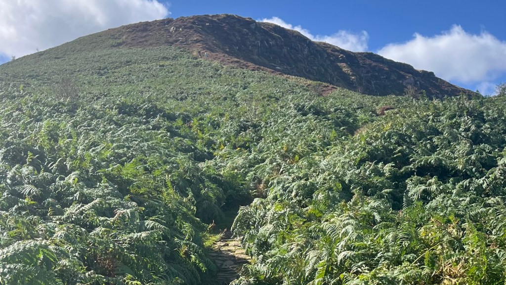
The path leads me through Rosthwaite and then starts to swing uphill. As I plod forwards, I begin to recognise the landscape: I’ve been here before, on the Cumbria Way, albeit travelling downhill. Then I remember the path stretching ahead of me, and knowing what’s coming almost makes the day harder. Luckily, it’s a gorgeous sunshiny morning and I have nothing better to be doing.
I play leapfrog with another solo female hiker for most of the ascent. Near the top we stop together for a snack, trading sunscreen and the usual trail stories. Then the final climb is conquered, and the descent begins. A steady stream of people are heading up to the pass I’ve just come from; all of them exchange friendly greetings with me.
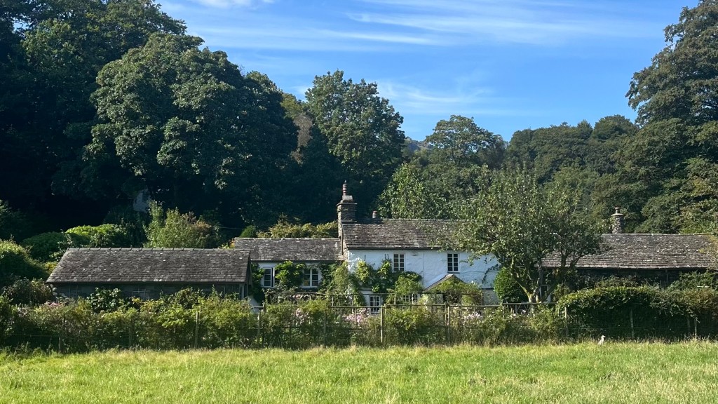
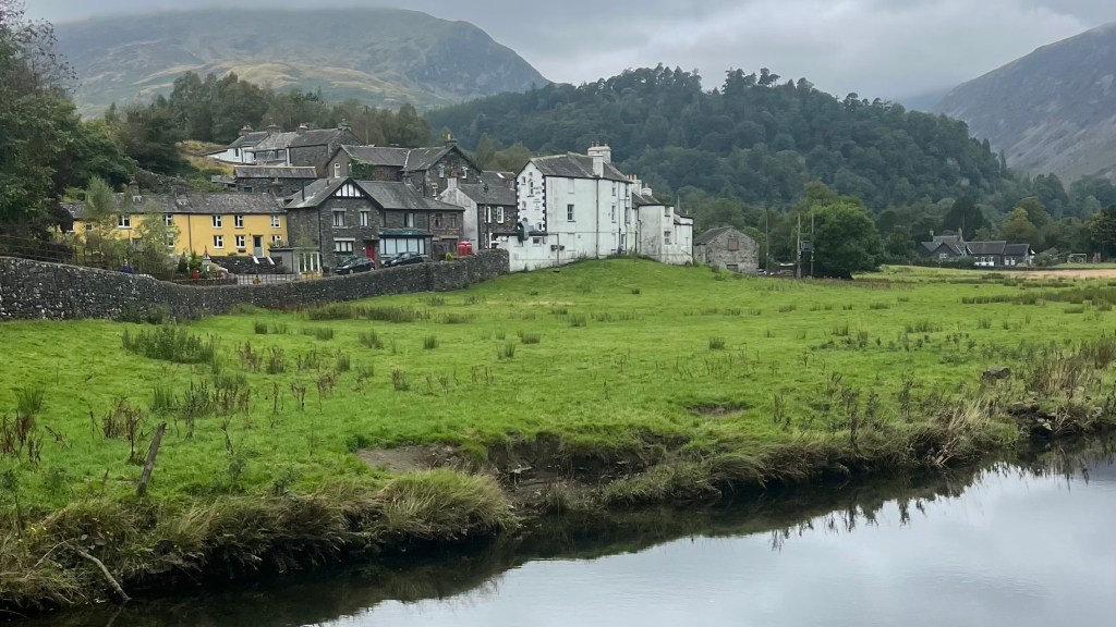
By the time I reach Grasmere, I feel the need to call it a day even though I’d planned to make it to Patterdale. The climb and my lingering fatigue, as well as the warmth of the day, all conspire to convince me to stop early. I secure a tent spot at the YHA and spend the afternoon wandering narrow streets, taking in the slate buildings and the buzz of hundreds of other tourists. It’s an easy afternoon of food and rest, before an early night.
Day 4 – 1 September 2024: Grasmere to Patterdale
Distance: 13.99 km | Elevation gain: 581 m | Moving time: 3h 51m | Average pace: 16:31/km | Average speed: 3.63km/hr
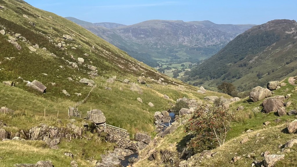
An overcast sky greets me this morning, and I’m grateful. This feels like sacrilege: blue sky days are far too few in England. But the cooler air makes the walking easier as I leave Grasmere and begin the steady climb toward Grisedale Tarn.
The ascent isn’t as sharp as yesterday’s, and I’m pleasantly surprised. Instead, the path settles into a gently gradient, contouring along the valley. At the pass, the shift in landscape is striking. I leave the soft and green behind, moving into a new world of rock and grey.
I fall into step with a father and his young daughter, who can’t be more than 6 or 7, but is skipping confidently across the rocks, unfazed by the terrain. She’s undoubtedly faster than I am. We chat for a while, exchanging the kind of pleasant conversation you only find on trails, before I push on as the clouds begin to thicken.
The descent into Patterdale is swift. I reach the campsite, located in a farm, and pitch my tent before wandering down to the water, drawn by an amplified voice echoing across it. I can see something is going on, but can’t make out what, so I take a stroll into town and discover a triathlon that is finishing up. The crowds are still a bit overwhelming, though, so I retreat to a pub for an early dinner instead.
Day 5 – 2 September 2024: Patterdale to Shap
Distance: 25.67 km | Elevation gain: 1,086 m | Moving time: 7h 27m | Average pace: 17:25/km | Average speed: 3.45km/hr
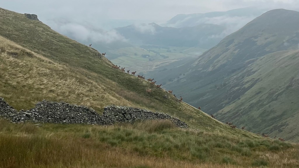
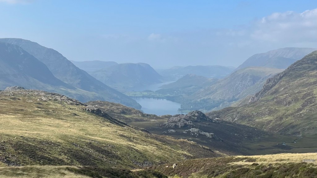
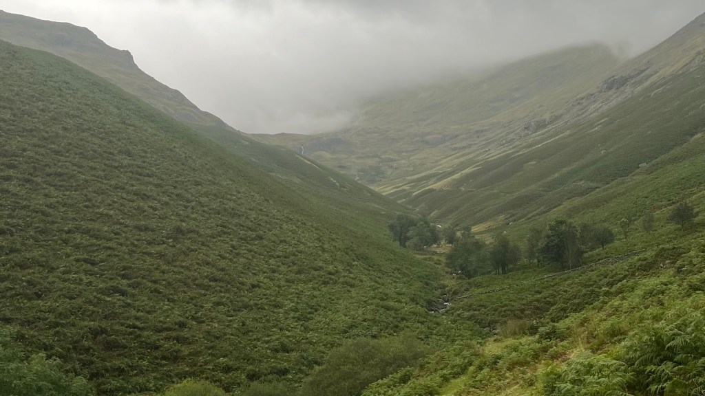
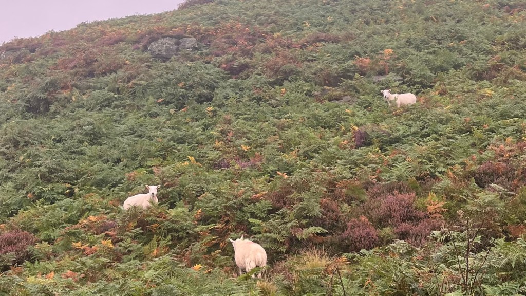
I climb out of Patterdale beneath low cloud, slowly leaving Ullswater behind me. The ascent is steady but not too severe, winding past small lakes where sheep graze close to the shore. Later, I spot movement on the hillside: a couple of deer darting away from me, but not long after I come across an entire herd of them. I pause to take them in, careful and still, they’re clearly skittish. The second I begin to move again, they scurry away.
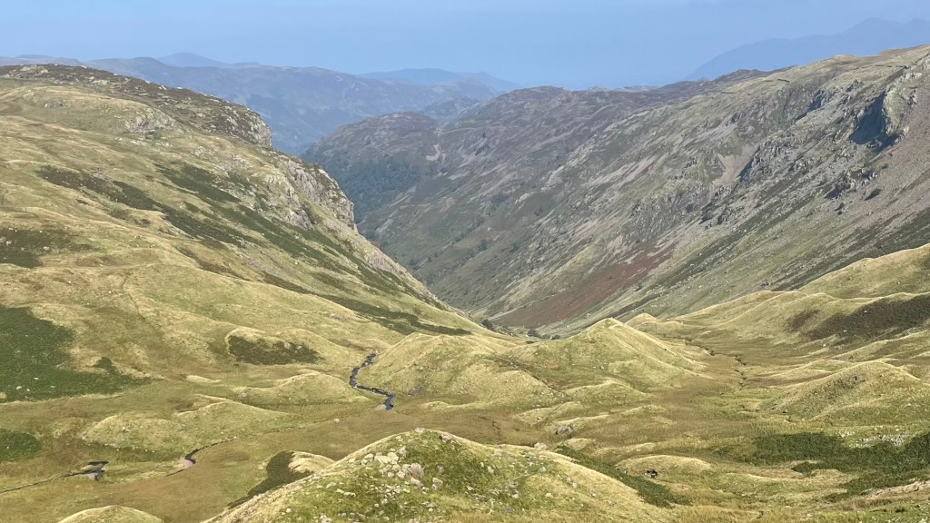
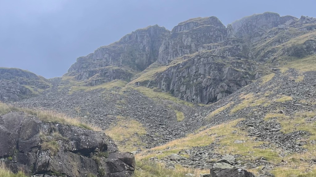
Rain drifts in as I approach Kidsty Pike. At first it’s light enough to ignore. At the summit, the views are meant to be spectacular: I wouldn’t know, visibility is basically non-existent behind the cloud. The rain shows no sign of relenting so I layer up to begin the descent, taking it slowly over slick rocks that require a bit of scrambling. The path eventually flattens out, but exchanges the gradient for boggy ground around Haweswater that demands patience and careful attention.
I eventually reach easier terrain, and pick up some more company: this time, a Coast to Coast walker ambling along at an easy pace. We chat for a while, and the kilometres pass quickly. Not long after parting ways, I take a slip on a grassy descent, and end up covered in sheep droppings. It’s not a pleasant smell, but it does motivate me to push onto Shap ASAP.
The campsite there is quiet and the host welcoming. I pitch quickly and head straight for the shower: for myself and my rain gear. The drizzle lets up in the evening, so I take myself to the pub for a comfort meal.
Day 6 – 3 September 2024: Shap to Kirkby Stephen
Distance: 33.22 km | Elevation gain: 716 m | Moving time: 7h 35m | Average pace: 13:42/km | Average speed: 4.38km/hr
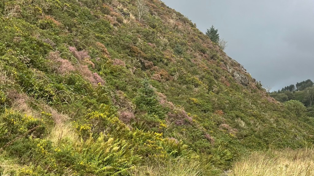
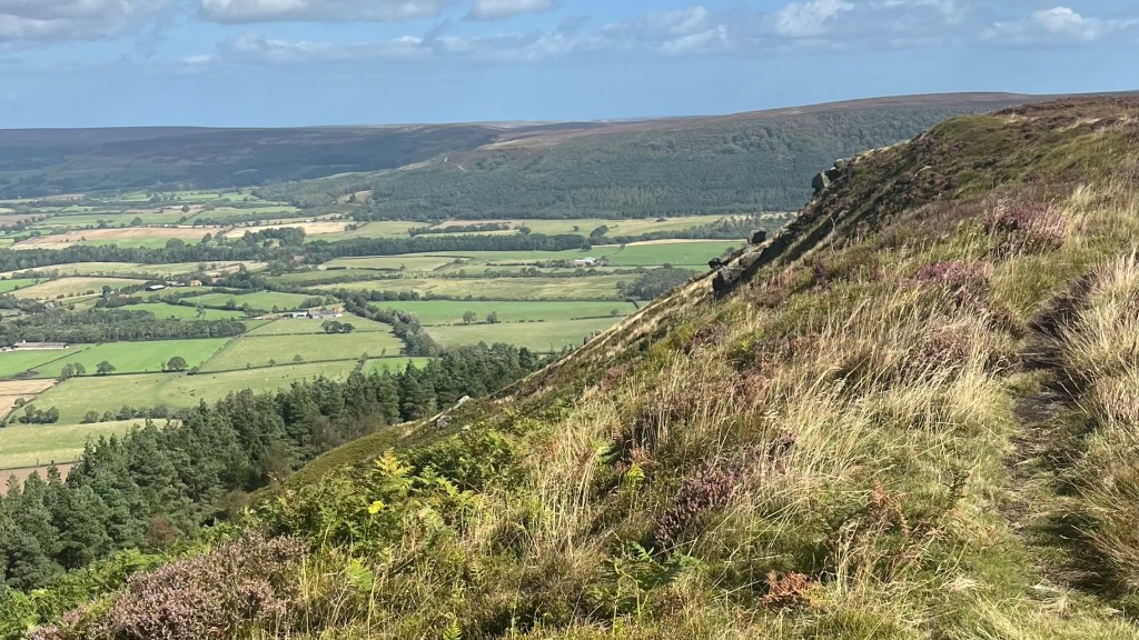
The Lake District is clearly behind me now. As I lave Shap, the landscape opens into wide, rolling terrain washed in muted purples and golds. Heather clings to the smaller slopes, and the light shifts constantly as clouds drift overhead.
In Orton, I stop for tea and a scone: a classic English refuel. Not long after I set off again, a couple of trail runners overtake me. One pauses to chat briefly, explaining they’re running the Coast to Coast in huge daily chunks; today, they’re aiming for 50k. It’s impressive, and it gets me wondering: should I start tackling trails at pace?
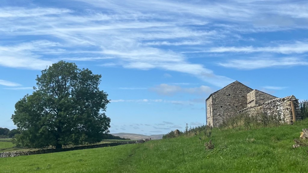
With that to ponder on, the trail passes by quickly as I traverse classic English countryside: stone fences, wide fields, quiet lanes and scattered farm buildings.
By the time I reach Kirkby Stephen the campsite check-in happens at their onsite bar, rather than reception which has closed for the day. I’m tired, so after eating quickly I head straight to bed, somewhat disappointed not to have had time to explore the village.
Day 7 – 4 September 2024: Kirkby Stephen
I’d been tempted to make today a rest day; the rain overnight feels like a sign to accept it. So I do, lingering in my tent in the morning over multiple cups of coffee and a good book, letting my body recover. When campsite reception opens, I book in for another night and then wander into town.
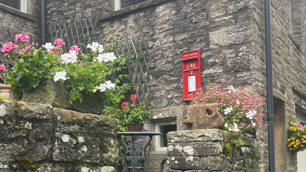
Kirkby Stephen is a gorgeous little town, its stone buildings softened by gardens, window boxes and late summer flowers. I loop the main streets slowly, ducking into shops but refraining from impulse purchases, because every gram counts. I duck into cafe for a tea and scone, and enjoy the novelty of just sitting still instead of moving.
Later, the sun emerges, and I take another slow wander, this time down to the supermarket. Resupply takes longer than expected; there are too many decisions to make, too much on offer. But it’s accomplished, and then I wind slowly back to camp where I while away the rest of the day reading and resting.
Day 8 – 5 September 2024: Kirkby Stephen to Keld
Distance: 19.19 km | Elevation gain: 653 m | Moving time: 4h 48m | Average pace: 15:00/km | Average speed: 4km/hr
The rest day seems to have done the trick. I leave Kirkby Stephen feeling more energetic than I have in a while, even though the day is blustery and grey. The road out of town offers a gentle warm up before it tilts more sharply upwards. Not long after that, though, visibility drops as drizzle sets in and clouds converse.
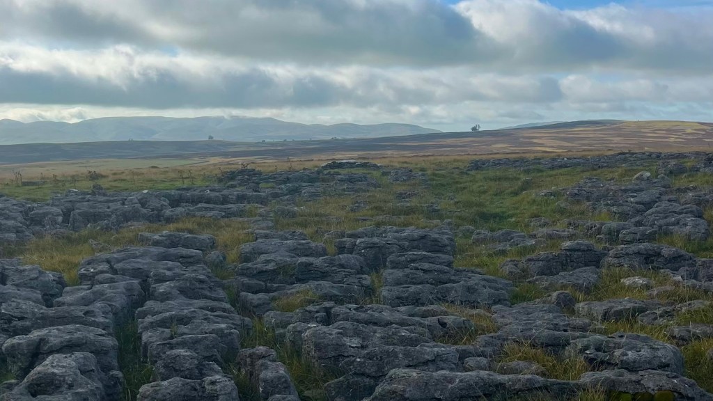
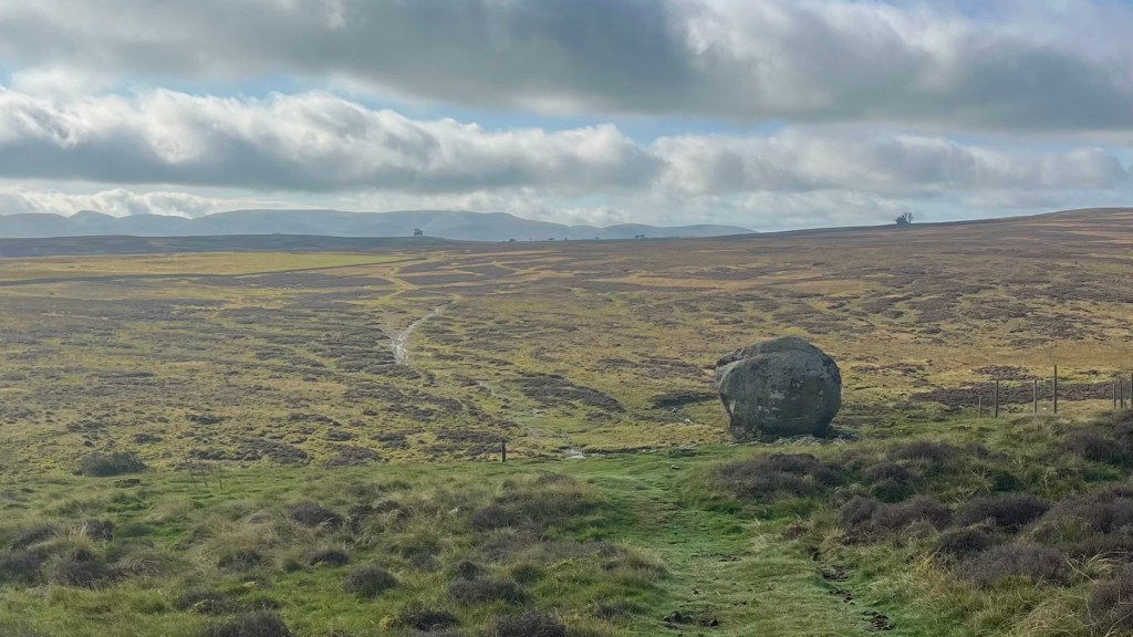
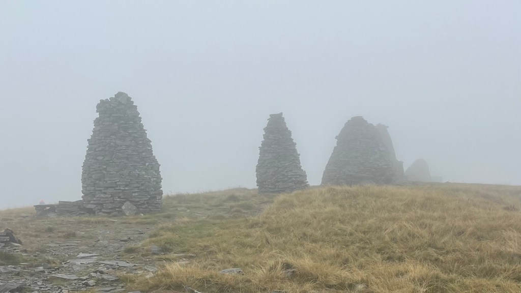
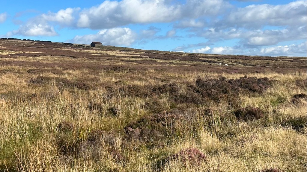
Nine Standards Rigg appears. Kind of. The famous cairns are just visible through the fog; I can barely see all of them at once. The wind makes lingering unappealing, so I push on.
The next obstacle is the peat bog, a section I’ve been warned about: even in good weather it demands good navigation skills; today, it requires precision. The trail markers are just visible enough, and I move carefully, checking my footing and my bearings, taking my time. I don’t want my attention to drift and suddenly become that hiker that has to call Mountain Rescue.
Eventually, the peat gives way to boggy farmland and I can relax a little. Though the drizzle continues, I stop briefly to eat in a little spot that’s protected from the worst of the wind, before continuing toward the road that finally delivers me to Keld.
The village is small and peaceful. After pitching my tent at the campground, I wander its handful of streets, poking my head into the museum in the old schoolroom, and find a pocket of WiFi that feels like a godsend: there’s no phone reception down in the valley where my campsite is. I download a couple of books, and then shelter in my tent for the rest of the evening.
Day 9 – 6 September 2024: Keld to Reeth
Distance: 19.55 km | Elevation gain: 288 m | Moving time: 4h 17m | Average pace: 13:09/km | Average speed: 4.56km/hr
This morning, I miss a turn almost immediately and decide to take it as a sign to keep things simple: the low route it is. It follows the river and is flat and fantastic for settling into an easy rhythm alongside the water. The morning is calm and clear, and it’s wonderful to walk without having to think too hard.
Gunnerside is quiet when I arrive, cafe and pub both closed, so I keep moving, actually enjoying a long stretch of road walking: traffic is quiet, and the surface is easy. At Low Row I strike gold: an open pub, sunshine and the chance to sit outside with a pub meal and a cold Coke.
More road follows, and I briefly worry I’ve drawn myself the wrong route for this alternate, but eventually the trail becomes obvious again, guiding me gently down into Reeth. As I pitch my tent I chat with a couple of westbound walkers, trading trail notes and warnings, before I head into the village.
I pick up a couple of items at the tiny convenience store, and then settle in at the pub for dinner, where I’m joined at the table by a local and his very cute dog. Conversation flows easily until the delicious food sends me near comatose and I wander back to camp to turn in early.
Day 10 – 7 September 2024: Reeth to Richmond
Distance: 21.31 km | Elevation gain: 440 m | Moving time: 4h 40m | Average pace: 13:08/km | Average speed: 4.57km/hr
The River Swale accompanies me out of Reeth, the trail winding gently toward Marrick. Rolling green hills are back, stitched together by old fences and tiny villages.
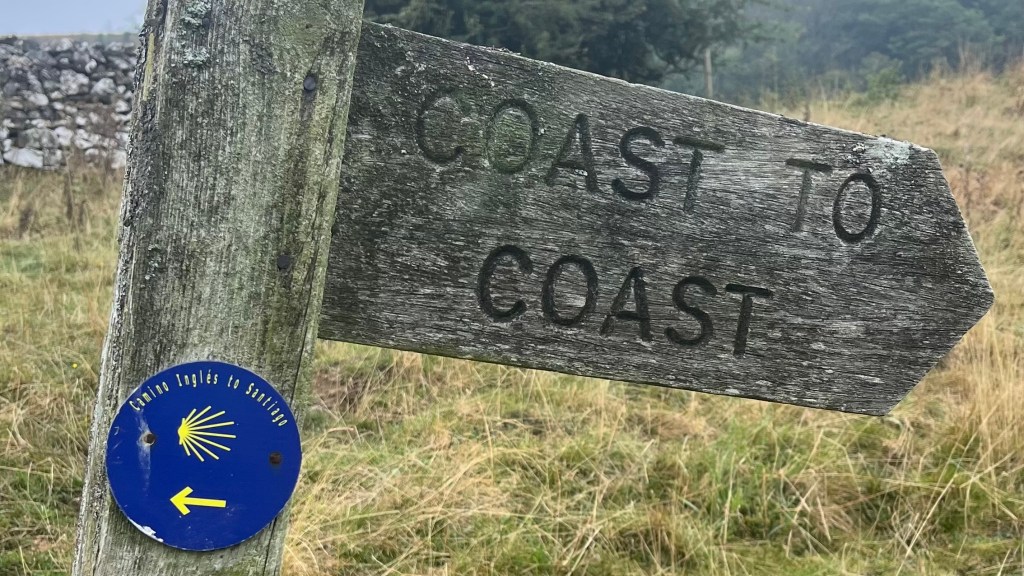
I spot a Coast to Coast marker that also bears a Camino Inglés marker; it’s a small moment of joy a present me and one-year-ago me collide. Not long afterwards, I catch up with a group of women tackling the trail in sections, supported by their partners. We climb together, exchanging trail stories, parting ways once the terrain flattens.
I can sense the trail is winding through the outskirts of Richmond. Day hikers are becoming much more common, along with other signs of civilisation like farm equipment and well-maintained buildings. A green tunnel of trees shelters the path, and I pause briefly to chat with a local out walking her dogs.
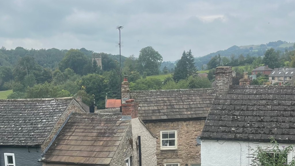
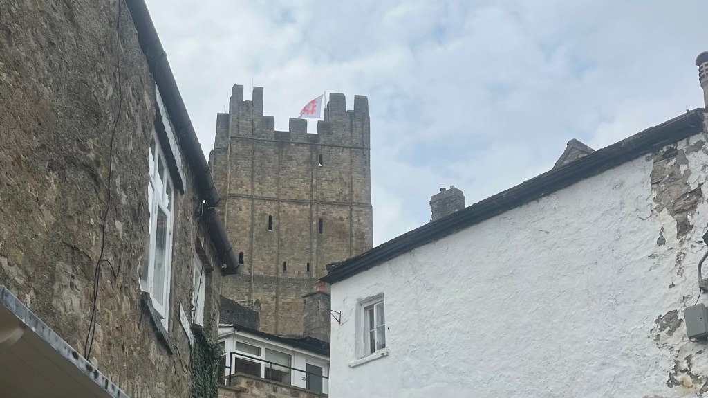
Richmond itself arrives, and it’s smaller than I anticipated: but this is a welcome surprise. I resupply at the first supermarket I see, and then wander through the old town before continuing on towards the campsite that’s a few extra kilometres on the other side of town. The final stretch is unexpectedly lovely, a well-used local path that feels welcoming.
At the campsite, I’m given my pick of spots along the river, and after the usual camp shores are done I spend the evening reading, accompanied by the gentle sound of flowing water which eventually lulls me to sleep.
Day 11 – 8 September 2024: Richmond
Another rest day feels earned, especially with drizzle threatening outside. I linger over my morning coffee in my tent, before slowly trekking back towards town.
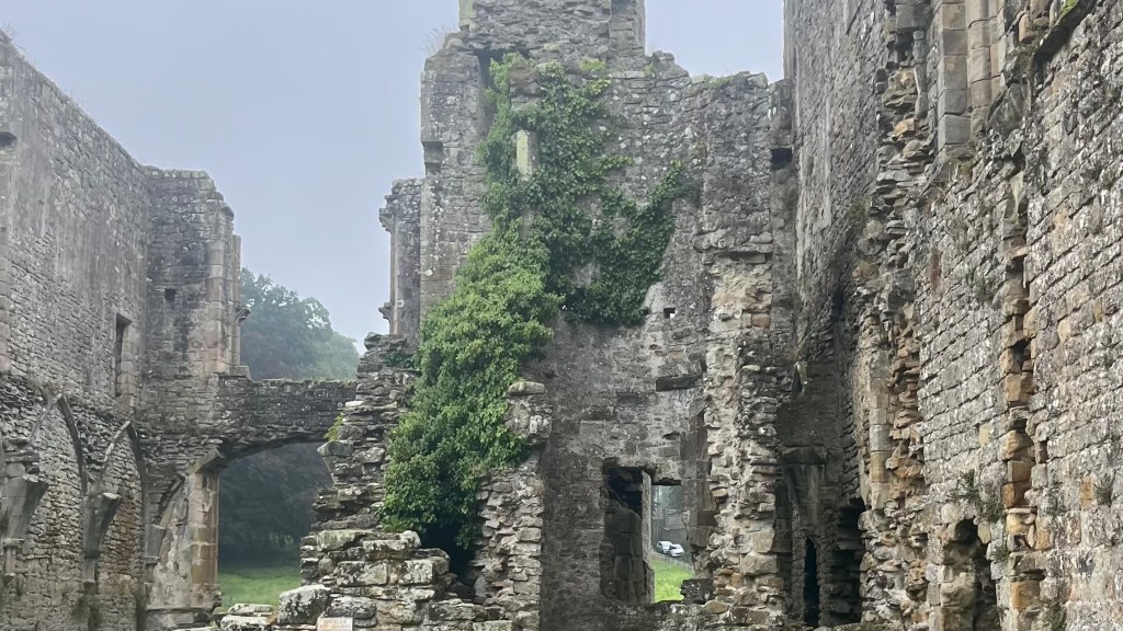
The ruins of Easby Abbey are my first stop, and they’re atmospheric: dramatic arches frame the landscape. It feels like something out of a Romantic era painting; and I’m pleased to learn my instincts are spot on when an informational sign informs me Turner once painted this scene.
Arriving back in Richmond, I wander through the main square and its surrounding streets, admiring shopfronts and resisting purchases only by thinking of the weight penalty. Eventually I settle into a large cafe, claiming a comfortable armchair and order multiple rounds of hot drinks while I take advantage of the free WiFi to catch up on messages and life admin.
In late afternoon I drift back to camp, not quite restored but well on the way.
Day 12 – 9 September 2024: Richmond to Osmotherly
Distance: 36.50 km | Elevation gain: 396 m | Moving time: 6h 42m | Average pace: 11:01/km | Average speed: 5.45km/hr
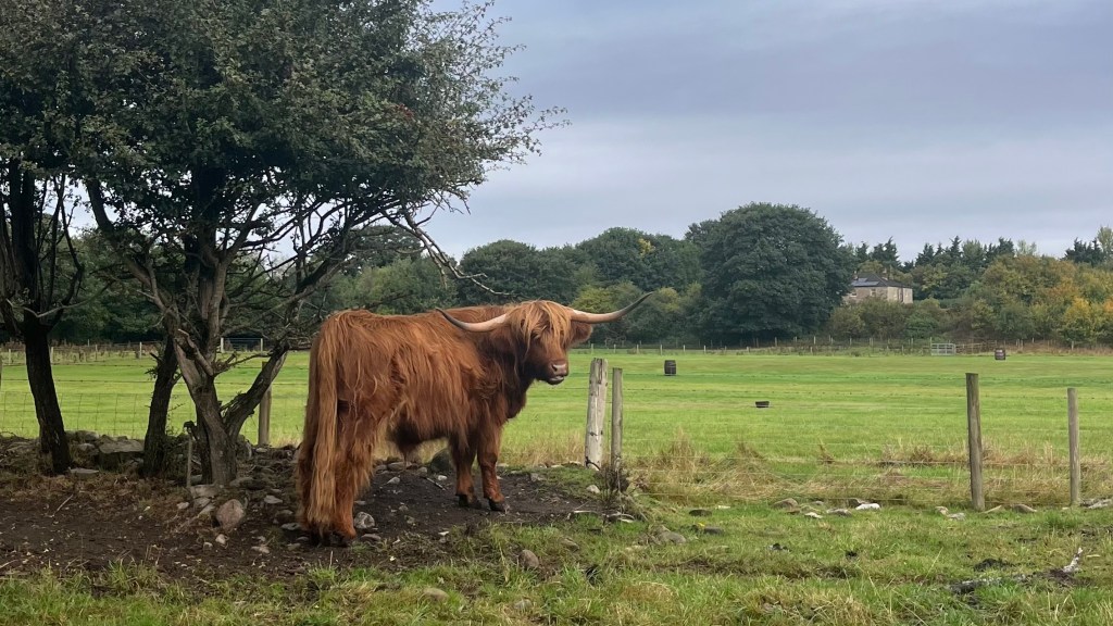
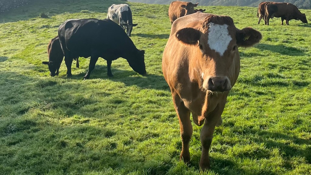
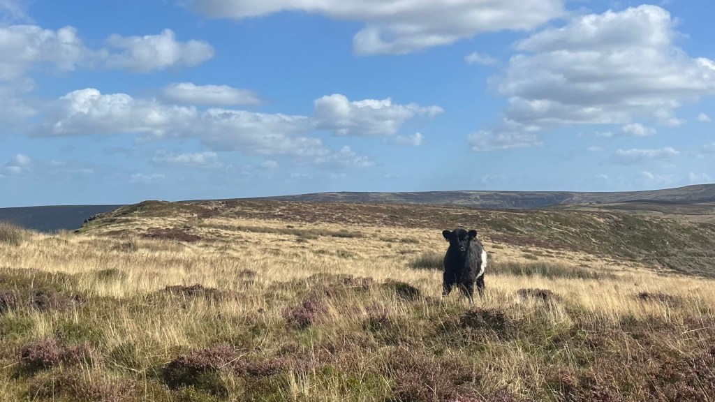
The day begins with a high note: a field of shaggy Highland cows, including an absurdly cute calf whose fringe is clearly too big for him. They’re camera shy, but I take my time and gaze my fill.
The kilometres and fields that follow are quiet, but flat: exactly what I need to ease back in after a rest day. Grey skies loom, but it isn’t raining; instead, it’s perfect walking weather. In one field I come across a small trail logbook, and spend several minutes perusing messages from others who are just ahead of me.
I reach Danby Wiske, unsure whether to stop or push on. It begins to drizzle, tipping the balance towards calling it a day, and I retreat to the campsite kitchen where walkers are invited to put their feet up, even if they aren’t staying. Other walkers are gathered there already: tea is made, stories are shared, and after an hour off my feet I feel unexpectedly recharged. So I keep going.
The afternoon is gentle walking, too, and as the light fades I pass through Ingleby Cross. The final hill is tackled with determination, rather than enthusiasm: it’s definitely time to stop soon. The campsite sits down a hill below the trail, and it’s tough to know tomorrow will begin with an extra climb, but it’s quiet and peaceful when I arrive, only a handful of others in residence. I settle in quickly, grateful for a warm shower and the ability to use more of the dry room than is rightly my share.
Day 13 – 10 September 2024: Osmotherly to Blakey Ridge
Distance: 30.98 km | Elevation gain: 1,129 m | Moving time: 7h 20m | Average pace: 14:12/km | Average speed: 4.22km/hr
The climb I’d feared yesterday evening is neatly avoided by a road alternative, and I start the day feeling quite pleased with myself. Cold Beck Reservoir offers sheltered, peaceful walking; the drizzle feels manageable beneath the trees.
Today I’m looking forward to a stretch along an old railway line that my guidebook warns me is dull and flat. To me, those easy miles are a powerful motivator. But first there’s Carlton Bank, where I stop for coffee and a hot pastry. Hiker hunger has well and truly arrived, and I can’t pass up any opportunity to stop.
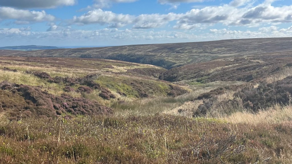
The next section is unexpectedly brilliant: flagstone paths thread up and over hills where the heather fades to dusty purple and the sky begins to shift from grey to blue. When the sun finally breaks through it feels like a gift, and I take full advantage of it, moving quickly through the landscape as if buoyed by its light.
The railway line stretch delivers exactly what I hoped for: smooth, rhythmic walking where I can switch off and cruise. The kilometres slip by quickly, and when The Lion Inn appears ahead it feels like a perfect beacon.
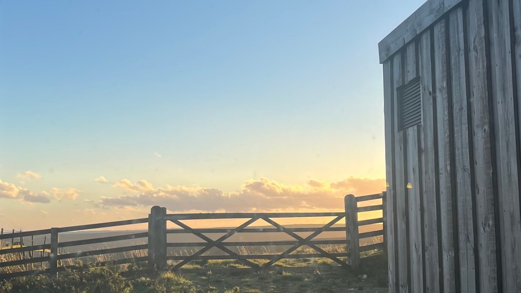
I pitch my tent in the beer garden as advised: it’s more sheltered from the wind than the small field next door. Then I head inside for dinner as the sunset stretches across the moors, all soft golds and peaches.
Day 14 – 11 September 2024: Blakey Ridge to Littlebeck
Distance: 27.92 km | Elevation gain: 512 m | Moving time: 5h 48m | Average pace: 12:28/km | Average speed: 4.81km/hr
A full English breakfast sets me up perfectly for a fantastic day. The dining room is buzzing with other walkers; most of them must have stayed the night inside, because there was only one other camper keeping me company in the beer garden.
The trail heads briefly along the road before turning off onto the moors under clear skies and endless views. I turn to look back at The Lion Inn, now a small dot on the horizon, and reflect on how far this journey has carried me.
Today it feels like I can take the foot off the pedal. The terrain is largely downhill, and it’s wide and flat so I can cruise. I eventually catch up with another solo female hiker and we walk together for a while, trading stories from this trail and dreams about what one will be next. We share a coffee and pastry at Grosmont before parting ways: I can see the steep hill ahead, and I’m eager to have it over and done with.
That final climb is a slog, but once I crest it the walking becomes easier once more as farmland unfolds easily before me. Tonight’s campsite is simply the garden of a B&B; the welcome there is warm, I’m invited in for tea and cake, granted access to a hot shower, and later served a hearty lasagna for dinner.
Day 15 – 12 September 2024: Littlebeck to Robin Hood’s Bay
Distance: 19.23 km | Elevation gain: 430 m | Moving time: 4h 7m | Average pace: 12:51/km | Average speed: 4.67km/hr
Golden light greets me as I wake and break camp, like a gift for my final day on trail. The path drops me into the village, climbs again, and then flows gently through fields and forest. Everything seems to pass by quickly, the promise of the end carrying me forward.
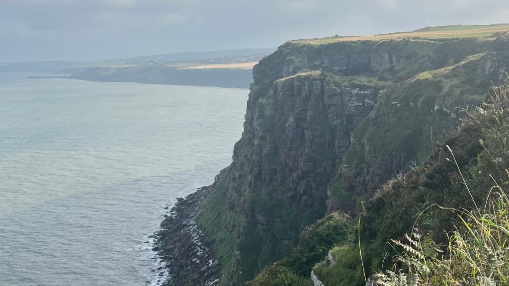
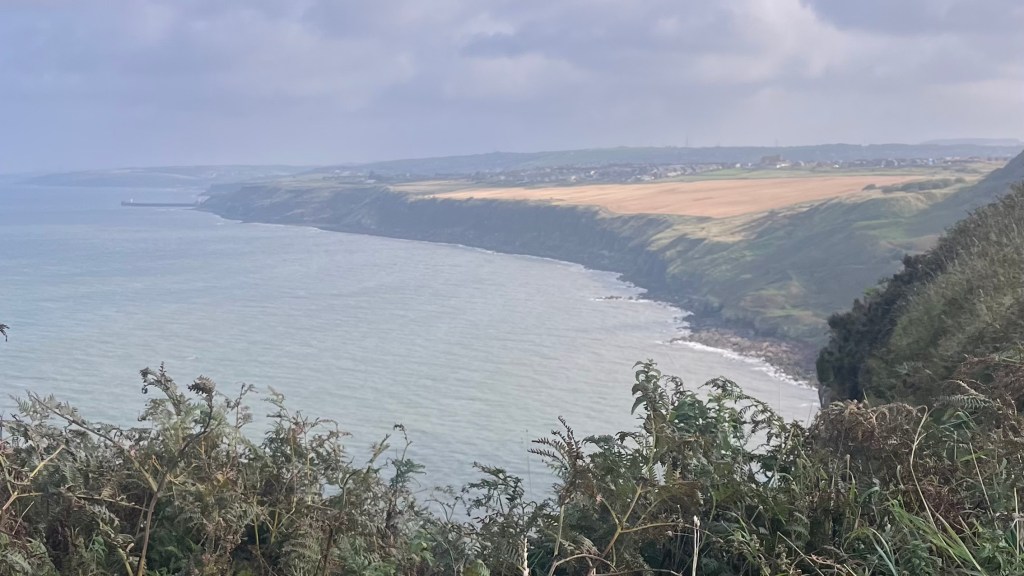
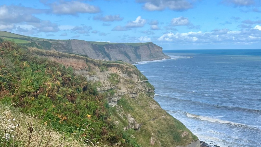
Then the sea appears and I can’t help but grin. The trail traces the coast for a while, an echo of the opening at St Bees, but the final ups and downs do feel like an extra, unnecessary challenge.
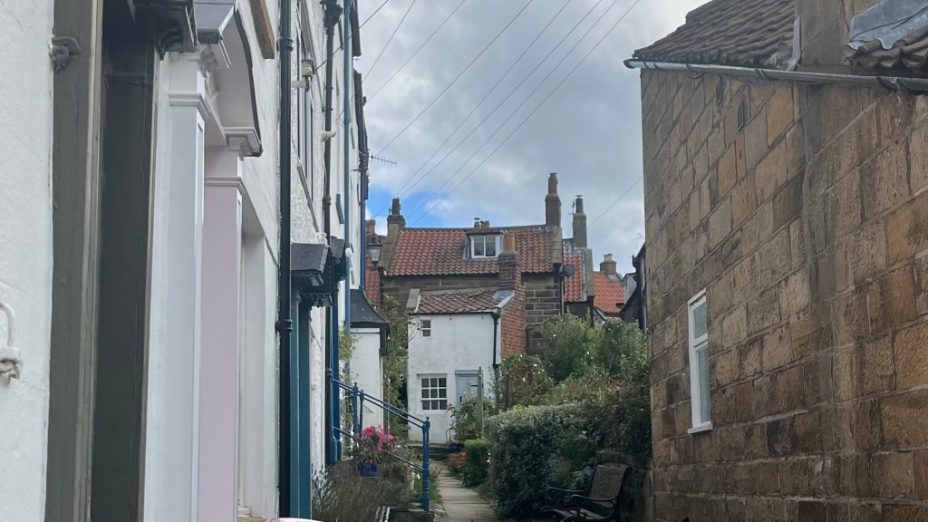
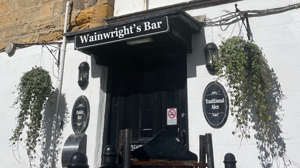
Robin Hood’s Bay finally comes into view, and the descent into town is busy: on the trail, I cross paths with many day walkers, and once I hit the concrete there are tourists everywhere. I feel that familiar tension of re-entering the real world. Eventually I reach Wainwright’s Bar and stop my watch.
The walking is complete, but the trail needs a proper send off. A burger and a beer go down too easily; a second beer is in order when the woman I walked with yesterday arrives. Together we sign the logbook and then step outside into the sunshine for our finisher photos by the wooden plaque.
Want More?
Curious about the practical side of the trail? Check out my Coast to Coast Path: How-To post for route info and planning tips.

Leave a comment