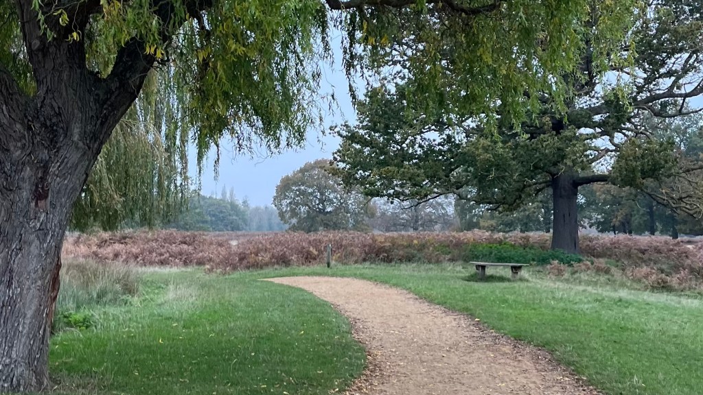
Craving a cheap, accessible escape from London? The London Outer Orbital Path (LOOP) was launched in the 1990s as a project to encourage walking around the city, developed by walking organisations and supported by local councils and Transport for London. The LOOP is the perfect weekend project: almost 250km of trail tracing the city’s outer edges, often feeling surprisingly remote as it transports the walker between quiet woodlands and riverside paths. Yet each stage conveniently ends near a bus or train that will have you back to the city centre in almost no time.
I section-hiked the trail between October and December 2024. For a closer look at the on-the-ground experience, head over to my London Outer Orbital Path (LOOP): Trail Journal post for my stats, photos and story.
- Quick Facts
- Map & Elevation Profile
- Preparation
- On-Trail Practicalities
- Side Missions & Connecting Trails
- Hiking as a Solo Woman
- Want More?
Quick Facts
| Distance | 250 km |
| Elevation gain & loss | 2,200 m |
| Days to complete | 10-14 |
| Best season | Year-round! |
| Trailheads | Erith; Purfleet |
| Recommended direction | Either way! |
Map & Elevation Profile
Preparation
Trailheads & getting there
The LOOP is a circular trail, and extremely accessible: you can start anywhere. The “official” start is at Erith, just south of the Thames; while Purfleet is the official end, sitting north of the river. There’s no convenient way to connect the two, by either foot or public transport, so don’t get your hopes up for a perfect footstep-to-footstep closure of the circle.
Direction to Walk
I can’t see any major pros or cons to heading in a particular direction on the LOOP. At best, it might be more convenient to travel clockwise if you’re following the walking notes prepared by the Inner London Ramblers.
Season to Walk
This trail is a year-round gem; I walked it in Autumn-Winter, and it was the perfect escape from the city during the gloomy months. Of course, this also meant the days were generally quite short, and rather chilly.
In warmer months you’ll have better daylight hours, the landscapes will be more vibrant, and you’ll possibly have more companions on the trail.

Accommodation
Because it’s so close to London, most people will choose to section-hike this walk, returning to home base each night. Even if you’re not a local, you might like to consider staying somewhere central and traveling out each day, which will mean you can leave the bulk of your things at home.
For those looking for a thru-hiking experience:
- Beds & bunks: hotels and B&Bs are plentiful along the route; hostels are available but less common
- Camping: wild camping isn’t permitted, and even if it was this is a fairly urban trail so you’d be hard-pressed to find a decent site. You could try finding some commercial campsites, but this will require careful planning
Gear List
Section hikers can pack extremely light:
- Day bag (or consider a running vest!)
- 2L water capacity
- Hiking clothes
- Hiking shoes or trail runners
- Warm layers (usually worth it for the train back, if nothing else)
- Rain layers (this is England)
- Optional: snacks and packed lunch
Possible Stages
These are the 24 stages provided in the Inner London Rambler’s excellent walking notes. But there are plenty of extra transport options mid-stage; see the notes for more detail.
| Place | Distance from previous (km) (clockwise) |
|---|---|
| Erith Station | 0 |
| Bexley Station | 14 |
| Petts Wood | 12.1 |
| Hayes (Kent) | 15 |
| Sanderstead | 15 |
| Coulsdon South | 10.3 |
| Banstead | 8 |
| Ewell West | 6.6 |
| Kingston | 12.9 |
| Hatton Cross | 16.1 |
| Hayes & Harlington | 6.4 |
| Uxbridge | 12.1 |
| Harefield West | 8.4 |
| Moor Park | 8.4 |
| Hatch End | 7.7 |
| Elstree | 15 |
| Cockfosters | 17.5 |
| Enfield Lock | 14.2 |
| Chingford | 8 |
| Chigwell | 7.2 |
| Havering-atte-Bower | 10.6 |
| Harold Wood | 8 |
| Upminster Bridge | 7.2 |
| Rainham | 7.2 |
| Purfleet | 8.2 |
On-Trail Practicalities
Finding Your Way
Trail Markings
The most common LOOP marker is a coloured disc with a bold white arrow, inside of which is a flying kestrel and, helpfully, the words “London LOOP”. These are typically found on wooden posts in more rural areas.
As you approach more populated areas of the trail, make sure you pay attention: sometimes there will be two signs, pointing in seemingly contradictory directions. Chances are that one of them bears the additional words “station link” to direct you to the nearest train station, which will be slightly off the main path.
In other places you’ll come across a more traditional directional sign attached to a lamppost or pole pointing you in the right direction.
Signage along the trail is good but not great; it can be easy to miss a marker. Bring an app or map as a backup.

Maps & GPX
If you’re into paper maps, your best best is probably printing off the walking notes put together by the Inner London Ramblers.
For the digitally inclined, the trail appears on the Go Jauntly app; or download a GPX file like this one from The Walking Englishman.
Guidebooks & Resources
Although there are a few published guidebooks available for purchase, realistically you need look no further than the Inner London Ramblers walking notes, which are rich in route detail and history.
If apps are more your thing, Transport for London have teamed up with Go Jauntly, which will guide you through the trail step-by-step.
Food & Water
Food stops are generally easy to find. Cafes and pubs are frequent along the trail, especially near villages; supermarkets are usually available around the start and end of each stage. Carrying snacks to get you through an energy crash is always a good idea, though. If relying on pub meals, keep in mind that the English love a Sunday roast so you may need to book ahead.
It’s not necessary to carry large amounts of water – refills are available in village parks, or you can ask politely at a cafe or pub. There are natural water sources, but I wouldn’t recommend trying these: a lot of the trail is used for farming, and unfortunately there is a visible amount of litter and pollution in many spots along the trail.
On-Trail Transport
The public transport connections to the LOOP are almost unparalleled. Transport for London has been instrumental in promoting the path, in collaboration with the Inner London Ramblers, to make access to the trail as straightforward as possible.
Each section is designed to end near a bus or rail link. The Ramblers’ walking notes also helpfully list mid-stage bail out options for those who might’ve bitten off a little more than they could chew.
Money Matters
Everything you could possibly want to buy on trail can be purchased with card: cash can be left at home.
Finisher’s Certificate
If you’d like to commemorate your walk, you can download a free finisher’s certificate from Transport for London.

Side Missions & Connecting Trails
It’s almost impossible to even begin to list the potential side missions from this trail (although the Inner London Ramblers do an excellent job at this in their walking notes). Major attractions along the trail include:
- Hampton Court Palace, residence of Henry VIII and other royals: it’s a short detour from Bushy Park;
- Epping Forest: the trail runs directly through this popular hiking destination. Spend more time here on some of the forest trails, or heading over to Queen Elizabeth I’s Hunting Lodge.
If you’re looking to extend your time on trail significantly, consider tackling the Thames Path. Another option, although there’s no direct on-the-ground overlap, is the LOOP’s younger sibling, the Capital Ring.
Hiking as a Solo Woman
I hiked this trail largely solo, although occasionally I managed to convince a friend or two to join me for a day. It’s very safe, with plenty of locals out enjoying the fresh air and walking their dogs. Mobile service was good throughout.
Having said that, the trail is close to London and some of the paths it takes are less-than-pleasant, taking you through a dodgy-looking street or the back of an industrial area. It’s that odd kind of liminal space where the simultaneous semi-remoteness and yet accessibility to anyone could be a problem.
All up, though, I didn’t feel unsafe on the trail at any point; there were just a few small stretches where I made sure to have my wits about me.
Want More?
Check out my London Outer Orbital Path (LOOP): Trail Journal for stats, stories and snapshots from the trail.

Leave a comment