11 days, 270 kilometres, 3,070 metres of elevation gain. I section-hiked the trail between October and December 2024: here’s the journey, day-by-day.
Thinking about tackling the trail yourself? Check out my London Outer Orbital Path (LOOP): How-To post.
- The Stats
- Trail Journal
- Day 1 – 13 October 2024: Erith to Sidcup
- Day 2 – 20 October 2024: Sidcup to Orpington
- Day 3 – 26 October 2024: Orpington to Whyteleafe
- Day 4 – 3 November 2024: Whyteleafe to Ewell West
- Day 5 – 9 November 2024: Ewell West to Hounslow Cemetery
- Day 6 – 10 November 2024: Hounslow Cemetery to Uxbridge
- Day 7 – 17 November 2024: Uxbridge to Stanmore
- Day 8 – 22 November 2024: Stanmore to Cockfosters
- Day 9 – 30 November 2024: Cockfosters to Chingford
- Day 10 – 8 December 2024: Chingford to Havering-Atte-Bower
- Day 11 – 14 December 2024: Havering-Atte-Bower to Purfleet
- Want More?
The Stats
Trip Summary
- Start date: 13 October 2024
- Days hiked: 11
- End date: 14 December 2024
Distance & Elevation
- Total distance: 270.48 km
- Average distance / day: 24.59 km
- Total elevation gain & loss: + 3,068 m / – 3,086 m
- Average elevation gain & loss / day: + 279 m / – 281 m
Time & Pace
Note that I used a couple of sections for my long runs, so these stats are a bit speedier than they would’ve been if I walked the entire way.
- Total moving time: 50h 12m
- Average moving time / day: 4h 34m
- Average moving pace: 11:08/km
- Average speed: 5.39/km
Budget (ex gear)
I haven’t put together my budget for this hike, since the total cost is going to be super dependent on where in London you’re based, how much mileage you do a day, and whether you bring food from home or eat out.
Trail Journal
Day 1 – 13 October 2024: Erith to Sidcup
Distance: 21.38 km | Elevation gain: 131 m | Moving time: 2h 59m | Average pace: 8:22/km | Average speed: 7.17km/hr
After hiking all summer on the Tour du Mont Blanc, the Kungsleden and the Coast to Coast Path, it’s hard to sit still. I’m craving a project, and the LOOP fits the bill.
I arrive in Erith beneath a classic grey English sky, but I’m ecstatic to be outdoors anyway. By the river, I warm up amongst seagulls and pigeons scavenging for scraps, and when I set off I almost immediately enter green space along a levee bank. The plan is to jog this section, as my long run for the week, but frequent informational plaques keep my pace low.
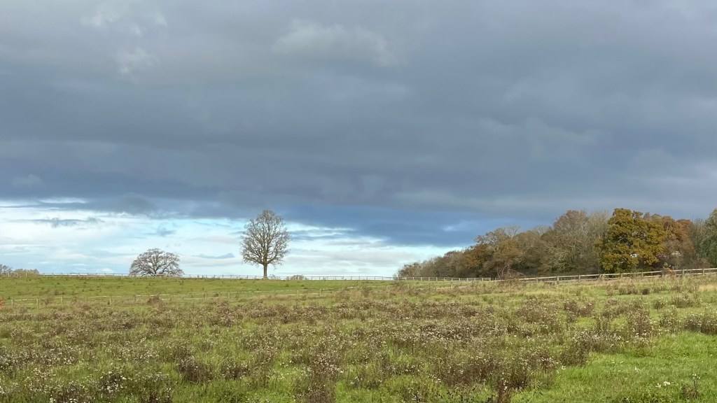
A tree-lined path along the River Cray is the highlight: still water, red leaves and a slowly emerging blue sky. I pass through sportfields and the trail briefly spits me onto a highway before returning me to woodland; I take a wrong turn and backtrack. Soon after, I skirt fields of horned cows that feel improbably rural this close to London.
By the time I reach Sidcup my body is tired, and although I want to continue I know it’s time to head home.
Day 2 – 20 October 2024: Sidcup to Orpington
Distance: 16.59 km | Elevation gain: 253 m | Moving time: 3h 31m | Average pace: 12:43/km | Average speed: 4.72km/hr
When I return to the trail I’m joined by my friends Rachel and Julie. The forecast promises drizzle all day, so I’ve warned them in advance about the hiker’s mantra: no bad weather, only bad clothes.
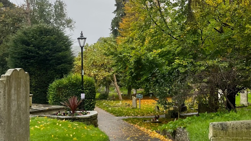
Thankfully, much of today’s route winds through country park, where the forest canopy shelters us from the worst of the rain. We chatter as we walk, the kilometres passing quickly.
We enter Petts Wood via a small churchyard just as the rain begins to fall in earnest. Spirits are high but stomachs are protesting, so we decide to call it a day. The pub beckons and we fantasise about a revitalising meal. But it’s Sunday, and we don’t have a booking. The best the staff can offer is sandwiches, which we accept and eat at the bar, refuelling for the journey home.
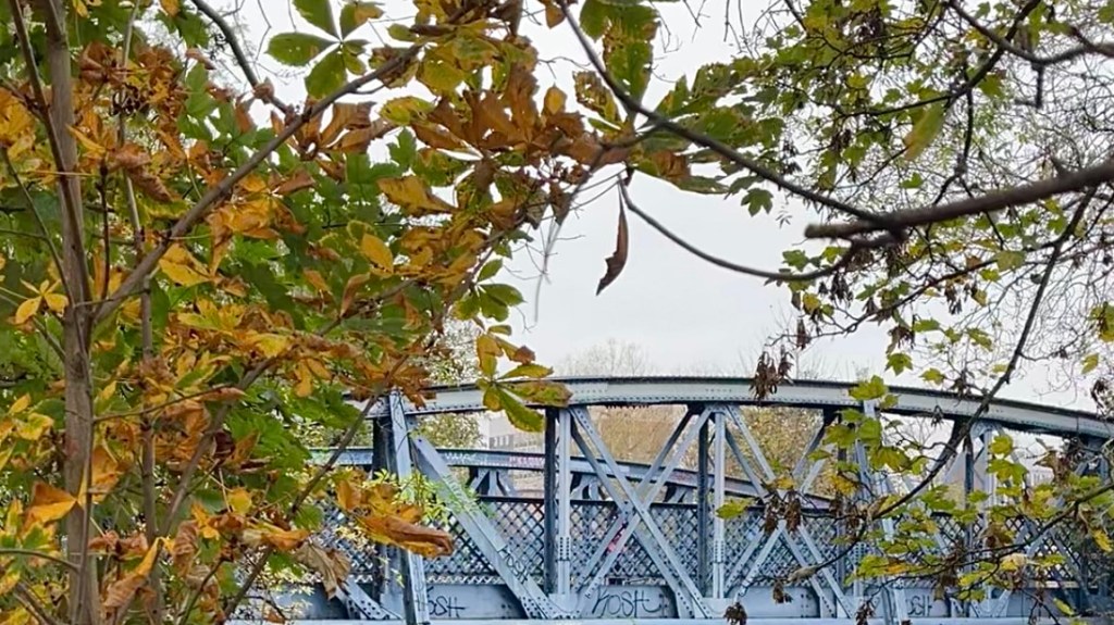
Day 3 – 26 October 2024: Orpington to Whyteleafe
Distance: 28.14 km | Elevation gain: 530 m | Moving time: 4h 30m | Average pace: 9:36/km | Average speed: 6.25km/hr
I return to Orpington to begin another long run along the LOOP, passing once more through the quiet churchyard before entering High Elms Country Park. The forest is quiet, the ground slick with soggy leaves that crunch and slide beneath my feet.
Soon I emerge onto a startlingly narrow country lane. It feels wildly out of place so close to London. Fields follow, some cultivated, others dotted with horses, and I pause briefly at Keston Ponds to admire the ducks.
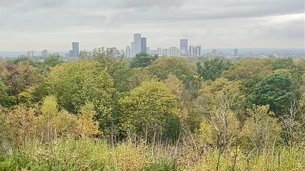
A short climb delivers a viewpoint over a village, then it’s into West Wickham Common where squirrels dart through the underbrush, evading all my attempts to snap photos. From Addington Hills viewpoint, skyscrapers rise in the distance like silver sentinels in the grey sky.
Near the end, I take a wrong turn and don’t realise for a while, adding some bonus kilometres before I finally arrive in Whyteleafe where I beeline for a snack resupply.
Day 4 – 3 November 2024: Whyteleafe to Ewell West
Distance: 22.42 km | Elevation gain: 322 m | Moving time: 4h 31m | Average pace: 12:05/km | Average speed: 4.96km/hr
Today begins with an accidental detour: partway up the climb out of Whyteleafe I realise I forgot to tap off at the train station and have to double back. At least the view, when I return, softens the blow, as a stark white cliff emerges in the distance.
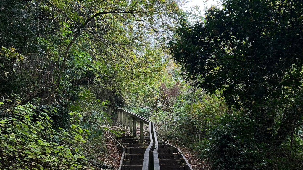
A steep staircase deposits me, breathless, onto Kenley Common, planes from the nearby airport gliding overhead. After several days of wet toes, I’m testing out new Core-Tex trail runners, which quickly prove their worth as I tramp through boggy sections.
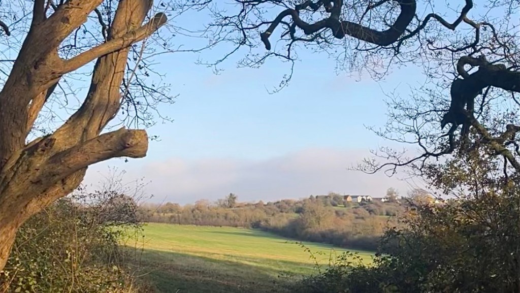
The autumn colours are still going strong, even under another overcast sky. A long, gentle stretch along Farthing Downs offers expansive views, and after crossing the railway in Coulsdon and enter a glorious green tunnel at Woodcote. Then I clamber over a stile into the graveyard of a lavender farm, ghostly and quiet without its summer blooms.
Squirrels distract me as my energy wanes, and Bourne Hall Park at Ewell provides a polished parkland finale.
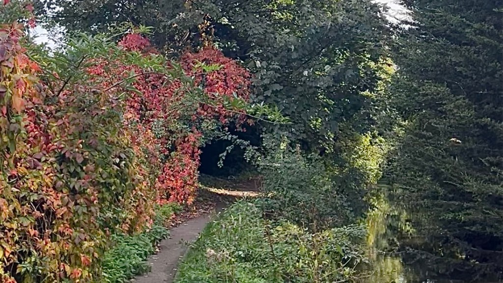
Day 5 – 9 November 2024: Ewell West to Hounslow Cemetery
Distance: 23.11 km | Elevation gain: 94 m | Moving time: 4h 37m | Average pace: 11:59/km | Average speed: 5.01km/hr
I retrace my steps through Bourne Hall Park and set off again. It’s a surprisingly quiet morning, even by London standards. The trail opens with a series of unwelcome obstacles: mud, reroutes, busy road crossings, and a long stretch of road walking.
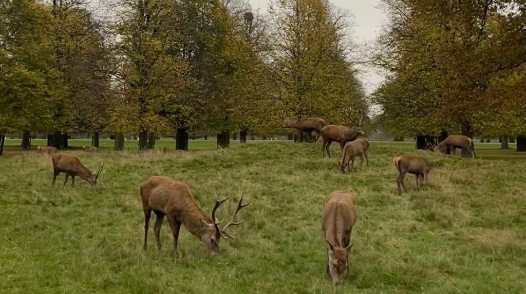
Eventually the woods return, and my spirits soar. Bushy Park is the highlight: vast, calm, and mercifully free of traffic noise. I linger while watching a deer wade into a pond for lunch, then stand quietly when I come across a large herd grazing nearby, giving them a respectful berth when I move on.
Waterhouse Woodland gardens are splendid, and pass by too quickly. But the River Crane offers peaceful walking, even as planes approaching Heathrow roar overhead. I’d hoped to reach Hatton Cross today, but a late start and the short daylight hours intervene and I call it a day at Hounslow Cemetery.
Day 6 – 10 November 2024: Hounslow Cemetery to Uxbridge
Distance: 25.91 km | Elevation gain: 108 m | Moving time: 4h 56m | Average pace: 11:25/km | Average speed: 5.25km/hr
The day begins with a dispiriting stretch along the River Crane, marred by litter and a general sense of neglect. Hatton Cross brings a long, frustrating road crossing, followed my more urban and littered walking that does little to lift the mood. In Hayes, I detour for a coffee, but navigating the crowds to get there proves more stressful than restorative.
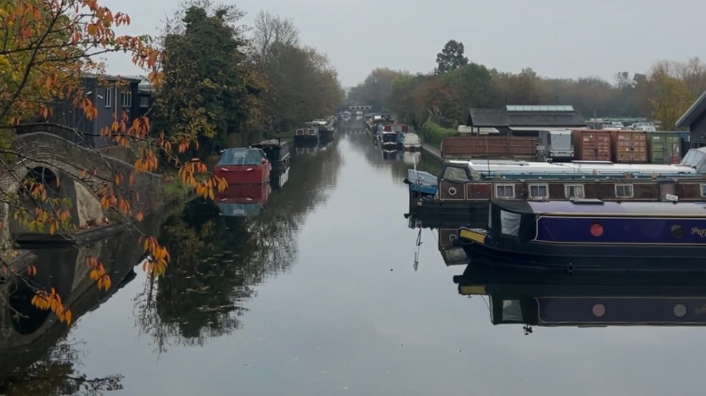
Eventually the canal towpath widens and quiets, and I relax into the trail. A golf course offers a brief return to green space, before the trail delivers me back to the canal once more. This section is calmer, and I settle into a rhythm.
Colne Valley Regional Park provides a welcome change, with lakes and open views. The path the trail takes through the outskirts of Uxbridge isn’t beautiful, but the sunset is. Clouds break apart to reveal periwinkle and apricot skies. The trail turns nicer when I rejoin the canal in twilight, pushing to reach the tube station before darkness fully settles.
Day 7 – 17 November 2024: Uxbridge to Stanmore
Distance: 32.07 km | Elevation gain: 432 m | Moving time: 5h 31m | Average pace: /10:19km | Average speed: 5.81km/hr
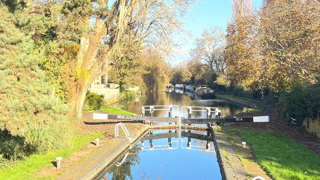
The weather gods are being kind today: blue sky, drifting clouds, and a canal transformed into a perfect mirror. Today is meant to be another long run, but after 10km I abandon that plan, too enamoured with the conditions to rush through them.
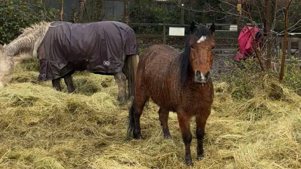
Gentle woods glow yellow, leaves clinging stubbornly to branches despite the breeze doing its best to dislodge them. Fields follow, dotted with polite, disinterested horses, and then Bishop’s Wood Country Park, dense and tangled in the best possible way. I cross another golf course and re-enter forest, where the light dances across the leaves. Some horses here are friendlier, demanding pats before allowing me to pass.
As clouds begin to descend I quicken my pace through Stanmore Country Park, arriving just as darkness starts to creep in.
Day 8 – 22 November 2024: Stanmore to Cockfosters
Distance: 26.49 km | Elevation gain: 419 m | Moving time: 5h 15m | Average pace: 11:53/km | Average speed: 5.05km/hr
With some annual leave to burn, I’m happy to spend a Friday on the LOOP. Another blue-sky day greets me as I return to Stanmore and grit my teeth to climb the hill I’d hurried down at the end of the last section. At the top, I pause to watch some ducks drift lazily across a pond.
The day unfolds in a familiar rhythm: fields, forests and short sections of road that make the greenery feel even more precious. Ice has begun to form in farm tracks and puddles, and dark clouds attempt, thankfully unsuccessfully, to bully the sunshine away.
I pass horses and buildings that have lived many lives, imagining the people and events that once filled these places. By the final kilometres I’m contentedly tired, and catch the Tube home pleased with the way I’ve used my annual leave.
Day 9 – 30 November 2024: Cockfosters to Chingford
Distance: 24.89 km | Elevation gain: 292 m | Moving time: 5h 1m | Average pace: 12:06/km | Average speed: 4.96km/hr
The weather has turned again, but at least it’s ideal walking temperature. The day begins with a grand parkland; wide, flat paths make progress easy. Then I follow a quiet brook and pass a series of ponds. The next park proves underwhelming, and the stretch past Enfield Lock is surprisingly dull.
Things improve in the afternoon. A brief towpath section along the River Lee leads to a modern cemetery and a hill climb where I miss a turn and have to double back. Eventually, a sweeping green field appears just as the sun starts to break through the cloud cover.
Boggy ground and forest follow; I’m grateful to be back among trees. Although I’d hoped to make it further along the trail, the shortening days have other ideas. At Chingford, I turn for home as dusk descends.
Day 10 – 8 December 2024: Chingford to Havering-Atte-Bower
Distance: 18.92 km | Elevation gain: 312 m | Moving time: 3h 49m | Average pace: 12:06/km | Average speed: 4.96km/hr
I rejoin the trail under a light drizzle, already dressed for the worst in full rain gear. The rain lasts for a while, but the mud lasts even longer. For once I’m grateful for stretches of urban walking, especially when it’s through handsome buildings that spark the imagination.
Fields return, complete with soggy horses and a flock of visiting geese. In Hainault Forest, I take a gamble on an off-route cafe declared to be open on Google Maps, and win. A hot cup of tea there works wonders, but with daylight slipping away I don’t linger long.
Havering Country Park is a standout: tall trees, soft light and a deep sense of calm. The village of Havering-atte-Bower appears just as the day begins to fade, and I head home tired by buoyed by one of the trail’s loveliest sections.
Day 11 – 14 December 2024: Havering-Atte-Bower to Purfleet
Distance: 30.56 km | Elevation gain: 175 m | Moving time: 5h 32m | Average pace: 10:52/km | Average speed: 5.52km/hr
I return beneath a sky that promises a beautiful day ahead, and with the determination to finish the trail today before the Christmas break.
Fields dominate the morning. Somewhere near Noak Hill I spot a couple of men with guns and immediately detour wide, in the process realising they’re likely hunting. My fire-engine-red backpack suddenly feels like my best purchase to date.
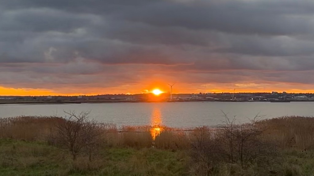
A brook winds through a garden, then forest returns, sunlit and energising. My pace lifts effortlessly as signs to Purfleet begin to appear, unhelpfully in miles. Eventually the Thames comes into view, unexpectedly lovely in the soft afternoon light.
The sun burns low as I walk the final stretch along the river, sky turning purple as day fade. I reach Purfleet in twilight, a spectacular, satisfying end to this project.
Want More?
Curious about the practical side of the trail? Check out my London Outer Orbital Path (LOOP): How-To post for route info and planning tips.

Leave a comment