4 days, 48 kilometres, 1,980 metres of elevation gain. I thru-hiked the trail in March 2025: here’s the journey, day-by-day.
Thinking about tackling the trail yourself? Check out my Three Capes Track: How-To post.
The Stats
Trip Summary
- Start date: 2 March 2025
- Days hiked: 4
- End date: 5 March 2025
Distance & Elevation
- Total distance: 48.31 km
- Average distance/day: 12.1 km
- Total elevation gain & loss: + 1,980 m / – 1,955 m
- Average elevation gain & loss / day (ex zeros): + 495 m / – 489 m
Time & Pace
- Total moving time: 12 h 26 m
- Average moving time / day (hiking days only): 3 h 6 m
- Average moving pace: 15:28/km; 3.88km/hr
Budget (ex gear)
| Category | Total (AUD) | Breakdown |
|---|---|---|
| Trailhead transport | 80 | 2x one-way tickets between Hobart & Port Arthur |
| Booking fee | 625 | Includes entry to Port Arthur Historic Site; boat ride to Denman’s Cove; bus ride from Fortescue Bay to Port Arthur Note this fee is subject to change annually |
| Food | 51.22 | Supermarket haul in Hobart |
| TOTAL | 756.22 | Average / day: $189.06 |
Trail Journal
Day 1 – 2 March 2025: Port Arthur to Surveyor’s Hut
Distance: 4.46 km | Elevation gain: 202 m | Moving time: 1h 4m | Average pace: 14:25/km; 4.16km/hr
Easing in: a gentle warm-up
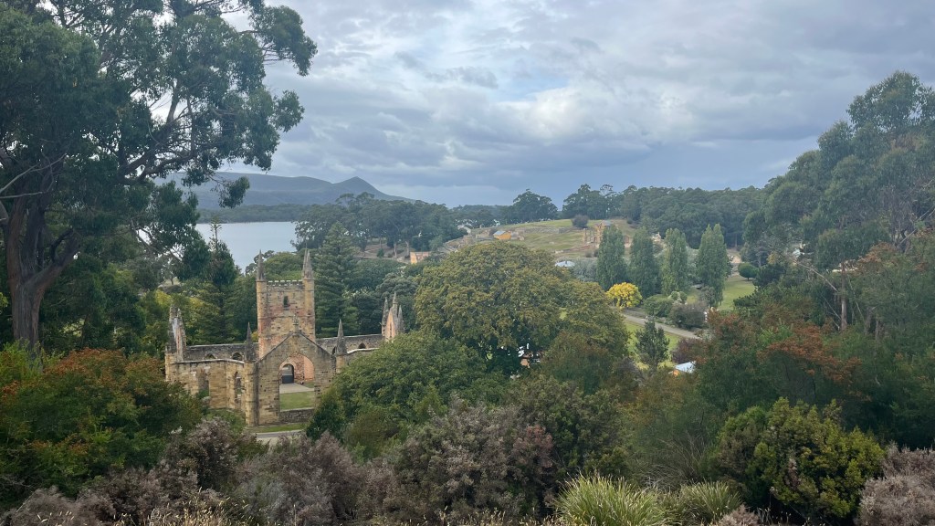
We arrived in Hobart yesterday afternoon, and this morning we’re up early to catch a shuttle to Port Arthur where the track officially begins. The city is bustling even this early in the morning: a race is in full swing, so plenty of people are out and about.
The shuttle drops us off around 9.30am, and at the trail office my priority is offloading the luggage I’ve brought with me from London: packing for a hike plus a wedding plus a conference was a challenge. With time to spare before our boat departure, we wander through the Historic Site, keeping one eye on the clock.
Down at the dock, we’re offered ponchos. Too lazy to dig through my bag for my rain gear, I take the only size that’s left: kids. It’s a good call: as the boat zips along it begins to rain, and what would’ve been drizzle if standing still turns into thousands of rough pinpricks. In-between the rain and the rev of the boat’s engine, I listen out to the crew’s stories about the coastline and its wildlife.
By the time we reach Denman’s Cove the rain has stopped, but we’re about to get wetter. We hop out into the shallows and wade ashore. Once we’ve re-laced our shoes and taken the obligatory terminus photo, it’s time to begin walking.
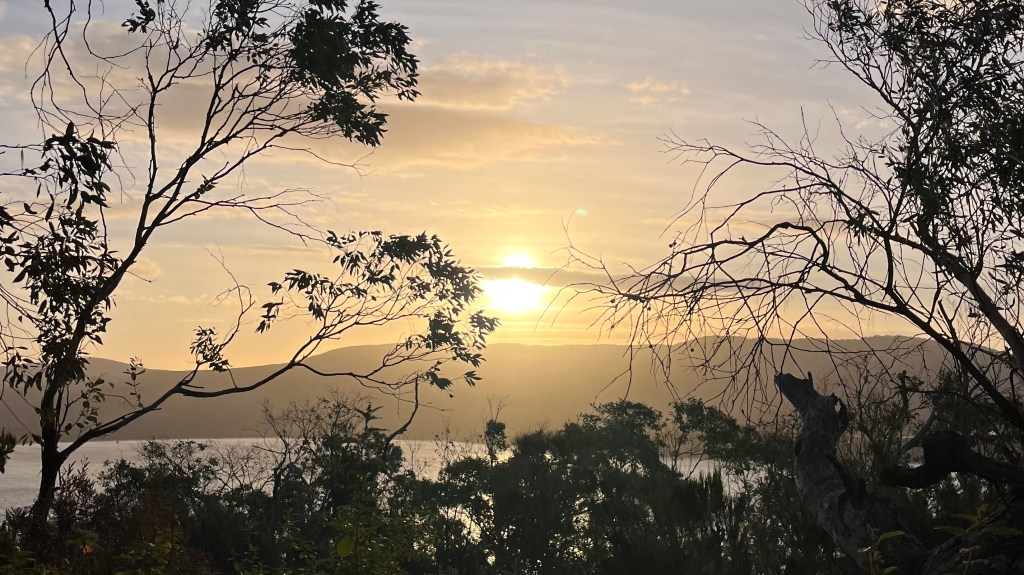
4km is all we have to do today. A forested path, through which we catch glimpses of the brilliant minty turquoise ocean, leads us to Surveyors Hut. It drizzles a little bit but eventually clears; we enjoy the view from the front deck, and take a stroll along tomorrow’s path to catch a sunset of warm apricot and peach against soft periwinkle. Jetlag calls, and I turn in early.
Day 2 – 3 March 2025: Surveyors Hut to Munro Hut
Distance: 11.26 km | Elevation gain: 402 m | Moving time: 2h 48m | Average pace: 14:57/km; 4.01km/hr
Wallabies & wild wide views
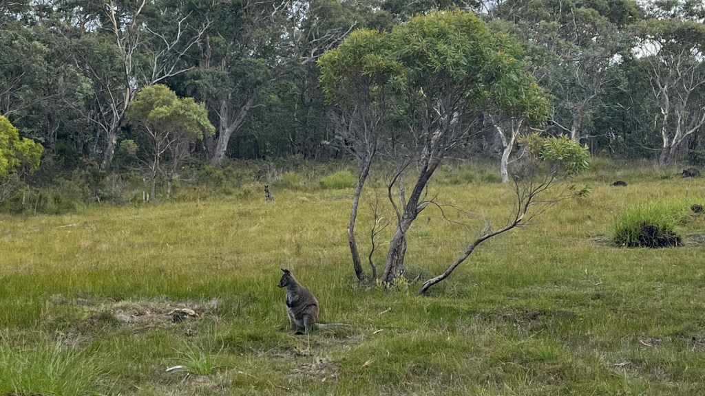
In the communal kitchen, breakfast chatter revolves around wildlife: there are several wallabies grazing just outside, and apparently wombats were practically queueing for the toilets overnight.
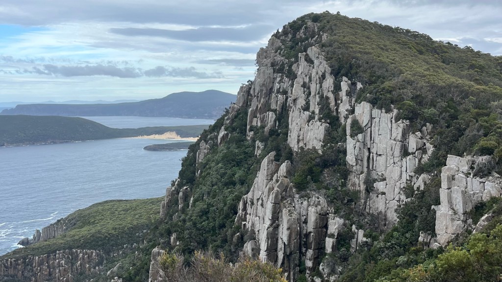
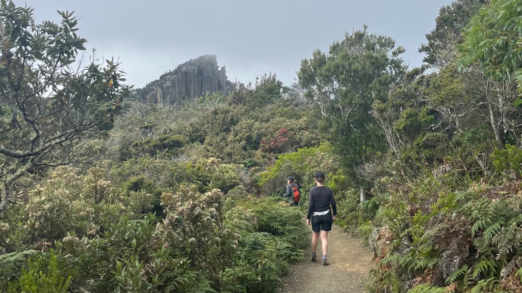
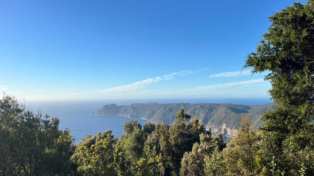
By 8.30am we’re walking, but with only 11km on the agenda there’s no reason to rush. The weather is cool enough for comfort, warm enough to take our time. The sky is grey again, but streaks of blue break through now and then. Soon enough, the first cliffs appear: towering columns shaped by cooling lava millennia ago. We’re in open, scrubby fell-like country with uninterrupted views.
Just as the sun fully commits to making this a perfect blue-sky day, the trail sends us back into forest and we begin to climb. Every twist in the track reveals a new lookout, another moment worth pausing for.
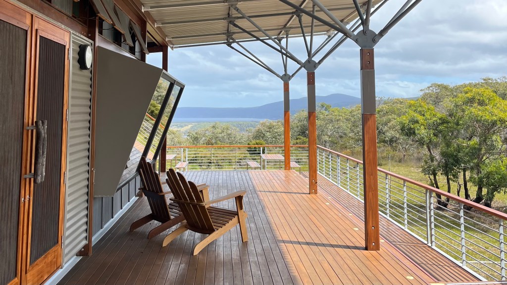
Despite our leisurely pace, we arrive early at Munro Hut. The rooms aren’t ready, so we claim some deck chairs, brew tea and eat lunch in the sun. After a while, restlessness sets in. There’s only one direction for exploring: tomorrow’s path. We set of with snacks, hoping to find a picnic spot. It’s a cool, shaded walk, but when stairs appear, ready to deliver us uphill, we decide the picnic isn’t that necessary and turn back.
Back at the hut, most people have arrived. We unroll yoga mats on the viewing platform and stretch in the shade of a gum tree before queueing for a shower; a bucket of hot water hoisted above your head by pulley, and surprisingly effective and luxurious. A quiet dinner, a browse through the library, and then we retreat to bed: on the way, we pass a possum investigating the verandah for snacks, completely unfazed by us or our torchlight.
Day 3 – 4 March 2025: Munro Hut to Retakunna Hut
Distance: 18.53 km | Elevation gain: 688 m | Moving time: 4h 42m | Average pace: 15:14/km; 3.94km/hr
Cloud-kissed cliffs and a snake gauntlet
Today’s the big one: 18km out to Cape Pillar, then back through Munro on the way to Retakunna Hut. I’m normally not a fan of out and backs, but I must admit it’s nice to only carry a day bag for most of today.
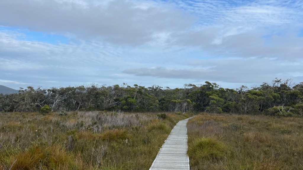
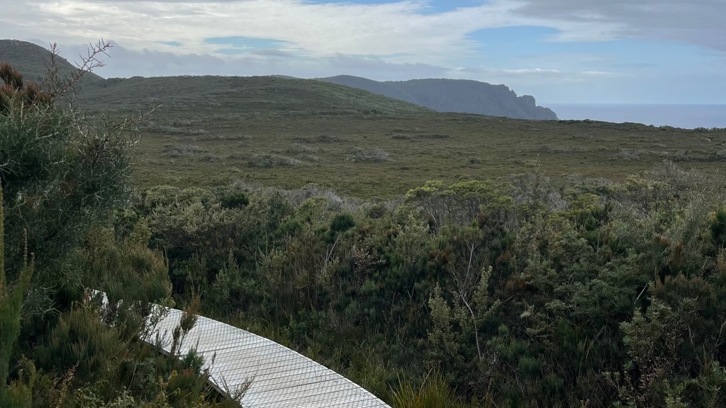
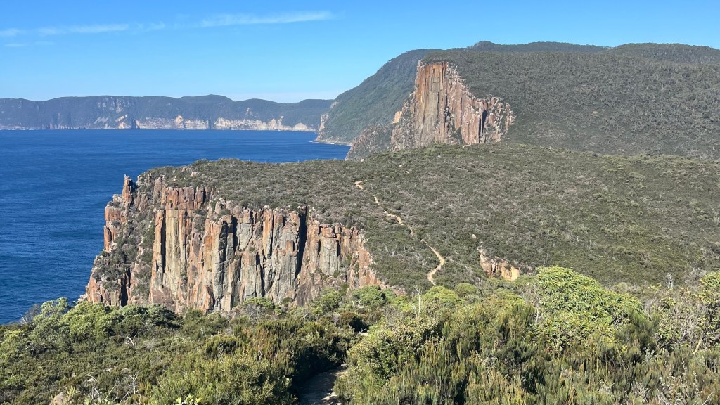
The morning is calm and grey as we retrace yesterday afternoon’s steps through the trees, and discover that if we’d just embraced the short stair section we would’ve arrived at a perfect bench picnic spot. The track soon transforms into a pale timber boardwalk that winds across the open, scrubby hills, tracing an elegant line through the bush.
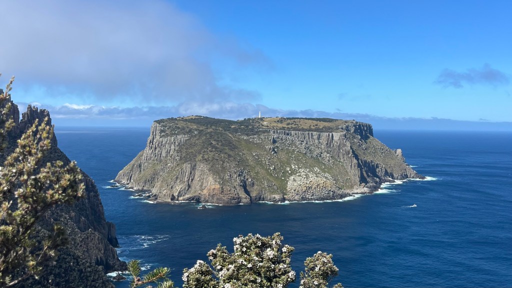
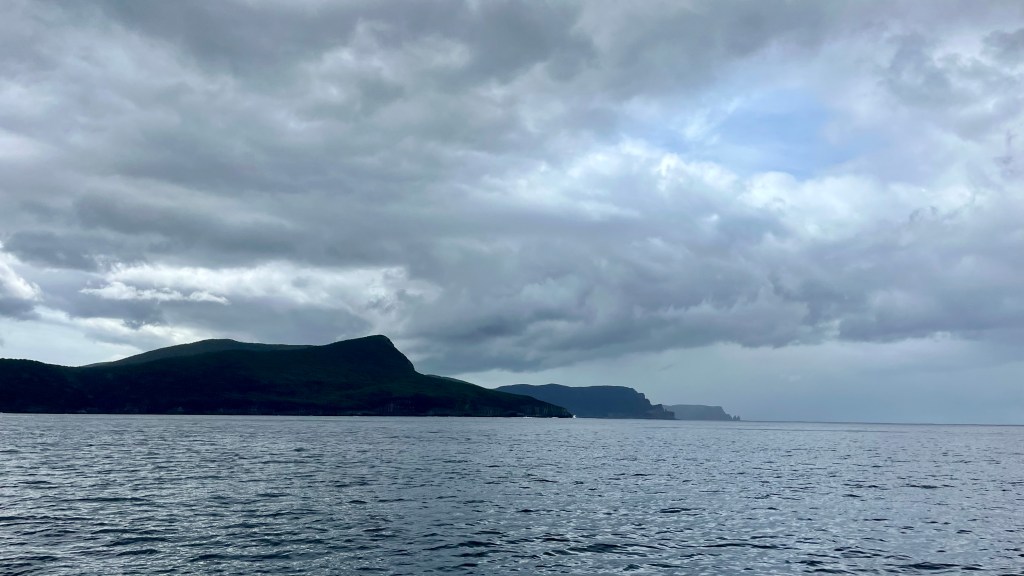
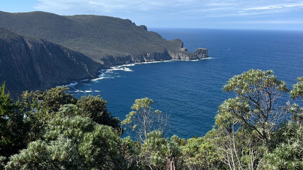
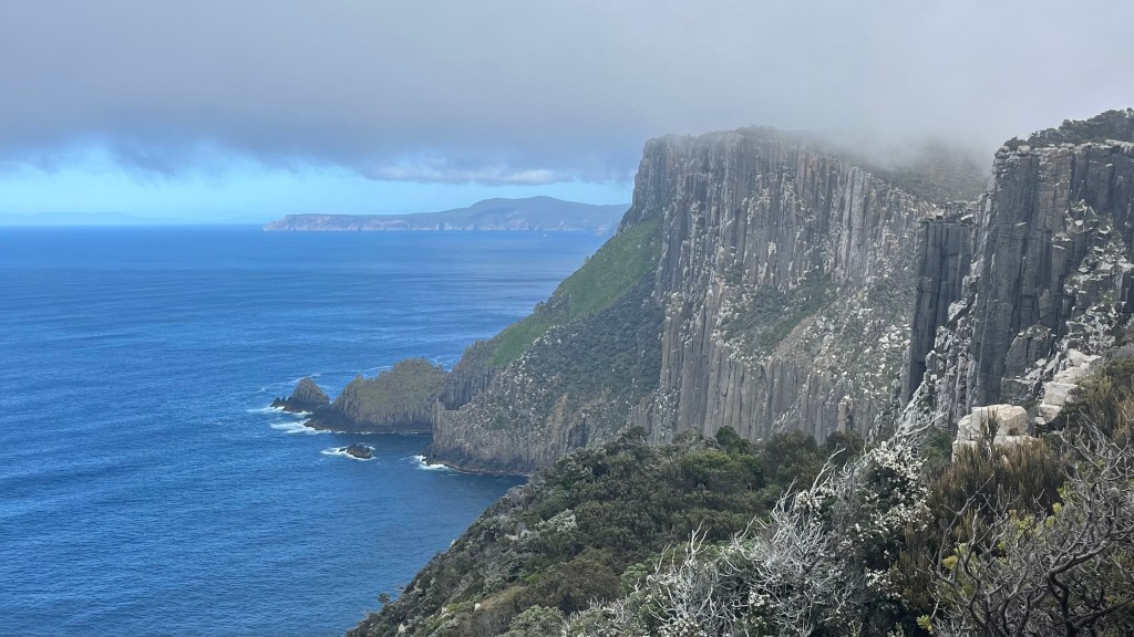
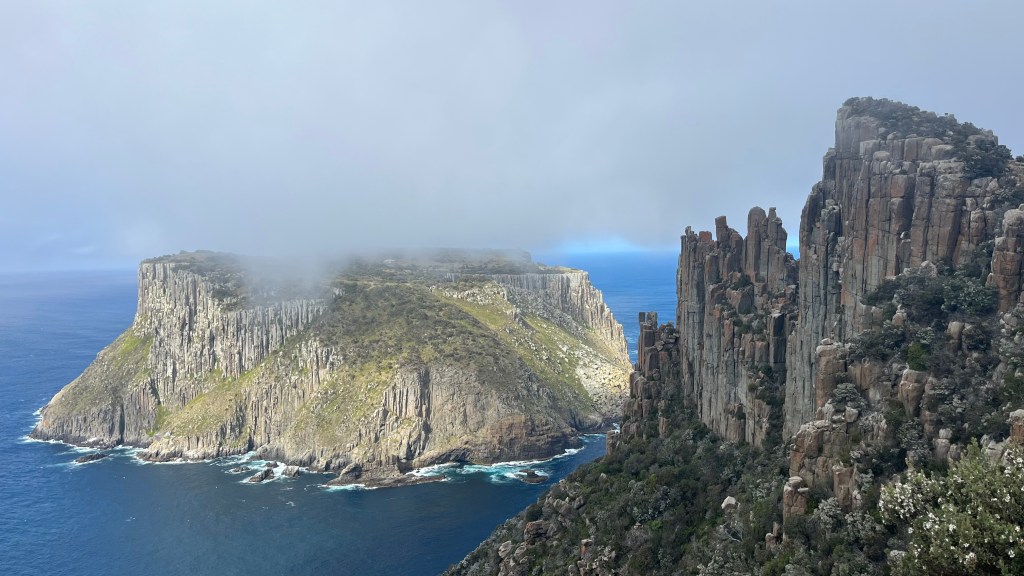
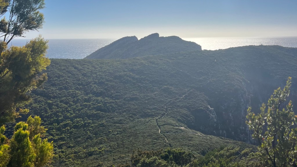
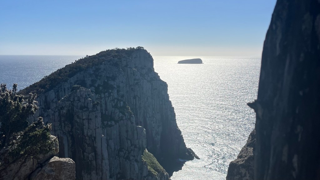
Cliffs appear all at once: vest, chiselled columns drop straight into the sea. Our pace drops as we take it all in. Tasman Island slowly reveals itself, its sheer cliffsides unbelievable: we squint at the tiny lighthouse on top and debate how on earth anyone managed to haul building materials up there before helicopters.
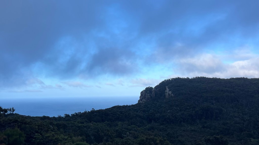
Clouds roll in, draping the cape in mist that dances along the cliffs: everything has a dreamlike quality. We scramble up one lookout to enjoy the performance, before continuing on to the next as the sun finally emerges, bringing bright blue skies with it.
Then it’s time to turn around. The second half of the day becomes a snake gauntlet: between us, we spot three. I manage not to react too strongly to the first, completely miss the second, but the third earns my more typical response: a strangled noise and a frantic two-footed hop that makes Caitlin look at me as though I’ve malfunctioned.
Back at Munro we repack our large bags and set off toward Retakunna. The afternoon is warm, and we’re eager to make good time. At Retakunna the breeze is strong: initially fantastic for cooling off, but it soon ruins our plans of sitting in the sun and we retreat into the communal cabins, where we spend the rest of the afternoon and most of the evening swapping stories with our fellow walkers.
Day 4 – 5 March 2025: Retakunna Hut to Fortescue Bay
Distance: 14.06 km | Elevation gain: 688 m | Moving time: 3h 52m | Average pace: 16:29/km; 3.64km/hr
Summit first, swim last, sunshine throughout
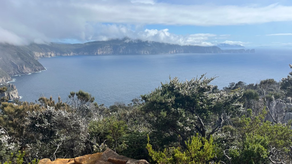
It was obvious to us yesterday that our first order of business this morning would be tackling a mountain; so we set out just before 7.30am to beat the heat. The sky was clear, soft light illuminating the trees as we climbed. Frequent viewpoints allow us to pause and appreciate the scenery. With not a cloud in sight we have a clear line to Cape Pillar, and we are able to spot all the places the trail had taken us yesterday.
At the junction to Cape Huay we drop our packs, taking only water for the stairs that go down, down, down and then back up, up, up. At the final viewpoint we linger for a while, enjoying a snack and the breeze as the morning warms up. Another snake appears on the path, but thankfully this time I don’t overreact. Perhaps yesterday’s exposure therapy did its job.
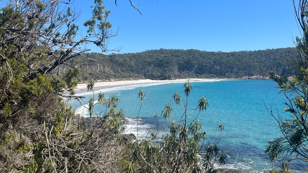
Back at the junction a school group is receiving a briefing before making their way out to the cape, so we slip around the back to retrieve our packs, but wait until they’ve moved on so we can claim the benches for a short break. The final stretch to Fortescue Bay is a pleasant end to the walk: shaded and downhill. All too soon the terminus marker appears, although we still have a few kilometres to go. A sweep of white sand appears through the trees, meeting a calm, bright cyan sea. Our final steps are motivated by the promise of a dip. We drop our packs and head for the water. It’s bracing, to say the least.
Our shuttle arrives to take us back to Port Arthur, where I indulge in a celebratory slice of cake and we take another turn around the Historic Site before our next shuttle arrives to take us back to Hobart.
Want More?
Curious about the practical side of the trail? Check out my Three Capes Track: How-To post for route info and planning tips.

Leave a comment