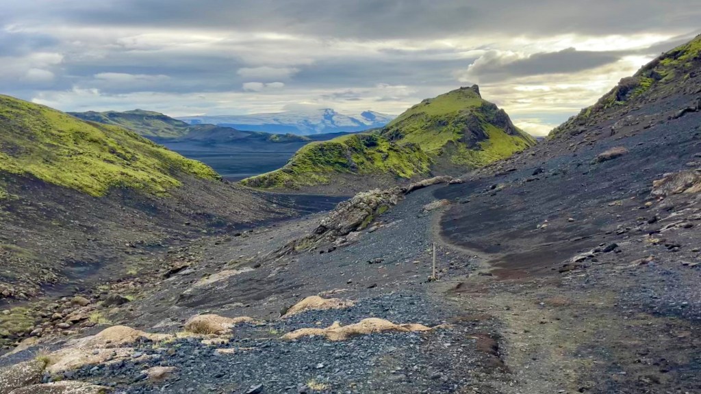
The Hellismannaleið, Laugavegur and Fimmvörðuháls are three trails in the highlands of Iceland which can be connected and walked as a single trail. The connected route showcases many of the diverse landscapes Iceland is famous for: black ash valleys, rainbow rhyolite mountains, steaming hot springs, lush green valleys and glacier-capped volcanoes.
Of the three, the Laugavegur is the most famous – walked for centuries by farmers and shepherds moving between pastures but officially established as a hiking route in 1978. The Fimmvörðuháls is the popular extension; drawing walkers past and through two new volcanic craters formed in the 2010 Eyjafjallajökull eruption. The lesser-known Hellismannaleið (“way of the cavemen”), so-named for the caves along the past used as shelters by travelling shepherds, offers a quieter start or end to the busy Laugavegur.
I thru-hiked the trails in late August 2025. For a closer look at the on-the-ground experience, head over to my Iceland’s Hellismannaleið, Laugavegur and Fimmvörðuháls: Trail Journal for my stats, budget, photos and story.
- Quick Facts
- Map & Elevation Profile
- Preparation
- River Crossings
- Accommodation
- Gear List
- Possible Stages
- On-Trail Practicalities
- Side Missions & Connecting Trails
- Hiking as a Solo Woman
Quick Facts
| Hellismannaleið | Laugavegur | Fimmvörðuháls | TOTALS | |
| Distance | 58 km | 55 km | 25 km | 138km |
| Elevation gain & loss | 627 m | 1,700 m | 1,400 m | 3,727 m |
| Days to complete | 2-3 | 3-4 | 1-2 | 6-9 |
| Best season | Mid-June to mid-September | Mid-June to mid-September | Mid-June to mid-September | Mid-June to mid-September |
| Trailheads | Rjúpnavellir; Landmannalaugar | Landmannalaugar; Þórsmörk (Thorsmork) | Þórsmörk (Thorsmork); Skógar | Rjúpnavellir; Skógar |
| Recommended direction | W2E | NOBO | Either! | West > South |
Map & Elevation Profile
Preparation
Trailheads & getting there
- Hellismannaleið: Rjúpnavellir* (east-bound) or Landmannalaugar (west-bound). *Technically, the trail actually starts an additional 25 km away in Leirubakki; however, apparently it is quite overgrown and it seems that most hikers skip this section.
- Laugavegur: Landmannalaugar (south-bound) or Þórsmörk (Thorsmörk) (north-bound)
- Fimmvörðuháls: Þórsmörk (Thorsmörk) (south-bound) or Skógar (north-bound)
Each of Trex and Rejkjavik Excursions’ Highland Bus travel daily during peak hiking season to major trailheads including Rjúpnavellir, Landmannalaugar, Þórsmörk (Thorsmörk) and Skógar. From Skógar, you could alternatively catch the public bus Strætó 51 to the bus interchange in Reykjavik; although not much cheaper, it does avoid the 6 hour stop over the Highland Bus takes between Skógar and Reykjavik.
Direction to Walk
Each trail can be hiked in either direction. If you’re tackling:
- The Hellismannaleið: start in Rjúpnavellir and walk east; ending at the rainbow mountains and hot springs of Landmannalaugar is a fantastic reward.
- The Laugavegur: head northbound from Þórsmörk (Thorsmork), for the same reason you should head east on the Hellismannaleið.
- The Fimmvörduháls: either way works! All of it is stunning
- All three at once: start with the Hellismannaleið and finish at Skógar. This way, you’ll end with more spectacular views on your final day.
Season to Walk
These trails should only be walked mid-June to mid-September. Even in this season, weather can turn dangerous quickly. In late August I ended up cabin bound for a day due to extreme winds.
Mountain Safety
Safetravel.is provides up to date information about weather across Iceland. They have an app, and publish regular updates on their social media. You can also register your travel plans with them – always a good idea.
River Crossings
Note there are several river crossings, mainly on the Laugavegur and Hellismannaleið. You need to know, or learn how to, cross them safely. It’s worth YouTubing a few instructional videos. If in doubt, especially if solo, wait until another hiker comes along so you can team up for safety. A lovely feature of this trail is the people: multiple other hiking groups saw that I was solo and stopped to see that I made it across safely.
On the Hellismannaleið, the major river is between Áfangagil and Landmannahellir. I asked at the tourist information centre for Reykjavik for any information about the water levels, and they didn’t have any way to tell. I planned on asking the hut wardens at Rjúpnavellir and Áfangagil if they had any intel; but the wardens weren’t present in person when I was there. Luckily the water level turned out to be safe.
On the Laugavegur and Fimmvörduháls check in with the hut wardens for information on river levels. They rely on hikers reporting the conditions from the previous day: so if you’re heading NOBO you’d be doing other hikers a service if you checked in with the wardens on your way through. The hut wardens can also run you through a refresher on how to cross a river safely, but you really should make an effort to learn before you go.
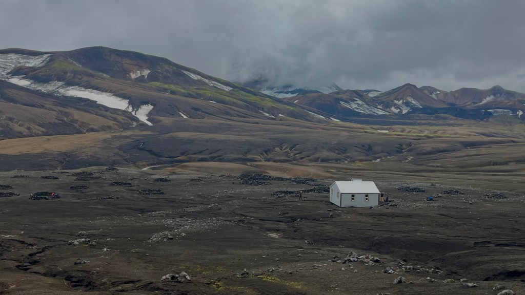
Accommodation
Beds & bunks
Cabins are available at all stage ends. These are privately run on the Hellismannaleið; and on the Laugavegur and Fimmvörduháls they’re operated by Ferðafélag Íslands, the Iceland Touring Association, (FÍ). You’ll be sharing the space with others, dorm-style.
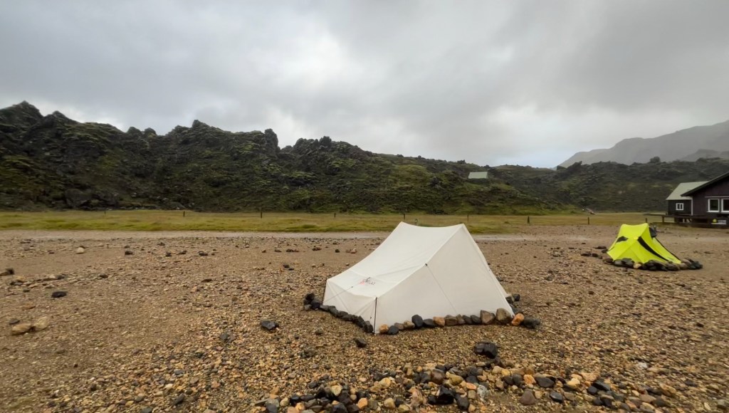
Camping
Wild camping is not permitted within nature reserves, so instead you’ll need to pay a fee to FÍ / at Landmannahellir to camp nearby a cabin. You can wild camp on part of the Hellismannaleið before you enter the nature reserve.
Gear List
I camped, which means a longer gear list than those staying in cabins will need:
- 50L backpack
- Tent
- Trekking poles
- Sleeping mat
- Sleeping bag
- Cooking gear: stove; pot; gas; spork
- Food for the entire trail
- Water capacity
- 1 set hiking clothes
- 1 set clean clothes (for travel / cabin wear)
- 3x socks and underwear
- Warm layers (leggings, fleece, puffer)
- Rain layers
- Sunglasses, hat, beanie / buff
- Trail runners or hiking shoes
- Sandals and lightweight towel (essential for river crossings)
- Electronics, including battery pack (no chargers at huts) and head torch (just in case)
- Toiletries and first aid
When I was researching there was a bit of discussion about whether river crossing shoes are required. They absolutely are. I often couldn’t see what I might be stepping on, and the rivers are so cold I wouldn’t want to take the risk of prolonging the crossing, or accidentally ending up in it.
Possible Stages
| Place | Distance from previous (km) (Hellismannaleið to Fimmvorduháls) | Distance from previous (km) (Fimmvorduháls to Hellismannaleið) |
|---|---|---|
| Rjúpnavellir | 0 | 18 |
| Áfangagil | 18 | 21 |
| Landmannahellir | 21 | 16 |
| Landmannalaugar | 16 | 12 |
| Hrafntinnusker | 12 | 12 |
| Álftavatn | 12 | 4 |
| Hvanngil | 4 | 12 |
| Emstrur | 12 | 15 |
| Þórsmörk (Thorsmork) | 15 | 15 |
| Baldvinsskáli / Fimmvörðuskáli | 15 | 12 |
| Skógar | 12 | 0 |
On-Trail Practicalities
Finding Your way
Trail Markings
You’ll be following wooden stakes in the ground at about knee height, topped with coloured paint: white on the Hellismannaleið, and a few different colours but manly a royal blue on the Laugavegur and Fimmvörduháls. Trail markings were generally good, although there were a few blow downs on the Hellismannaleið, and they can be hard to spot in cloud so you’ll definitely need your own map or app on these trails.
Maps & GPX
For paper maps, you’ll want to collect a detailed topo map from a Reykjavik bookstore or the FÍ office.
If you prefer something electronic, I used a GPX file from Outdoor Active (here), which I added to my Garmin Explore app.
Guidebooks & Resources
There’s no guidebook dedicated to any of these trails alone, but all of them appear in Cicerone’s Walking and Trekking Iceland: 100 days of walking and multi-day treks by Paddy Dillon. But you don’t need a guidebook for these trails – I didn’t use one, but I did review a lot of blog posts on the Hellismannaleið in particular before heading out.
Food & Water
There are no supermarkets or grocery stores on trail, so you’ll need to prepare ahead of time. On the Laugavegur and Fimmvörðuháls many of the cabins sell some food items (at a significant mark-up, but they’ll do in a pinch)
I had no problems finding water on these trails; I generally only carried 1L at a time. The exception is on the Fimmvörðuháls where you’ll need to carry all the water you need, as there are no suitable streams for refilling. I didn’t take a filter, but I took care not to drink from any sources that looked stagnant or which had livestock upstream
On-Trail Transport
There are effectively no options for on-trail transport on any of these trails. Buses run to their trailheads, but not along the way. There are, however, a couple of places you can drive in, including Áfangagil, Landmannalaugar and Skógar, if you have a support crew. If you really need to bail, speak to the hut wardens for advice.
Money Matters
Card is absolutely fine on these trails, I didn’t even get cash out

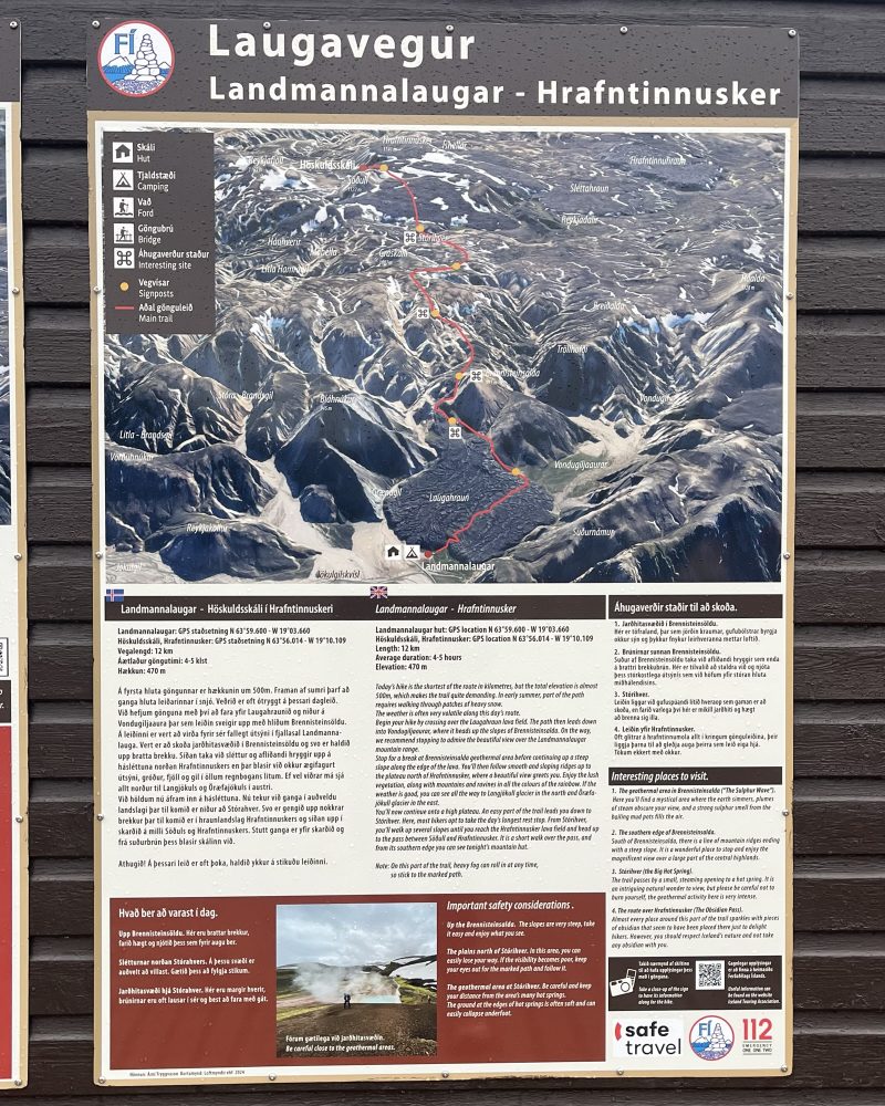
Side Missions & Connecting Trails
There are a good number of side missions from this trail, particularly on the Laugavegur where the cabins each display large maps with detailed overviews of the next section of the walk.
Hiking as a Solo Woman
I had an excellent experience as a solo female hiker on these trails. I never felt unsafe, and mobile reception was generally good once you were out of the bottom of the valleys. Although my research had suggested the Hellismannaleið was rarely walked, I encountered three other hikers at Áfangagil, and six more on the trail between there and Landmannalaugar. The Laugavegur and Fimmvörðuháls were a lot busier by comparison; but neither felt like a highway of hikers. I managed to carve out a good space from those walking behind and in front of me so that it didn’t feel like I was tailgating anyone or being tailgated myself. The wardens at the huts on the Laugavegur and Fimmvörðuháls were a fantastic source of knowledge about any upcoming hurdles (especially current river levels) and didn’t hesitate to tell me whether or not my plans were feasible
Want More?
Check out my Iceland’s Hellismannaleið, Laugavegur and Fimmvörðuháls: Trail Journal post for stories and snapshots from the trail.

Leave a comment