5 days, 138 kilometres, 4,580 metres of elevation gain. I thru-hiked the trail in late August 2025: here’s the journey, day-by-day.
Thinking about tackling the trail yourself? Check out my Iceland’s Hellismannaleið, Laugavegur and Fimmvörðuháls: How-To post.
The Stats
Trip Summary
- Start date: 25 August 2025
- Days hiked: 4
- Zero days: 1
- Total days: 5
- End date: 29 August 2025
Distance & Elevation
- Total distance: 138.3 km
- Average distance / day (hiking days only): 34.6 km
- Total elevation gain & loss (hiking days only): + 4,579 m / – 4,361 m
- Average elevation gain & loss / hiking days: + 1,145 m / – 1,090
Time & Pace
- Total moving time: 31h 44m
- Average moving time / hiking day: 7h 56m
- Average moving pace: 13:46/km
- Average moving speed: 4.36km/hr
Budget (ex gear)
| Categrory | Total (ISK) | Breakdown |
|---|---|---|
| Accommodation | 25,850 | 2x transit nights in Reykjavik campsite (3,775 / night); Day 1 camping (2,500); Day 2 cabin (7,200); Day 3 camping (3,200); Day 4 camping (3,200); Day 5 camping (2,200) |
| Food | 17,905 | Pre-prepared meals (~£50); Mountain Mall snack haul (2,150); Langidalur snack (1,000); Skógar cafe & restaurant meals (6,485) |
| Trailhead transport | 25,805 | Return bus Reyjkavik airport to city (£57.49); Highland Bus to Rjúpnavellir (£55.04); Stræto bus Skógar to Reykjavik (7,200) |
| Other | 3,000 | Camping gas (free from hiker boxes if you’re lucky; or 3,000 ISK from cabins if you’re not!) |
| TOTAL | 72,560 | Average / day (inc zero & travel days): 10,366 |
Trail Journal
Day 1 – 25 August 2025: Rjúpnavellir to Áfangagil
Distance: 17.8 km | Elevation gain: 494 m | Moving time: 3h 50m | Average pace: 12:56/km | Average speed: 4.6km/hr
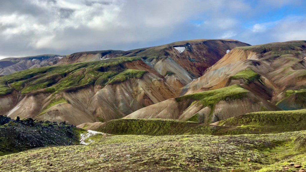
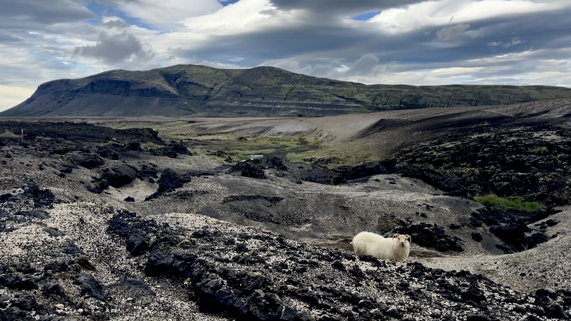
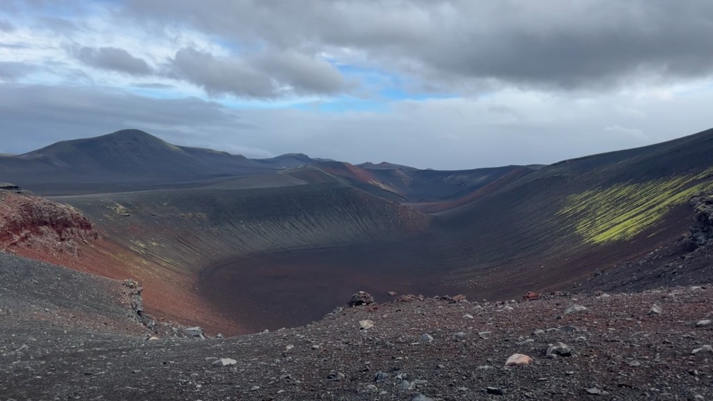
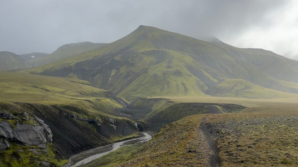
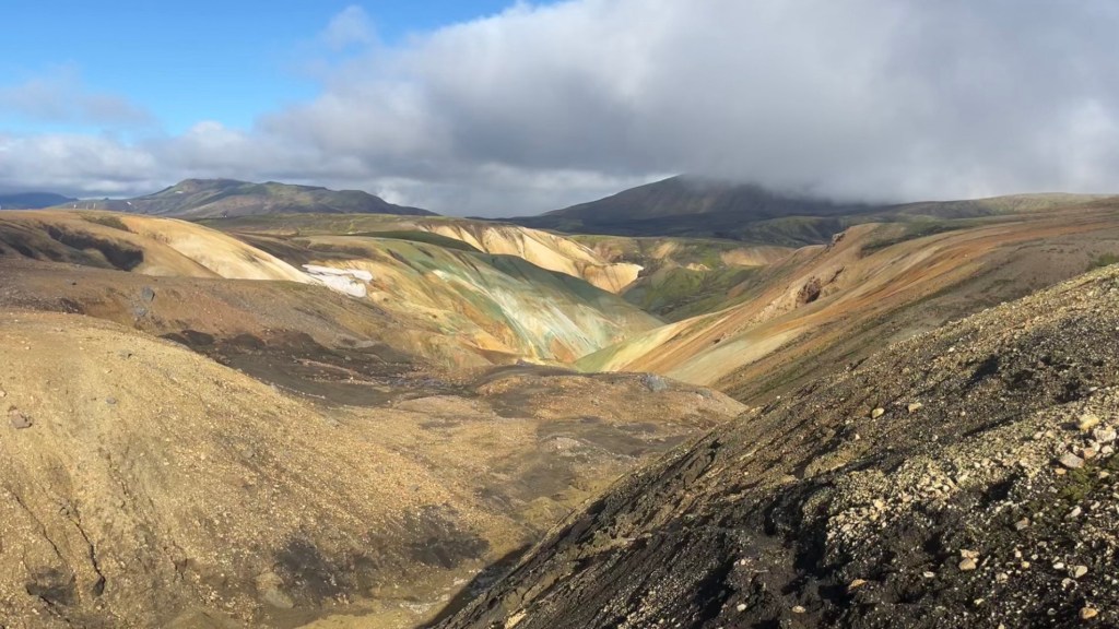
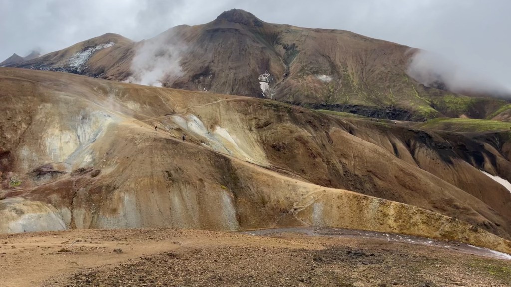
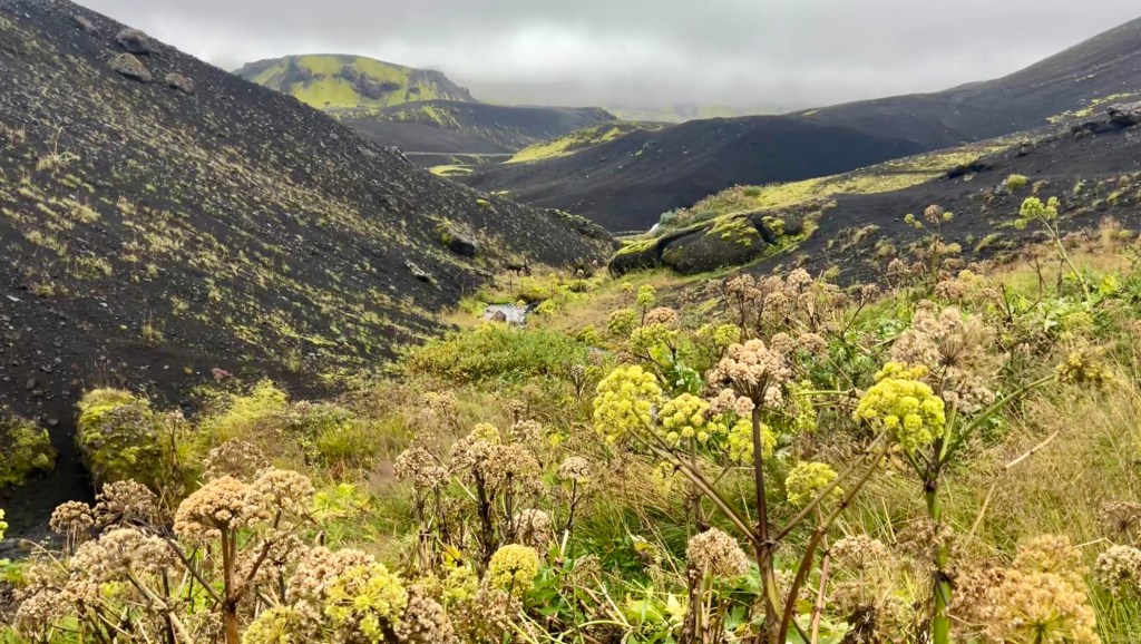
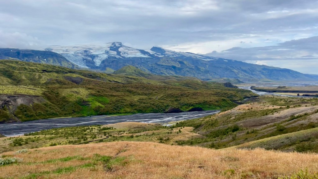
Hellismannaleið setting the tone: lush green one side, barren lunarscape the other
An early morning start to catch the 6.30am Highland Bus from Reykjavik campsite to the trailhead. Of the three buses that departed, most were heading to Landmannalaugar, where the Laugavegur begins – but I alighted at Rjúpnavellir to tackle the Hellismannaleið first. Only two others joined me, a couple – I took comfort from their presence given the unsteady weather forecast.
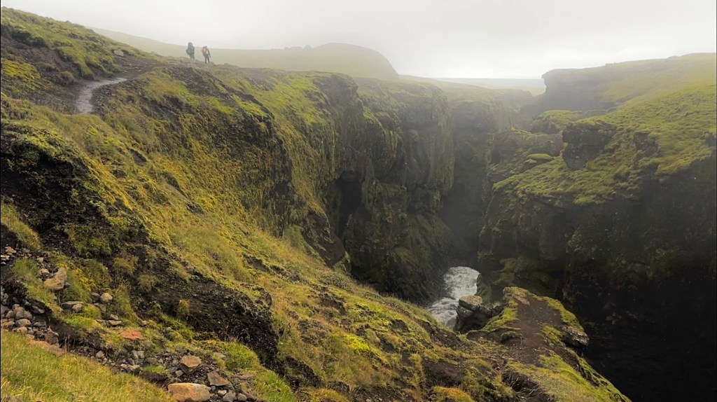
The trail began along the Ytri-Rangá river, already a study in contrasts: green and alive on the left bank; barren, pebble-strewn moonscape on the right. A bridge crossing led to a gentle climb, granting a birds-eye view of the Fossabrekkur waterfalls; a pebbly descent then deposited me right in front of the crashing water.
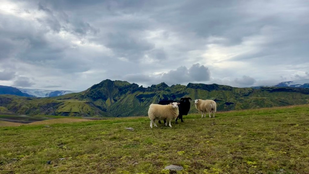
The remainder of the trail was windy, along the barren bank with Hekla’s peak hidden behind clouds. Scattered sheep eyed me suspiciously as I pressed on. My original plan had been to cover 38km on this first day, to free up shorter days later, but by Áfangagil, 18km in, I decided to stop; fatigue was setting in, the wind was picking up, and the forecast for tomorrow wasn’t promising. The tent went up quickly, dinner was prepared, and an early night followed.
Day 2 – 26 August 2025: Áfangagil
Distance: 0 km | Elevation gain: 0 m | Moving time: 0 | Average pace: 0 | Average speed: 0
A weather-induced rest day
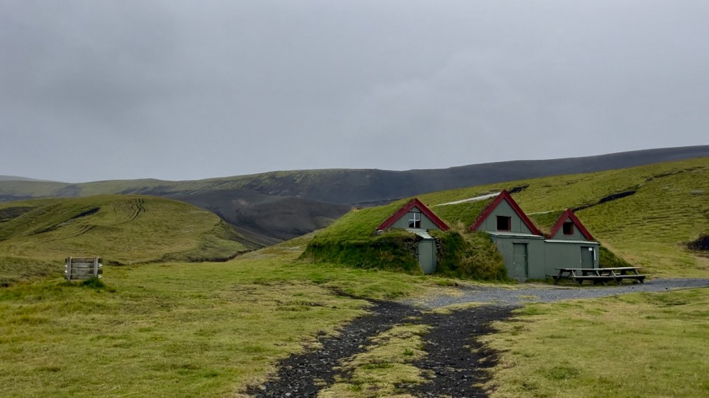
Overnight the wind howled, but my tent held up better than expected. Today’s forecast showed sustained 12 metres / second gusts and rain, making hiking too risky. Staying put was the smart choice. A guy-line soon snapped on my tent, so I arranged a cabin for the day to shelter from the wind and cold.
I had a quiet but pleasant breakfast with the couple who had arrived by the same bus yesterday. By 9am the hut warden had given me access to the cabin, where I spent the day reading and drying gear. Later, another hiker arrived, having braved the atrocious conditions from Rjúpnavellir. We shared stories over dinner, and I was grateful for a slower day to regroup and reflect on my goals for the trails. To finish all three, I’d need to do some big days.
Day 3 – 27 August 2025: Áfangagil to Landmannalaugar
Distance: 38.7 km | Elevation gain: 1,405 m | Moving time: 8h 21m | Average pace: 12:59/km | Average speed: 4.6km/hr
A battle with the wind, rewarded by wonder
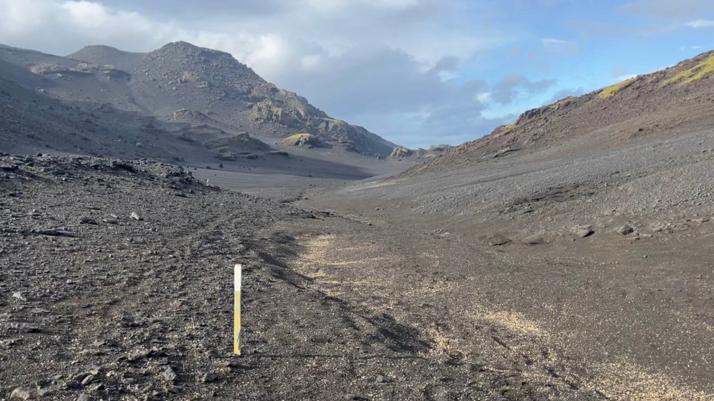
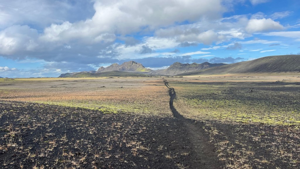
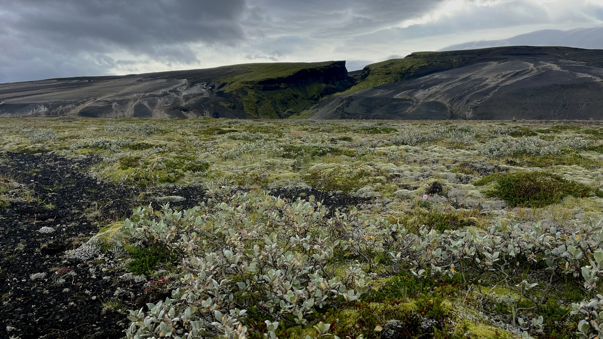
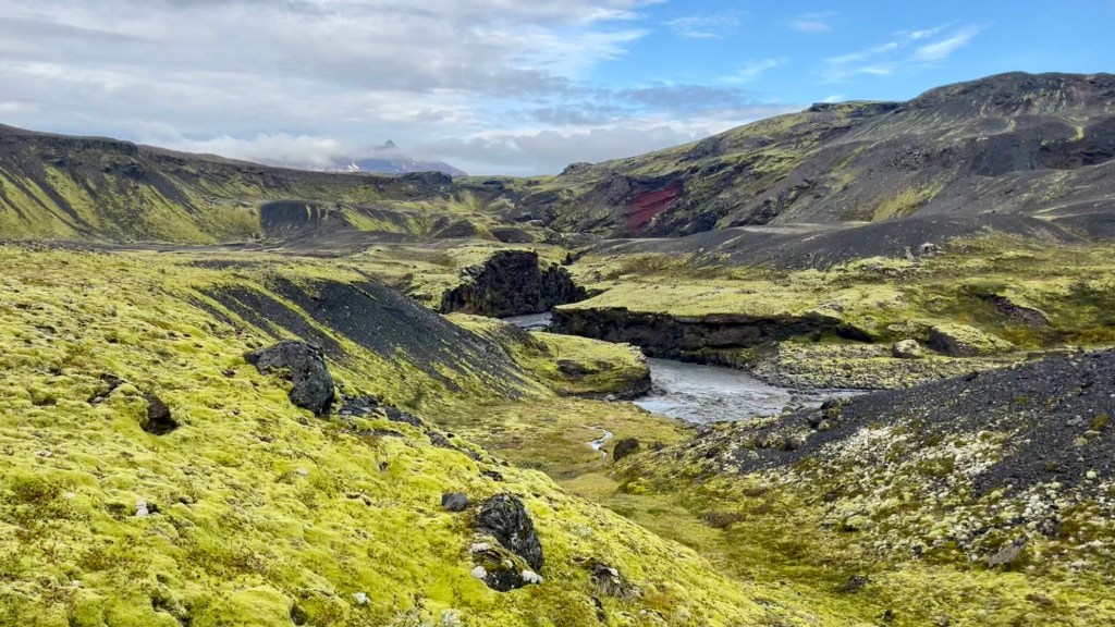
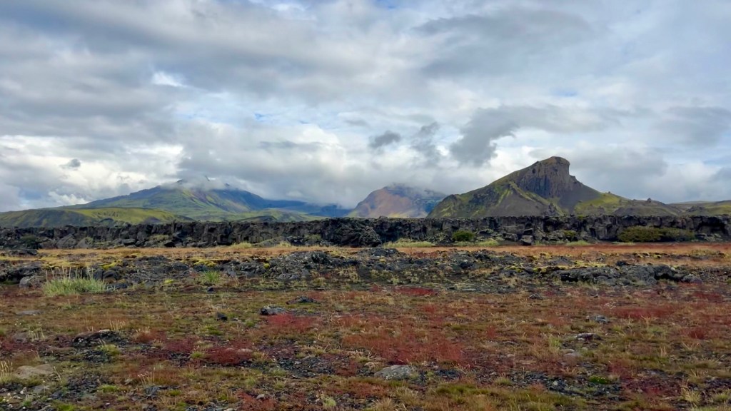
After a comfortable night in the cabin, I set out on the goal to reach Landmannalaugar – 38km away. The morning started with a small climb out of the valley, revealing black ash fields and distant peaks – though Hekla remained hidden behind clouds. The wind was persistent, but I pressed on through rolling ashy valleys and scattered rock formations.
Midday brought a jaw-dropping shift: a lush, green valley bathed in sunlight. Here the major river crossing of the day awaited, and after scouting a suitable place upstream I braved the knee-deep icy water and made it to the other side safely. It was warm and I decided to shed my shell jacket; but soon discovered that that green valley was clearly uniquely protected, as if by magic, from the weather. The trail soon returned to ashy plains, wind and rainclouds reclaiming the sky.
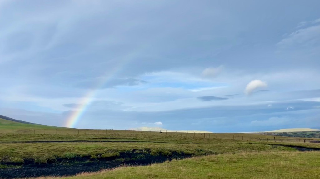
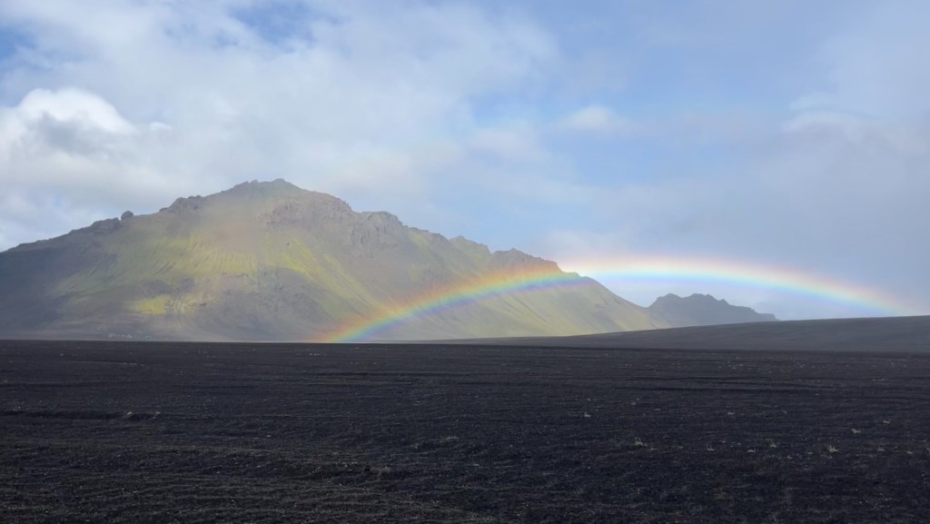
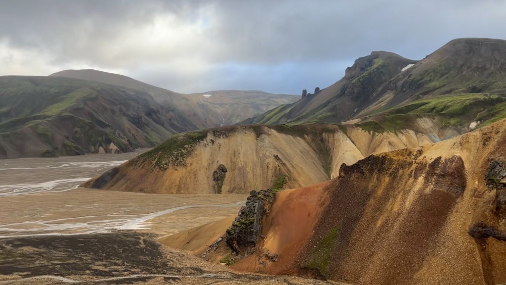
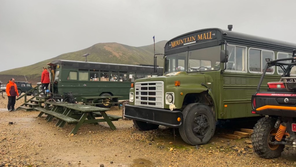
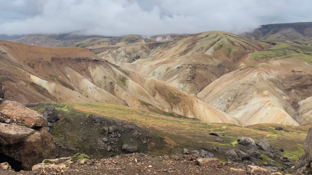
A brief pause for rest at Landmannahellir led to very encouraging remarks from the staff telling me I could easily make it to Landmannalaugar today. The final sections involved steep ascents, rolling passes, and frequent rainbows – all among misty mountains. Approaching Landmannalaugar, the vivid colours of the geothermal landscape began to reveal themselves. A final set of snowmelt streams were hopped across, leaving my feet damp although spirits remained high. I passed the hot springs and set up camp, rewarding myself for completing the Hellismannaleið with a snack run at the famous Mountain Mall before an early night.
Day 4 – 28 August 2025: Landmannalaugar to Emstrur
Distance: 38.3 km | Elevation gain: 1,160 m | Moving time: 8h 52m | Average pace: 15:53/km | Average speed: 3.8km/hr
Today’s menu: diverse landscapes
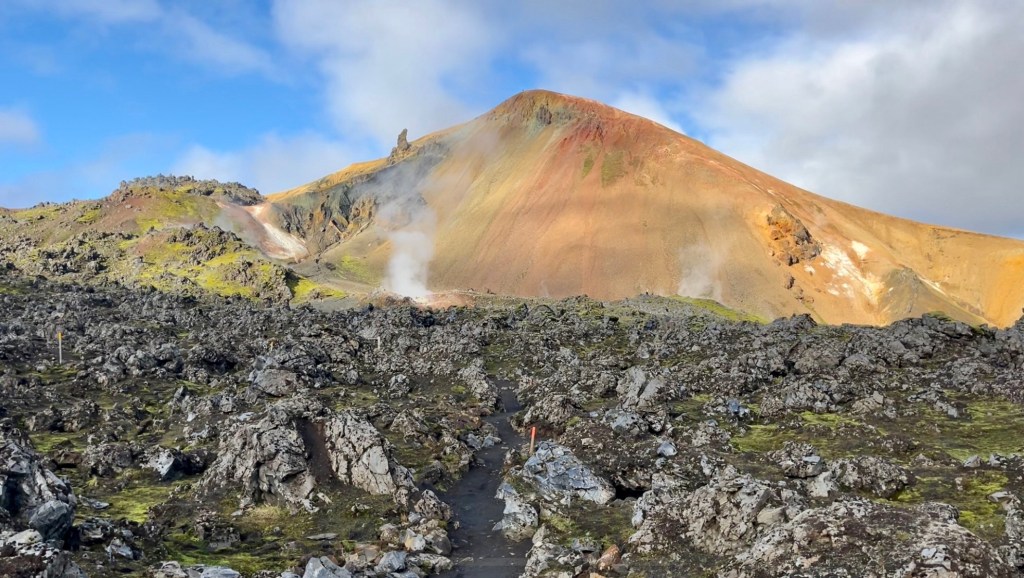
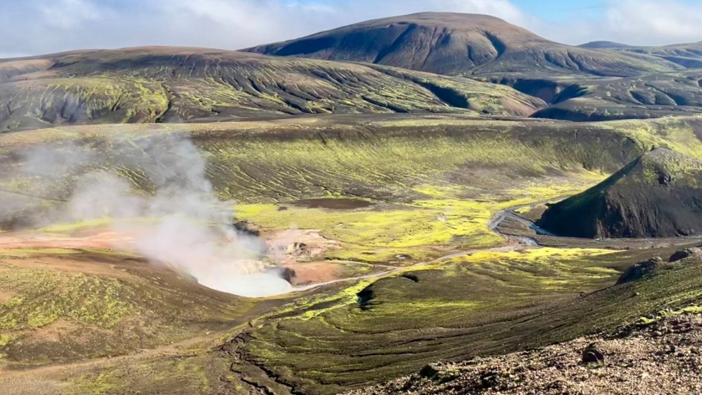
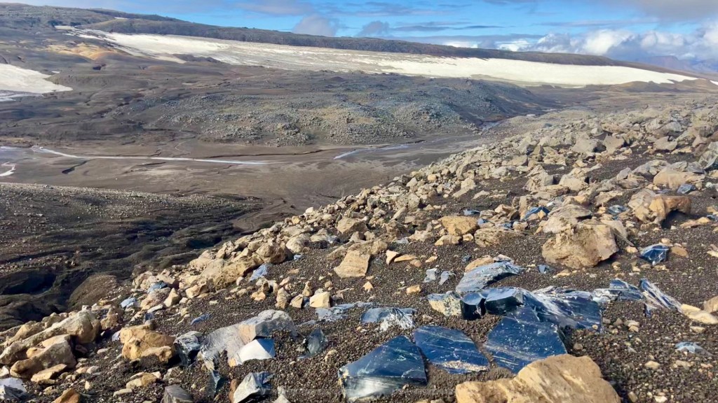
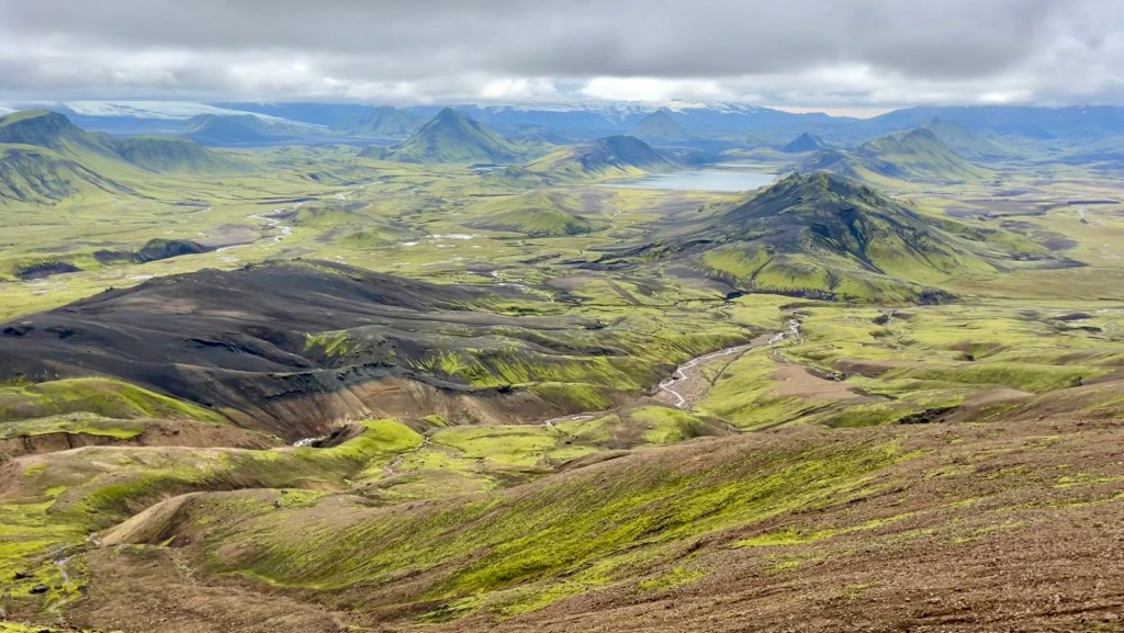
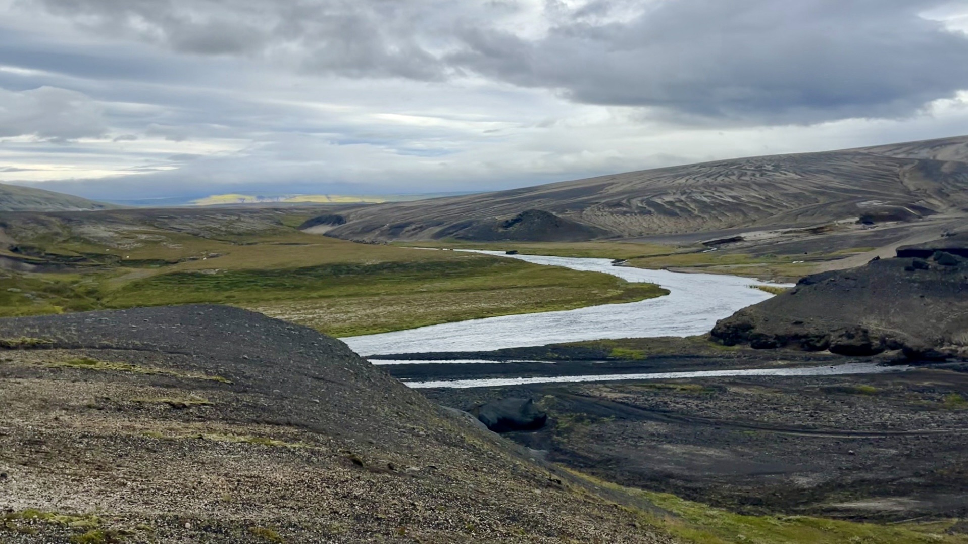
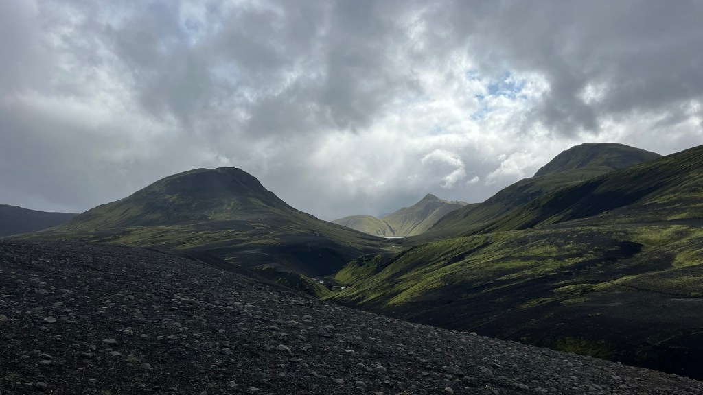
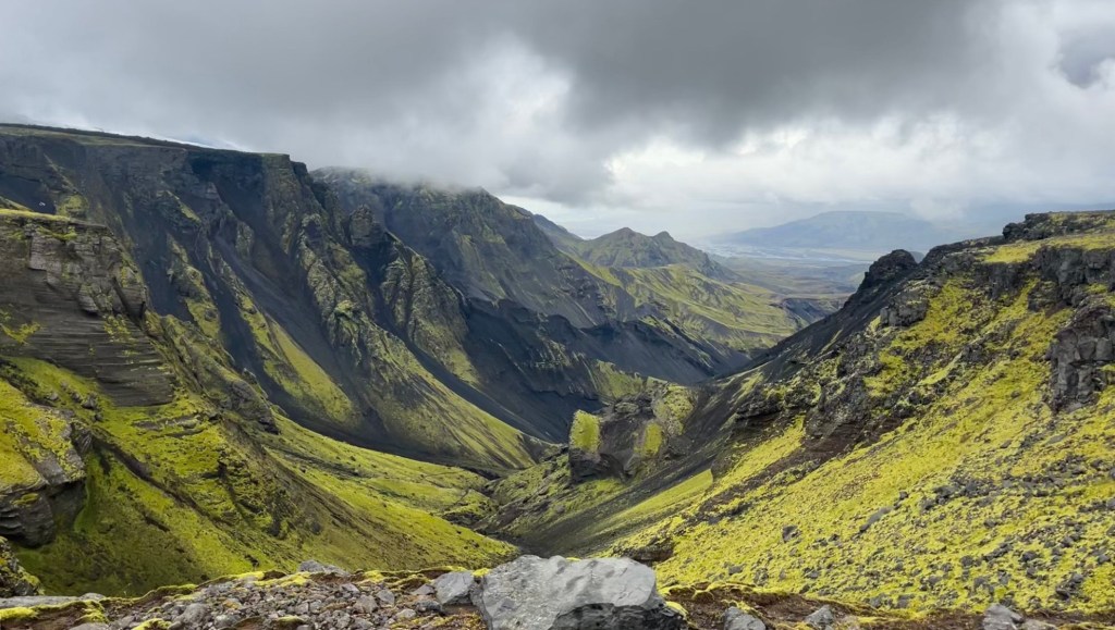
The landscapes today were extraordinary; no two valleys were the same. First through an old lava field, then rolling trail over the famous striated mountains where hot springs bubbled by the path. Next came a glittering field of obsidian, followed by a short section on snow and ice to reach Hrafntinnusker hut. From there the trail turned into relentless up-and-downs over rolling basalt hills. The final pass offered spectacular views of a resplendent green valley, jagged and wild with mountains, rivers, and lakes, even glaciers just visible on the horizon beneath the clouds. The descent from here was rough, loose scree and a river crossing to make it to Álftavatn hut.
Between Álftavatn and the next hut, Hvanngil, another wider river awaited crossing. Arriving alone, I was reassured to see two hikers halfway up the trail on the far side, pausing to watch me safely across. I was grateful for the kindness, and made sure to thank them for it later. Reaching Hvanngil, the warden assured me I would make it to Emstrur by nightfall, and offered tips for the next river crossing. Once there, I was again fortunate to meet with other hikers who had just completed the crossing and offered to watch me safely to the other side.
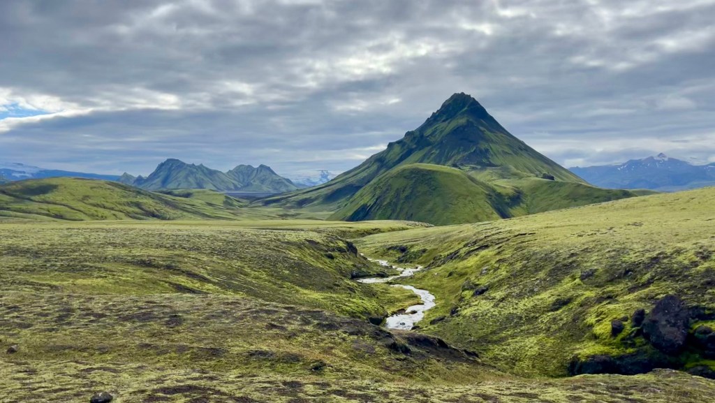
From there, the walking eased. A long ashy valley stretched flat ahead of me, framed by jagged green mountains and distant glaciers. The melt from the glaciers was easily crossed thanks to a bridge over the gorge. Reaching the final pass of the day, I snapped a quick photo of the glaciers glimmering ahead; a view that disappeared in the time it took me to pull on my shell. Reaching Emstrur, I set up my tent by the river, which was a beautiful situation with shelter from the wind and easy water access. Dinner, then straight to sleep – ready to tackle an even bigger distance tomorrow.
Day 5 – 29 August 2025: Emstrur to Skógar
Distance: 43.5 km | Elevation gain: 1,520 m | Moving time: 10h 41m | Average pace: 14:44/km | Average pace: 4.1km/hr
Glaciers, waterfalls and grit
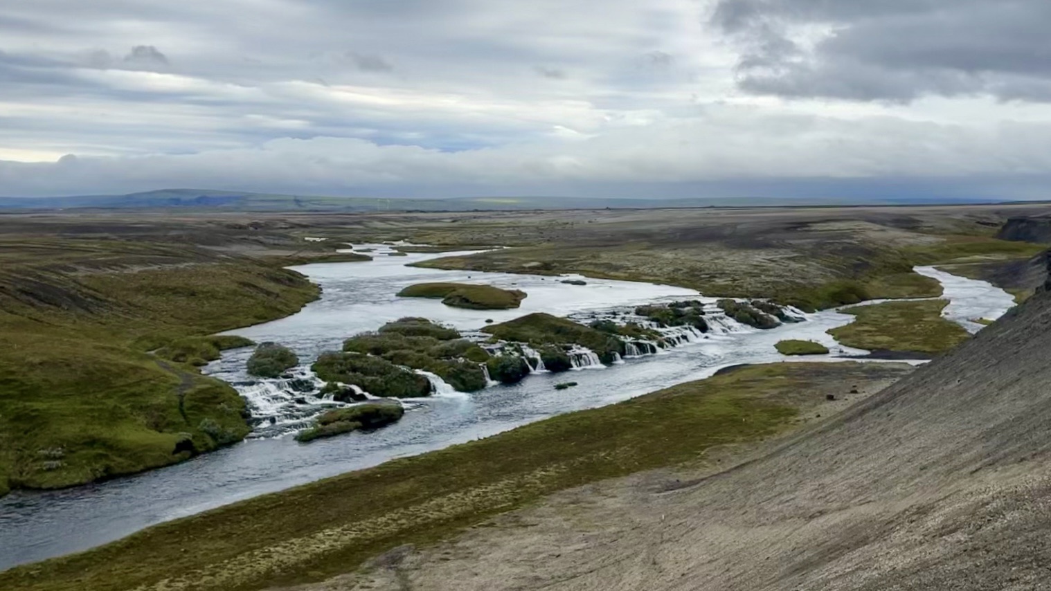
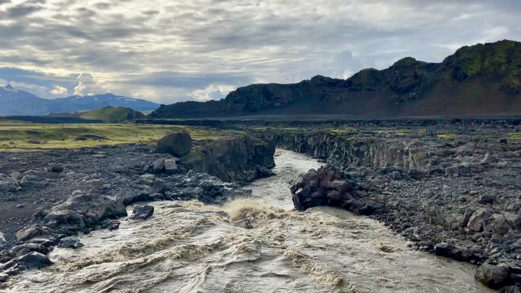
The trail started flat, so I moved quickly – pausing only to photograph a thundering glacial river thankfully crossed via bridge. I kept my pace high throughout the morning and was on track to reach Þórsmörk by 11. But the trail had other ideas.
With 5km of the Laugavegur to go a short but steep climb followed by a knee-deep river crossing slowed me down. Once again kind hikers on the far bank watched me safely across; and this time I was able to pay it forward by helping the solo hiker who arrived soon after I had reached the far bank. The trail then wound through birch forest, leaves beginning to turn and reminding me of last year’s finale on the Kungsleden. Finally Þórsmörk, and the finish of the Laugavegur, appeared.
At Langidalur hut I asked whether it was feasible to complete the Fimmvörðuháls trail today. The warden didn’t hesitate: yes, if I left immediately. She also advised hitching across the next river on one of the departing tour buses, which proved wise; water lapped high against the massive high-flotation tires and I was glad not to be wading it.
The climb out of Þórsmörk was spectacular: jagged green ridges with glaciers looming ever closer. It began to drizzle, but cleared just as the trail turned serious: exposed saddles, chain-assisted scrambles, scree slopes and even a glacier crossing before the final hut. Moving carefully, I reached the hut in five hours; with three more for the descent, I felt confident I could reach Skógar by nightfall.
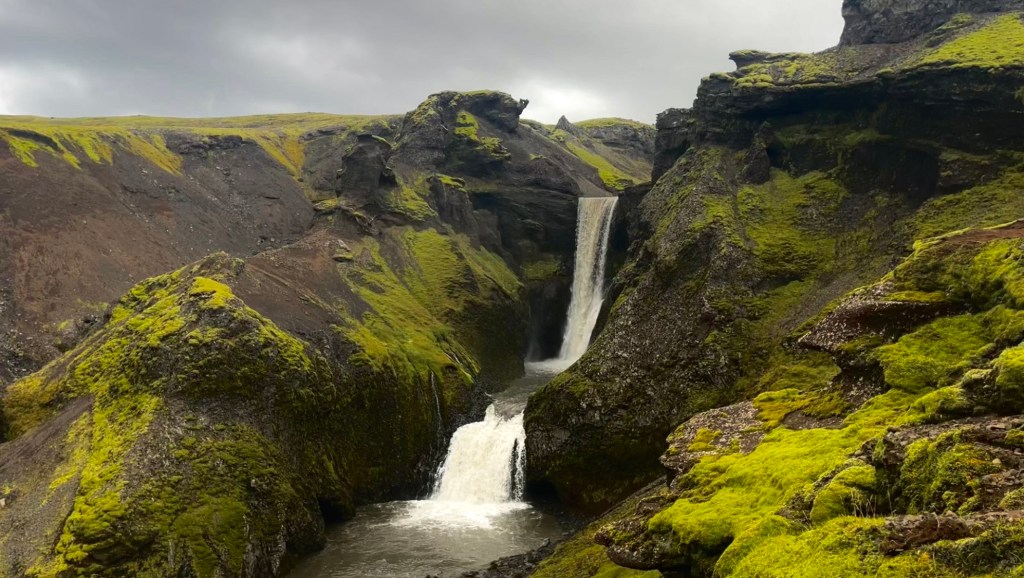
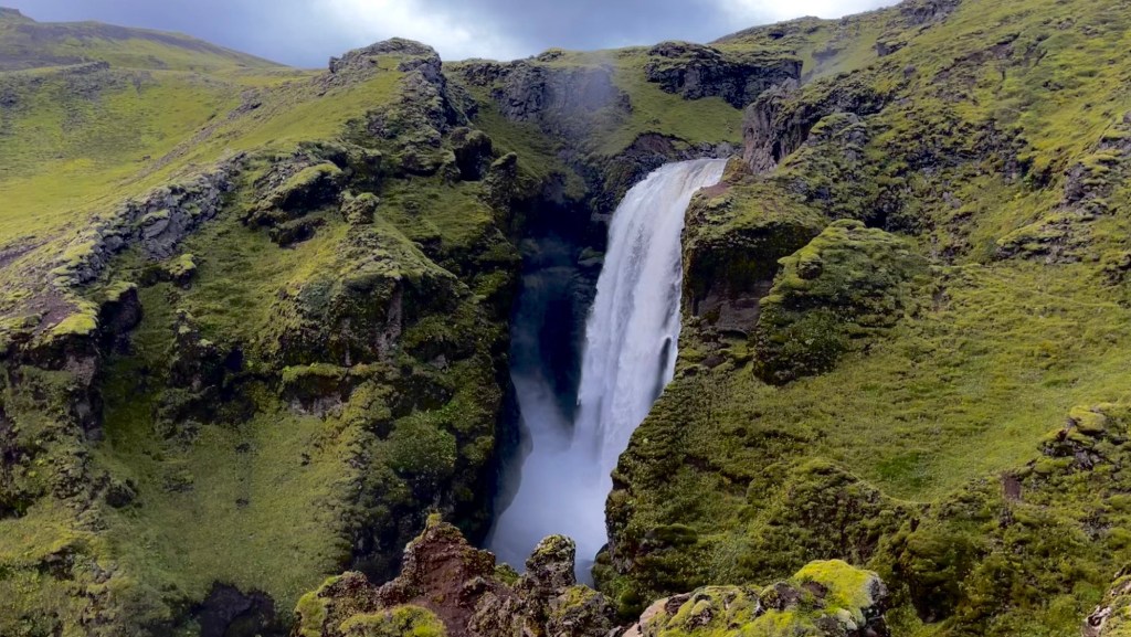
The first half of the descent was fast, clouds hiding all views and removing the temptation to pause for photos. But once I crossed a bridge over a gorge, the weather transformed: sudden sunshine revealed waterfall after waterfall to accompany me to the end of the trail. Their grandeur slowed my pace considerably, but it was impossible not to stop.
At last, the long final staircase to descend to Skógar appeared – like a final joke for my tired legs. I staggered into camp at 8.30pm, exhausted but elated to have finished both the Laugavegur and Fimmvörðuháls.
Want More?
Curious about the practical side of these trails? Check out my Iceland’s Hellismannaleið, Laugavegur and Fimmvörðuháls: How-To post.

Leave a comment