If you’re craving a truly immersive Scottish adventure, the West Highland Way delivers everything you could ask for. It’s Scotland in miniature: a journey through rolling lowlands, rocky loch shores, rugged mountains and charming historic towns and villages. Here, adventure, history and breathtaking landscapes converge to create a truly unforgettable experience that you’ll treasure forever.
I thru-hiked the trail in October-November 2023.* For a closer look at the on-the-ground experience, head over to my West Highland Way: Trail Journal post for my stats, photos and story.
* Ok, ok thru-hiking police. Yes, technically I skipped a day and had to go back and fill it in later. Sue me.
- Quick Facts
- Map & Elevation Profile
- Preparation
- On-Trail Practicalities
- Side Missions & Connecting Trails
- Hiking as a Solo Woman
- Want More?
Quick Facts
| Distance | 154 km |
| Elevation gain & loss | 3,150 m |
| Days to complete | 6-9 |
| Best season | Spring (April) to Autumn (October) |
| Trailheads | Milngavie; Fort William |
| Recommended direction | NOBO |
Map & Elevation Profile
Preparation
Trailheads & getting there
The official start of the trail is in Milngavie (pronounced “mill-guy”, go figure), just north of Glasgow. Catch a local train from Glasgow Queen Street Station, or warm up your trail legs by taking the Kelvingrove Walkway. In Milngavie, don’t forget to snap a photo at the obelisk (subtle) and/or giant archway (less subtle) on the high street.
The trail ends at the foot of Ben Nevis in the town of Fort William, which is connected by train to Glasgow: from there, switch trains to connect with other major cities including Edinburgh and London. The terminus is marked by a statue of a walker sitting on a bench in front of a stone pillar.
Direction to Walk
The trail can be walked in either direction, but I strongly recommend NOBO: this way, the landscape becomes progressively wilder and the views more awe-inspiring. You’ll also have the opportunity to build up to the bigger elevation days. But SOBO could be a good option if you’re looking for shorter, gentler days towards the end when you’ll be tired; or if you want slightly easier transport logistics.
Season to Walk
The trail can be walked year-round, although a winter hike should only be attempted by experienced hikers as there will be snow and ice on-trail, and accommodation options are very limited in the off-season.
Most people will tackle the trail between April and October, although conditions can vary widely from month to month. Peak season is usually June to August, when the daylight is long and the weather is at its warmest but you will be contending with the nasty Scottish midge and will want to bring appropriate protective clothing and repellent.
Shoulder seasons, between April-May and September-October offer a quieter trail experience, with less midge risk. It may, however, be a bit chillier than you’d like, and the days can quickly get short that far north.
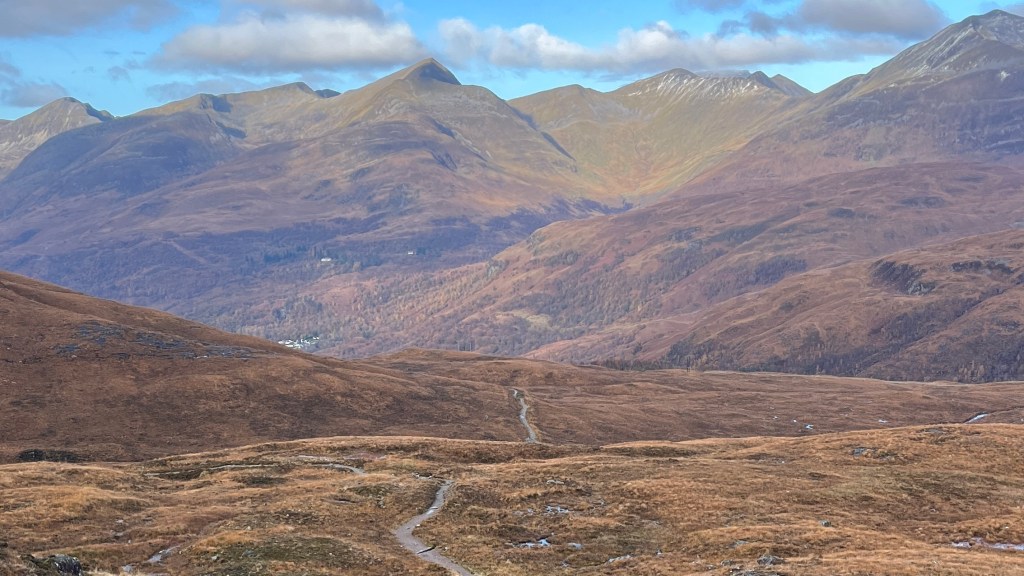
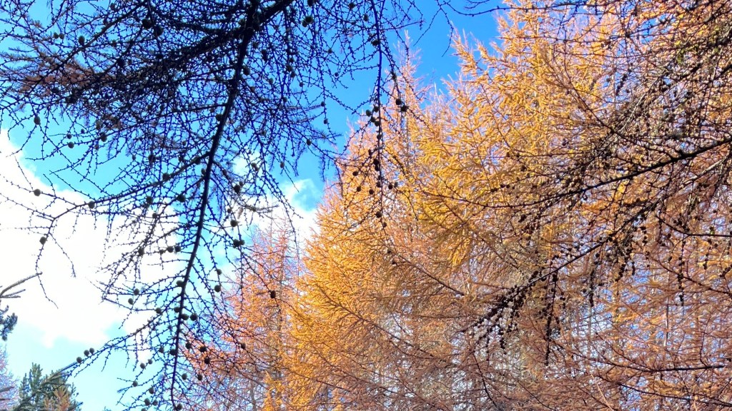
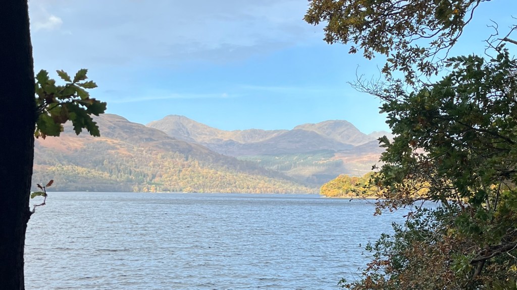
I hiked in late October to early November without putting any real thought into the timing (the trail fit within a reading week at uni) and I think we really lucked out. The trail was lovely and quiet, although we still made friends with other hikers, and the colours of the landscape were truly stunning. The only drawback was that we had to plan some big stages and had no wriggle room since many accommodation providers were already closed for the off-season.
Accommodation
Beds & Bunks
The West Highland Way is one of the most popular long-distance hiking routes in Europe, so in the main hiking season there’s usually no shortage of accommodation to suit every budget and hiking style. Booking ahead is important in peak summer season. Be aware that many accommodation providers close or offer limited services during the off season (from around the end of October to early April), which can add a logistical challenge for shoulder and off-season hikes.
Camping
Wild camping is permitted everywhere in Scotland, but ensure you follow the Scottish Outdoor Access Code. Note that wild camping is not permitted along Loch Lomand & The Trossachs National Park, except in designated areas.
For those keen on camping but reluctant to forego a shower, most stage end villages and towns offer at least one commercial campsite.
There are a couple of bothies along the trail which offer the opportunity to shelter from the elements or experience a truly Scottish off-grid experience; but you can’t complete the whole trail relying on these.
Gear List
If you’re staying in accommodation you can travel light. I took:
- 35L backpack (smaller would also work, this is just what I had)
- 2x merino shirt and athletic leggings (1 set for hiking; 1 for travel/evening wear)
- 3x socks and underwear
- PJs
- Fleece, puffer jacket
- Rain gear – make sure it’s water proof not water resistant – we learned the hard way)
- Sunglasses, hat, buff
- Trail runners
- Lightweight towel (needed for hostels; or you could pay to rent one)
- Electronics
- Toiletries & first aid
- 1L water bottle, assorted snacks
If you’re planning on camping, you’ll need to add at least a tent (obviously!), sleep system and cooking system.
If you’re walking in warmer months, you’ll also need to bring some midge defences.
Possible Stages
With wild camping a possibility, you can truly make this trail your own. But there are also some common stages for those looking for a little more structure.
| Place | Distance from previous (km) (NOBO) | Distance from previous (km) (SOBO) |
|---|---|---|
| Milngavie | 0 | 19.2 |
| Drymen | 19.2 | 12.9 |
| Balmaha | 12.8 | 11.2 |
| Rowardennan | 11.2 | 11.2 |
| Inversnaid | 11.2 | 11.2 |
| Inveraran | 11.2 | 9.6 |
| Crianlarich | 9.6 | 9.6 |
| Tyndrum | 9.6 | 11.2 |
| Bridge of Orchy | 11.2 | 3.2 |
| Inveroran | 3.2 | 16 |
| Glencoe / Kingshouse | 16 | 14.4 |
| Kinlochleven | 14.4 | 24 |
| Fort William | 24 | 0 |
On-Trail Practicalities
Finding Your Way
Trail Markings
You’ll be following the thistle symbol of the Scottish Great Trails. Waymarking is pretty well maintained throughout the trail, although there are a couple of places where the signs are easy to miss, so bring a map or an app.
Maps & GPX
For paper maps, you’ll need a collection of Ordnance Survey sheets. Alternatively, go digital with the OS Maps app. GPX files are also readily available online; I like this one from The Walking Englishman.
Guidebooks & Resources
There’s no shortage of guidebook options for this trail, including Cicerone, Trailblazer and Rucksack Guides. If you’d rather not purchase a guidebook, there’s plenty of information about the trail online including the official West Highland Way website which gives you all the information you need to complete it.
Food & Water
There are a number of towns and villages directly on trail, or within a stone’s throw of it, that generally boast at least a local pub and/or cafe. Many accommodation providers also provide cooked meals, which may be included in your room. Larger supermarkets are available in Milngavie, Tyndrum (The Green Welly Shop) and Fort William; other villages typically have a small convenience store with limited options. A great feature of this trail is the frequency of small honesty boxes stocked by locals, which typically offer small snacks like fresh fruit, museli bars and packets of chips; they’re a godsend when you find one just as your energy starts to dip.
There are several natural water sources on trail, but you’ll want to bring a filter if you plan on using these. Otherwise, ask nicely for a refill at cafes and pubs along the way.
On-Trail Transport
The trail is fairly remote; mis-stage transport options are pretty much non-existent, so you’ll need to make it to the stage end under your own steam for the most part. At stage ends, transport options usually (but not always) include a local bus to a larger village or town; or occasionally you might be able to catch the Scottish There are train stations in Crianlarich and Tyndrum, both around halfway along the trail. Timetables for both busses and trains are infrequent: plan ahead.
Money Matters
A feature of this trail is the honesty boxes that dot it, which are maintained by locals and filled with snacks and other goodies to tempt a hungry hiker. You might want to bring some small change to leave in these. Card is accepted pretty much everywhere else.
West Highland Way Passport and Finisher Souvenirs
There are a couple of great ways to support the trail and simultaneously take home a unique souvenir. The first is the West Highland Way Passport, which is similar to the Camino credencial (although isn’t required to stay in accommodation). You can collect stamps in your passport at designated “Passport Points” to track your progress on trail. Proceeds go towards the maintenance and conservation of the trail.
You can also purchase a Finisher’s Certificate and/or a Finisher’s Medal from the West Highland Way Shop. There’s nothing you need to do to “prove” you’ve completed the trail and are eligible for these, though.
Side Missions & Connecting Trails
Scotland is a hiker’s paradise: there’s no shortage of trails to explore. Those bagging the Munros might want to fit in Ben Lomond, best accessed around Rowardennan and Inversnaid. Buachaille Etive Mór, one of Scotland’s most famous mountains, can be summited just after Kingshouse, but note it is quite technical and you’ll probably want to factor in an extra day at Kingshouse or wild camping near the base of the mountain. The most popular side mission from the trail is the opportunity to summit Ben Nevis, the highest mountain in Scotland at 1,345 m. The trail up is largely paved, and can be accessed from Fort William; a fitting conclusion to the trail for those hiking NOBO.
Those interested in spending more time on trail have plenty of options. Sections of the trail overlap with the John Muir Way and Rob Roy Way. Or you can connect to the Great Glen Way from Fort William to create a thru-hike of over 200km. If you’re looking for a true challenge, consider the Scottish National Trail: an unofficial route for experienced hikers connecting Kirk Yetholm on the Scottish Border to Cape Wrath, the most north-westerly point of the mainland, via St Cuthbert’s Way, the Southern Upland Way, the West Highland Way, the Rob Roy Way, a brief section of the Great Glen Way and the Cape Wrath Trail.
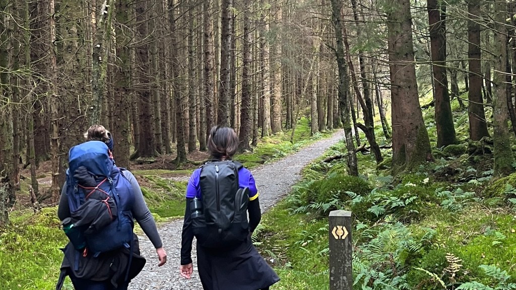
Hiking as a Solo Woman
I hiked most of the Way with friends, but this would be a fantastic first solo trail. It’s extremely well-maintained, and very popular with thru- and day hikers alike. Stages are very manageable, and see you entering towns and villages fairly frequently; or if not, then you’re passing close by. The locals and other hikers are incredibly friendly and mobile service is often available, although it can be in some of the more remote and northerly sections of the trail when the mountains get in the way of the signal.
Want More?
Check out my West Highland Way: Trail Journal for stats, stories and snapshots from the trail.

Leave a reply to Great Glen Way: How-To – Thru Horizons Cancel reply