8 days, 172 kilometres, 4,230 metres of elevation gain. I section-hiked the trail between November and December 2023: here’s the journey, day-by-day.
Thinking about tackling the trail yourself? Check out my Cotswold Way: How-To post.
- The Stats
- Trail Journal
- Day 1 – 23 November 2023: Chipping Camden to Broadway
- Day 2 – 24 November 2023: Broadway to Winchcombe
- Day 3 – 25 November 2023: Winchcombe to Charlton Kings
- Day 4 – 26 November 2023: Charlton Kings to Painswick
- Day 5 – 27 November 2023: Painswick to Dursley
- Day 6 – 30 November 2023: Dursley to Wotton-under-Edge
- Day 7 – 1 December 2023: Wotton-under-Edge to Tomarton
- Day 8 – 2 December 2023: Tomarton to Bath
- Want More?
The Stats
Trip Summary
- Start date: 23 November 2023
- Days hiked: 8
- End date: 2 December 2023
Distance & Elevation
- Total distance: 171.93 km
- Average distance / day: 21.49 km
- Total elevation gain: 4,232 m
- Average elevation gain / day: 529 m
Time & Pace
- Total moving time: 40h 52m
- Average moving time / day: 5h 7m
- Average moving pace: 14:16/km
- Average speed: 4.21km/hr
Budget (ex gear)
| Category | Total (£) | Breakdown |
|---|---|---|
| Accommodation | 390.43 | Day 1 B&B (44.87); Day 2 pub (66.50); Day 3 B&B (51.63); Day 4 pub (58); Day 6 B&B (54.98); Day 7 hotel (93.20); Day 8 hostel (21.25) |
| Food | 83.64 | Day 1 coffee (3.7); Day 1 supermarket (24.24); Day 3 dinner (12.50); Day 5 supermarket (24.60); Day 5 coffee (2.7); Day 7 dinner (15.90) |
| Transport | 92.45 | Train London Paddington to Moreton-in-Marsh (28.95); Bus Moreton-in-Marsh to Chipping Camden (2); bus Dursley to Stonehouse (2); train Stonehouse to London Paddington return (38); bus Stonehouse to Dursley (2); bus Bath to London (19.50) |
| TOTAL | 566.52 | Average / day: 70.82 |
Trail Journal
Day 1 – 23 November 2023: Chipping Camden to Broadway
Distance: 9.19 km | Elevation gain: 193 m | Moving time: 2h 6m | Average pace: 13:43/km | Average speed: 4.38km/hr
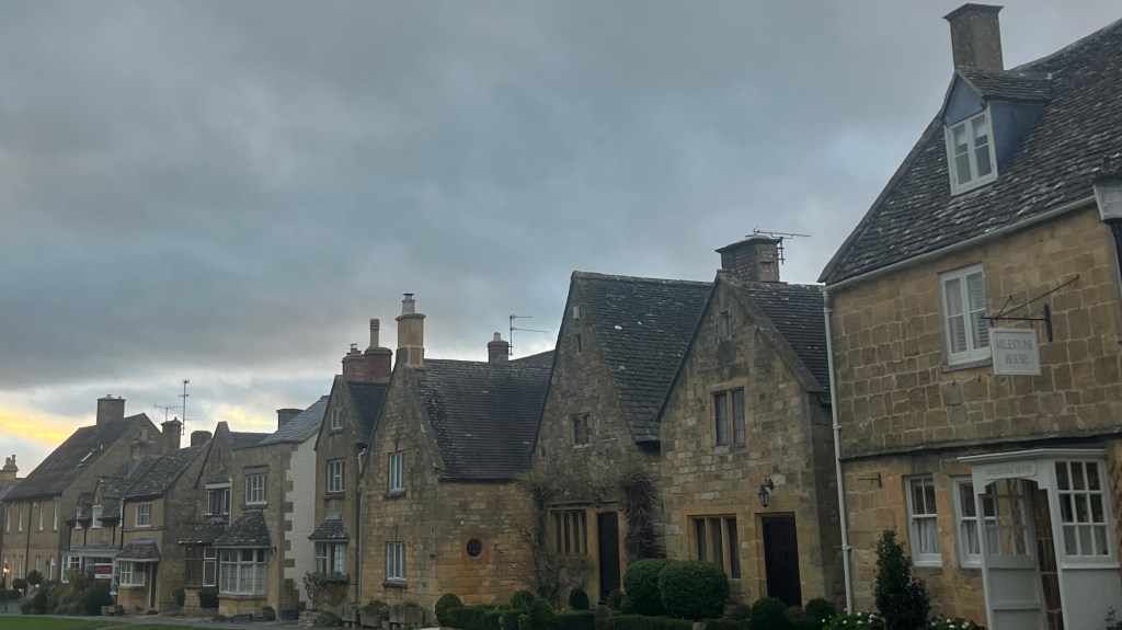
It takes me a while to reach the start of the Cotswold Way. A peak-hour Tube to Paddington, a train to Moreton-in-Marsh, a longish layover, then finally a bus winding is way into Chipping Camden. By the time arrive I’m keen to move; I shoulder my pack and set off immediately, buoyed by the rare and welcome sight of blue sky.
Today was always going to be short, hamstrung by travel. Logistics and the early winter sunset. The trail gently eases me out of town and into rolling fields dotted with sheep. Underfoot, leaves of brown and gold crunch satisfyingly as I progress. Slowly, the sky begins to cloud over, as though someone is pulling a blanket across the landscape for the night.
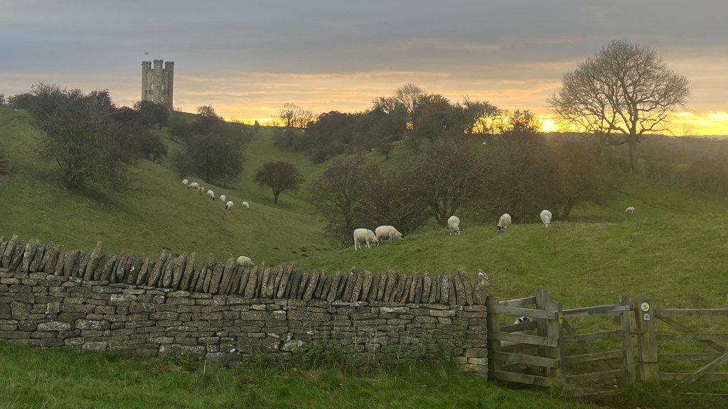
Before I know it I’m climbing toward Broadway Tower. My timing couldn’t be better: as I arrive, the sun slips through a gap in the clouds and washes the countryside in amber and gold. The tower stands watch over it all, stoic and theatrical, and I linger, letting the view sink in.
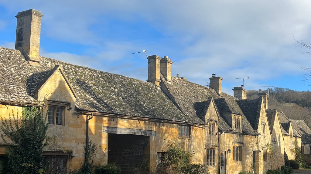
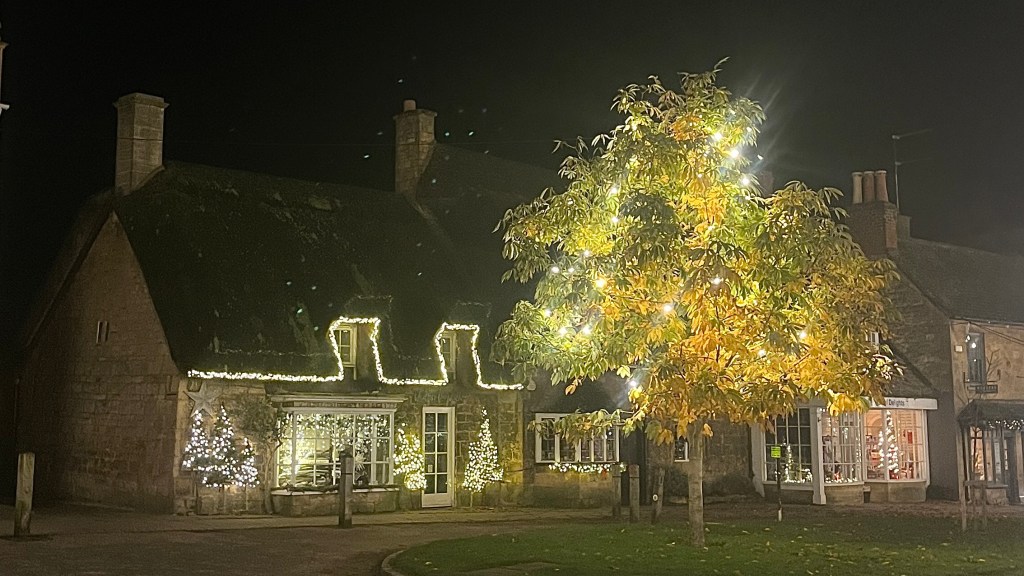
Eventually the light begins to fade and I start the descent toward Broadway village, arriving just as darkness settles in properly. After dropping my bag, I wander through the streets lined with honey-coloured buildings, each one twinkling with golden Christmas lights.
Day 2 – 24 November 2023: Broadway to Winchcombe
Distance: 19.90 km | Elevation gain: 487 m | Moving time: 4h 43m | Average pace: 14:13/km | Average speed: 4.22km/hr
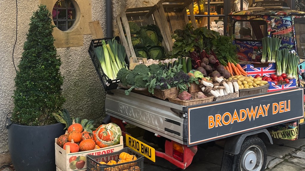
In contrast to yesterday’s cozy Christmas glow, Broadway feels sulky this morning. Under a low grey sky the village has all the energy of a teenager refusing to get out of bed. The only thing trying is a cheerful little cart selling a collection of bright vegetables.
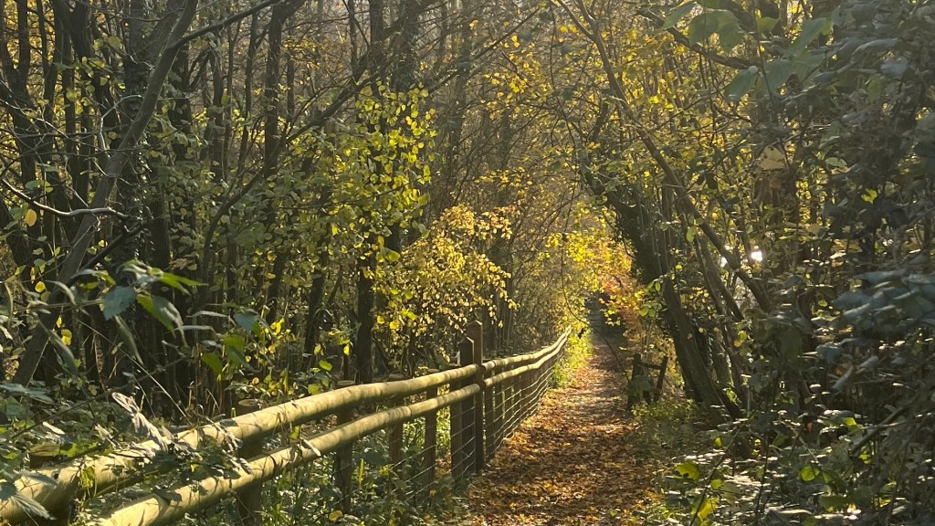
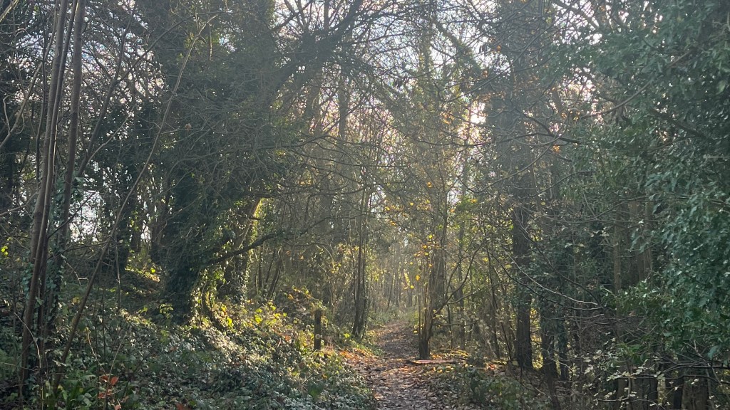
The trail wastes no time ushering me out of town and into a forest, where the atmosphere shifts almost immediately. Autumn leaves spiral down around me, caught in playful gusts of wind. The cloud cover begins to thin, patches of soft blue sky appearing overhead tentatively.
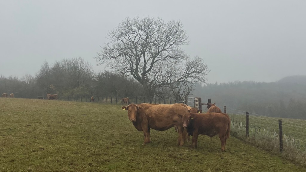
I emerge into open farmland, and pass by a field of fluffy black-and-white cows, who couldn’t care less about my existence even after I chk-chk-chk them. More fields follow, and as I make my way along a wide dirt road I can’t help but gaze at the stark silhouettes of bare trees standing out sharply against the brightening sky.
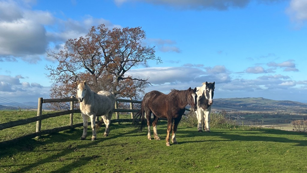
The descent into Stanton is perfectly timed for the mid-morning sun to show off the village’s golden stone buildings. From there, the trail strings together a series of postcard-perfect settlements: Stanway, Wood Stanway and Hailes are interspersed with sheep who flee at my approach, a trio of very photogenic horses, and a final short climb.
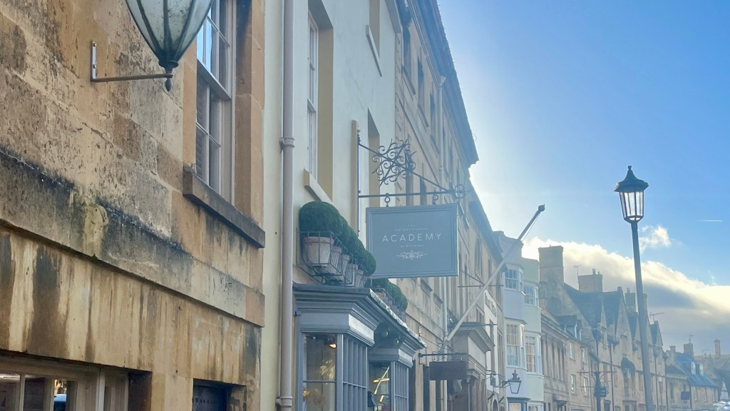
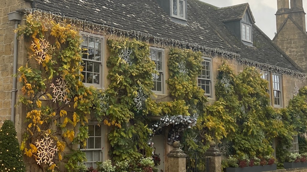
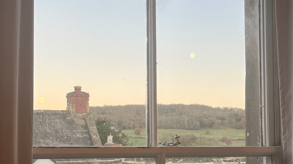
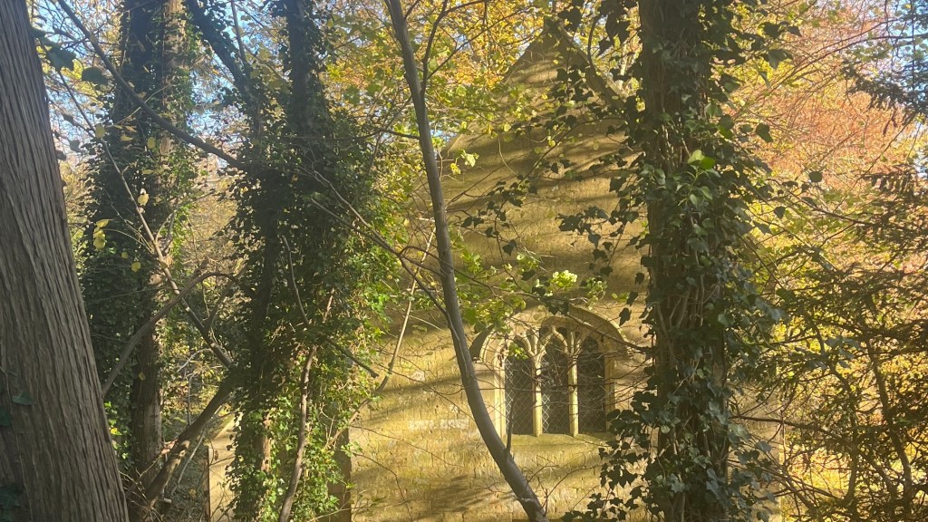
I reach Winchcombe with daylight to spare, and choose to wander. I drift toward Sudeley castle, turning back as the sky fades to pale rose. That evening, from my pub stay window, I watch the moon rise over rooftops and rolling hills, gently ushering in the night.
Day 3 – 25 November 2023: Winchcombe to Charlton Kings
Distance: 20.16 km | Elevation gain: 536 m | Moving time: 5h 2m | Average pace: 14:58/km | Average speed: 4km/hr
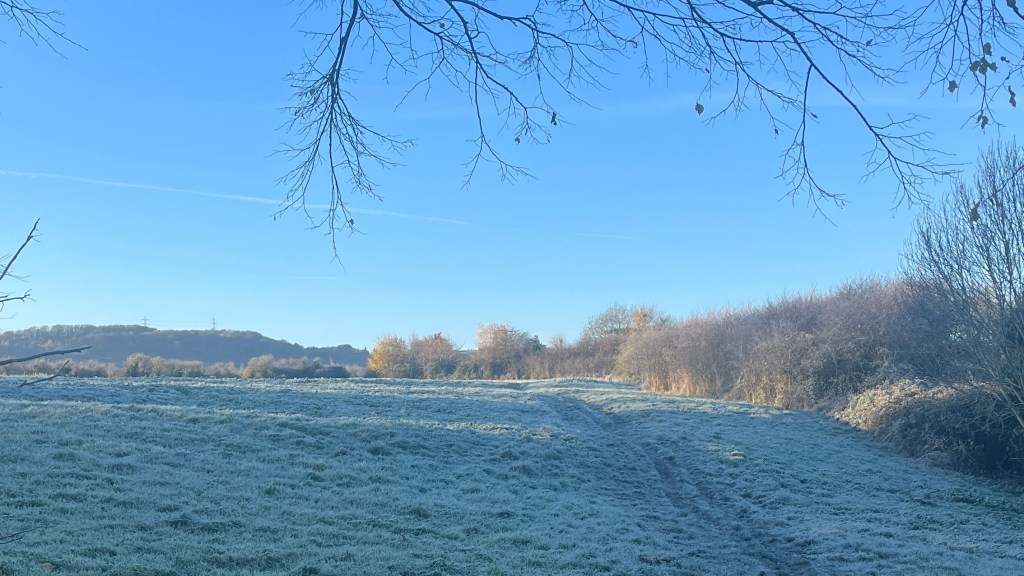
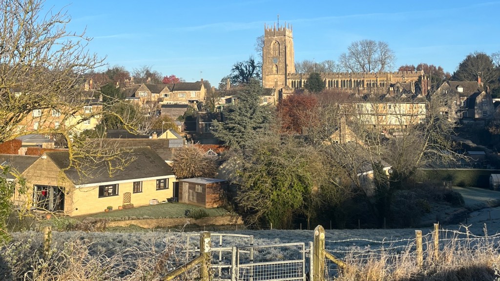
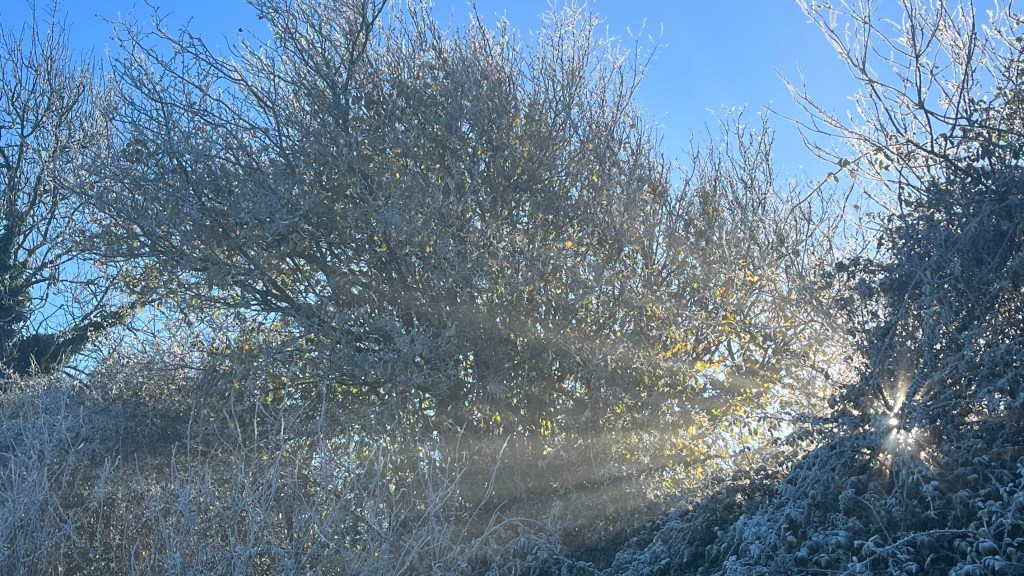
After breakfast I step outside into a world that looks as though it’s been lightly dusted with icing sugar. A delicate frost coats the ground and there’s a sharp nip in the air, but above me the sky is uninterrupted blue.
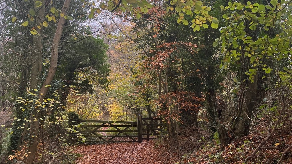
Today is a steady rhythm of farmland and forest, each putting on its best performance. As the frost melts it reveals vibrant green grass. The woods glow with leaves of citrus yellow and soft orange, and even the bare trees pull their weight, their skeletal branches softened by deep green ivy winding patiently upward.
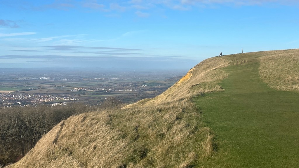
I arrive at Cleve Hill, and it’s the busiest stretch of trail so far: dog walkers, hikers, picnickers, horse riders. Everyone seems to have had the same idea. The climb delivers me onto a golf course, where I keep a cautious eye out for stray balls and enjoy surprisingly expansive and extensive views across the countryside.
The later part of the day is quieter: tree-lined country lanes, a leafy archway overhead, usher me forward. At a bench I take a pause to rest my feet, but the cold quickly informs me that rest will need to wait.
I leave the trail at Salts Farm, heading into the outskirts of Charlton Kings. Dinner is a well-earned burger, and I spend the evening researching gear to take on my next adventure.
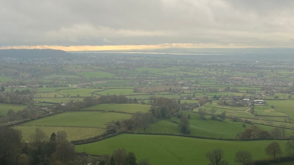
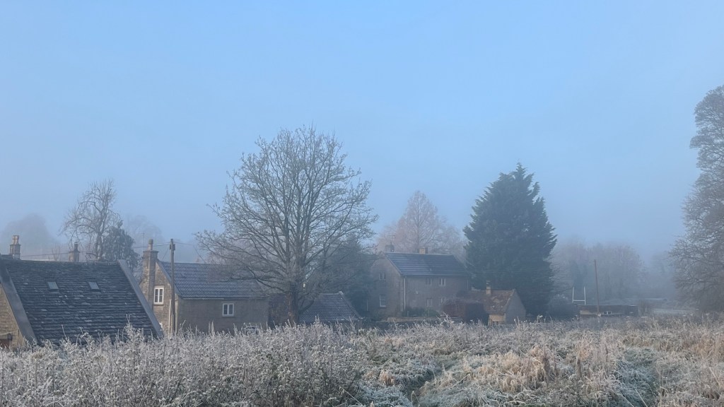
Day 4 – 26 November 2023: Charlton Kings to Painswick
Distance: 29.19 km | Elevation gain: 765 m | Moving time: 6h 55m | Average pace: 14:13/km | Average speed: 4.22km/hr
I rejoin the trail early in the morning, under a stubbornly grey sky. There are stairs immediately, which feels mildly cruel now that my legs are starting to protest after several consecutive days on foot.
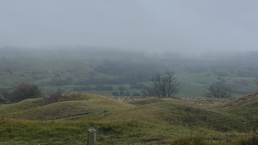
As the morning wears on, the weather declines rather than improves. Fog rolls in, softening the world until views are essentially theoretical. Fortunately, most of the day winds through forest, where limited visibility is always the order of the day. Fields punctuate the trees at intervals, but the landscape never quite emerges. Although the route skirts several villages, it never actually enters any of them, and with the short winter days I don’t feel inclined to detour.
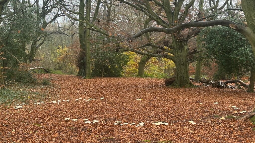
In one forest I come across an enormous fairy ring, a perfect circle of white mushrooms caps almost glowing against the leaf littered forest floor. It’s a small moment of delight in the muted day.
Eventually the lack of views begins to get to me, and I put on an audiobook to keep my mind occupied. Late in the afternoon, as I’m really starting to crave a cup of tea, the trail pitches straight uphill, a blunt ascent into thick fog. It’s eerie, exactly the sort of setting for an establishing shot in a horror film, and although I know there’s no real danger I pull out my earbuds anyway. I’m quietly relieved when I pass a family out for a walk; the simple presence of other people is reassuring.
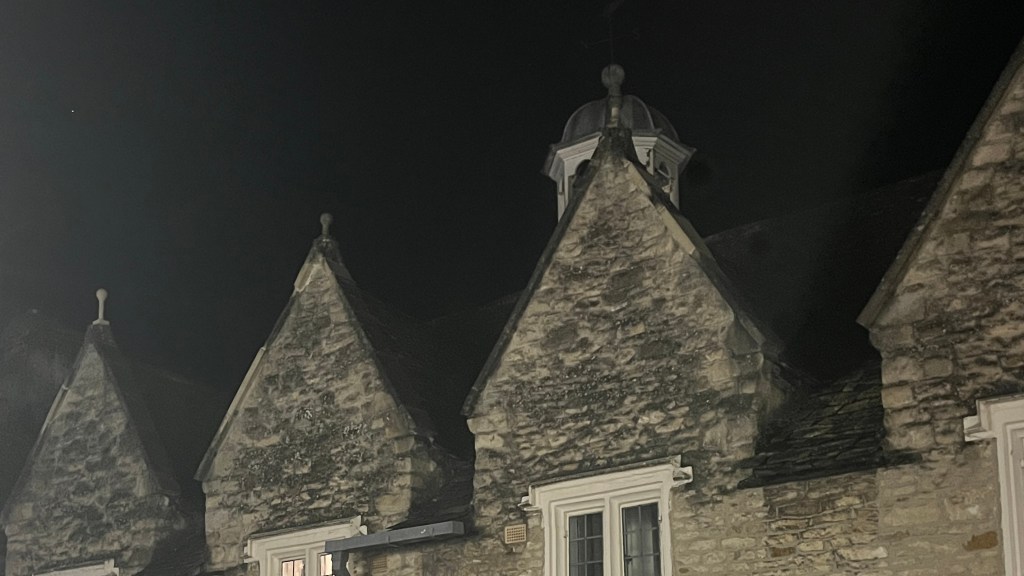
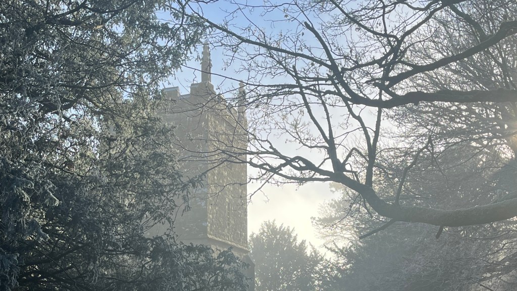
The trail eventually drops me back town to a road, within a stone’s throw of Painswick. At The Falcon, the welcome is warm. I’ve accidentally booked two rooms, but the staff kindly let me have the pick of the two, and refund the other. I choose the one overlooking the churchyard, and watch the last light of the day dapple across the village as the sun slips away.
Day 5 – 27 November 2023: Painswick to Dursley
Distance: 27.15 km | Elevation gain: 778 m | Moving time: 6h 35m | Average pace: 14:34/km | Average speed: 4.12km/hr
I take a quick loop around the village after breakfast, pleased to be able to see it properly. Yesterday’s fog had kept everything at arm’s length; today, colour has returned. Resuming the trail, I wind through the newer edges of town and soon I’m back in open fields, the landscape rolling gently ahead of me. Above, the sky is undecided; a tug-of-war between cloud and sun.
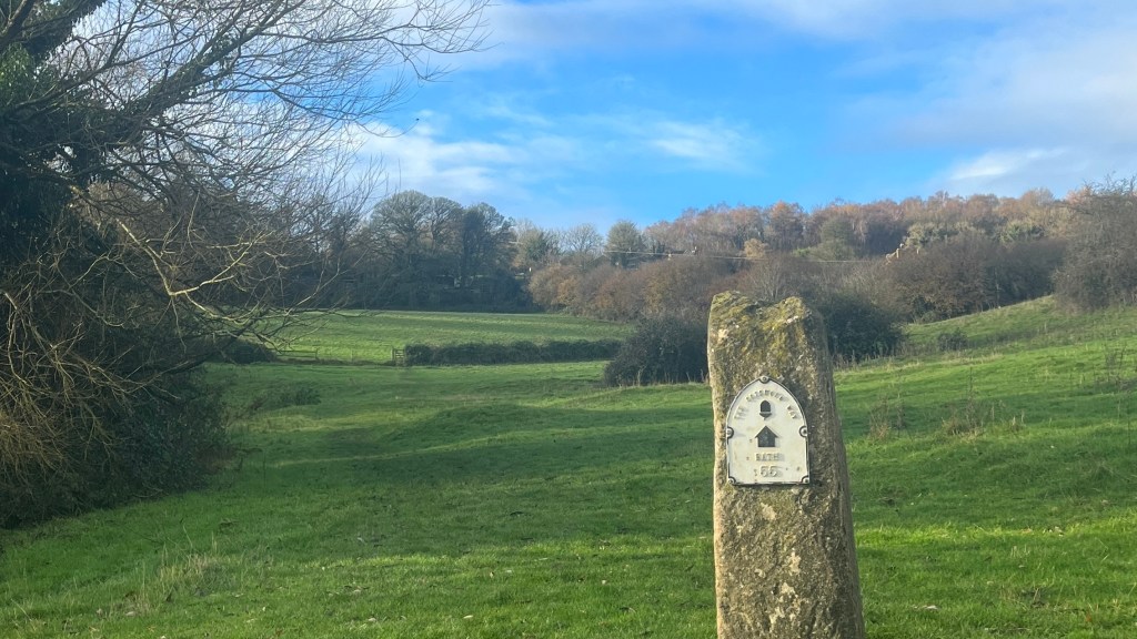
Partway through the morning I spot a substantial stone marker beside the trail. From a distance it looks like some relic of an old road, but as I draw closer I realise it’s the halfway marker. Bath: 55 miles. Mildly thrilling, or it would be if I understood miles.
The day continues in a rhythm of short but steep climbs and descents. The sun seems to be losing the war, but it wins a few battles: when it appears, it transforms the landscape, bathing everything in bright shades.
I pass through Stonehouse, a tempting exit point, but decide to press on, eager to make the most of the daylight. I regret that decision as soon as I come to the next set of stairs, which are followed by a steep forest climb. But at least the effort is rewarded; at the top, the view opens wide across the extensive farmland below.
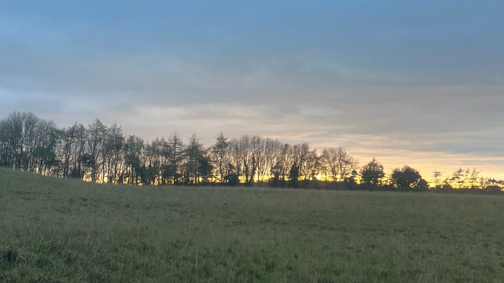
As evening approaches the sun makes one last dramatic appearance, blazing orange through a gap in the clouds and casting the landscape in purples and golds. I descend into Dursley tired, satisfied with my progress, and ready for a brief return to London: uni calls.
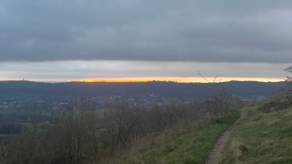
Day 6 – 30 November 2023: Dursley to Wotton-under-Edge
Distance: 12.72 km | Elevation gain: 340 m | Moving time: 3h 3m | Average pace: 14:23/km | Average speed: 4.17km/hr
After a few days in London I’m excited to leave the hustle and bustle behind and return to the trail, especially under a bright expanse of sky. Dursley looks almost unfamiliar in this new light as I stop for coffee before restarting Strava and heading out of town.
There’s no easing in; the first order of business is a steep climb straight up a road, which feels rude but manageable. When it finally turns back into trail I put my new trekking poles to work. I bought them mostly in anticipation of boggy sections after a few near misses earlier on the trail, and I’m keen to see if they earn their keep.
The sky is clear but moody, a deep winter blue that makes the time feel later than it is. No matter: I have just seven kilometres planned today, which should leave plenty of daylight. At the top of the climb the trail skirts a golf course, where the sun has turned everything in the wide expanse technicolour, before I slip back into a tunnel of autumn leaves.
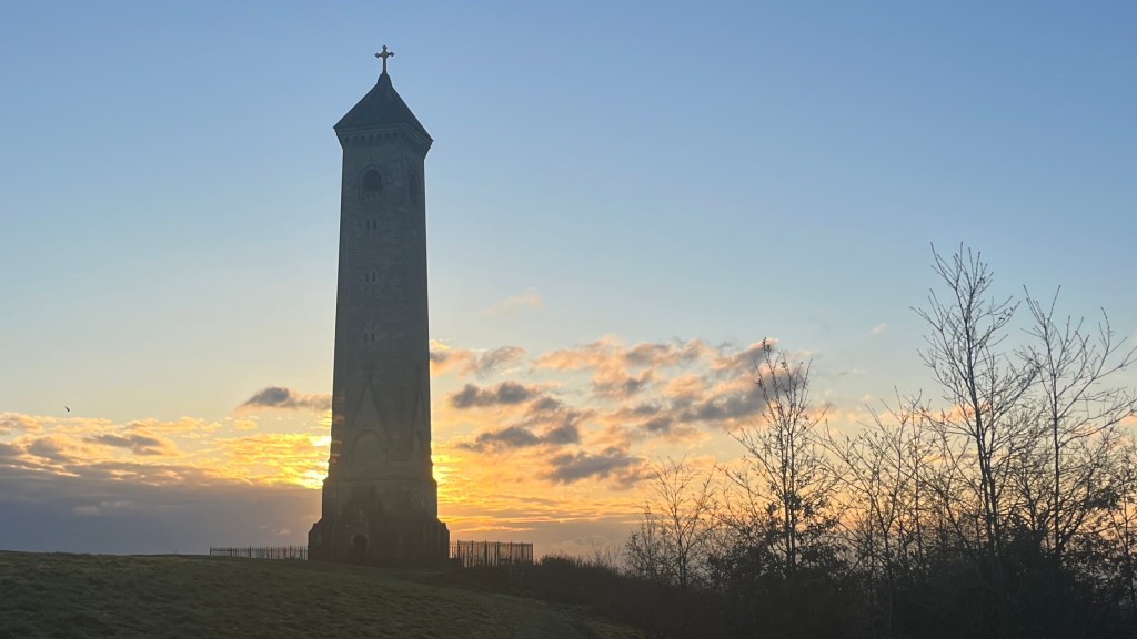
There’s more climbing, then a forest still holding onto a light dusting of frost in nooks the sun hasn’t reached. Eventually the William Tyndale Monument appears on the skyline. The next descent proves the value of my poles immediately: I slide across a boggy patch near a gate, and the poles save me just in time.
As the sky softens into rose and periwinkle, the monument inches closer. I reach it just as the sun flares one last time, behind a stubborn band of cloud on the horizon. A quick Strava check reveals an unpleasant surprise: I’ve overshot my expected distance and still have ground to cover.
I head downhill. I wish it was at speed, but the sunset is too gorgeous for that to be true. Just as the day finally slips away into night I arrive in Wotton-under-Edge in the twilight, tired but triumphant. I discover the source of the extra distance: I forgot to convert this section’s mileage to kilometres.
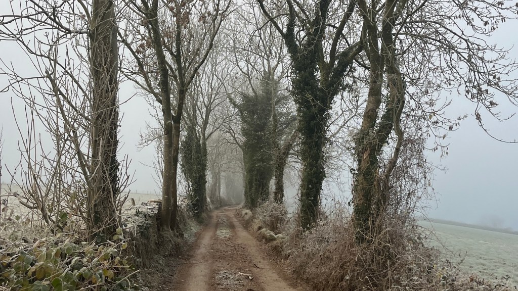
Day 7 – 1 December 2023: Wotton-under-Edge to Tomarton
Distance: 23.41 km | Elevation gain: 542 m | Moving time: 5h 33m | Average pace: 14:14/km | Average speed: 4.22km/hr
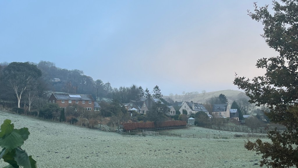
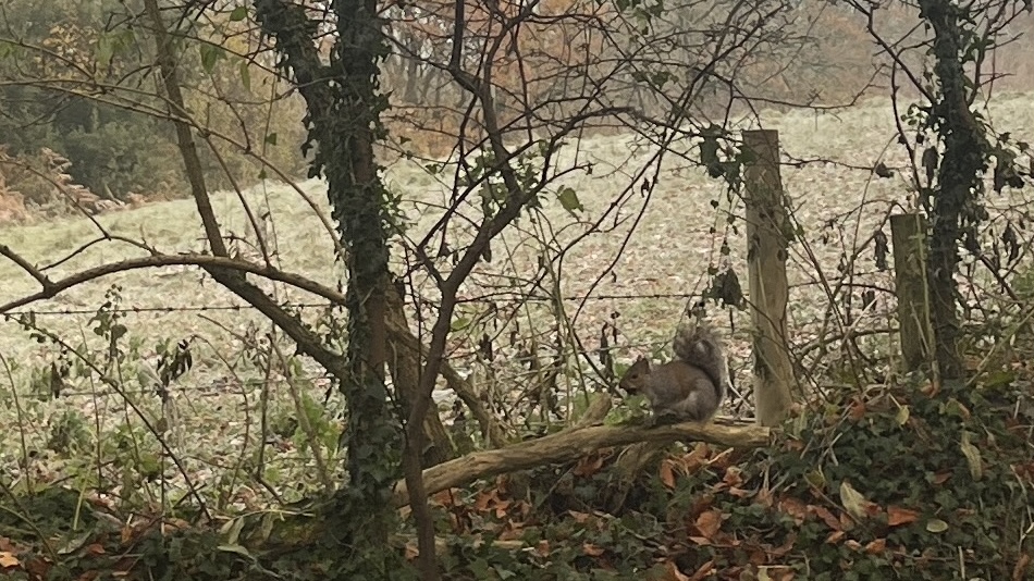
It’s another frosty morning, and I couldn’t be happier to be outside. Light cloud, or fog – it’s hard to tell – drifts lazily over the rooftops as I begin a gentle climb out of the village. It feels like I’m catching the seasons mid-change. A rotund squirrel, clearly well into its winter bulking phase, scurries across a branch ahead of me. Colour me one delighted Australian: everything about this landscape is wonderfully foreign.
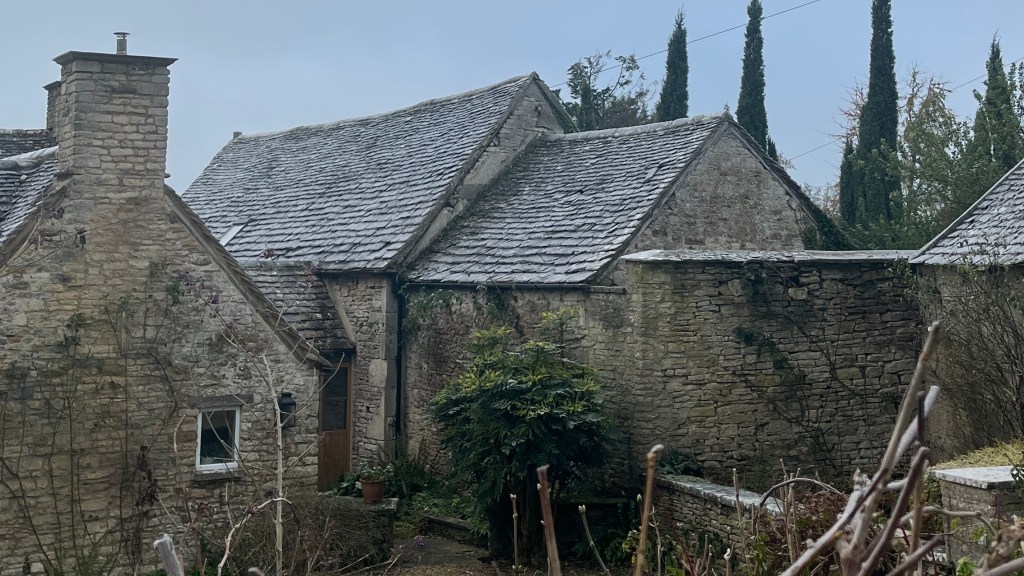
I climb higher, into thicker cloud, along a dirt road lined with trees sparkling in their frosted garments. The cottages here look like they’ve been lifted straight from a fairytale. As if on cue, I spot a small group of hairy Highland cows in the distance; the only downside is that they’re too far away for photos.
The trail threads through a couple of sleepy hamlets where no one appears to be stirring. On the approach to the Somerset Monument, I cross paths with a local walking his dog. He stops for a chat and casually mentions reports of big cats in the area, supposedly descendants of animals once kept by wealthy landowners. I’m not sure whether I believe him, but it certainly gives my imagination something to chew on for the rest of the day.
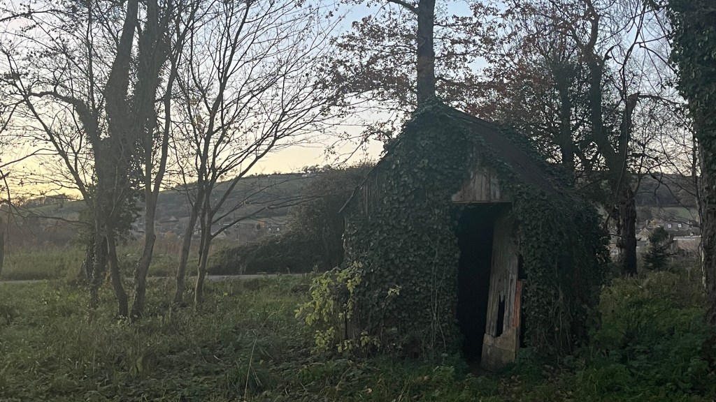
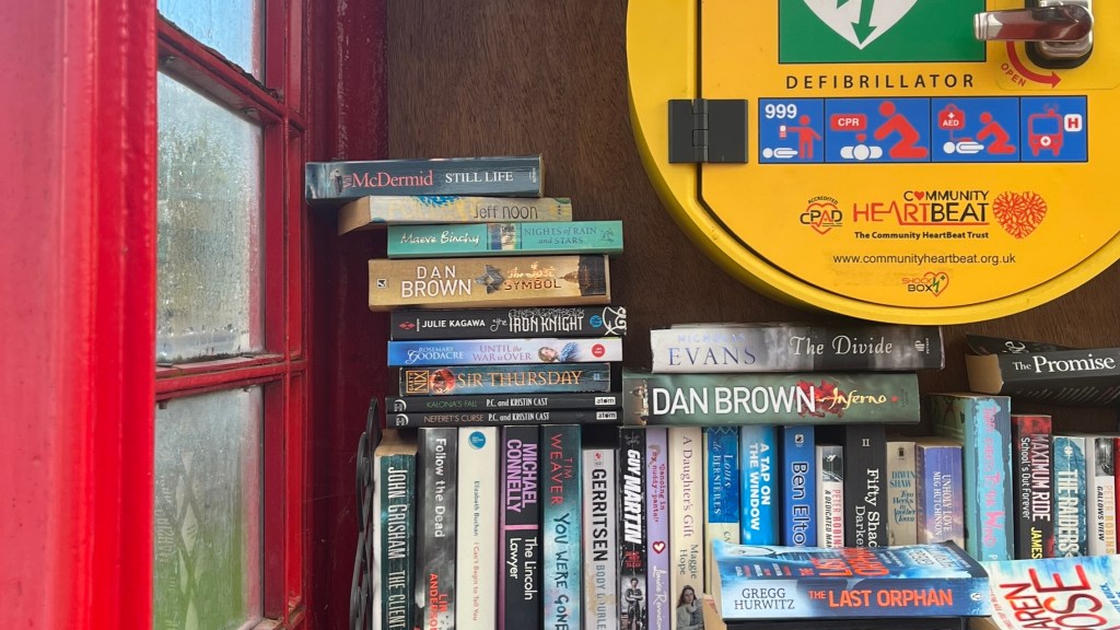
Passing through a field of horses, a few get uncomfortably close as I negotiate a kissing gate, and even post-pats they remain unsatisfied. In Old Sodbury (what a name!) I poke my head into a former phonebox-turned-defibrillator-turned-community library before continuing on. Half-frozen fields, ancient stone stiles, and one final push deliver me into Tomarton, riding an undeniable trail high.
Day 8 – 2 December 2023: Tomarton to Bath
Distance: 30.21 km | Elevation gain: 591 m | Moving time: 6h 55m | Average pace: 13:44/km | Average speed: 4.37km/hr
As I set off the sun is just rising, spreading shades of orange across frosted fields like marmalade over toast. The air is crisp, the landscape is sparkling, and everything feels impossibly still.
Passing through Dyrham, the grand estate is shrouded in fog, lending it the atmosphere of a grand estate from a murder mystery novel. Spiderwebs glisten with frost, thin sheets of ice glimmer in ponds, and on a gentle rise I find a small message box with a trail logbook tucked inside. I spend a few minutes flicking through entries before adding my own, a small contribution amongst the thousands who have walked here before.
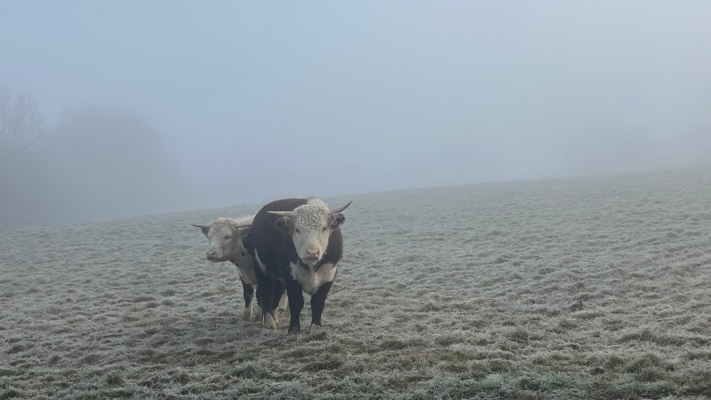
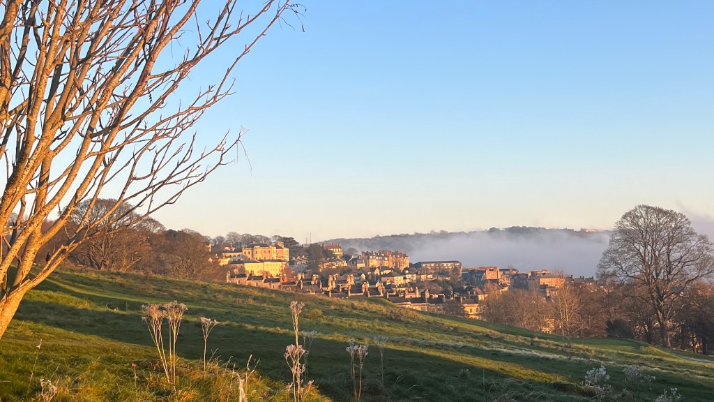
The trail winds across more farmland, frost clinging stubbornly to the fences and barbed wire. A few startled cows regard me with curiosity, and deer scatter gracefully as I navigate myself back from an unintended detour. Eventually, I emerge above the lingering fog, the early winter sun illuminating the hills in a shining golden light.
By the time I’m approaching Bath, its outskirts are glowing in the soft pink of twilight. Arriving at the abbey, I hunt for the terminus marker, but a bustling Christmas market makes it impossible. The crowds are jarring after the serenity of the day, so I make my way to my hostel; the final marker will keep until tomorrow.
Want More?
Curious about the practical side of the trail? Check out my Cotswold Way: How-To post for route info and planning tips.

Leave a reply to Cotswold Way: How-To – Thru Horizons Cancel reply