
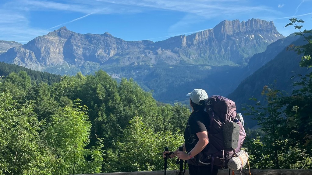
10 days, 196 kilometres, 11,500 metres of elevation gain. I thru-hiked the trail in July 2024: here’s the journey, day-by-day.
Thinking about tackling the trail yourself? Check out my Tour du Mont Blanc: How-To post.
- The Stats
- Trail Journal
- Day 0 – 8 July 2024: Geneva to Chamonix to Les Houches
- Day 1 – 9 July 2024: Les Houches to Les Contamines-Montjoie
- Day 2 – 10 July 2024: Les Contamines-Montjoie to Les Chapieux
- Day 3 – 11 July 2024: Les Chapieux to Val Veny
- Day 4 – 12 July 2024: Val Veny to Courmayeur
- Day 5 – 13 July 2024: Courmayeur to Plampincieux
- Day 6 – 14 July 2024: Plampincieux to La Fouly
- Day 7 – 15 July 2024: La Fouly to Champex
- Day 8 – 16 July 2024: Champex to Trient
- Day 9 – 17 July 2024: Trient to Lacs des Chéserys
- Day 10 – 18 July 2024: Lacs des Chéserys to Les Houches
- Want More?
The Stats
Excluding Day 0 walk from Chamonix to Les Houches
Trip Summary
- Start date: 9 July 2024
- Days hiked: 10
- End date: 18 July 2024
Distance & Elevation
- Total distance: 195.9 km
- Average distance / day: 19.6 km
- Total elevation gain & loss*: + 11,507 m / – 10,807 m
- Average elevation gain & loss / day*: + 1,151 m / – 1,081 m
* My Garmin died on the final descent to Les Houches. I switched on Strava, but it doesn’t give precise elevation loss numbers. Based on the chart, I estimate it was another ~500m of loss. I haven’t included this estimate in these calculations.
Time & Pace
- Total moving time: 58h 55m
- Average moving time / day: 5h 54m
- Average moving pace: 18:02/km
- Average speed: 3.33km/hr
Budget (ex gear)
This table is my share of costs split between my friend and I. For simplicity’s sake, I’ve converted amounts in Swiss Francs to Euros.
| Category | Total (€) | Breakdown |
|---|---|---|
| Accommodation | 173 | Day 0 campsite (9.50); Day 1 campsite (12); Day 2 campsite (10); Day 3 campsite (18.50); Day 4 hotel (47.50); Day 5 campsite (12); Day 6 campsite (22.50); Day 7 campsite (22.50); Day 8 campsite (9); Day 9 campsite (free!); Day 10 campsite (9.50) |
| Food | 235.35 | Day 0 groceries (13.50); Day 1 refuge drink (3); Day 1 beer (5); Day 1 groceries (15); Day 1 burger (17.50); Day 2 beer (4); Day 3 lunch (8.85); Day 3 dinner & beer (14); Day 3 coffee (3); Day 4 lunch (10.50); Day 4 groceries (13.50); Day 5 groceries (7); Day 5 dinner (11); Day 6 groceries (6.50); Day 7 icecream & coke (5.30); Day 7 chips (4.50); Day 8 groceries (18.20); Day 9 lunch (23); Day 10 lunch and coffee (5); Day 10 icecream & iced tea (10); Day 10 arrival beers (7); Day 10 dinner (30) |
| Trailhead transport | 32.70 | Bus Geneva to Chamonix (15); bus Les Houches to Chamonix (1.70); bus Chamonix to Lyon (16) |
| Other | 20 | Luggage storage Chamonix (20) |
| TOTAL | 461.05 | Average / day on trail: 46.11 |
Trail Journal
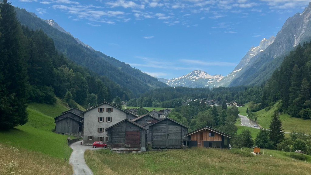
Day 0 – 8 July 2024: Geneva to Chamonix to Les Houches
Distance: 10.33 km | Elevation gain: 62 m | Moving time: 2h 7m | Average pace: 12:22/km | Average speed: km/hr
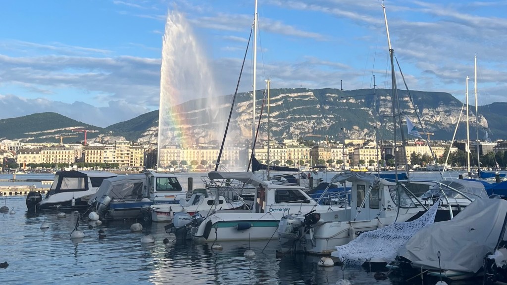
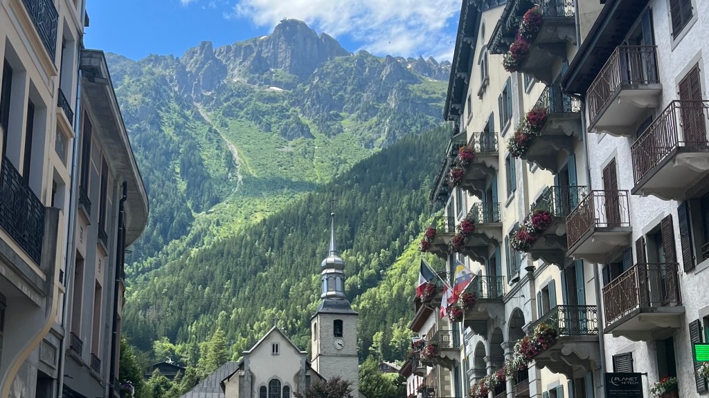
After a few days sightseeing in Geneva, allowing my friend Penny to overcome her jetlag (and crying about the Swiss prices), we finally board a bus to Chamonix. When we arrive, I’m struck by how bustling it is; larger and far more touristy than I imagined, even though I’ve heard of its reputation before. We track down a few last minute essentials from the sports stores and grab a late lunch.
Then, with the day bright and warm, and nothing better to do, we decide to walk the 8km to Les Houches rather than taking the bus. Leaving Chamonix, the bustle fades. It’s a mix of graded paths, sidewalks and a brief stretch along the road, as we pass small lakes and small groups of people.
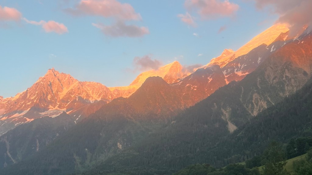
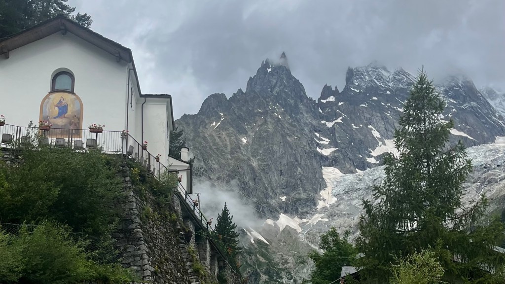
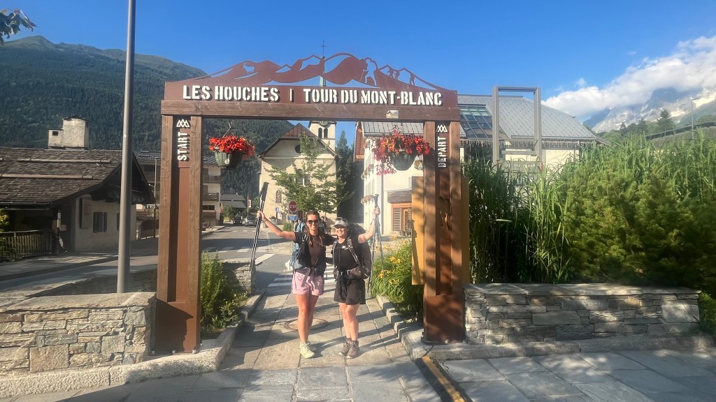
Almost before we know it, we’re arriving at the arch that marks the beginning and end of the Tour du Mont Blanc. Our campsite is ahead, so we pause to take our beginning photos even though we won’t be starting until tomorrow.
After accidentally overshooting the campsite by a few hundred metres, we locate the campsite and pitch our tents. With chores done, the evening fades into a spectacular pink-and-orange sunset over the mountains. We pass the time while our phones charge playing cards, until the chilly evening mountain air sends us to bed early.
Day 1 – 9 July 2024: Les Houches to Les Contamines-Montjoie
Distance: 22.09 km | Elevation gain: 1,522 m | Moving time: 7h 1m | Average pace: 19:03/km | Average speed: 3.15km/hr
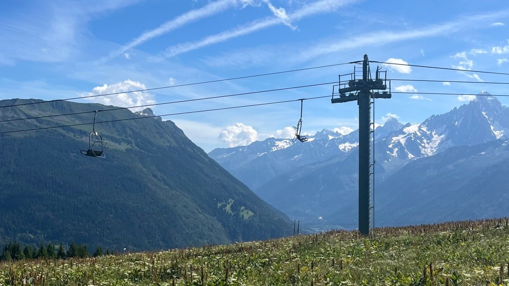
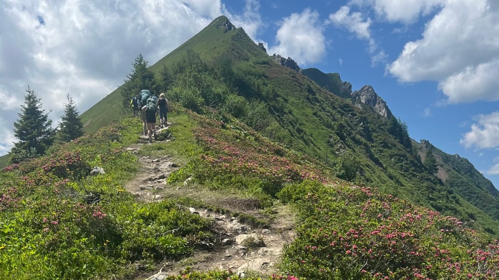
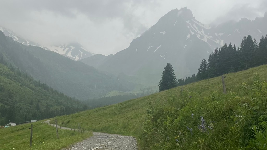
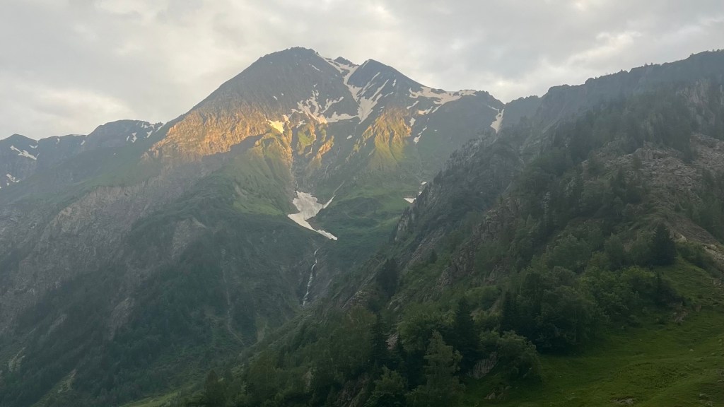
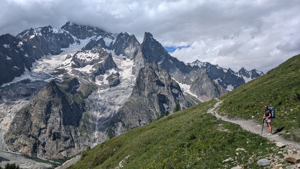
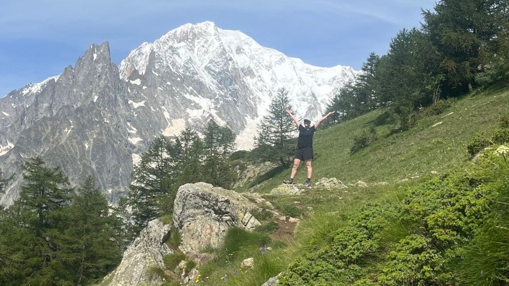
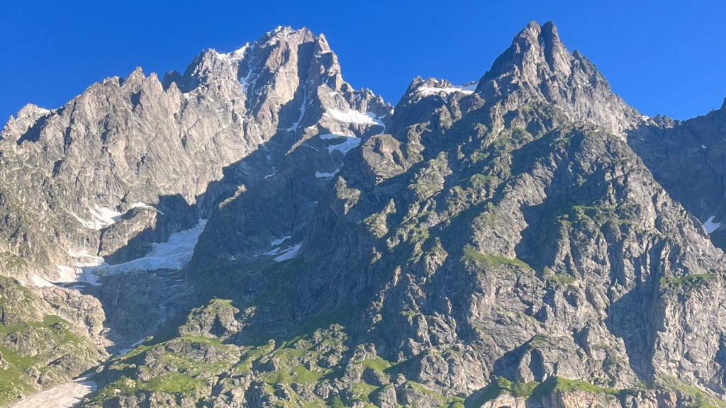
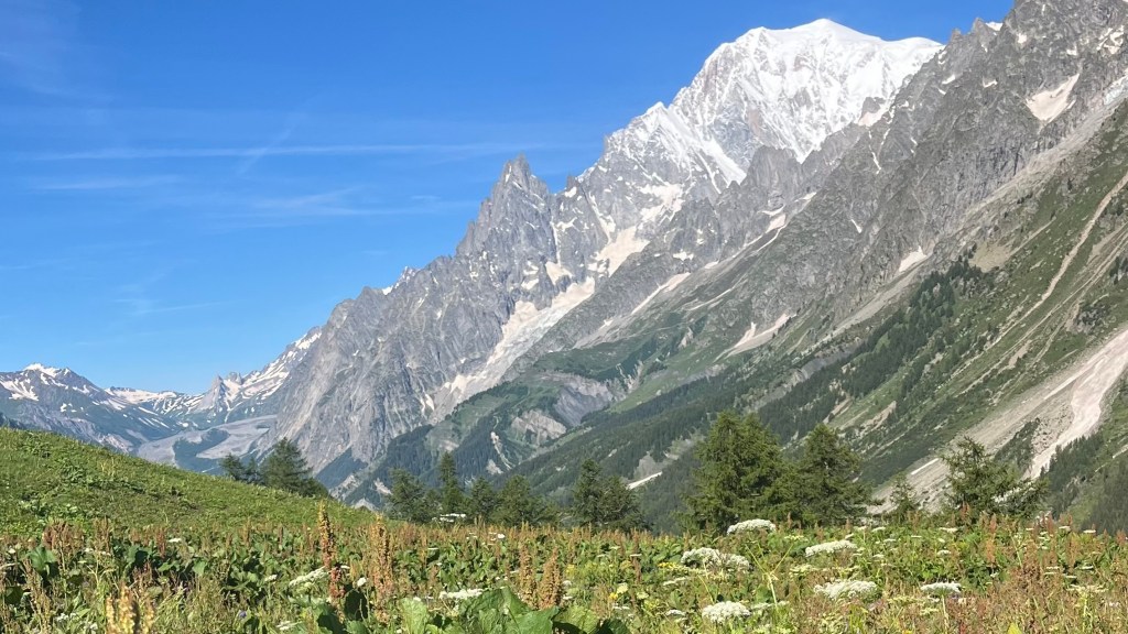
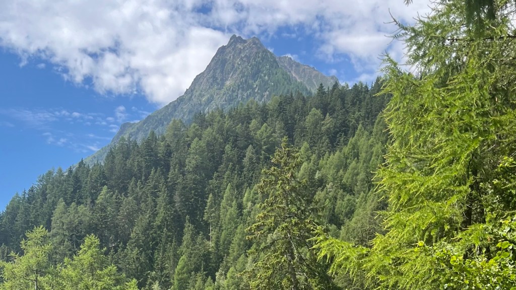
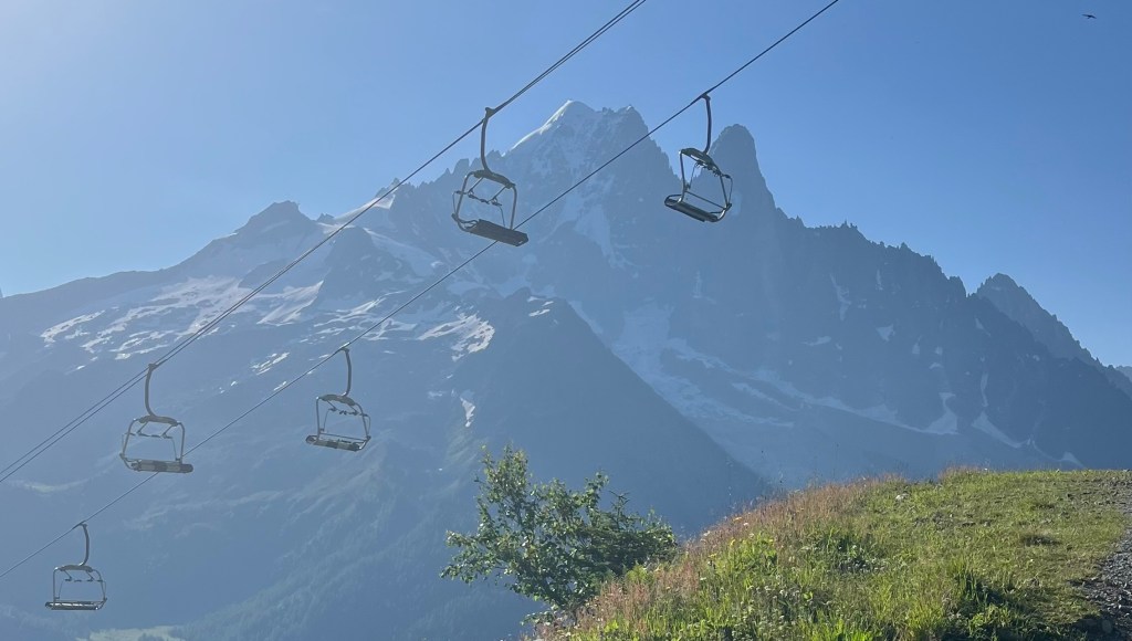
We set off at 8am, opting to skip the chairlift that could’ve saved us a significant bit of elevation gain and instead choosing pain. The first part of this section was pretty much straight up, until we joined a road graded for cars which eased the burn in our calves. Less than half an hour in, we were already stopping frequently for photos of the mountains. For two Aussies unused to alpine landscapes, the morning light on the grand peaks was breathtaking.
At the Kandahar chairlift we took a quick hydration break; an idea shared by most of our fellow hikers. Continuing along to the Col de Tricot, the path finally started to feel like trail: less steep, more varied terrain. A suspension bridge over glacier meltwater provided a perfect viewpoint, and wildflowers began to appear. The final few kilometres proved the hardest, especially in the afternoon heat. But as soon as we reached the Col, the weather shifted cooler.
With the first refuge in sight, down a zigzagging trail in front of us, we didn’t linger long. The descent was punishing on the knees, but a drink at the refuge revived us. It was 2pm; we decided to continue on, and a final ascent and descent through a forest brought us to Les Contamines-Montjoie. Arrival beers were in order, followed by a quick supermarket stop and then a burger dinner on our way to the campsite. Arriving at 8pm, we made quick work of tent pitching and showering before diving into bed.
Day 2 – 10 July 2024: Les Contamines-Montjoie to Les Chapieux
Distance: 17.86 km | Elevation gain: 1,348 m | Moving time: 5h 47m | Average pace: 19:27/km | Average speed: 3.09km/hr
We were up early, not wanting to arrive as late as we had yesterday. Leaving the campsite just after 7am, overcast skies greeted us and we began a steep climb over bare rock. After pausing to admire a gorge carved by a fast-flowing river, the trail eased into a relatively flat stretch that was perfect for catching our breath. A quick pause at Refuge de la Balme allowed us to admire the long valley we’d just crossed.
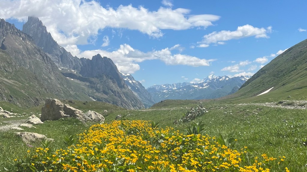
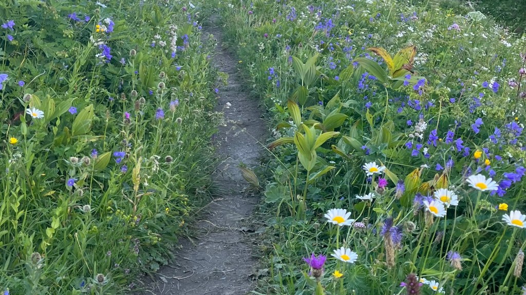
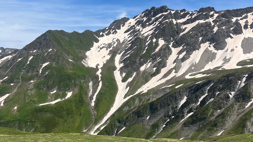
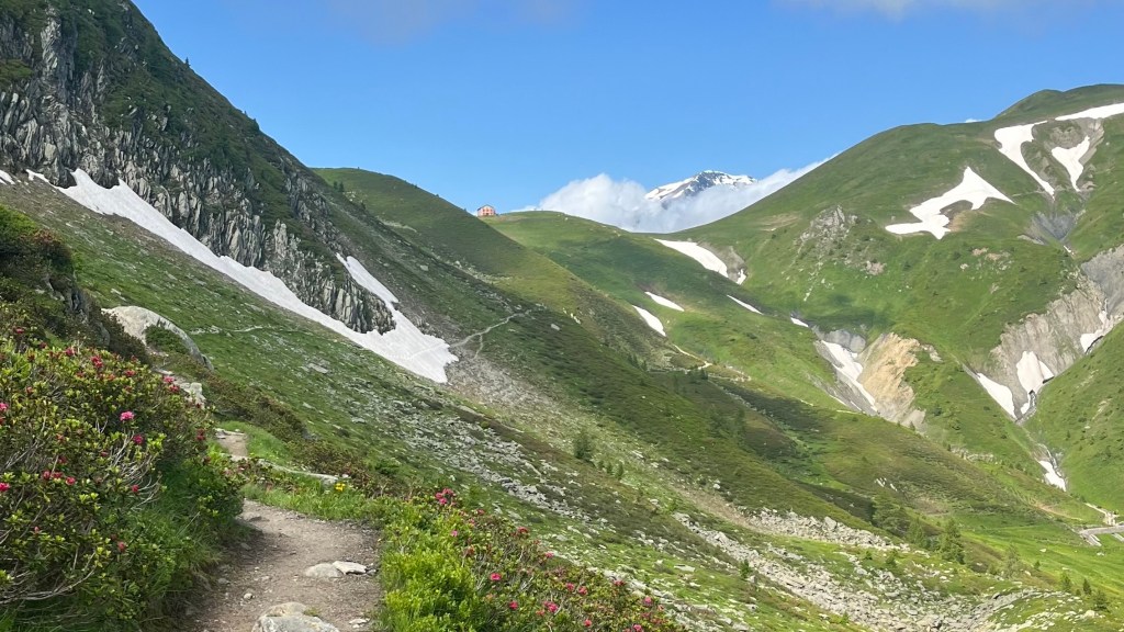
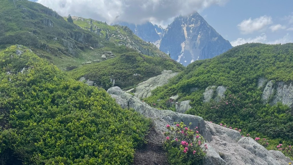
From there, the trail gained vertical steadily as we ascended towards Col du Bonhomme. Wildflowers lined the path, and our first patches of snow were crossed with excitement. At the Col, we took a long snack break, sharing the vistas with many other hikers, several of whom were inexplicably puffing on cigarettes.
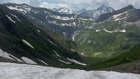
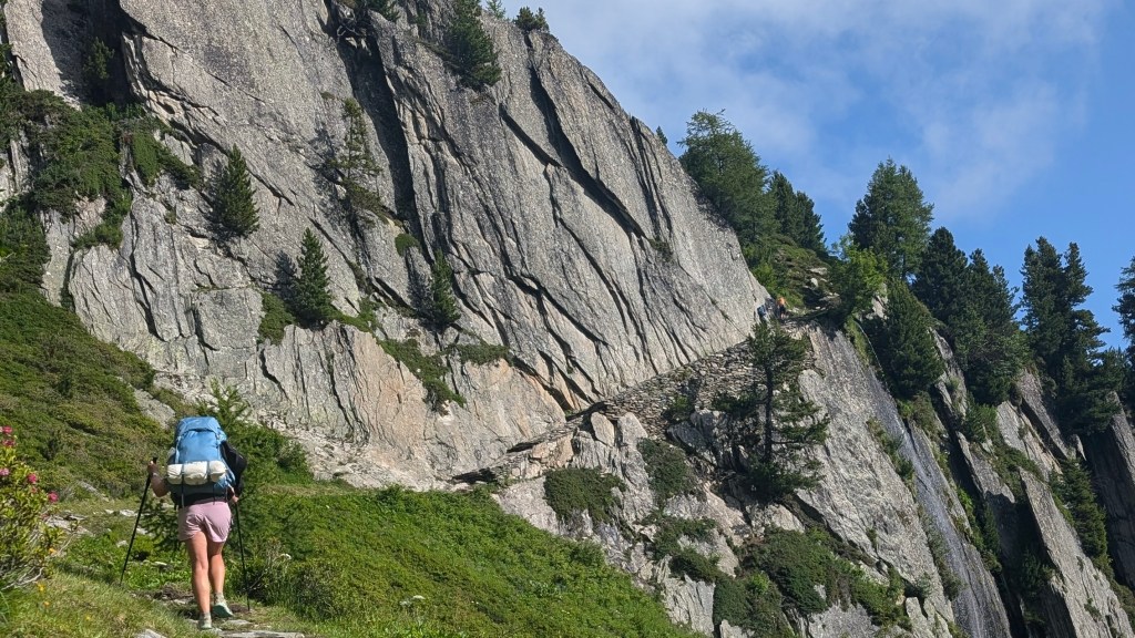
The afternoon involved crossing a few snowy sections that had some exposure, but we took our time and had the path largely to ourselves, which was a welcome change after the busy section up to the Col. The views down into the Chapieux valley were superb, and photo stops once again slowed our pace.
Lunch outside Refuge du Col de la Croix du Bonhomme was scenic and restorative, giving us the chance to consider whether to camp nearby or continue to Les Chapieux. We opted to push on, following a series of switchbacks down into the valley. Streams of snowmelt provided ample hydration, as well as a boggy patch that almost claimed one of my shoes as I sank ankle deep.
Arriving in Les Chapieux via a trail lined with wildflowers, we quickly set up camp and headed for an arrival beer. The village is tiny and remote, but it felt magical to be surrounded by the mountains. The afternoon was spent playing cards, and nerviously watching the sky as booms of thunder grew closer; happily, they never materialised into anything more.
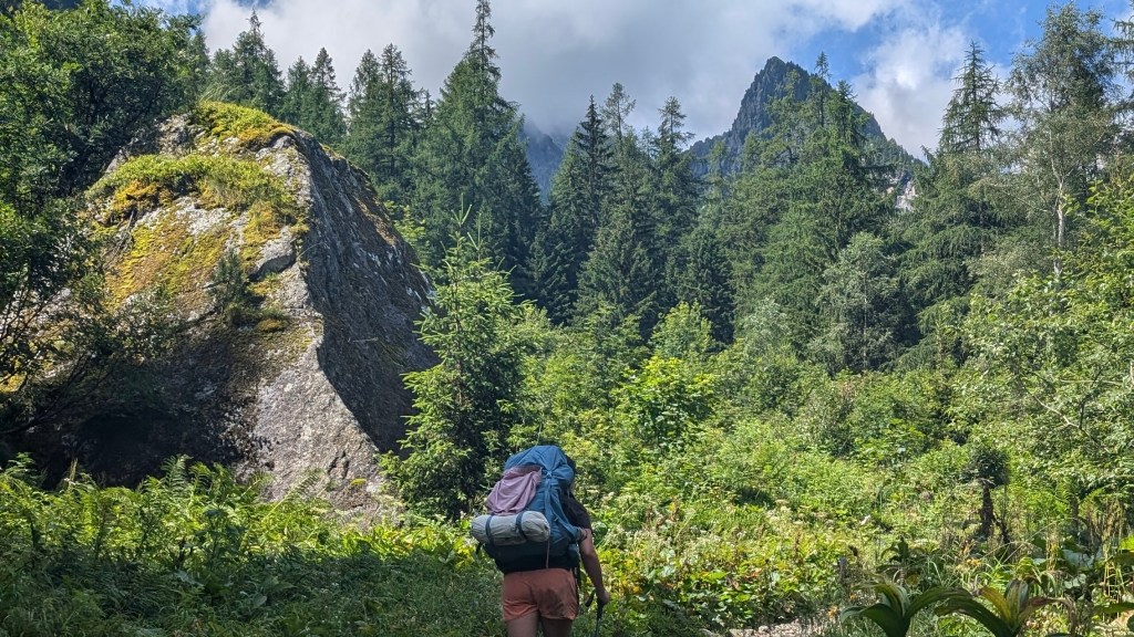
Day 3 – 11 July 2024: Les Chapieux to Val Veny
Distance: 31.25 km | Elevation gain: 1,665 m | Moving time: 8h 20m | Average pace: 16:00/km | Average speed: 3.75km/hr
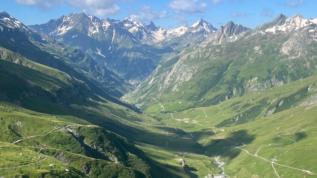
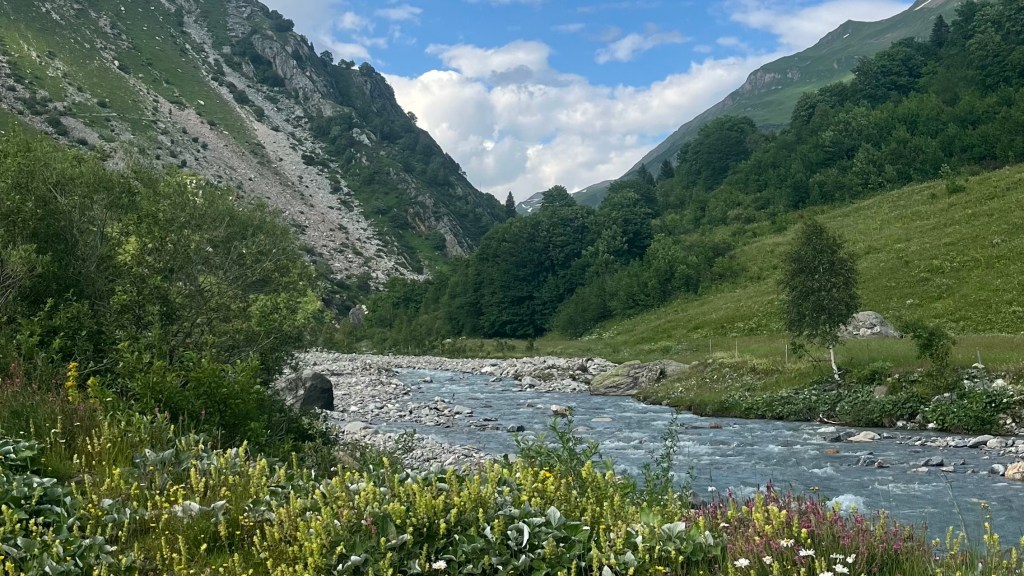
I set off early on my purist agenda, walking six kilometres along the valley road while Penny and most other hikers opted for the bus. The morning was chilly and still, wildflowers carpeting the path. The quiet was broken only as mini-buses passed along the valley.
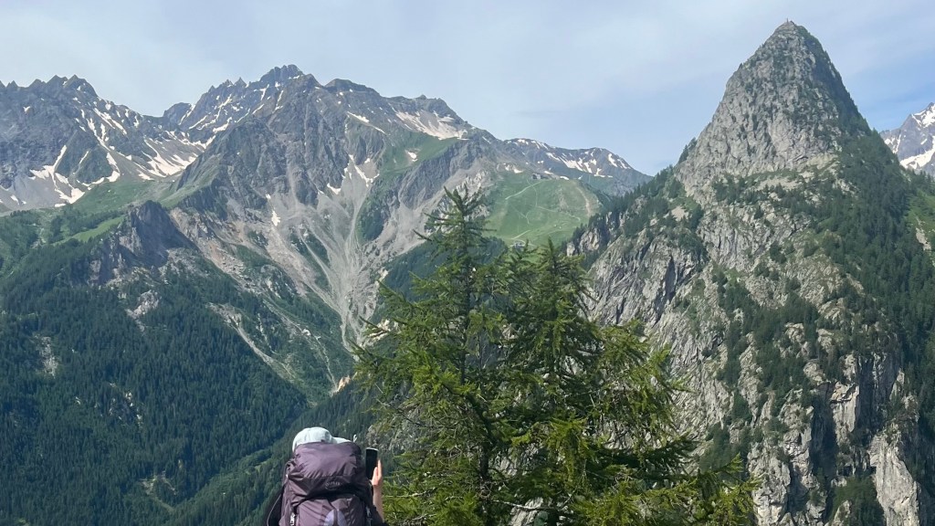
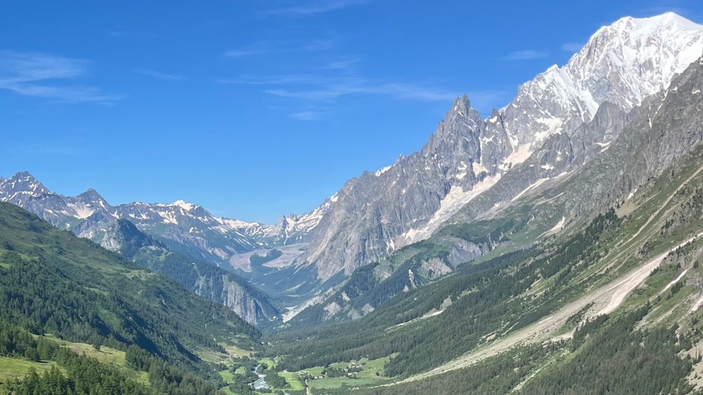
Reunited, Penny and I continued along a gentle incline, chatting steadily until the trail turned into switchbacks towards the Col de la Seigne and the French-Italian border. What felt like hours of zigzags found us in a long game of leapfrog with other hikers; we formed a friendship with a Korean couple whose plans mirrored ours: finish the hike, then recover by the beach in Marseille. Finally reaching the top, we paused to take in the spectacular views, captivated by a cloud caught dramatically on a nearby peak.
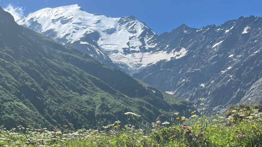
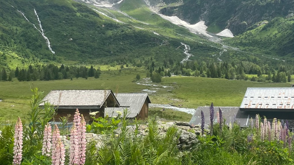
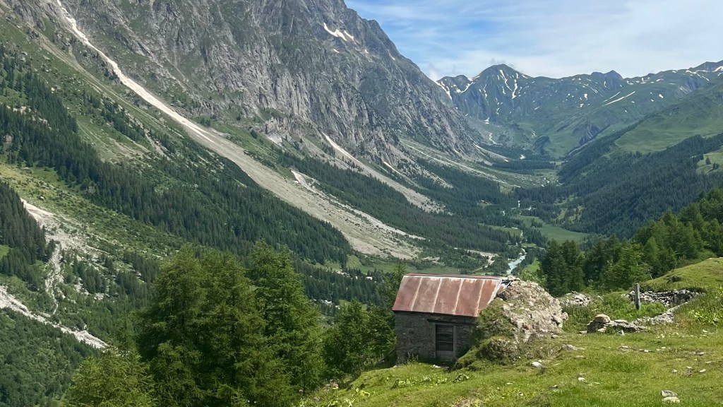
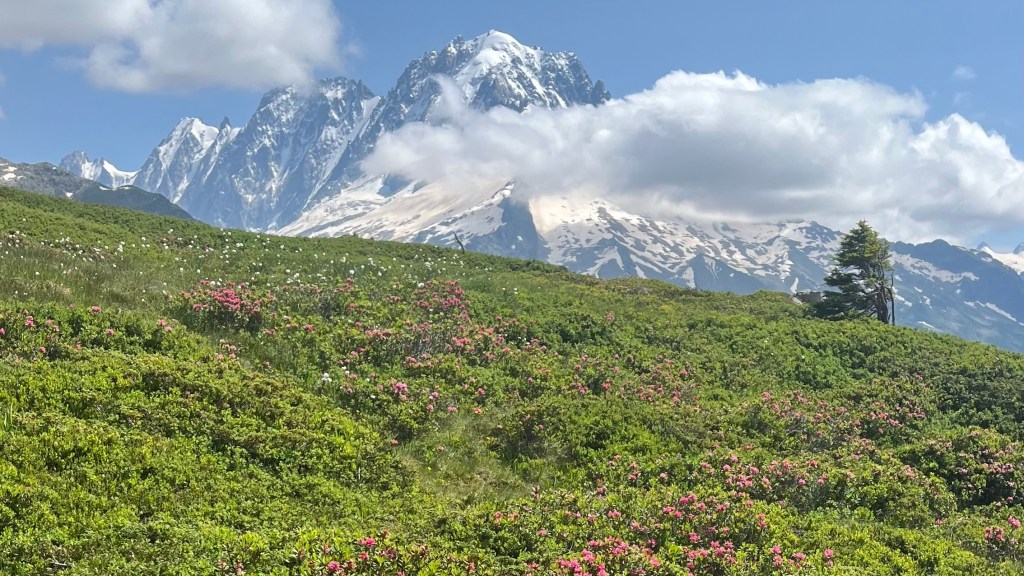
The descent offered wildflowers-lined paths and easier walking, though a detour to Refugio Elisabetta Soldini added a climb in exchange for a takeaway lunch. In the afternoon, we took the high route toward the Arête Mont Favre, rather than continuing along the valley. Wildflowers dazzled and danced, and the vistas of Mont Blanc’s Italian side were breathtaking. The descent required careful concentration on a few exposed snow patches, especially once the wind began to gust in earnest.
A final break at Refugio Maison Vielle allowed us to admire Courmayeur far below, before we turned to navigate a final series of switchbacks towards the campsite down in the valley of Val Veny. The final kilometres were slow and exhausting, thanks to confusing, and then non-existent, signage. Arriving was a major victory. Tents were pitched just as drizzle began, the campsite gossip turning to whether a storm would hit us. Heading to bed after dinner, showers and our customary arrival beer, it still hadn’t materialised.
Day 4 – 12 July 2024: Val Veny to Courmayeur
Distance: 5.58 km | Elevation gain: 12 m | Moving time: 1h 10m | Average pace: 12:39/km | Average speed: 4.78km/hr
Although it rained all night, the storm never quite reached us. By 6am we were both awake as the rain steadily continued, showing no signs of letting up. Penny’s tent hadn’t fared well; a leak led her to evacuate to mine. We then reconvened in the shelter of the camp kitchen porch, enjoying our morning coffee while we compared the day’s options with two Belgian hikers doing the same. We were all reluctant to head into high terrain with storm warnings floating around.
Penny and I settled on a pragmatic plan: walk to Courmayeur, visit the tourist office, and decide from there. Penny consigned her tent to the campsite bins, and we wished luck to some other hikers who were starting to become familiar to us. Everyone was either hunkering down in Val Veny for the day, or seeking shelter in Courmayeur.
The six kilometre road was was actually fairly pleasant: glacial water rushing beside us, quiet forest, and minimal traffic. Courmayeur’s tourist office confirmed we shouldn’t attempt the mountains today; but they did help us find cheap accommodation that wasn’t listed on Booking.com. With time to kill before it opened, we sheltered under a cafe awning drinking multiple rounds of coffee while the rain continued to pour.
The hotel room was a delight: warm, dry, full of character and equipped with a balcony perfect for tent-drying. We changed into clean clothes and set off for pizza, weaving through crowds of trail runners in town for tomorrow’s race. Afterwards, we wandered through town before eventually turning to the usual chores of grocery shopping and reorganising gear, before indulging in a gentle afternoon of rest. Of course, the storm never materialised as we sheltered indoors.
Day 5 – 13 July 2024: Courmayeur to Plampincieux
Distance: 11.04 km | Elevation gain: 872 m | Moving time: 3h 12m | Average pace: 17:25/km | Average speed: 3.45km/hr
Bright sun and clear skies greeted us; a happy sight after yesterday’s rain. We packed up, grabbed a baguette from town, and headed out; straight into today’s trail race. Runners streamed uphill as we climbed the same narrow path, stepping aside as often as we reasonably could. We bonded with other hikers over the shared chaos.
Once we rose above the treeline, the views back over Courmayeur were gorgeous. Dozens of hikers paused to take in the panorama, then continuing on to the refuge for a cold drink. We skipped the refuge stop, instead climbing over a small crest and entering a jaw-dropping meadow bursting with wildflowers.
Today’s lunch stop was our best so far: sun, quiet, and a perfect view of an old hut perched beneath the Grandes Jorasses. Although we could see the campsite far below and were tempted to continue on, with the next campsite 25km and another Col away, we decided to take today easy, soaking up the sun before beginning the descent.
Camping Tronchey’s closed reception and dubious bathrooms sent us to a nearby bar for a research break. We then switched to a far nicer campsite, where we were welcomed to pitch before paying. Hot showers required a swipe-card system offering two precious minutes of hot water.
We unexpectedly ran into a couple of Danish hikers we’d met in Les Chapieux. Their tent had given up in the rain, putting an end to their purist agenda; their trail was now about surviving til the end.
With hours of daylight left and fresh legs after yesterday’s rest day and today’s short section, we wandered up the valley until we found a tiny bar overlooking the mountains, where we spent a blissful afternoon in the sun, nursing local beers.
Dinner was campsite pizza; one each, naturally, because perpetual hunger was starting to set in. The evening brought the cold, and we retreated to the tent early.
Day 6 – 14 July 2024: Plampincieux to La Fouly
Distance: 27.72 km | Elevation gain: 1,521 m | Moving time: 7h 42m | Average pace: 16:40/km | Average speed: 3.6km/hr

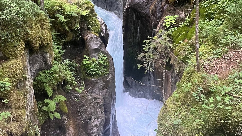
We woke to a very chilly morning in the valley, and were glad we had brought some extra layers as we rugged up and coaxed the water to boil for our morning coffees. We were easily the first hikers on trail, and we were rewarded with a peaceful climb through a silent valley that slowly came alive as the sun’s rays reached lower and lower on the mountainside. The early light on the mountains was simply spectacular. A questionable farm, featuring an axe casually abandoned beside the track, briefly broke the serenity; but soon afterwards we were compensated with views of a perfect waterfall.
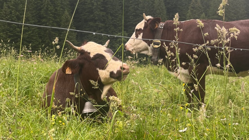
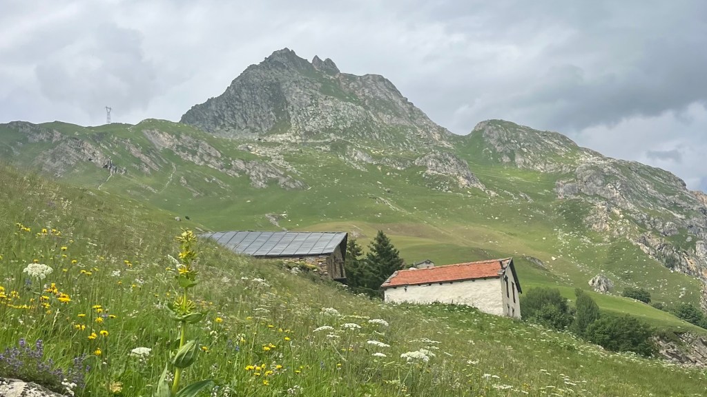
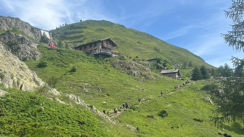
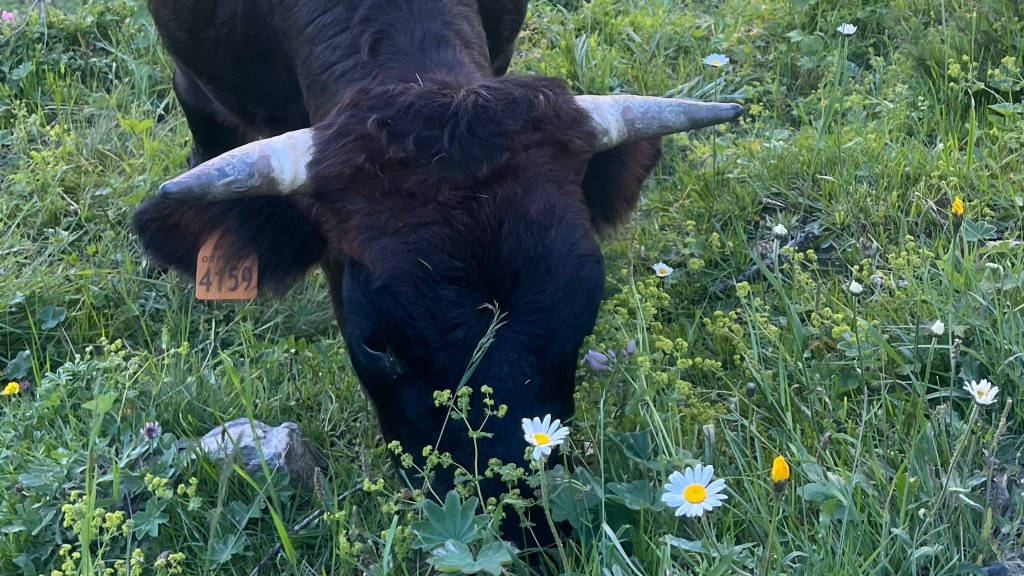
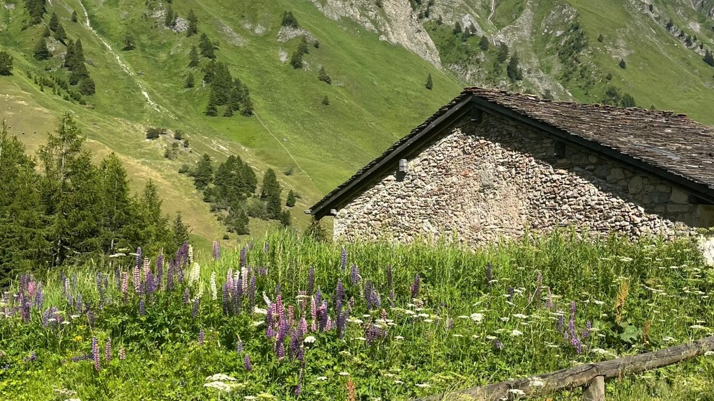
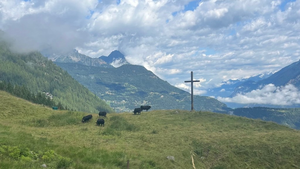
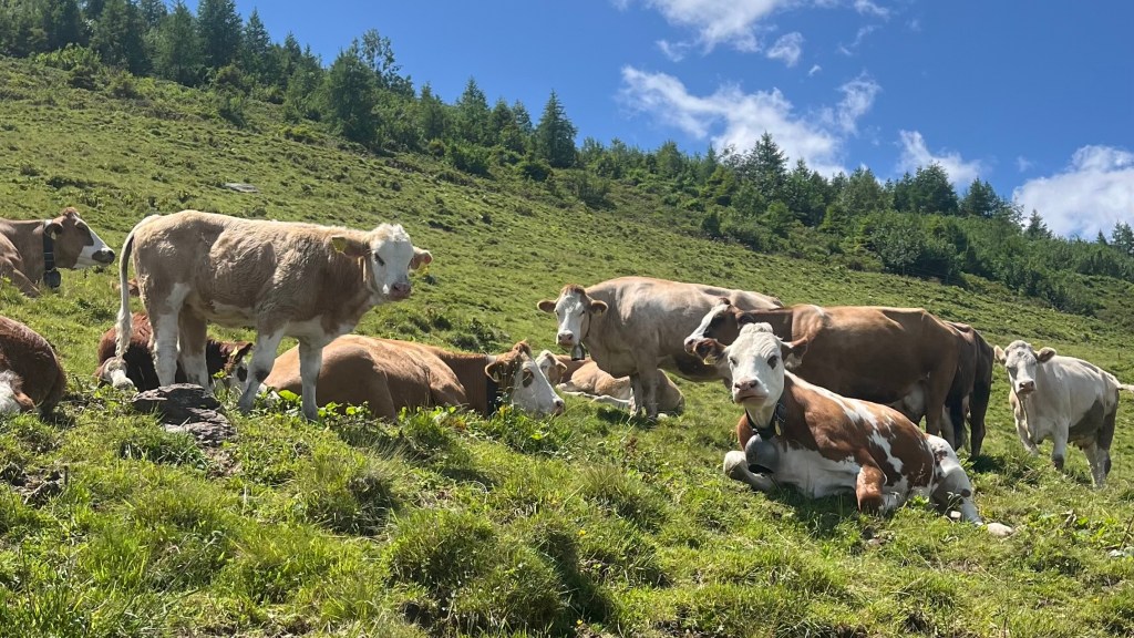
Our arrival at Rifugio Bonatti was perfectly timed; with only a small handful of other hikers lingering there, we ordered a coffee and enjoyed the way the mountains glowed in the sun. A gentle descent followed, past ruined stone buildings and a herd of photogenic cows, before the gradient steepened as it led us to Chalet Val Ferret. Our stomachs insisted it was lunchtime, and were managed to score some pre-made sandwiches.
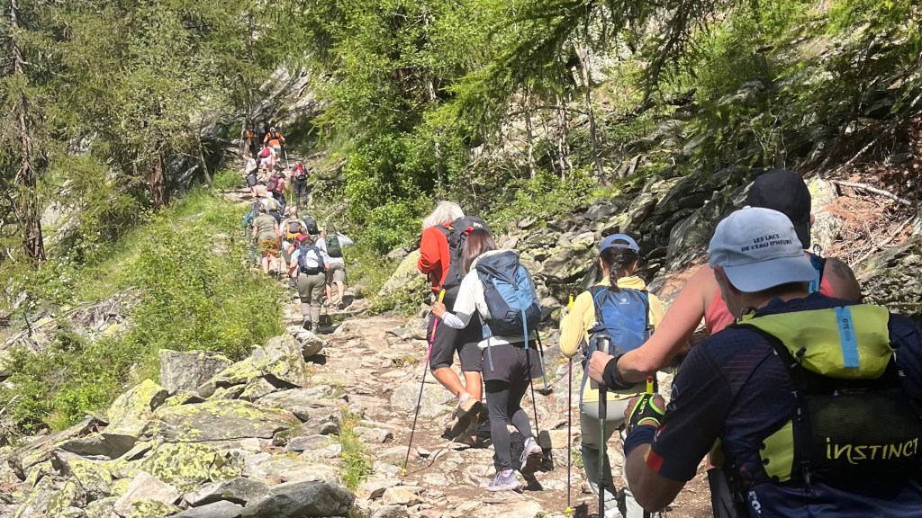
From there, the long grind up to Rifugio Elena began. The heat was building, but snowmelt-fed streams offered perfectly icy refills. Elena, when we arrived, was heaving with lunchtime traffic, so we skipped the queue in favour of our own snacks before continuing the final ascent to the Grand Col Ferret. The traffic in this section was frustrating, to put it mildly: big guided groups and inexperienced hikers seemingly unaware of trail etiquette. But a strategic lolly break near the top restored energy and morale levels.
Crossing into Switzerland really felt like stepping into a new world; a patchwork of white snow, grey stone and bright green grass. We descended until the wind eased, taking a break on the side of the trail for a proper lunch, and then enjoyed a mellow walk toward La Peule where a cold Coke revived us for the final stretch to La Fouly.
A curious calf welcomed us to La Fouly by licking Penny’s leg, and we soon ran into several familiar faces of other hikers at the relaxed campsite. Dinner, showers and an early bedtime followed; with another storm forecast for tomorrow afternoon, we planned on a short day to Champex, timed to arrive before it hit.
Day 7 – 15 July 2024: La Fouly to Champex
Distance: 17.34 km | Elevation gain: 576 m | Moving time: 4h 4m | Average pace: 14:04/km | Average speed: 4.26km/hr


We emerged from the tent to find first light hitting the peaks of the mountains behind us, the whole ridge glowing in soft rose and gold. We packed up efficiently, in a routine by now, but then had time to kill as we waited at the campsite bakery for our pre-ordered baguette. The supermarket had been picked clean yesterday.
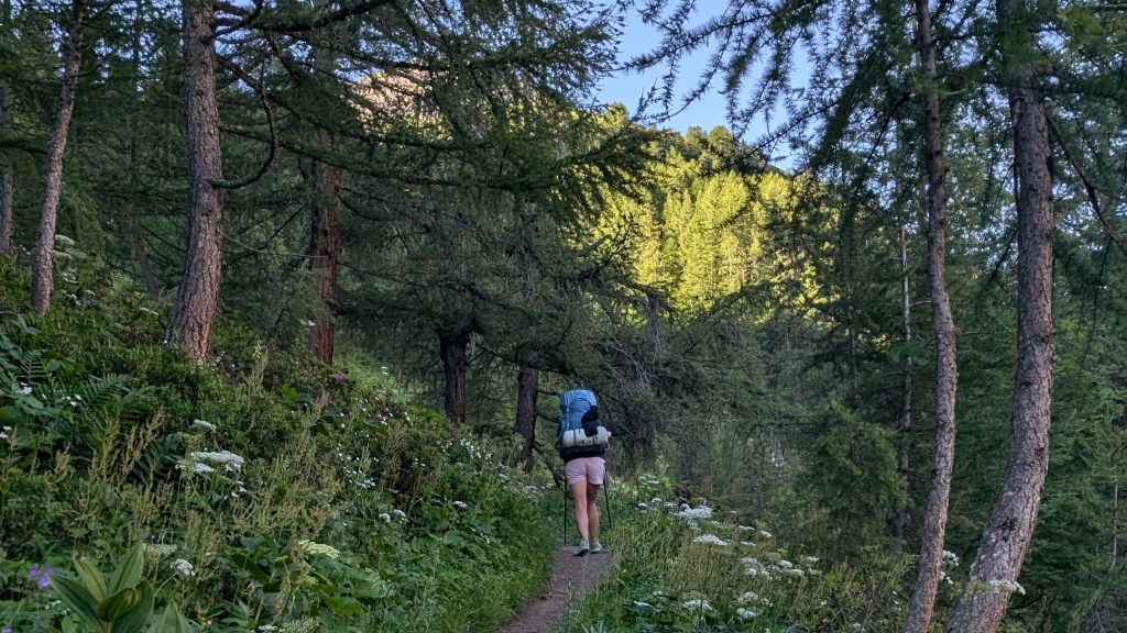
We finally set off around 8am, which had become a late start by our standards. The morning was gentle: easy trail, rolling valleys, and a wildflower meadow notably dotted with bright red poppies, the first we’d seen. But despite perfect conditions, I found the day quite a slog. After so many spectacular sights on every other day, the long forest stretches felt flat and monotonous.
We made great time through small villages, even taking a couple of breaks for coffees. We started to debate whether we had the legs, and the weather window, to push all the way to Trient today.
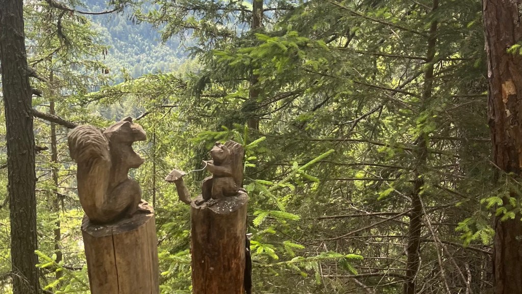
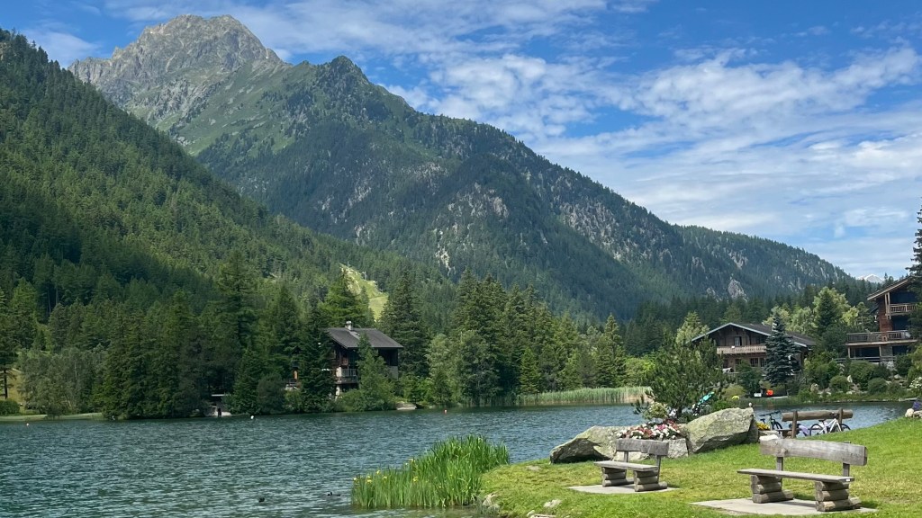
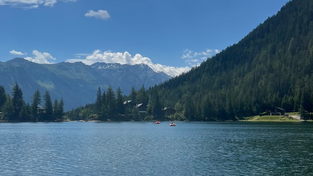
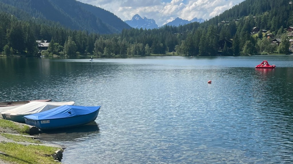
The climb out of the last village was steeper than the others, but didn’t hold a candle to all the Cols we’d crossed so far. It was enlivened by wooden carvings we delighted in spotting. Then, suddenly, Lac de Champex appeared, glassy and blue below: phones came out instantly for photos. As we made our way along the shoreline we ran into a group of hikers we hadn’t seen for a few days; we swapped trail gossip and intel about the cheapest campsite in town.
Over icecream we weighed our options: we couldn’t see a cloud in the sky, but a storm was still forecast. Ultimately, the lure of a lakeside afternoon won out. We swam, very briefly: the chilly water made sense once a fellow tourist informed us it freezes over in winter. In-between dips, we sprawled in the sun.
By late afternoon clouds finally began to roll in. We set up camp and then headed back to town for a pack-free resupply. We cracked a beer at a bench overlooking the lake, and were soon caught in a downpour; we dashed for shelter under the narrow roof of a boatshed. The rain didn’t seem like it would cease, so when it relented we made a break for the campsite, where we cooked dinner under the only covered area, where every other camper was also taking shelter.
Day 8 – 16 July 2024: Champex to Trient
Distance: 15.52 km | Elevation gain: 823 m | Moving time: 4h 25m | Average pace: 17:06/km | Average speed: 3.51km/hr

After a night of steady rain, we woke to a grey morning and a dripping tent. With only 15km on the agenda, we leaned into a slow morning: breakfast under a small picnic shelter, a wander around the glassy lake, and a supermarket resupply as the tent dried.
Back at camp, the tent hadn’t dried as much as we hoped, but we packed it up anyway and set off around 10am. The first stretch took us along easy forest tracks and sleepy hamlets, leapfrogging with an Italian school group.
Then the climb began; gently at first, then steepening into a lush, shaded mountainside full of meltwater streams. It was like an alpine jungle, and I must have been so mesmerised that I forgot to take photos, much to present-me’s disappointment. Eventually the path itself became a flowing creek; we waded straight through, grateful to have chosen trail runners.
On the other side, the ascent steepened dramatically, with long stretches between hairpins. Stunning views and rising head led to limited conversation: all energy was going to the climb. When we finally reached Alpage de Bovine, it was like a hiker convention. We grabbed lunch in the meadow, away from the bustle, before the final push to the col. After that, the descent to Col de la Forclaz was pleasant; the steep final drop into Le Peuty less so.
A windy campsite perfectly lent itself to drying the tent; meanwhile, we found the Danish boys again and shared some beers at a refuge. We ended the day trying to light the stove in a blustery shelter, playing a couple of card games.
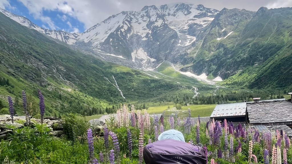
Day 9 – 17 July 2024: Trient to Lacs des Chéserys
Distance: 22.97 km | Elevation gain: 2,124 m | Moving time: 8h 33m | Average pace: 22:20/km | Average speed: 2.69km/hr
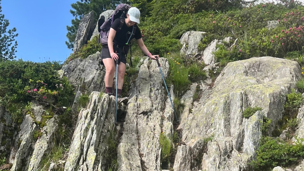
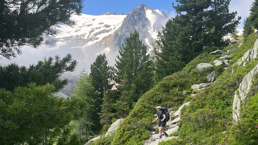
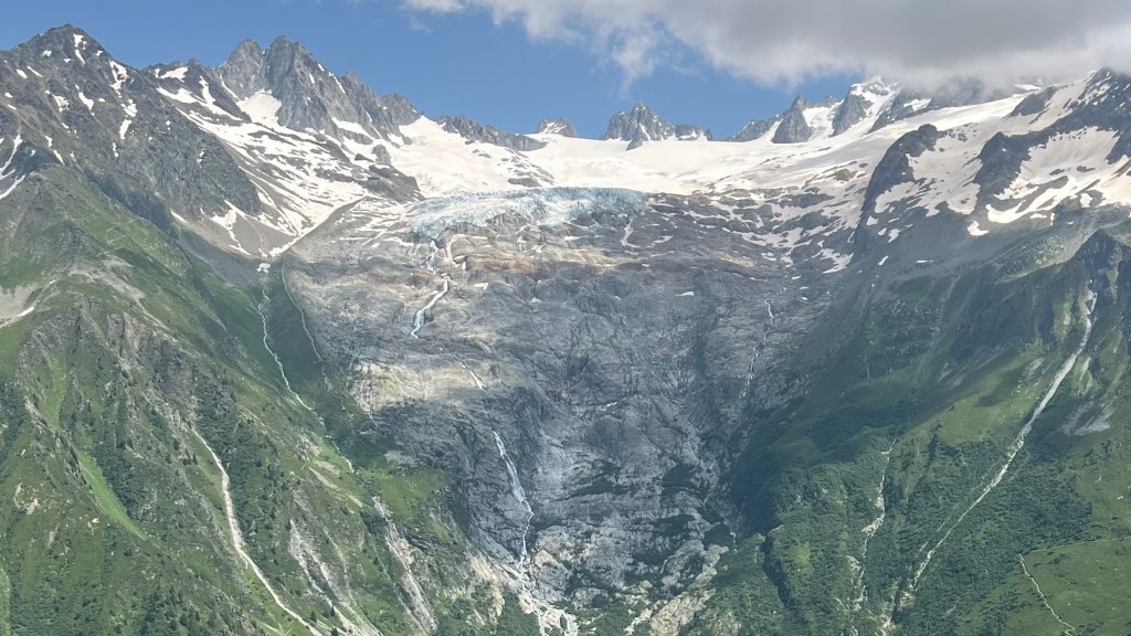
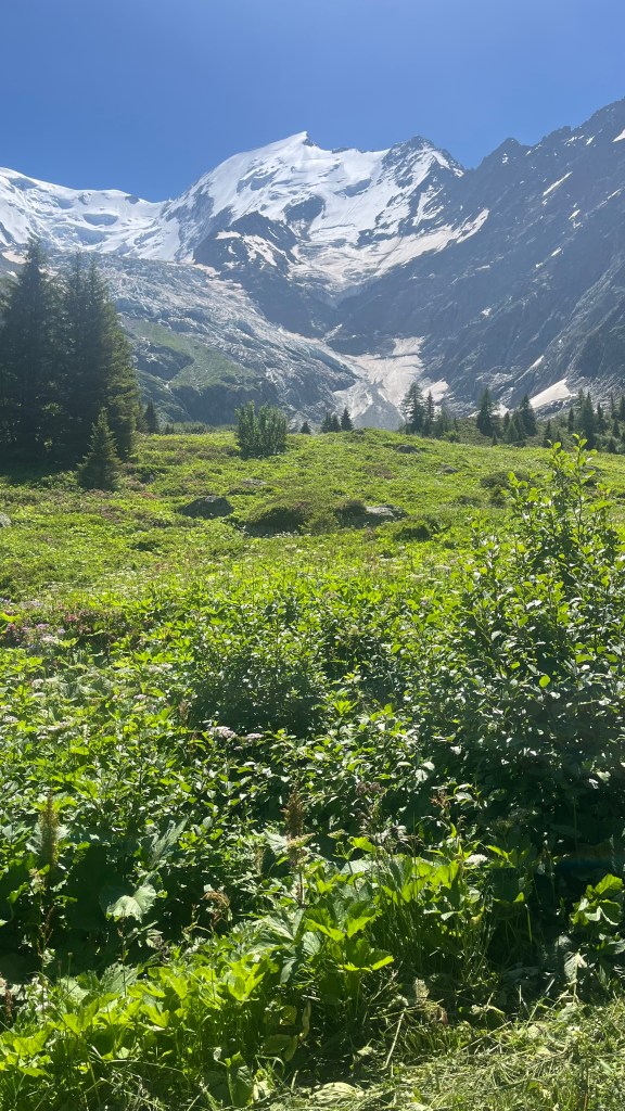
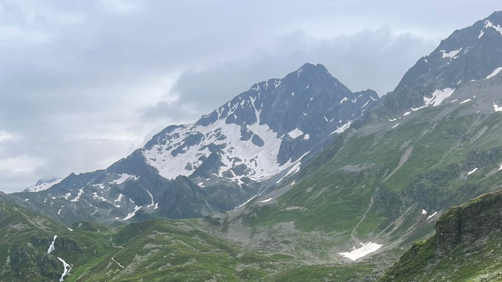
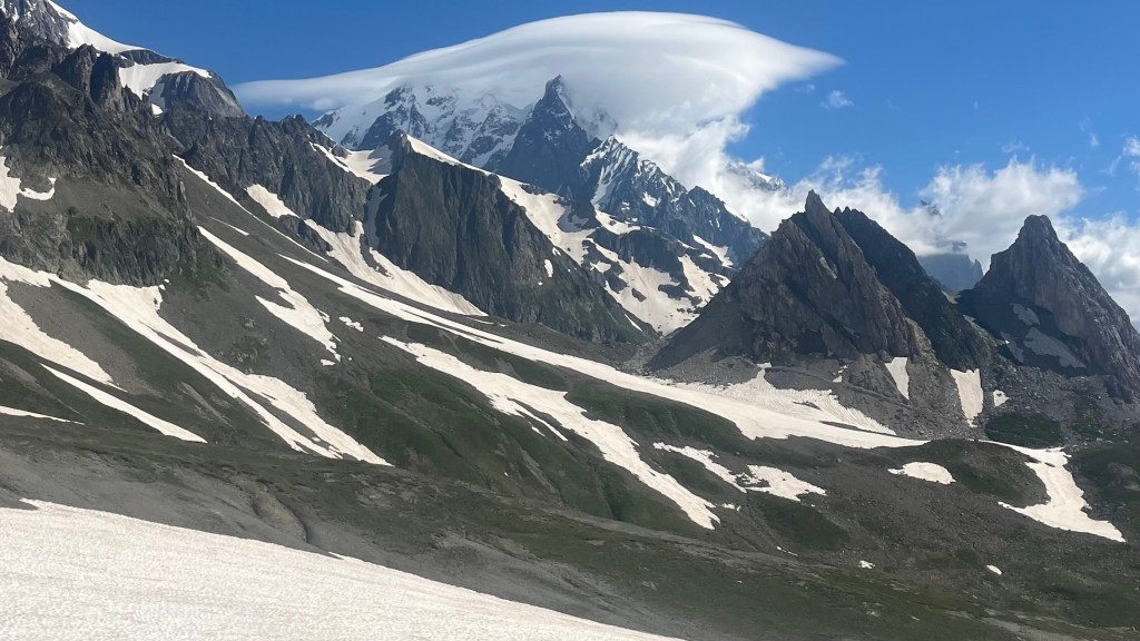
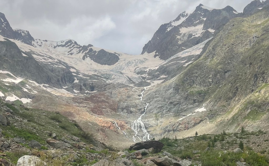
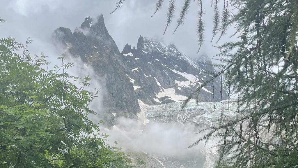
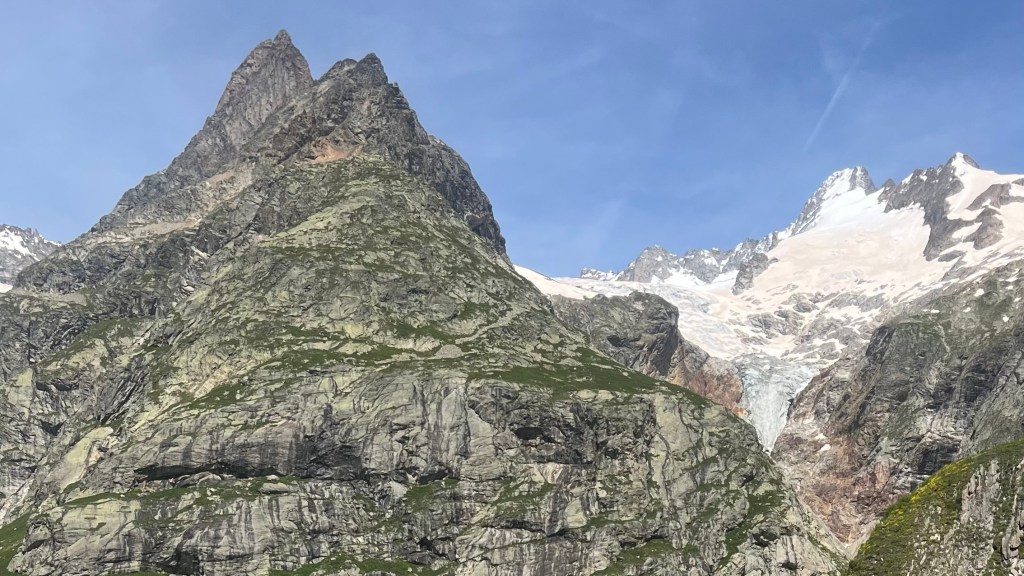
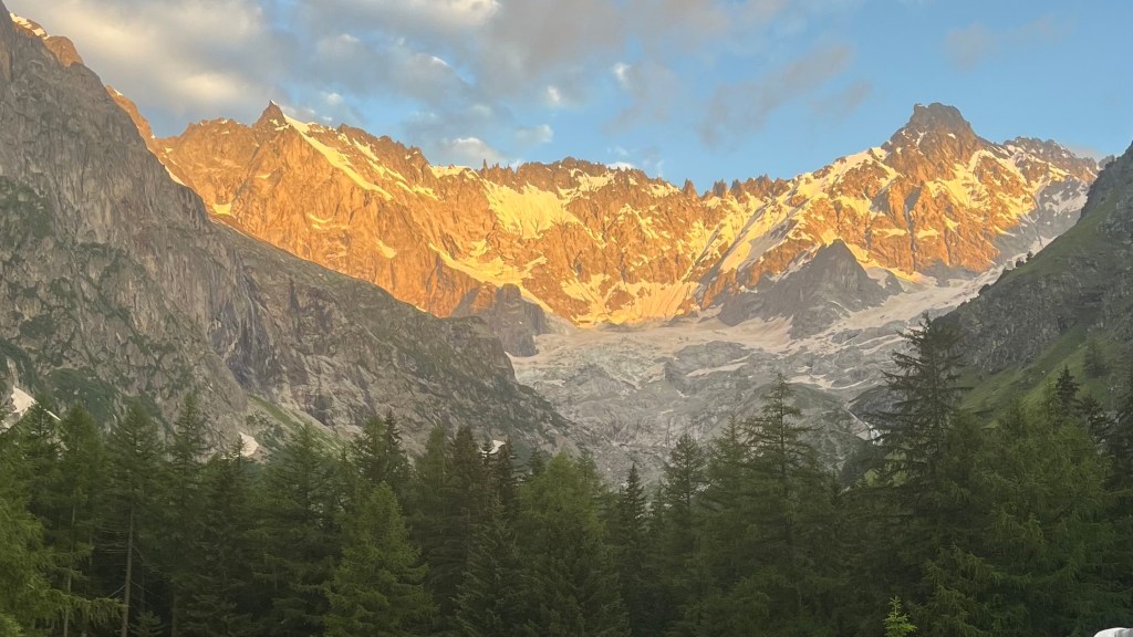
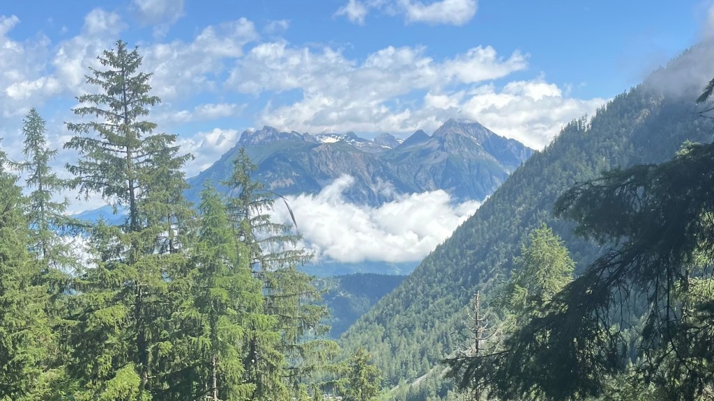
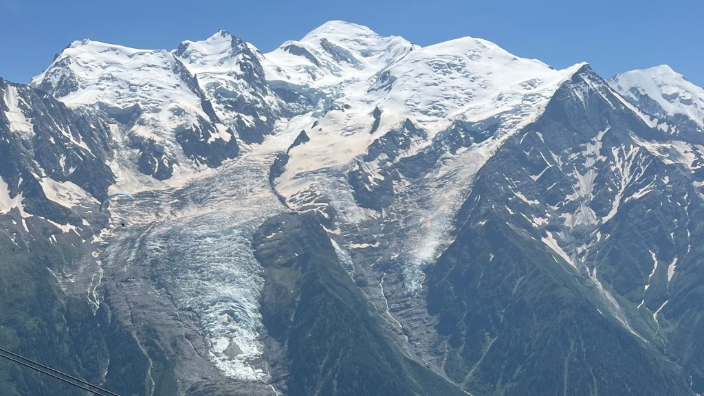
Having planned yesterday to take a variation via Les Grandes to Col de Balme, we were up early and on trail by 7am. The morning climb wound steadily up an access road; it was peaceful and quiet, a lovely walk to slowly wait for our morning coffee to kick in. Glaciers appeared through gaps in the forest, along with dramatic rock formations unlike anything else we’d seen on trail.
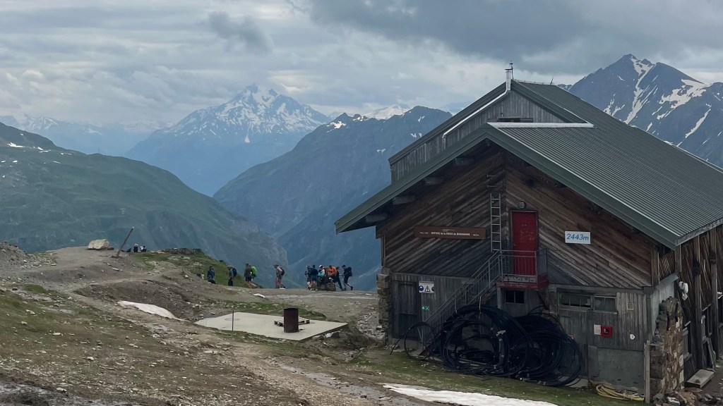
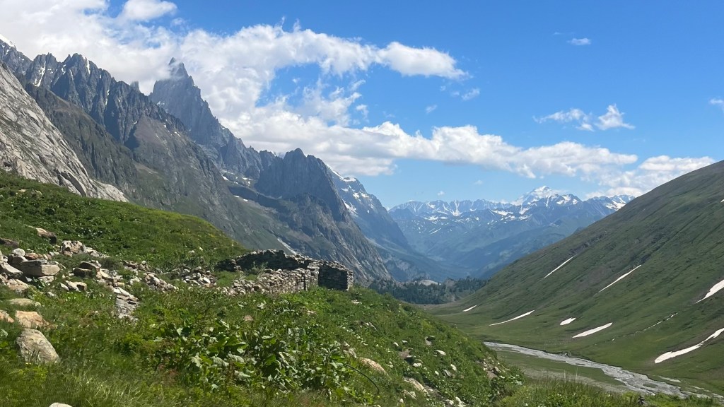
A steep stone ramp, with a very welcome safety rail made of chain, spat us out at Refuge Les Grandes, a tiny picture-book building where, to our delight, coffee was available. We lingered in the sun as we sipped, before continuing on the rocky track that the guidebook aptly described as “the path less travelled”. Tricky footing, bursts of wildflowers and a few snow patches soon delivered us to Refuge du Col de Balme. With no sandwiches on offer and the lunchtime crowd out in full force, we settled instead for a Coke and chips which we took outside to admire the sweeping view into the Chamonix valley.
Crossing back into France, we followed a wide ski-field track before detouring to Alpage de Balme for a proper lunch; absolutely the right call. Penny and I shared quiet grins as the hiker next to us asked for tap water and, when told it wasn’t available due to lack of plumbing, ordered a beer instead.
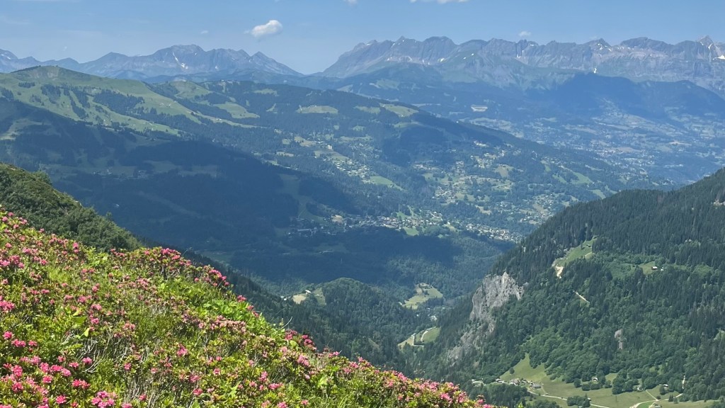
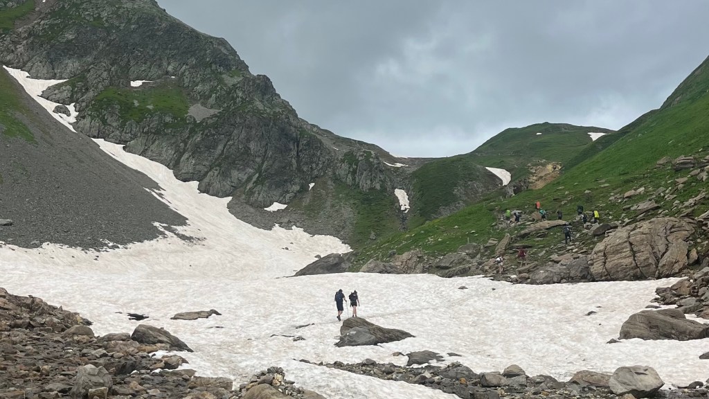
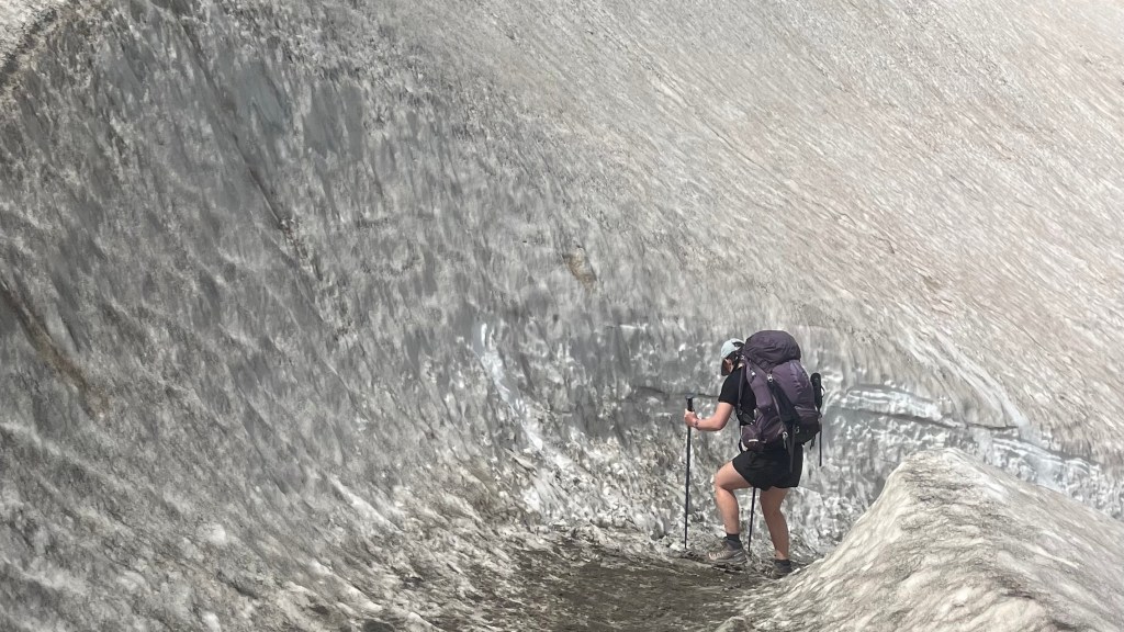
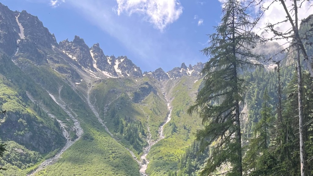
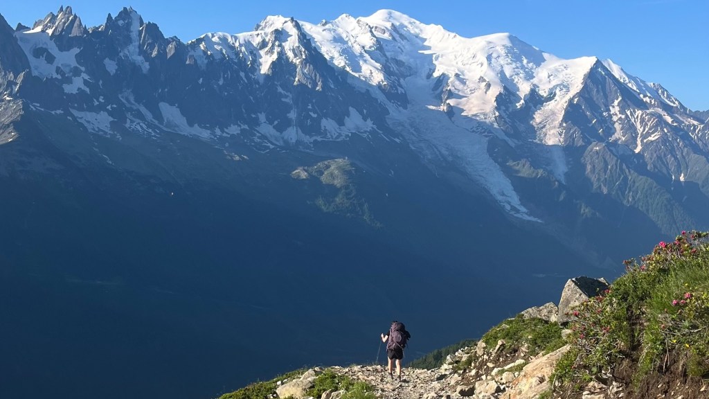
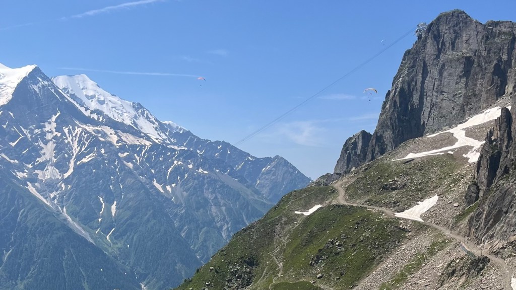
Energised, we climbed to the Aiguillette des Posettes for 360 degree views, then endured a seemingly endless descent, exposed to the heat of the afternoon and with dwindling water supplies. A meltwater stream at the bottom saved us; I wasted no time cameling up, splashing my face and dunking my hat.
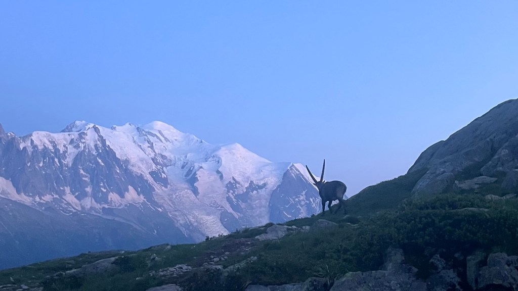
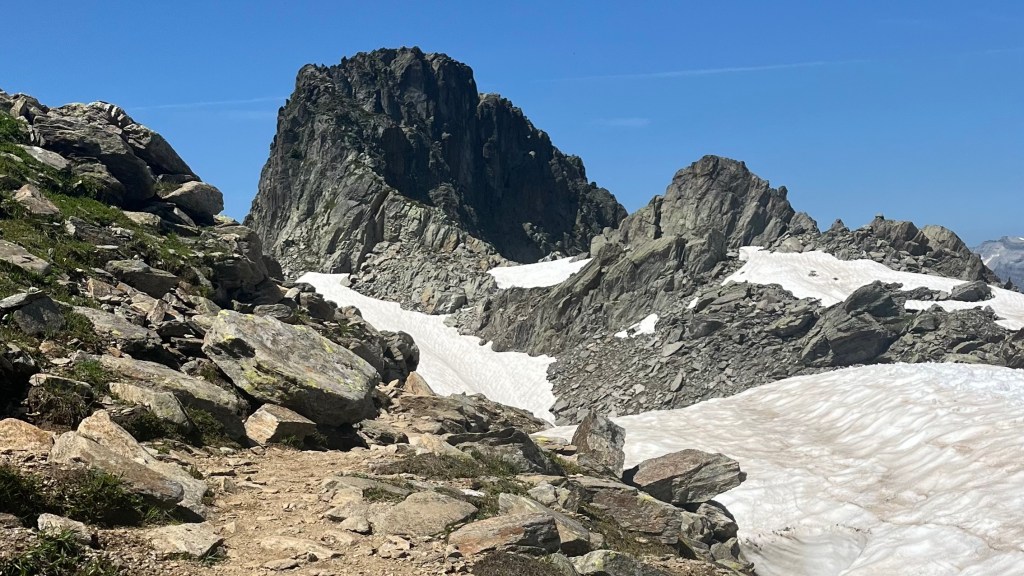
Our final climb delivered some serious memories. Incredible glacier views, an ibex blocking the trail, and the infamous ladders. Somewhere on the way up, my beloved water bottle launched itself into the abyss. There was no hope of retrieving it.
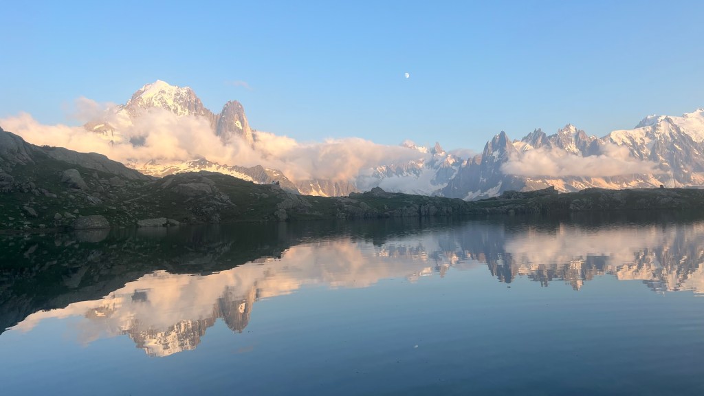
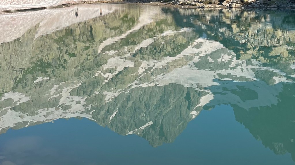
As the sun dipped, lighting the Mont Blanc massif in dusty pink, we crossed path with the warden who checked our camping permit shortly before we reached Lac des Chéserys. Ibex grazed around the mirror-still lakes as we quickly pitched the tent, and then postponed dinner in favour of a sunset wander around the shoreline as the moon rose. It was a perfect, unforgettable campsite; the best possible reward for today’s long effort, and a fantastic way to begin to end the trail.
Day 10 – 18 July 2024: Lacs des Chéserys to Les Houches
Distance: 23.53 km | Elevation gain: 1,044 m | Moving time: 8h 41m | Average pace: 22:06/km | Average speed: 2.71km/hr
We woke to our coldest morning yet; unsurprising, at above 2,000 metres. The lakes around us were still and silver in the early light. With a big day ahead we packed quickly, refilled bottles at an icy meltwater stream, and set off just before 7am. A short ladder section delivered us to Refuge du Lac Blanc, and the lake itself. It was beautiful, but after last night’s sunset performance nothing could quite compare.
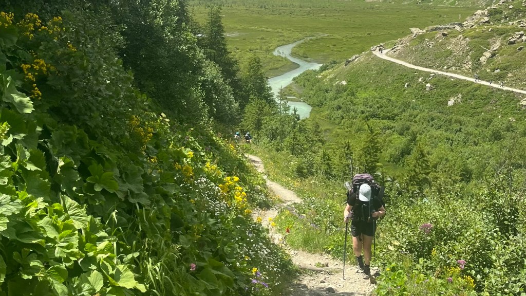
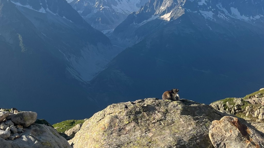
The early hours of walking were bliss, filled with quiet trail, soft light, and even marmots playing between boulders as we wound past high alpine lakes. As we arrived around La Flégère, so were the crowds. We grabbed a coffee, and then continued along the path, Chamonix sprawled below us.
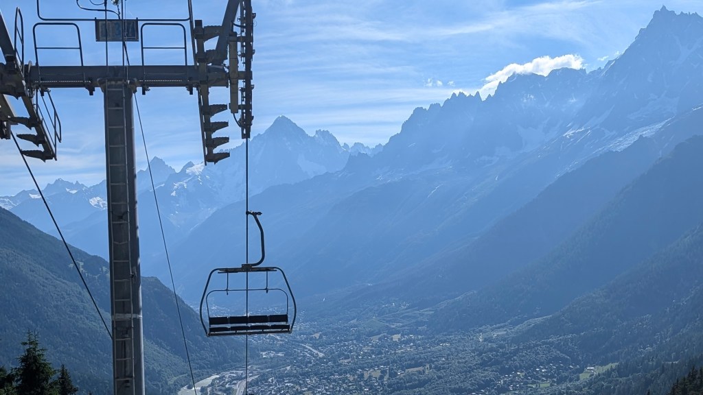
Heat settled in as we climbed toward Col du Brévent: 27 degrees felt relentless. Snow patches slowed us down, and ladders just before Brévent were frustratingly congested with hikers. The final push over loose scree to reach the top of the cable car landing felt endless; an iced tea and iceblock at the summit were necessary to revive us.
Then came the descent. It started off fine, at first. At least until we reached the Refuge de Bellachat; after that, “brutal” barely began to cover it. Hours of steep switchbacks filled with loose rock, exposed sections and one part where handrails were necessary to overcome a section slicked with water, where rude hikers chose to overtake us instead of waiting twenty seconds. Shade when we reached the treeline was a relief, but the descent was far from over. The signs with estimated timings seemed to be taunting us as we became slower and slower.
Eventually, we spilled out onto the road at Les Houches: hobbling, starving, and ready to be triumphant. We sped towards the arch, snapped our finishing photos, and chose a table at the first bar we passed, claiming a ginormous beer. Later, a short walk led us to a burger bar, where I deflated after a few bites as exhaustion took over. We shuffled towards the campsite, setting up in the dark, and crashing immediately: Tour du Mont Blanc conquered.
Want More?
Curious about the practical side of the trail? Check out my Tour du Mont Blanc: How-To post for route info and planning tips.

Leave a comment