6 days, 144 kilometres, 4,780 metres of elevation gain. I section-hiked the trail in December 2024: here’s the journey, day-by-day.
Thinking about tackling the trail yourself? Check out my Malerweg: How-To post.
The Stats
Trip Summary
- Start date: 21 December 2025
- Days hiked: 6
- End date: 26 December 2025
Distance & Elevation
- Total distance: 144.11 km
- Average distance/day: 24.02
- Total elevation gain: 4,781 m
- Average elevation gain/day: 797 m
Time & Pace
- Total moving time: 31 h 37m
- Average moving time / day: 5h 16m
- Average moving pace: 13:10/km
- Average speed: 4.56km/hr
Budget (ex gear)
| Category | Total (€) | Breakdown |
|---|---|---|
| Accommodation | 392.97 | Pirna accommodation x 2 nights (156.4); Bad Schandau accommodation x 4 nights (236.57) |
| Food | 46.73 | Day 1 supermarket haul (11.06); Day 3 supermarket haul (12.60); Day 4 supermarket haul (23.07) |
| On-trail transport | 3.20 | Bus Räumicht to Bad Schandau (forgot my travel card) (3.20) |
| TOTAL | 442.90 | Average / day: 73.82 |
Trail Journal
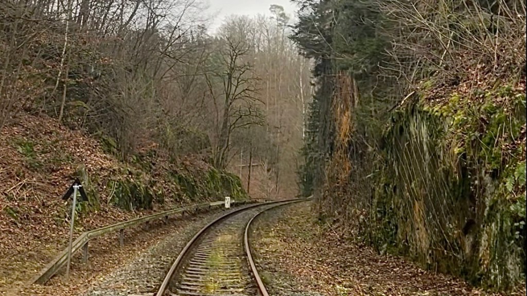
Day 1 – 21 December 2024: Pirna (Liebethal) to Hohnstein
Distance: 24.85 km | Elevation gain: 741 m | Moving time: 5h 33m | Average pace: 13:24/km | Average speed: 4.48km/hr
Holiday spirits
I’d arrived in Pirna in the dark the night before, so setting off under a light blue sky felt like discovering a completely different place. My accommodation was right in the old town, and instead of catching a bus to the official Malerweg trailhead out in the suburb of Liebethal, I decided to walk there as a warm-up. A quick supermarket stop for snack supplies was required, and in classic fashion when I resumed walking I forgot to restart my Garmin. And so my Malerweg began with some unrecorded bonus kilometres.
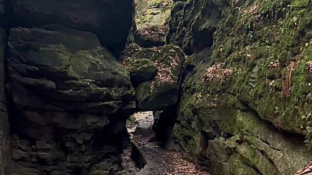
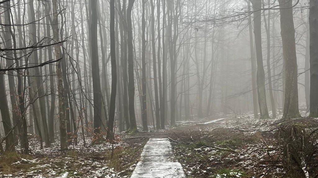
At Liebethal I spotted my first Malerweg trail marker, restarted the Garmin, and stepped straight onto a quiet, well-maintained forest path following a narrow river. Its water was so still it reflected the sky and trees perfectly. A handful of day walkers appeared here and there, but mostly it was just me and the forest, and eventually also the sandstone. The first rock formations appeared early; moss-covered pillars creating dark, shaded passages.
The trail soon spat me out above Stadt Wehlen, and I descended into a town so quiet I half wondered if everyone was asleep. With nowhere open and nothing happening I kept walking along the Elbe until I found a park bench for a five-minute lunch consisting of pretzel.
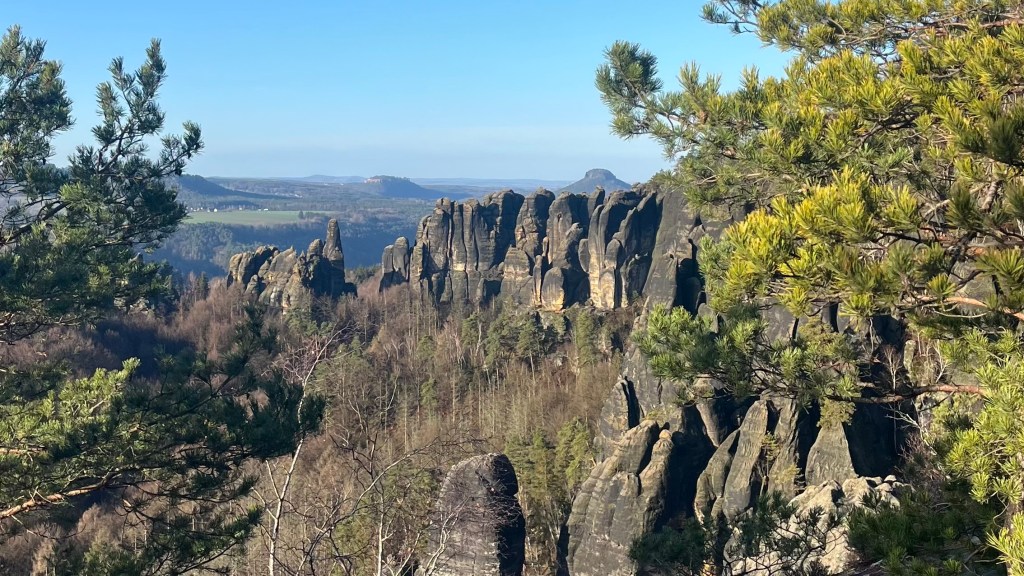
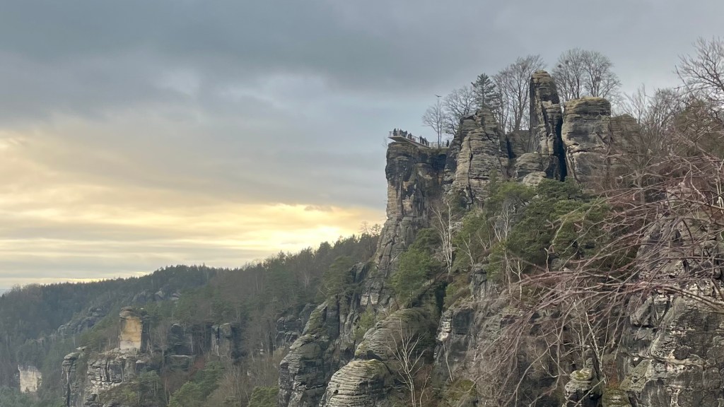
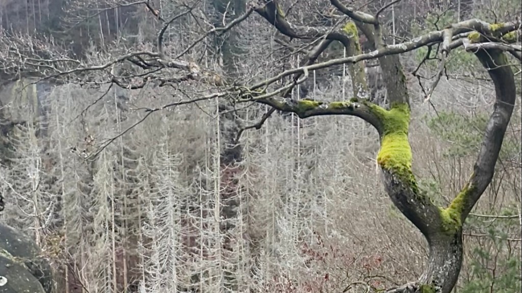
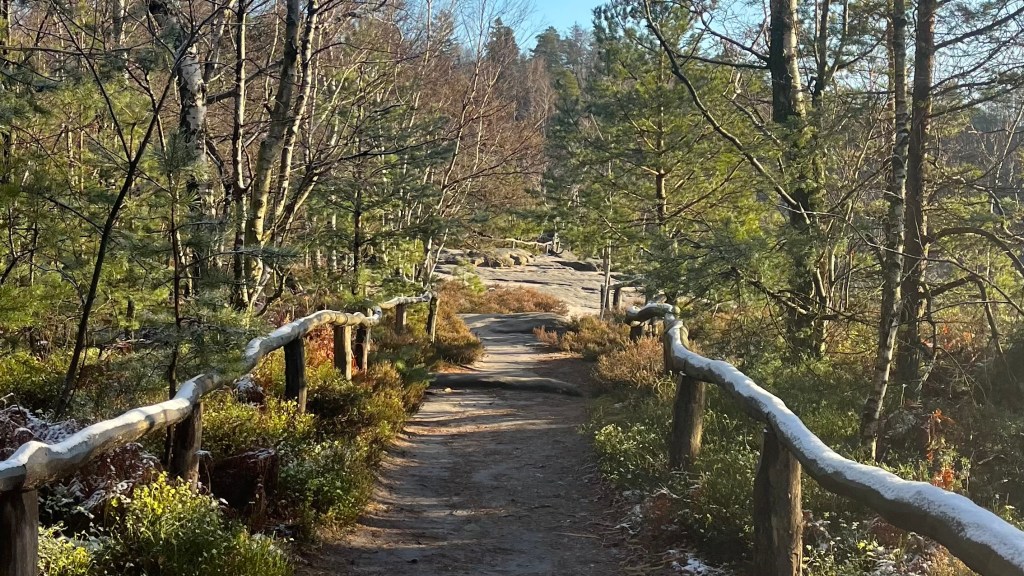
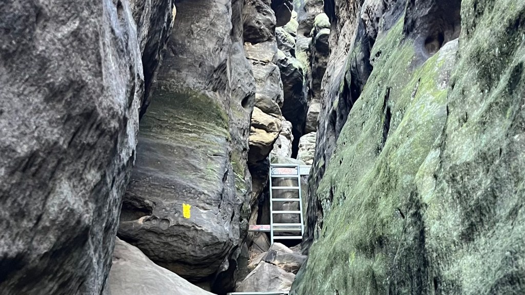
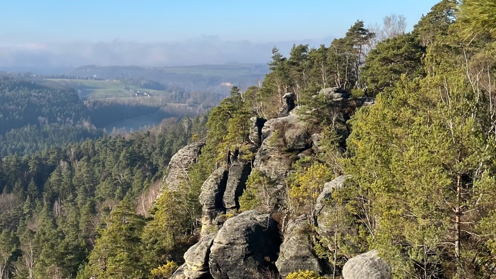
A short climb delivered me into another forest, and before long I was at the famous Bastei Bridge. I briefly lost the trail markers, but found them again after doing a few loops, and wandered through the towering sandstone formations, stopping frequently for photos. Next the path carried me through Rathewalde, and a surprisingly lovely climb revealed a forest that looked ghostly: tall pines stripped bare, bleached white but not by snow. It was a picture-perfect rendition of “eerily beautiful”. Soon after there was another cluster of sandstone formations, these ones designated for clambering. The route would up, around and through them via narrow metal ladders and staircases wedged into the spaces between pillars. It was slow going, but such a unique experience. I was glad I only ran into one other couple heading in the opposite direction.
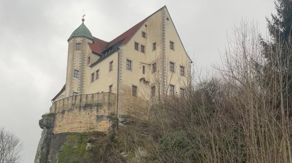
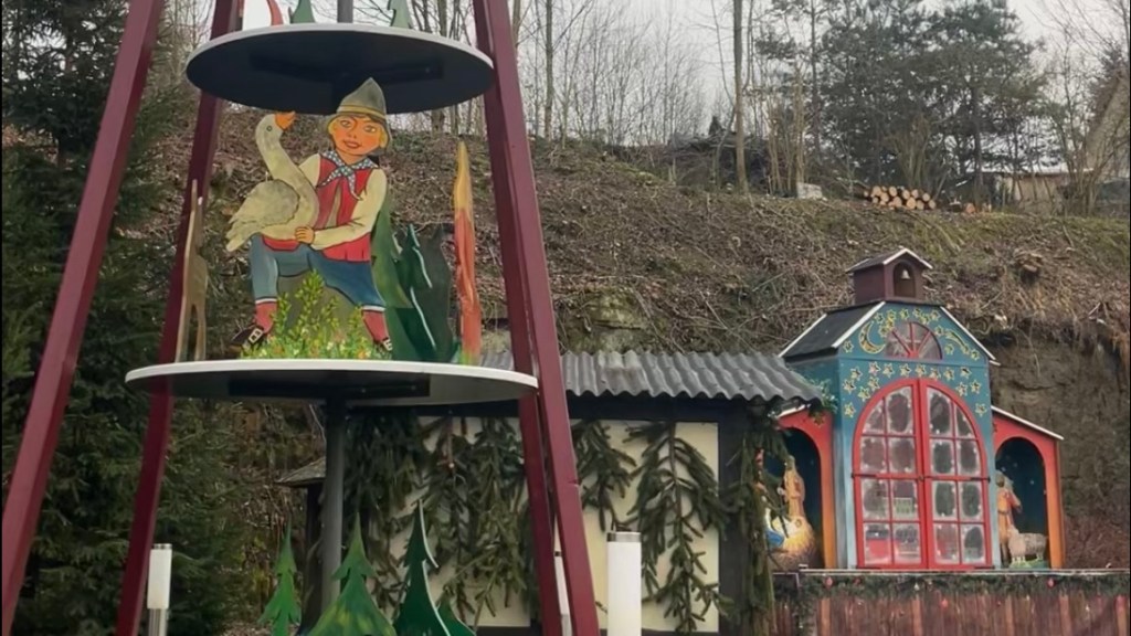
From there, it wasn’t far to Hohnstein; at least on paper. But daylight was fading behind thick, grey cloud, and the final climb after Polenztal had be questioning whether I’d accidentally left the marked trail to bushwhack up a hillside instead. My GPX insisted I was correct, but the terrain was less than welcoming. Eventually the ground levelled and I practically flew towards the twinkling town lights. Hohnstein Castle appeared high above me, perched dramatically on an outcrop.
I reached the town square in the hopes of finding a cafe to kill time before the next bus. But not a single place was open. Instead, I settled in for a 40 minute wait at the chilly bus stop, soon joined by a small group of equally cold, equally resigned hikers.
Day 2 – 22 December 2024: Hohnstein to Bad Schandau
Distance: 20.36 km | Elevation gain: 525 m | Moving time: 4h 15m | Average pace: 12:30/km | Average speed: 4.79km/hr
Malerweg moseying
In an attempt to maximise daylight hours after yesterday’s race against dusk, I was up before sunrise to catch the first bus back to Hohnstein. Unfortunately the bus driver was less motivated than I was: the bus simply never came. A few others were waiting, too, which at least confirmed none of us were hallucinating. We resigned ourselves to waiting for the next service over an hour later, and gratefully sheltered in the terminal in the morning air that was only just above freezing.
When I did arrive back in Hohnstein, this time carrying my full pack since Bad Schandau would be my base from today, I wasted no time slipping back into the forest. The wide, flat and peaceful trail eased me in gently, hemmed in by more sandstone pillars which seem to be growing in stature as the trail progresses.
Mid-morning I cruised through the little cluster of buildings at Brandstufen, pausing to watch one very determined goat headbutting his penmate with complete focus. Soon after, the real work began: a twisting staircase dropped sharply, on and on and out of sight. It was the kind of descent where you pray for your knees and promise to get into a training regime next time.
When the stairs finally relented, the path continued to drop down until t reached a road; only to demand an immediate and steep, stair lined ascent on the opposite side. It’s momemts like these that really test you “why” on a long-distance trail.
Crossing a river and railway line eventually delivered me to Altendorf, a charming village with colourful houses perched above a central pond. The sun flirted with the idea of appearing, sending brief flashes of sky between the clouds cover. I would my way back into the forest, enjoying the easy walking. Until the trail marker directed me downhill again, right as it began to rain, on a descent that was more “step and hope for the best” than a walk. Metal staircases eventually appeared to help, but slick with drizzle the camera stayed firmly away.
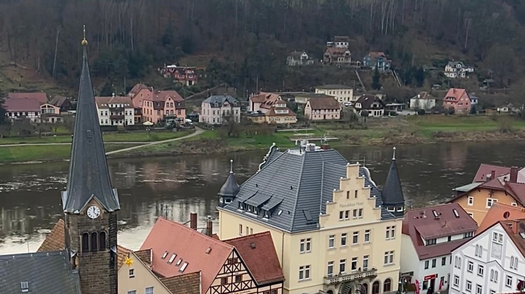
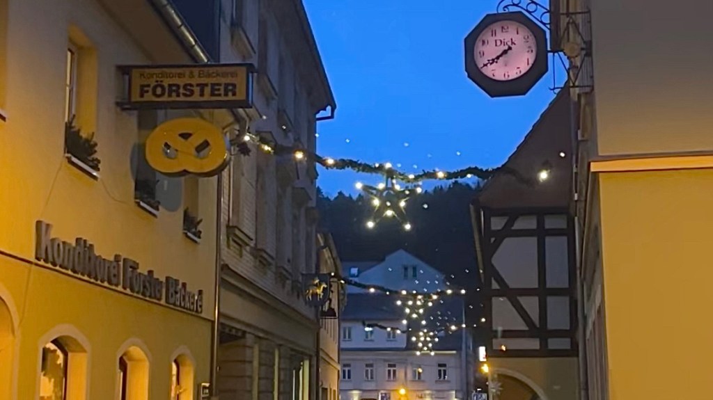
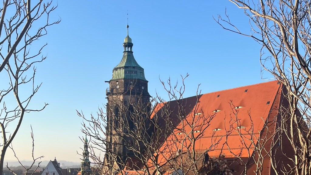
I finally emerged onto the quiet main road leading into the Saxon Switzerland National Park. I had the option of hopping on a tiny, single-car tram into Bad Schandau, but one pulled away just as I arrived, so I decided to continue on foot. Before long I had arrived in town, where I thawed out, regrouped and wandered to the supermarket for a resupply, guided by the sparkle of Christmas lights lining the beautiful streets.
Day 3 – 23 December 2024: Bad Schandau to Räumicht
Distance: 27.50 km | Elevation gain: 790 m | Moving time: 5h 30m | Average pace: 12:00/km | Average speed: 5km/hr
Sunlight, snow and sandstone
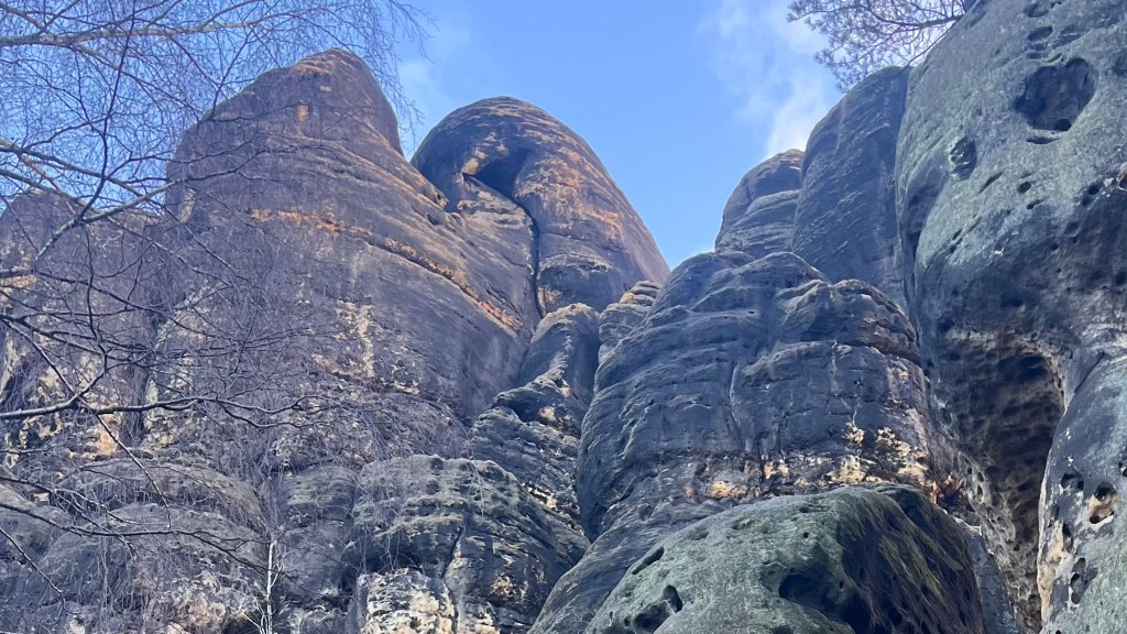
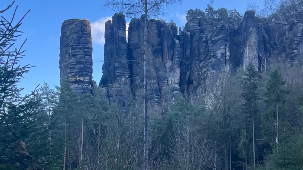
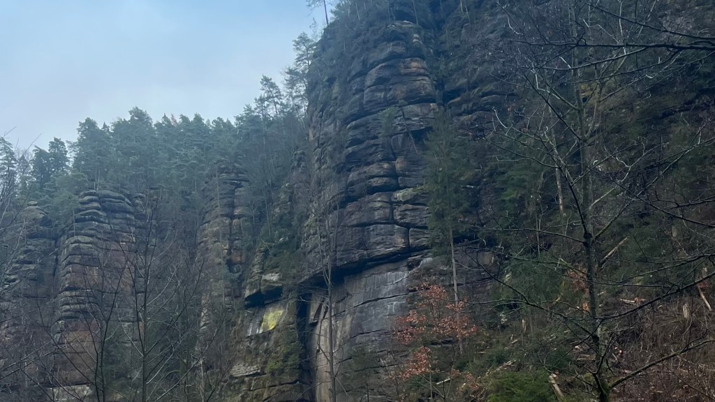
I woke to a sky that couldn’t make up its mind; a brooding blue-grey that suggested either sunshine or a full day of cloud. As the morning unfolded it leaned towards overcast, but the moment the first enormous sandstone formation appeared between the trees I almost didn’t care. More giants emerged one-by-one, and then the sun committed to the day after all, lighting the rock faces in gold. Standing in the heart of the national park, I realised how impassable this place must be in summer with tourist crowds. I was grateful to be here when it was so still and quiet.
A run of metal stairs and narrow ladders led me on top of one of the formations, where I paused for a snack with sweeping views over the countryside. Crossing to the shadier sider, I was delighted to find the path edged with a fine dusting of snow, like icing sugar carefully dropped around the path. I’d hoped this winter walk might offer a real chance to test my snow legs; in the end it never amounted to more than this sprinkle, but for an Australian it was enough to be a real novelty as I dropped into a cold, shaded valley where every branch and blade of grass was coated white.
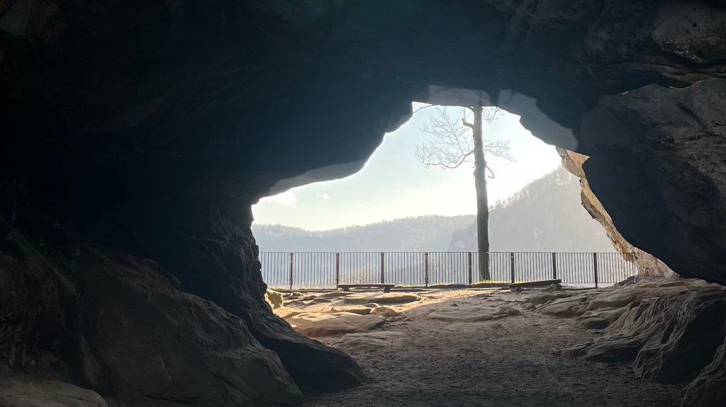
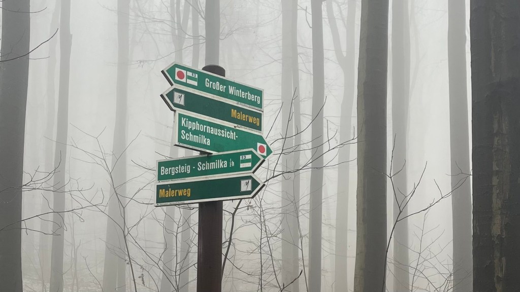
The spell lifted as I reached a wider path descending gently towards the road and eventually to the Lichtenhainer Wasserfall, glimmering in the midday sun. Every building there claimed to be open, but none was. So I continued uphill until I arrived at the Felsentor Kuhstall arch, and then descended the narrow Himmelsleiter “stairway to heaven” wedged between sandstone pillars.
The afternoon clouded over as the trail flattened into road walking. The final kilometres included an unwelcome hairpin climb after Neumannmühle; it felt like an unnecessary and dull slog, especially after this morning’s awe-inspiring landscapes. But the timing was perfect: I reached Räumicht just five minutes before the bus back to Bad Schandau rolled in.
Day 4 – 24 December 2024: Räumicht to Krippen
Distance: 25.85 km | Elevation gain: 899 m | Moving time: 5h 28m | Average pace: 12:42/km | Average speed: 4.73km/hr
Fog & fairytales
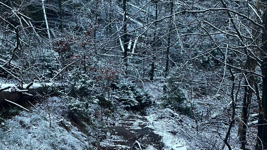
The first bus dropped me back in Räumicht, and within minutes I was climbing straight off the road and into a foggy forest. Yesterday’s sunshine had vanished; today was all muted grey mood lighting. A steep calf-burner later, I popped out into a forest of tall, bare trees, the ground sprinkled with a thin layer of snow. It felt like a fairytale; Hansel & Gretel, but with way better signage.
Soon enough the snow ended and I was back in regular, brown-and-grey forest. I slipped through the tiny village of Hoffmann-Mühle and made a beeline for the ferry, which whisked me across the Elbe in a matter of minutes. On the other side I boldly attempted a simultaneous incline + snack + work call. Shockingly, this didn’t increase my efficiency and I surrendered to the inevitable; work call first, snack second, incline third.
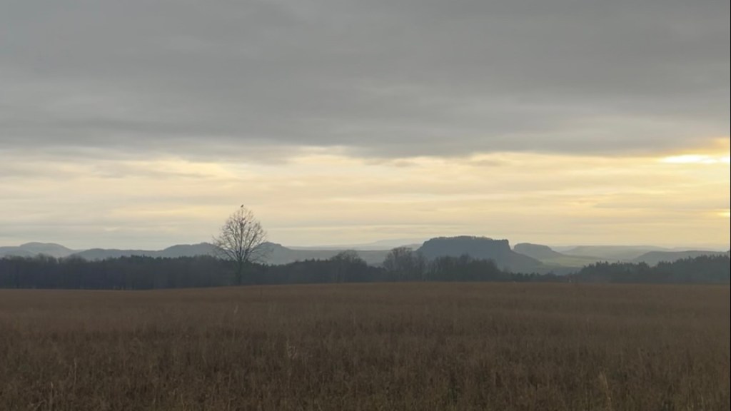
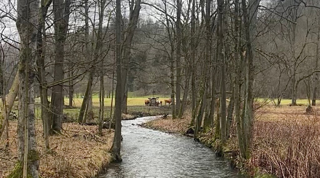
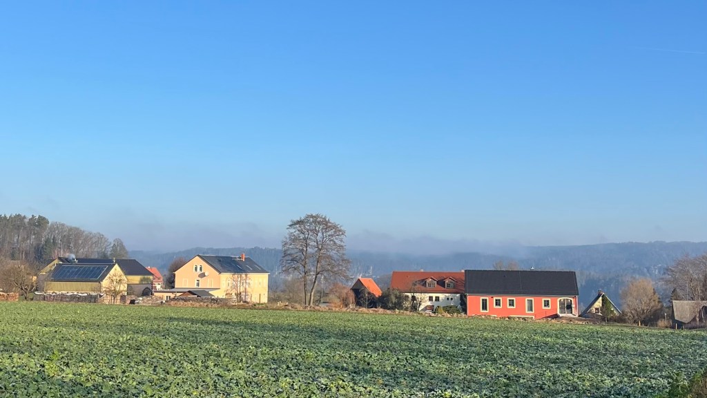
At the top, I unexpectedly found farmland – not at all what I imagined would sit on one of the sandstone hills rising remarkably out of flat surrounds that I’d been admiring all trail. There were also a surprising number of villages, and the afternoon passed in a wander between fields and hamlets, gradually descending toward Krippen.
There, I faced a dilemma: push on, or take the exit? I was leaning towards pushing on, and even set off to continue. But then I realised I’d taken a wrong turn and the next exit point was much further away than my mental maths had at first suggested. Decision made, I turned back, and caught the ferry from Krippen back to Bad Schandau.
Day 5 – 25 December 2024: Krippen to Thürmsdorf
Distance: 27.61 km | Elevation gain: 1,326 m | Moving time: 6h 26m | Average pace: 13:58/km | Average speed: 4.29km/hr
Christmas magic
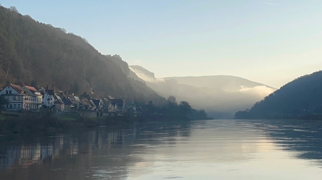
Christmas morning arrives bright and clear; the weather feels like the trail’s gift. I call Australia to listen to the present-opening ceremonials. When we’re done, I wander back to the ferry where the Elbe reflects the pale colours of lingering sunrise.
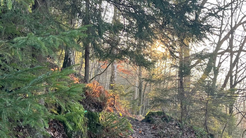
Krippen disappears behind me quickly as the sun climbs higher, and to my surprise I’m not alone on trail. Other hikers are also following the Malerweg through a forest, where soft light flickers between the trees in a tapestry of gold and green.
I drift through tiny settlements, with chimneys puffing gently. Farmland appears radiant, and sandstone formations appear in the far distance as though they’re toys dropped by a child in the middle of the floor. The trail climbs again into the hills, and suddenly everyone and their grandparents seems to be out for a Christmas walk. It’s lovely to share the trail with others for once.
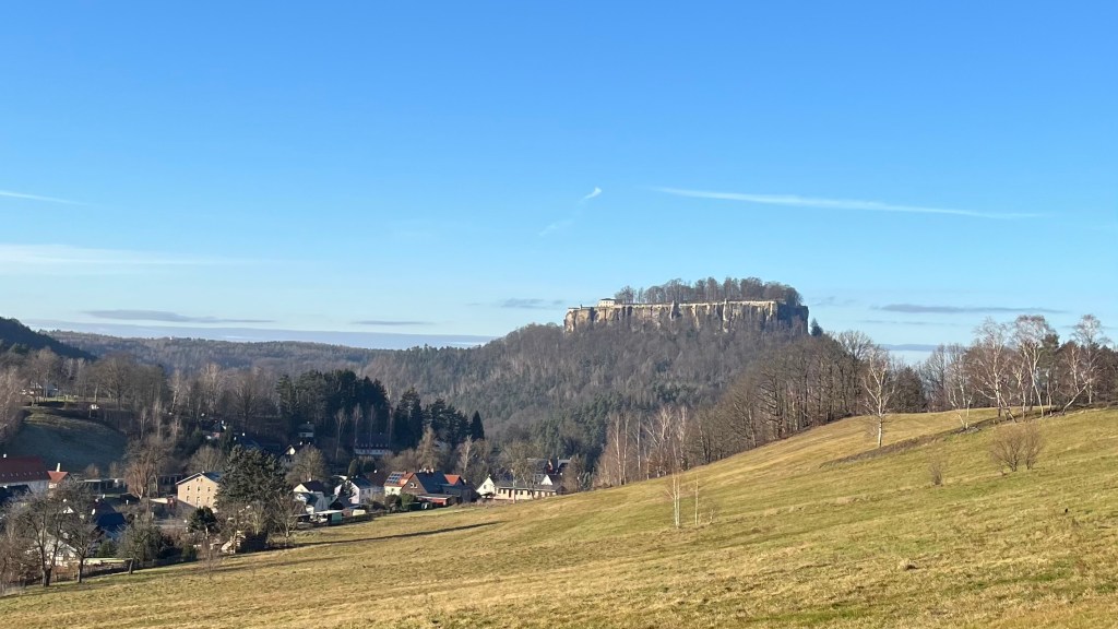
More ladders appear, followed by more rolling farmland, and then one sandstone massif stands out: broad, imposing, unmistakably crowned with a fortress. Königstein. I wonder whether the trail will send me all the way up there. It teases me with detours through more villages, ponds icing over and trapping water lilies beneath, and a Rapunzel-worthy tower tucked among the trees. The sky stays a clear winter blue, but the sun begins to drop as I descend into Königstein town. I move through it quickly, then climb sharply; clearly, I am indeed going to the castle.
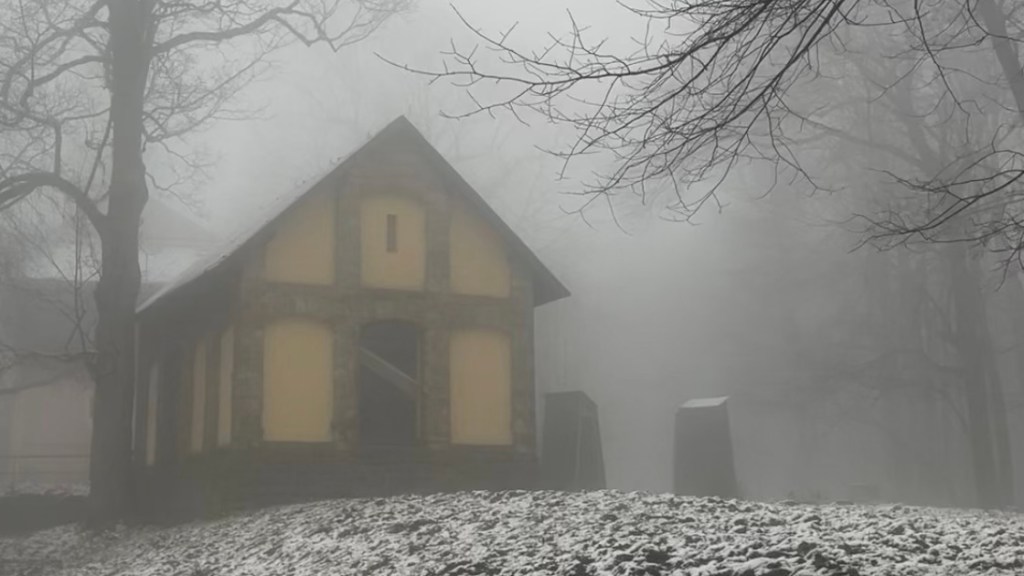
At the top, the fortress rises imposingly in front of me, open for visitors despite the holiday. I nearly go in, even standing in the slow-moving ticket queue for a few minutes, but the risk of the end of today’s stage ending in a night hike and/or a missed bus persuades me to give the fortress a miss. I slip back into the forest and descend, crossing a quiet field before reentering the forest once more. The Elbe appears again, washed in rosy light as the sun grazes the horizon. By the time I reach Thürmsdorf and find the bus stop, dusk has settled and it grows dark as I wait for the bus to spirit me back to my accommodation.
Day 6 – 26 December 2024: Thürmsdorf to Pirna
Distance: 18.94 km | Elevation gain: 500 m | Moving time: 4h 25m | Average pace: 13:59/km | Average speed: 4.29km/hr
Blue sky Boxing Day
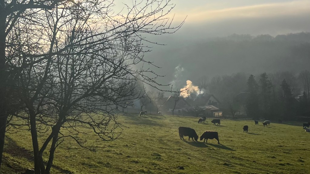
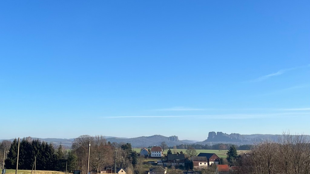
The bus drops me, and my full pack, back into Thürmsdorf just before 10am. It’s another blue-sky winter morning, and the trail slowly eases my uphill past sleepy fields of cows and chimneys exhaling soft ribbons of smoke. Soon I reach a sweeping viewpoint over the Saxon Switzerland landscape I’ve spent the past five days wandering through; early fog still clings to the hills like a veil.
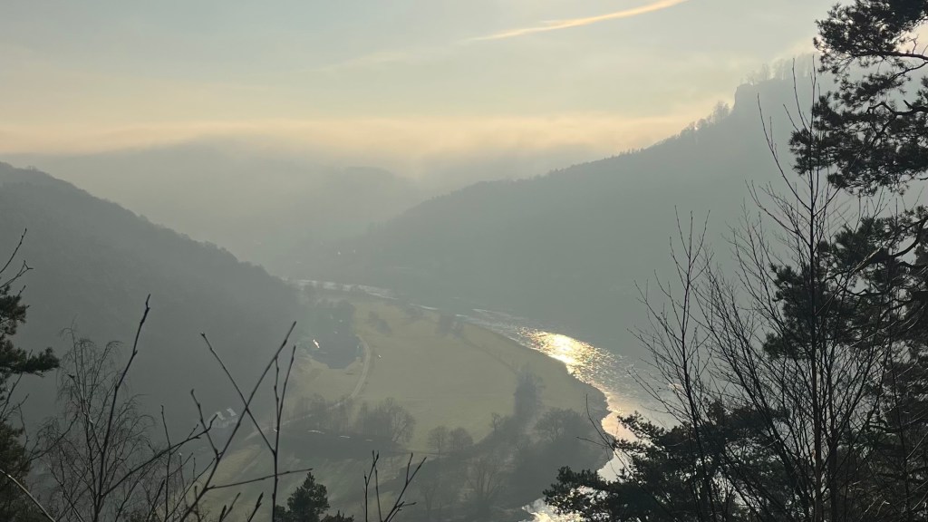
More farmland, more forest, and then another solo hillcrest where the world is perfectly still and quiet. In the distance I can make out Bastei Bridge, tiny but unmistakable, a reminder of how far I’ve come. As I descend into the forest the trail becomes busier, hikers emerging as the day warms. I can feel that I am leaving the sandstone behind as the trail sends me through farmland dotted with horses and goats, and forces me to climb a few more viewless hills. Buildings begin to appear through the trees, a sure sign of approaching civilisation. Down below, the Elbe shimmers like a silver snake.
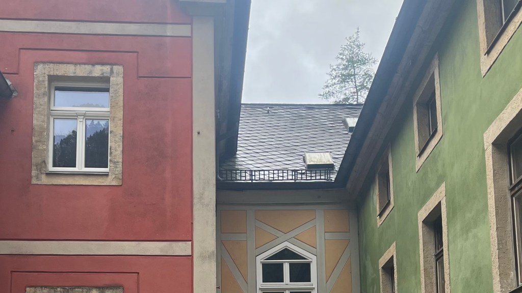
At a set of picnic tables I stop, unhurried, soaking up the sunshine. It’s too cold to linger for more than 15 minutes, so I descend to the riverbank where the trail merges with road. At the end, a final hill awaits. I briefly consider skipping it, but lacking a good excuse I trudge upwards. The forest thins to reveal elegant old buildings, their tangerine roofs glowing against the cold blue sky.
The trail ends at Pirna’s tourist information centre. It’s closed for Boxing Day, and the Christmas markets are shut as well. So much for my dreams of a celebratory Glühwein. Instead, I drift slowly through the quiet streets, letting the finish sink in on my way to the train station.
Want More?
Curious about the practical side of the trail? Check out my Malerweg: How-To post for route info and planning tips.

Leave a reply to Malerweg: How-To – Thru Horizons Cancel reply