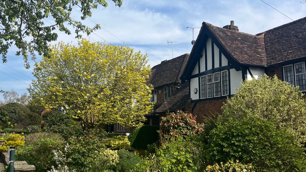
The younger sibling of the London Outer Orbital Path (LOOP) (see my How-To and Trail Journal), the Capital Ring offers a 125 km loop through the city’s green spaces, never more than 10 miles (16 km) from Big Ben. Weaving between forests, canals and royal parks, it’s the perfect way to explore a quieter, greener side of the capital in weekend-sized chunks.
I section-hiked the trail between January and April 2025. For a closer look at the on-the-ground experience, head over to my Capital Ring: Trail Journal post for my stats, photos and story.
- Quick Facts
- Map & Elevation Profile
- Preparation
- On-Trail Practicalities
- Side Missions & Connecting Trails
- Hiking as a Solo Woman
- Want More?
Quick Facts
| Distance | 125 km |
| Elevation gain & loss | 1,400 m |
| Days to complete | 6-9 |
| Best season | Year-round! |
| Trailheads | Woolwich foot tunnel |
| Recommended direction | Either way! |
Map & Elevation Profile
Preparation
Trailheads & getting there
Start anywhere! The Capital Ring is a circular route with stages designed to offer convenient public transport options, and unlike the LOOP it is possible to connect your footprints. The “official” start is the Woolwich foot tunnel, which is easily reached by the DLR or Elizabeth Line.
Direction to Walk
Walk the Capital Ring in either direction! It really doesn’t matter. I found the sections between Hackney Wick and Falconwood to be the least appealing due to reduced greenery, so you might like to knock those over first so you finish on a more outdoorsy note.
Season to Walk
This trail is great year-round; I walked it over winter and had a great experience. Of course, the days were a lot shorter than they would be in summer, and stopping for breaks a bit harder with the chill, so you might prefer to walk in warmer months.

Accommodation
Beds & Bunks
Thru-hikers have no shortage of accommodation options: stay near the trail in hotels, B&Bs, pubs or hostels; or stay off-trail in another area of London and commute back each day.
Camping
You can rule out the possibility of camping this trail: wild camping isn’t permitted, and even if it was this is a fairly urban trail and there aren’t any decent spots to set yourself up. You could try finding some camping pods or small campsites along the trail, but with other accommodations such as hostels likely to be just as cheap and probably more convenient, I don’t know why you’d burden yourself with the extra weight of camping gear.
Gear List
If you’re section-hiking, which I recommend for this trail even if you’re visiting from elsewhere, you’ll be able to achieve top speed and comfort by packing light:
- Day bag (consider a running vest!)
- 1 – 1.5L water capacity
- Hiking clothes
- Hiking shoes or trail runners
- Snacks, food (optional)
- Warm layers (worth bringing something for the train, just in case)
- Rain layers (this is England; but check the forecast)
Possible Stages
This table follows the “stages” of the excellent walking notes issued by the Ramblers’ Association. But there are many convenient public transport options pretty much everywhere on trail; just bust out Google Maps or CityMapper whenever you’ve had enough for the day.
| Place | Distance from previous (km) (clockwise) |
|---|---|
| Woolwich | 0 |
| Falconwood | 11.6 |
| Grove Park | 7.1 |
| Crystal Palace | 12.6 |
| Streatham | 7.1 |
| Wimbledon Park | 9.2 |
| Richmond | 11.7 |
| Osterley Lock | 7.7 |
| Greenford | 8.6 |
| South Kenton | 9 |
| Hendon Park | 11.3 |
| Highgate | 9 |
| Stoke Newington | 9 |
| Hackney Wick | 6.4 |
| Beckton District Park | 8.4 |
| Woolwich | 7.1 |
On-Trail Practicalities
Finding Your Way
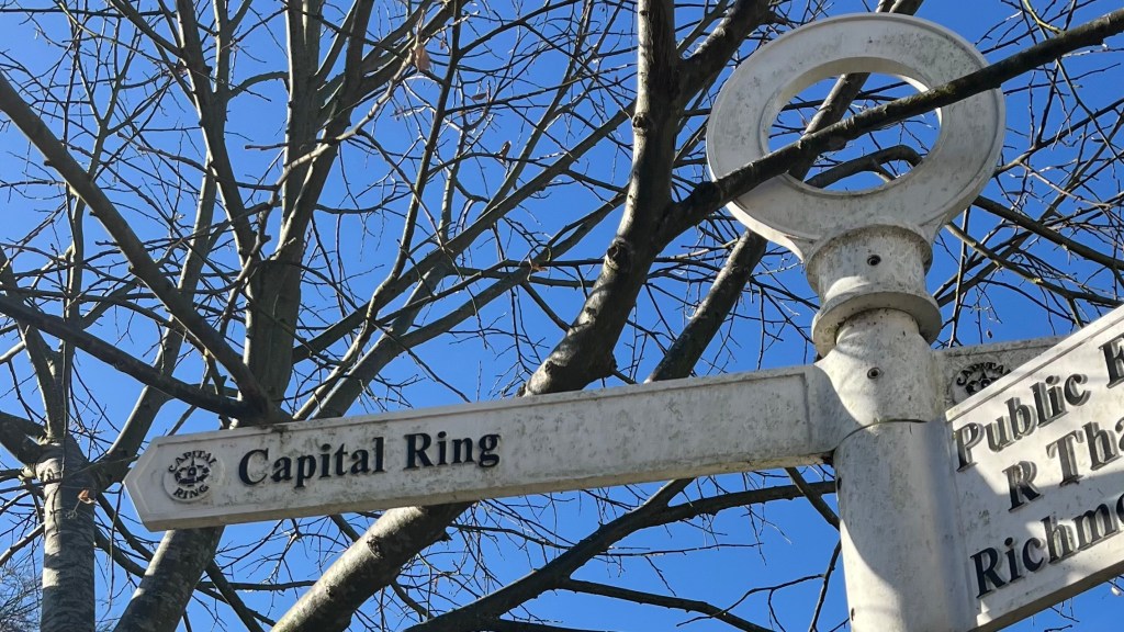
Trail Markings
There are a few different trail markers you’ll need to keep an eye out for. These range from directional arrows mounted on poles and lampposts, to the trail disc mounted on wooden posts at around waist level. While trail markings are pretty good, there are sections where it’ll pay to know where you’re going: since there are so many public footpaths in Greater London, sometimes Capital Ring markings are subordinated to more popular trails. A map or app is also a good idea, as it can be easy to miss the trail markers in the more urban areas, or in sprawling parks where signage has fallen victim to the elements.
Maps & GPX
The trail appears on the Go Jauntly app, which has detailed directional notes. I instead chose to use a GPX file from The Walking Englishman, added to my Garmin Explore app. You’ll be hard pressed to find a paper map that marks out the trail; but you could print off the Ramblers’ Association walking notes and maps if you really wanted to.
Guidebooks & Resources
Look no further than the free walking notes published by the Ramblers’ Association. These are truly fantastic, containing a wealth of information about the route, local area, optional detours, and major transport connections. For those interested, Trailblazer has published a more traditional guidebook.
Food & Water
Live all your foodie dreams on this trail: it’s never far from bakeries, cafes, pubs, restaurants, take-away joints, and everything else you could possibly want. Supermarkets are also frequently found, so you generally don’t even need to pack lunch. Although it’s always wise to have a few snacks on hand.
You don’t need to carry much water, either: 1 to 1.5L should suffice. Refilling is easy at many of the parks the trail winds through, or just ask nicely at a cafe or pub.
On-Trail Transport
The Capital Ring’s stages are bookended by convenient public transport options, usually a train or tube station. However, it’s even more accessible than it’s older sibling the LOOP: stop whenever you’ve had enough and you’re pretty much guaranteed to be only a short walk away from the nearest bus station.
Money Matters
If you bring cash, you won’t use it: card accepted everywhere. I haven’t included a breakdown of my budget for this trail, since transport costs will depend on where in London you’re travelling from and how big your stages are. Your food costs could be sky-high if you eat out everywhere; or next to nothing if you pack it all at home.
Finisher’s Certificate
If you’d like to commemorate your time on the trail, you can download a free Finisher’s Certificate from TfL.
Side Missions & Connecting Trails
The trail passes or comes very close to several of London’s most famous attractions, all of which would make worthwhile detours. Including:
- Hampton Court Palace: famous as the home of Henry VIII. I visited the palace on a separate occasion, and it’s well-worth the admission;
- Richmond Park: hugely popular park amongst both locals and visitors, home to many deer herds – you’re almost guaranteed to spot some; and
- Kew Gardens: world famous botanical garden with flora from every continent.
It would be futile to attempt to list all possible side missions here. Refer to the Ramblers’ walking notes if you’re interested in exploring further.
Hiking as a Solo Woman
I felt incredibly safe on this trail: although the trail itself isn’t busy, London’s population love to get out into nature so there were people pretty much everywhere. The proximity to the city means exit options abound and mobile reception is basically universal. I honestly felt slightly safer on this trail than the LOOP: there were no sections where I felt the need to be more aware of my surroundings. By contrast, the slightly more remote or industrial sections of the LOOP fall into that tiny trail category where the simultaneous remoteness and yet accessibility could be a problem.
Want More?
Check out my Capital Ring: Trail Journal for stats, stories and snapshots from the trail.

Leave a comment