10 days, 221 kilometres, 11,680 metres of elevation gain. I thru-hiked the trail in June 2025: here’s the journey, day-by-day.
Thinking about tackling the trail yourself? Check out my Peaks of the Balkans: How-To post.
- The Stats
- Trail Journal
- Days -1 & 0 – 14 & 15 June 2025: London to Theth
- Day 1 – 16 June 2025: Theth to Valbona
- Day 2 – 17 June 2025: Valbona to Çerem
- Day 3 – 18 June 2025: Çerem to Dobërdol
- Day 4 – 19 June 2025: Gjeravica Side Mission
- Day 5 – 20 June 2025: Dobërdol to Milishevc
- Day 6 – 21 June 2025: Milishevc to Drelaj
- Day 7 – 22 June 2025: Drelaj to Babino Polje
- Day 8 – 23 June 2025: Babino Polje to Plav
- Day 9 – 24 June 2025: Plav to Vusanje
- Day 10 – 25 June 2025: Vusanje to Theth
- Day 11 – 26 June 2025: Theth Side Missions
- Day 12 – 26 June 2025: Theth to Tirana
- Want More?
The Stats
Including Gjeravica side mission
Trip Summary
- Start date: 16 June 2025
- Days hiked: 10 (9 on trail; 1 for Gjeravica side mission)
- End date: 25 June 2025
Distance & Elevation
- Total distance: 220.79 km
- Average distance/day: 22.08 km
- Total elevation gain & loss: + 11,678 m / – 11,992 m
- Average elevation gain & loss / day: + 1,168 m / – 1,199 m
Time & Pace
- Total moving time: 60 h 39 m
- Average moving time / day: 6 h 4 m
- Average moving pace: 16:48/km
- Average speed: 3.6km/hr
Budget (ex gear)
I was travelling with friends; the below is my share of our joint expenses. You could easily spend a lot less than we did by camping and / or pre-packing most of your food instead of using the guesthouses. However, the trail was designed to bring tourism dollars to the region, so I’d encourage you to use the guesthouses if it’s in your budget.
| Category | Total (€) | Breakdown |
|---|---|---|
| Accommodation | 479.93 | Day -1 hotel (€28.33); Day 0 guesthouse (€30); Day 1 guesthouse inc meals (€38.33); Day 2 guesthouse inc meals (€69.67); Days 3 & 4 guesthouse inc meals & drinks (€88.33); Day 5 guesthouse (€36.66); Day 6 guesthouse inc meals (€40); Day 7 guesthouse inc meals (€36); Day 8 hotel inc dinner (€29.17); Day 9 guesthouse inc meals (€40.77); Days 10 & 11 guesthouse inc breakfast (€26.67); Day 12 hostel (€16) |
| Food | 106.17 | Day 0 snacks (€9.44); Day 1 snacks & lunch (€8.33); Day 2 snacks (€3); Day 3 lunch & snacks (€4.33); Day 6 lunch (€10); Day 7 brunch (€12); Day 9 breakfast & snacks (€4.73); Plav supermarket haul (€13.57); Day 10 snacks, arrival celebration, dinner (€28.34); Day 11 snacks & meals (€10.50); Day 12 dinner (€15.50) |
| Trailhead transport | 74.67 | Tirana taxi hotel to bus stop (€4); private bus Tirana to Theth (€31.67); taxi to Blue Eye (€5); private bus Theth to Tirana (€30); taxi to Tirana airport (€4) |
| Other | 26.33 | Border crossing permit (€20.33); national park entry fee x2 (€6) |
| TOTAL | 700.67 | Average / day: €59.05 (14 total trip days) |
Trail Journal
Days -1 & 0 – 14 & 15 June 2025: London to Theth
Chaotic travel days
I’ve been sick for a week, and it’s only once I leave for the airport that I realise how unravelled I am. First I drop my phone in the middle of London Victoria, and walk away oblivious until strangers point it out. Then I discover I’ve somehow booked the bus from Stratford rather than Victoria. Somewhere in the chaos I lose both my lip balm and my sport, and at the currency-exchange I wasn’t clear-headed enough to catch an error that left me £100 out of pocket. A problem for after the hike, I decided. The upside, I told myself, is that this had to be all the bad karma for this trip out of the way at once.
Once I finally make it onto the plane, things level out courtesy of a friendly Scottish seatmate, a nap, and some light reading. Landing in Tirana I check in to our stifling hotel room, switch on the air-con, and leave again to forage for dinner and breakfast. By the time I return the room is cool, and Ellen arrives soon afterwards; we chatted away while we waited for Alisha’s late-night arrival. With a 5.30am bus to catch, I decided to pull an all-nighter, but the others slept.
At 4.45am we were in a taxi heading for the city centre. The bus company clearly tells tourists to arrive too early, so we spent half an hour watching our driver meander between cafes before boarding and setting off. The first bus was more of a minivan: it was hot and crowded, and the lack of suspension meant every bump was felt. In Shkodër we changed to a new minibus, mercifully airconditioned, but the mountain roads were hardcore: single-lane ribbons, where drivers overtook with wild confidence.
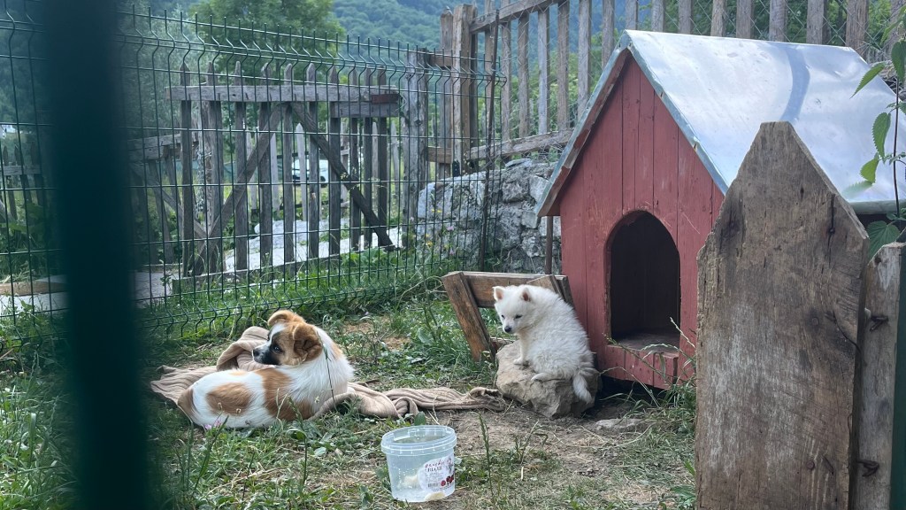
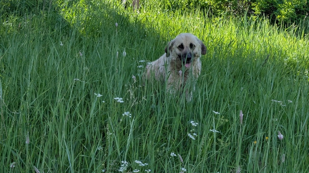
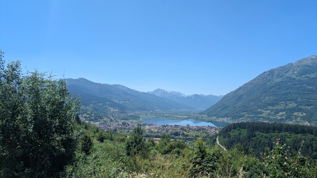
By 11am we rolled into Theth. Coffee, a gentle walk to the guesthouse, a delicious and unbelievably cheap lunch, an underwhelming €22 zipline, and dog the size of my foot, and dinner rounded out the afternoon and evening.
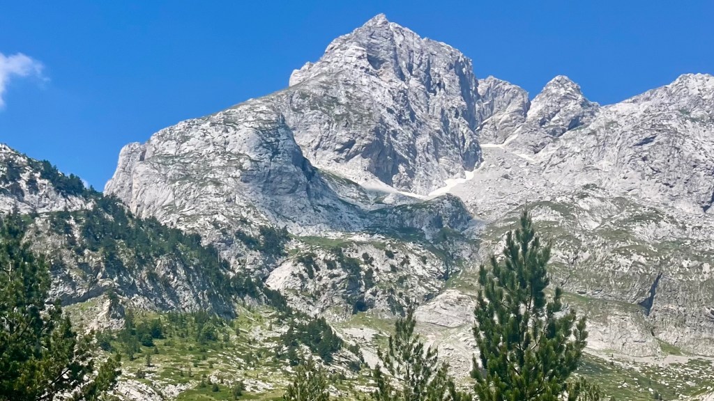
Day 1 – 16 June 2025: Theth to Valbona
Distance: 17.16 km | Elevation gain: 1,107 m | Moving time: 5h | Average pace: 17:29/km | Average speed: 3.4km/hr
Accidental detours; big climb, big reward
I’d been unsure about packing a fleece, but was glad I did when we awoke to crisp morning mountain air and sat outside to eat our breakfast of tiny fried pancakes drizzled in honey and jam. At 8.15am, we set off, eager to make the most of the cooler hours of the day.
That plan went downhill when I realised I’d forgotten to return the guesthouse keys, adding an extra 2 kilometres my daily total. Lucky I’d remembered just on the outskirts of Theth, and not halfway up the mountain.
The ascent was brutal. I blame my lingering cold for the way I struggled up the steep climb, gasping for breath. Meanwhile Alisha practically ran ahead, like a mountain goat: we agreed it would be best to let her roam and just meet her at the top. A guesthouse close to the top offered the perfect opportunity for a breather and a motivational Coke.
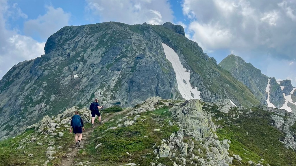
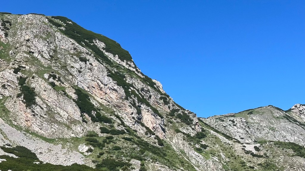
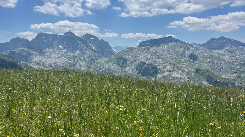
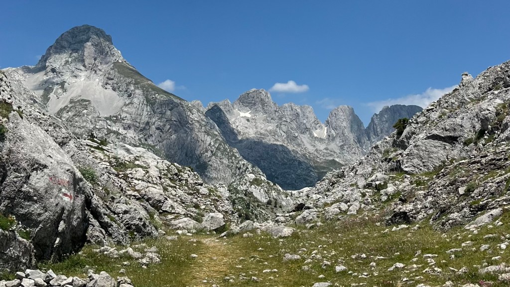
There was some traffic on the final push, thanks to some pack donkeys making their way back down, completely oblivious to the risk they could knock a hiker over the edge. At the saddle, we undertook a short scramble to the nearest peak, which rewarded us with a breathtaking mountainous panorama. Then the descent began, a loose-stone gauntlet that tested our balance (2/3 failed), knees and nerve.
Lunch at Rragram was cheap and hearty, then the dusty valley floor carried us along a wide snowmelt channel toward Valbona. We locked in for a 4km roadwalk, but soon discovered there was no need: our guesthouse was on this side of the village. Showers, dinner, mountain tea and an early bedtime closed the day.
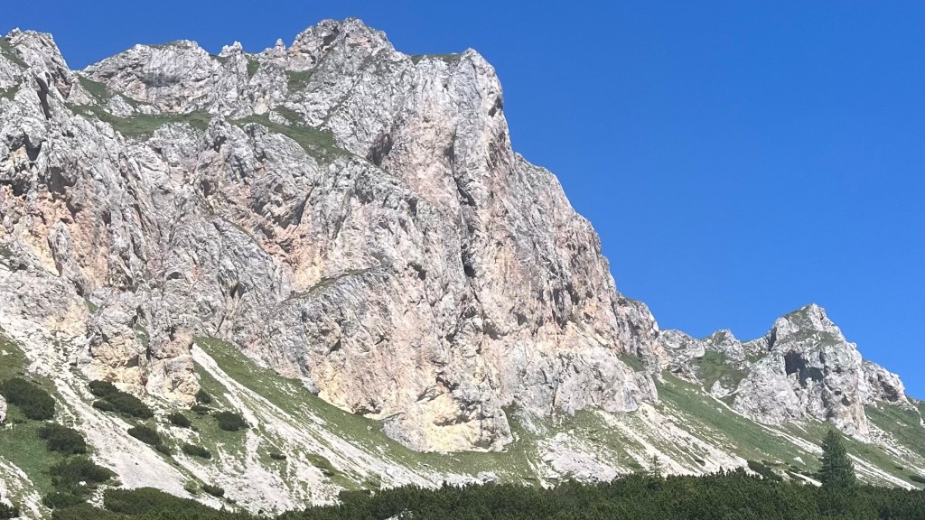
Day 2 – 17 June 2025: Valbona to Çerem
Distance: 19.07 km | Elevation gain: 1,107 m | Moving time: 6h 29m | Average pace: 20:22/km | Average speed: 3km/hr
No hairpins, no mercy

We were back in the rhythm of a long trail this morning: bags packed before breakfast, eating quickly, and on the road by 8am. The first kilometres along the road were a gentle warm-up, but then we chose to take an alternate over the Prosllopit Pass and the trail switched to a relentless vertical over the next six kilometres. No hairpins, just a straight grind. Within minutes I was gasping for air and drenched in sweat; I was grateful when the rain arrived, it would’ve been a tough climb on a warmer day.
The scenery was beautiful, but all my energy was going into climbing; there was hardly any to spare for photos. An organised group resting at a shoulder assured us that the pass was only 100 metres ahead. It wasn’t. That final push was mentally tough; when we finally reached the pass we threw our bags down, donned some wind layers, and refuelled with the lunch we’d brought from the guesthouse.
The descent was just as slow as the ascent: big, jagged rocks demanded complete focus, or we risked a twisted ankle. We paused at a cave exhaling icy air, before dropping into a meadow where a pair of kids on horseback were selling soft drinks. A cold Coke in the middle of nowhere tastes miraculous.
The descent continued through vibrant wildflowers and clouds of butterflies, mountains looming overhead. Eventually we reached the shade of a forest, and found a stream to cool our faces and refill our water bottles. An organised group tipped us off to a collection of tiny wild strawberries, which we sampled with delight.
When we emerged on to a road, we thought we’d reached our guesthouse. Bad news: ours was actually another 1.5 kilometres of uphill away. That final climb felt like an unnecessary test, but the views became increasingly spectacular and were picture perfect from our balcony. We begged the hostess for something to tide us over before dinner, and she delivered: a wonderful, fresh, homemade bruschetta. Then we were served the best meal of our entire trip, with so many dishes it was impossible for us to finish. We collapsed in our room, happily exhausted.
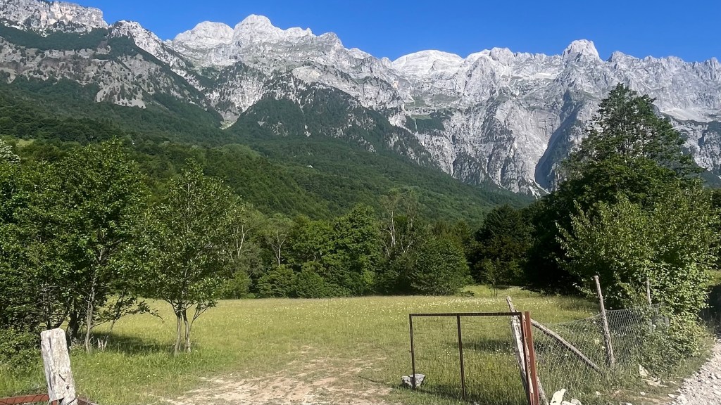
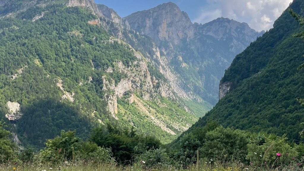
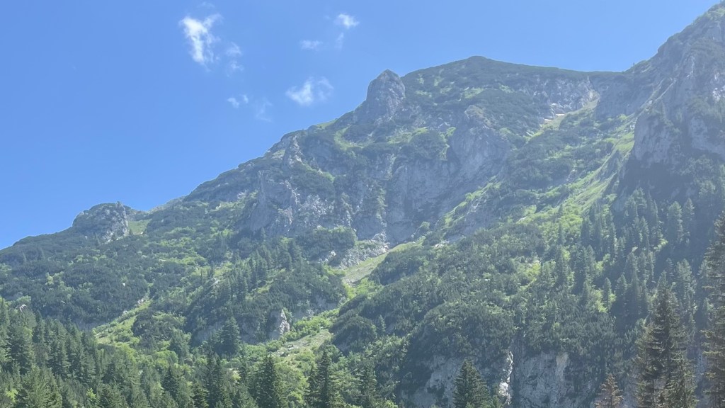
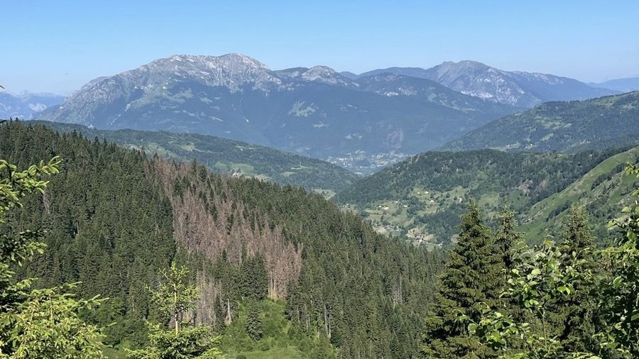
Day 3 – 18 June 2025: Çerem to Dobërdol
Distance: 16.91 km | Elevation gain: 1,009 m | Moving time: 4h 37m | Average pace: 16:22/km | Average speed: 3.7km/hr
Wildflower wandering
A soft bed and yesterday’s climb had resulted in a fantastic deep sleep. Morning broke, clear and gold, and our guesthouse served a breakfast so generous we couldn’t finish it even after packing half of it for lunch.
Happily, yesterday’s final climb wasn’t wasted: we discovered we were on an alternate and could make our way up to the main route without descending first. The trail felt much kinder today, softer underfoot with gentle gradients along 4WD tracks. We dipped in and out of forests and wildflower meadows, and I soon set myself the task of photographing every different kind of wildflower. It turned out to be a great project, making me look more closely at my surroundings and slow down.
There was still plenty of climbing, but it came in manageable waves. We took frequent breaks: we lounged in a wildflower meadow, stopped by a few guesthouses for a drink or snack, and let the day pass easily. We had several lovely conversations with our fellow hikers. Light rain blew in by afternoon, but never committed to a full downpour.
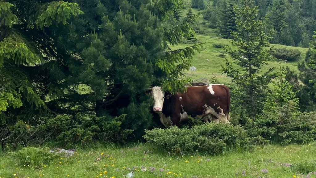
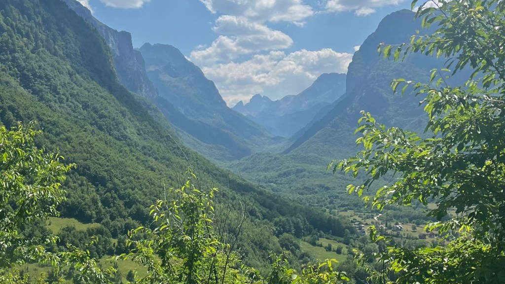
The final 200 metres of ascent felt like another test, delivering each of us our own personal cloud of flies. But then Dobërdol appeared on the horizon. As we wove through herds of cows we spotted a bright little salamander, and crossed the most precarious bridge I’ve ever seen.
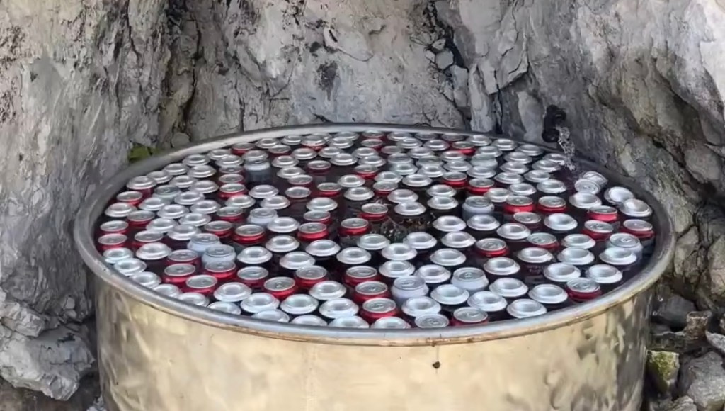
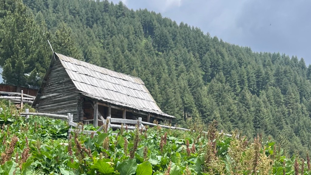
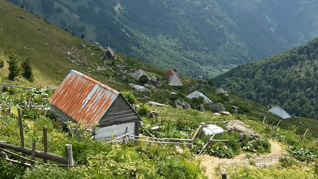
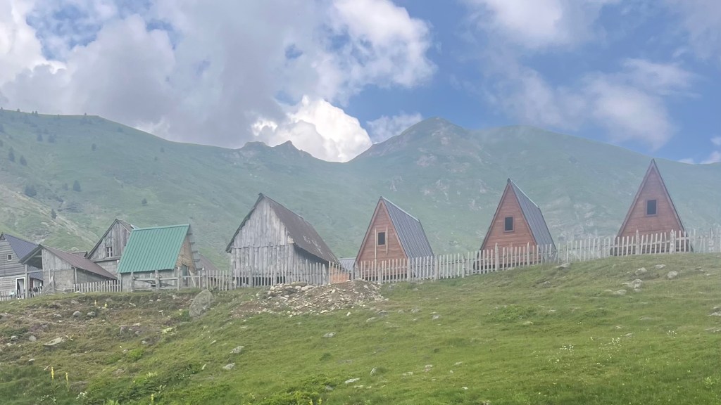
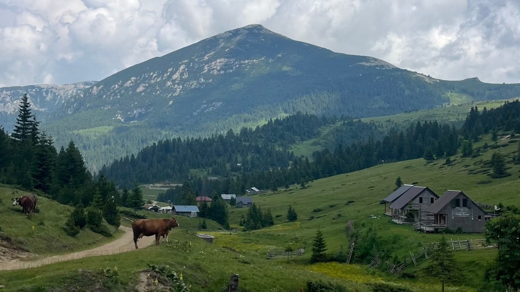
Dobërdol was exactly what I’d pictured: a rough, spacious summer settlement. The “fridge” cooled our arrival beers with snowmelt instead of electricity. The rain finally began in earnest as we showered under a tin roof; an incredible sensory experience. We stayed dry in the overheated communal hut until the sun reappeared and the satellite wifi returned. Dinner was simple, but a pleasant opportunity to meet our fellow hikers and gather intel for tomorrow’s side mission. Fatigue hit me fast: I crawled into bed at eight and was asleep not long after.
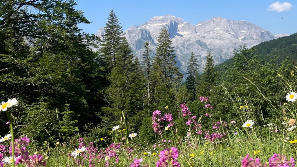
Day 4 – 19 June 2025: Gjeravica Side Mission
Distance: 18.99 km | Elevation gain: 1,240 m | Moving time: 6h 2m | Average pace: 19:05/km | Average speed: 3.1km/hr
Summits & storms
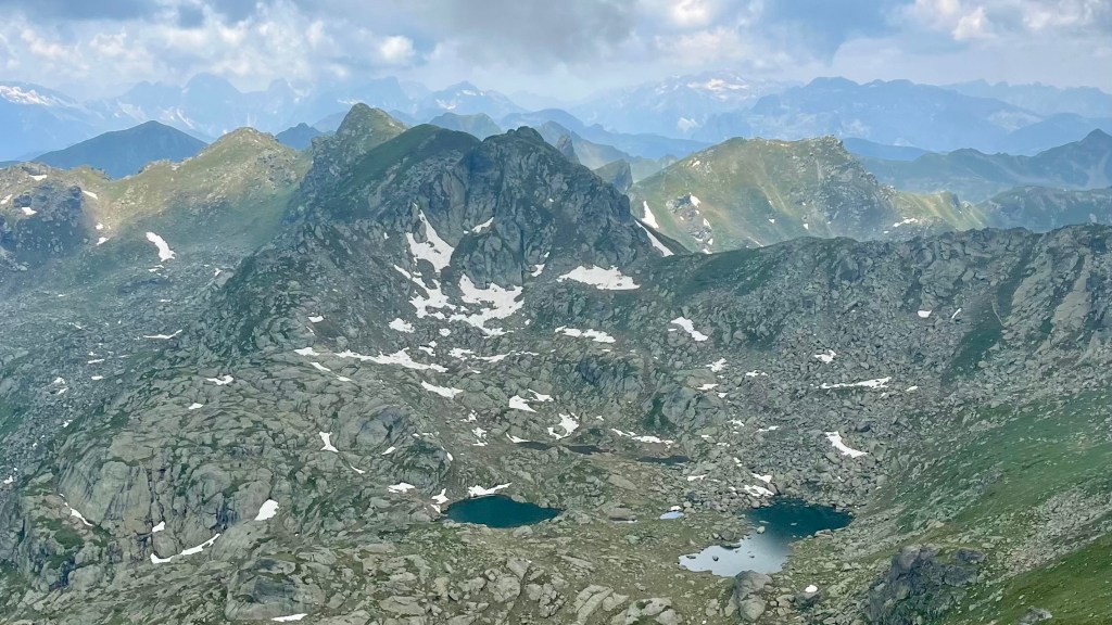
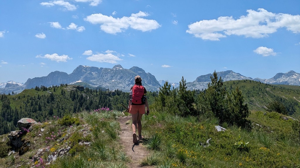
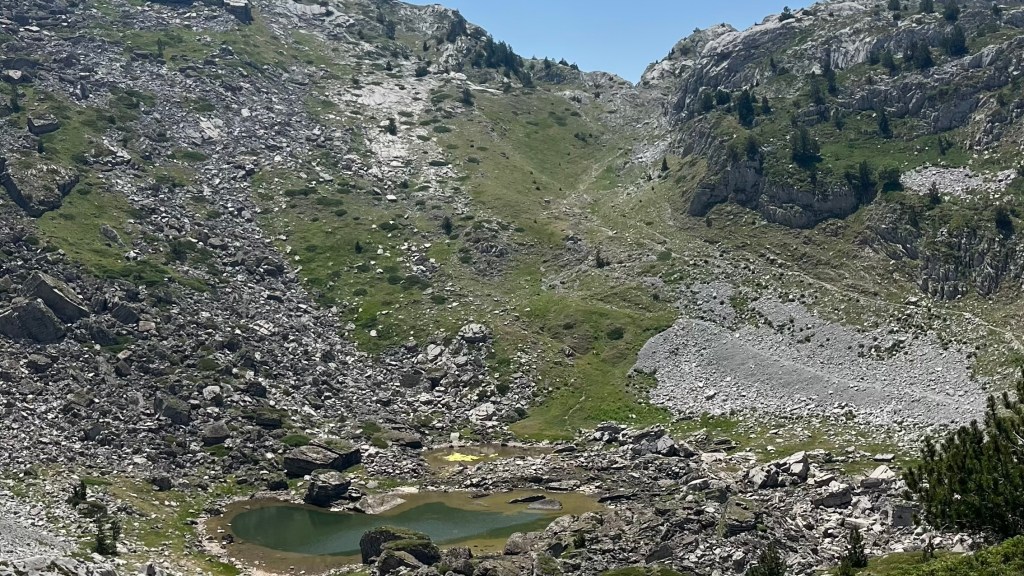
We woke to a bright, sunshiny morning in Dobërdol, and a communal breakfast of dishes I couldn’t name but happily devoured. We packed our lunches, and set off to climb Gjeravica, Kosovo’s highest peak at 2,656 metres. I’d braced for a brutal ascent, but after an initial steep section to leave the valley the trail softened, easing us along a high saddle and following an easy contour line towards a crystalline alpine lake.
From there, the ascent steepened again. There were a few snow patches to cross, which we knew to expect from the discussions at dinner yesterday. Thankfully none of them were particularly sketchy: worst case, we would’ve taken a gentle slide and recovered ourselves quickly.
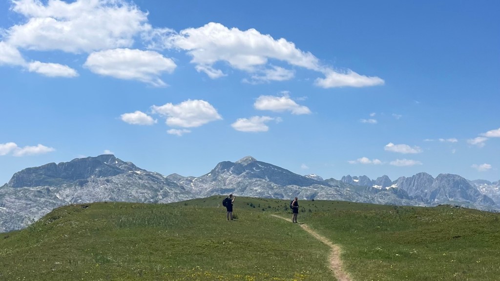
We made it over another pass, and then the summit revealed itself. With clouds starting to roll in, we were eager to make the top, but first had to pace ourselves against an organised group that was descending. From the sounds of it, most of them were fellow Aussies. We had the top to ourselves for several minutes, and lingered there over snacks, photos, and adding an entry to the summit logbook.
The descent was quick, and back at the lake Ellen braved a swim while Alisha and I cracked into lunch. As rain began to spit, and another organised group looked like it was preparing to head off, we set off again, eager not to get trapped in a bottleneck.
As we arrived at the saddle over the Dobërdol valley, we witnessed herds of cows and flocks of sheep being shepherded home for the evening. We found ourselves caught in the middle of two herds, and had thread ourselves between them. We chose to stick closer to the sheep, preferring to risk the sheepdogs than accidentally getting between a mama cow and her baby.
The rain started hammering down just as we approached the guesthouse. We showered and dried off, and then thunder cracked and the power went out. Smoke soon rose from a nearby building: lightning had struck the house of a family who’d moved in just the day before. Luckily everyone escaped unharmed, but the same couldn’t be said for their belongings. Locals managed to contain the fire, while hikers collected donations for the family. It was a sobering reminder to us all of the astonishing ways that mountain weather can turn and surprise.
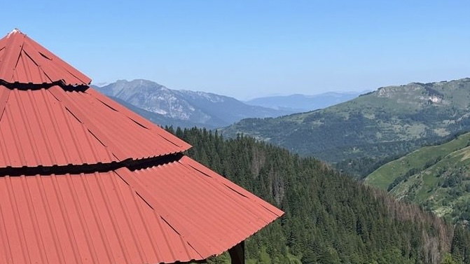
Day 5 – 20 June 2025: Dobërdol to Milishevc
Distance: 20.85 km | Elevation gain: 935 m | Moving time: 5h 33m | Average pace: 15:57/km | Average speed: 3.8km/hr
Drizzle, wind, and other obstacle courses

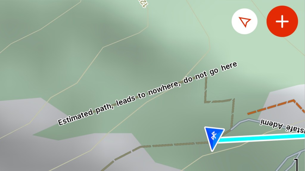
Tiredness seemed to hit everyone this morning. It took real effort to peel myself out of bed, and breakfast was a quiet, subdued affair. A light drizzle set in as we packed lunch and stepped outside. We set off, but within minutes took a wrong turn and had to backtrack to rejoin the trail: we weren’t the only ones, though. Not the most motivating start.
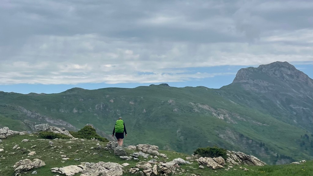
Then came the now-familiar ritual: a big climb straight out of the gate. About 400 metres of elevation gain, in wind and wet, and we weren’t the all feeling it. By the time we reached the top of the pass, it was clear none of us had the energy for the optional detour to Three Border Peak. We skipped it without hesitation and carried on.
Thankfully, the trail mellowed out after that. The rest of the day was gentle ridgeline and contour line walking, with wide-open views and the weather slowly improving. It was a peaceful day, and I enjoyed bringing up the rear of our little party, hiking at my own pace.
Late in the day we took a variant, to avoid a 200 metre climb at the end of the day. This turned out to be a good call, even though we exchanged the vert for an obstacle course of mud, cow pats, half-trails and scrub.
We reached Milishevc just before 3pm. Snacks, showers, laundry and wifi were our immediate priorities. Later, an organised group we’d met at the top of Gjeravica yesterday arrived, and we passed the afternoon chatting with them and enjoying the views, and a beer, from the balcony.
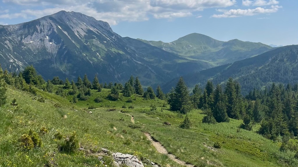
Day 6 – 21 June 2025: Milishevc to Drelaj
Distance: 26.88 km | Elevation gain: 1,353 m | Moving time: 7h 5m | Average pace: 15:49/km | Average speed: 3.8km/hr
A pair of unexpected trail guides
I woke up feeling properly restored, and was soon buzzing with energy after our simple but perfect breakfast of fried eggs, bread, jam and cheese. It made for a nice change from the tomato and cucumber salad that seems to be a staple at every meal – breakfast, lunch and dinner – in the region.
We set off just after 8, accompanied by cuckoo calls and, predictably, a vertical climb. In the bright, sunny morning sweat was in my eyes within minutes. Once we finally crested the first saddle, though, the walking opened into gentler terrain where we made good time, and then dropped through the Rugova Valley, where our pace slowed on the rough track. The descent was fun, if slightly chaotic: fallen trees and loose stones required attention, but at least we had the shade as the day warmed up.
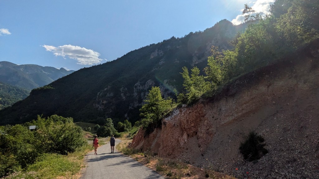
Towards the end of the valley we deciced to give our knees a break and take an alternate on a 4WD track instead, which proved much kinder on our bodies. After a snack break at a bus stop, we began the road walk up to Reka e Allagës. It reminded us of the Camino: a steady walk in the heat. The elevation began gently but soon ramped up, and the opportunity to stop for lunch at Panorama guesthouse was a lifesafer: one of our most delicious meals on trail, and one of the cheapest at just €6 each.
There was still more climbing to be done, and we soon found ourselves bushwhacking and second-guessing our navigation skills, until we crossed paths with a German couple who confirmed we were on track. Here we picked up two stray dogs, who promptly adopted us and guided us all the way to Drelaj through fields of wild mint. They knew the trail better than we did.
The final downhill stretch into Drelaj featured a camera rescue mission by Ellen, red poppies, and of course an arrival beer. We chatted with the two other hikers staying at our guesthouse over dinner, and tried to call it an early night but were roused by fireworks at hiker midnight (9pm).
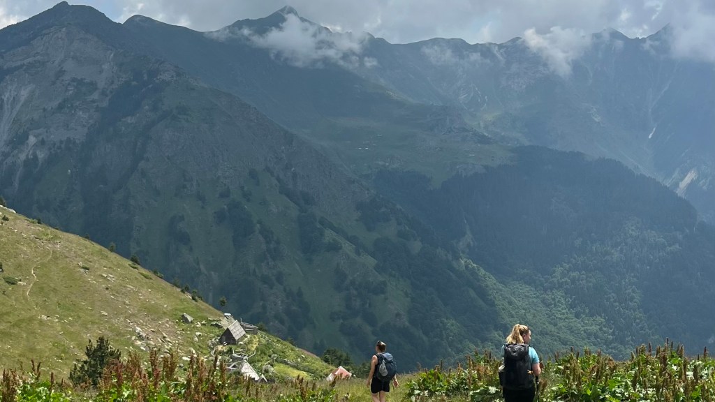
Day 7 – 22 June 2025: Drelaj to Babino Polje
Distance: 29.73 km | Elevation gain: 1,928 m | Moving time: 8h | Average pace: 16:10/km | Average speed: 3.7km/hr
A day of endurance

Well rested, we were up early to tackle our longest day on trail: nearly 30 kilometres and 1,900 metres of vertical. The morning began with a gentle road walk, and some bonus kilometres for Ellen when she realised she’d left her poles (which she’d borrowed from her sister) at the guesthouse and ran back to collect them. I, too, had left my “poles” at the guesthouse, but they were simply sticks I’d pick up along the path and I would’ve been happy to abandon them.
The road walk felt a little pointless, like it had been introduced just so there were roughly equal kilometres in each of the three countries the trail passed through. But then the road gave way to trail, and we wound through a village and then a forest, enjoying having the trail to ourselves. after a steep forest descent we reconnected with the road, and then turned onto a 4WD track that would lead us up to Te Liqueni. I popped on a podcast to help me power through.
At Restaurant Guri I Kuq we stopped for brunch, sharing a table with one of the hikers from last night’s guesthouse, to refuel for the rest of the day. We lingered, delaying the inevitable remaining climb. When we finally began it, we were surprised to come across an organised hiking group: most people take a road transfer to Te Liqueni, and so we thought they’d have started earlier in the day. They were a frustrating bottleneck on a steep section, but good motivation to keep moving uphill at pace in the warm morning.
We made it to a lake that is a popular swimming spot: we could see several people on its far shore enjoying a dip. We thought we were clever by sticking to our side, but the water there was stagnant and uninviting, so we pressed on through the forest and instead took a quick break at a shepherd’s hut before tackling the final climb of the day.
Of course, just as we reached the pass the clouds started to roll in. We sat and enjoyed the view for 15 minutes, but with plenty of kilometres still to go we knew we couldn’t linger long. Mercifully the rest of the day’s walking was much gentler, as we followed ridge and contour lines towards Babino Polje.
We discovered that the guesthouse we had booked was a further 3km and some uphill out of Babino Polje. I didn’t have the energy in me, so we set about investigating other options. The first guesthouse we enquired at lacked showers and WiFi, but the second offered both and we decided to call it a day.
Day 8 – 23 June 2025: Babino Polje to Plav
Distance: 24.33 km | Elevation gain: 710 m | Moving time: 6h 2m | Average pace: 14:52/km | Average speed: 4km/hr
Only 700 m elevation? Basically a rest day
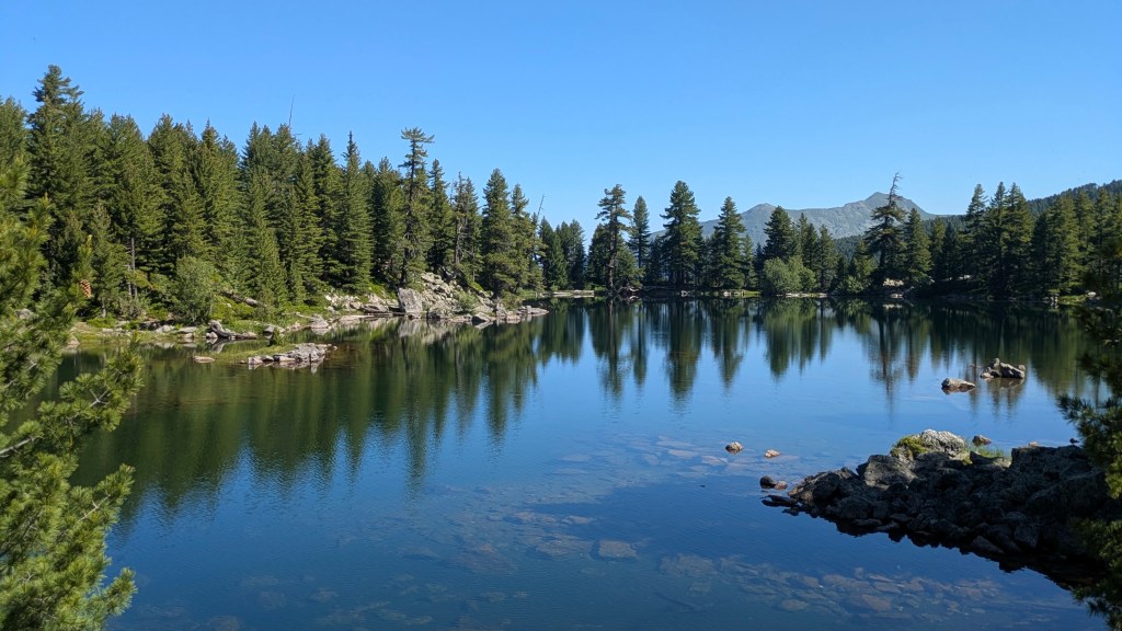
My body was feeling the hike this morning: sore feet and tired knees made getting out of bed a challenge. I ended up lying in a bit longer than planned, but Ellen and Alisha were up and ready to head off, so I decided to take my time and walk alone for the day.
Once I finally set off, the morning was surprisingly gentle. Most of the trail followed easy 4WD tracks and dirt path through shady forest. I stopped at the guesthouse we had booked but not made it to yesterday for a coffee, soaking in the sun. From there, short uphill sections were manageable, and I soon arrived at Lake Hrid. It was busy with other hikers, some taking a dip in the cool water, and I paused just long enough for a quick snack before scrambling along the boulder-strewn path.
At the next pass there was a small cabin shelter, where I lingered in the sunshine, enjoying the views and the quiet. The descent from there was mostly pleasant: shaded forest trails alternating with stretches of sunlit 4WD tracks. Butterflies flitted along the way, keeping me company but impossible to photograph.
Plav appeared in the distance, but reaching it took longer than expected. A quick supermarket snack resupply, and an iceblock, soon revived me for the final push to the hotel that was just out of town. When I arrived I beelined for the bed, needing a brief rest before I could shower, do laundry, and then while away the evening on the porch swing. I was grateful we were all in agreement to have dinner at the hotel rather than venturing back into town. A quiet evening of rest was necessary ahead of another big day tomorrow.
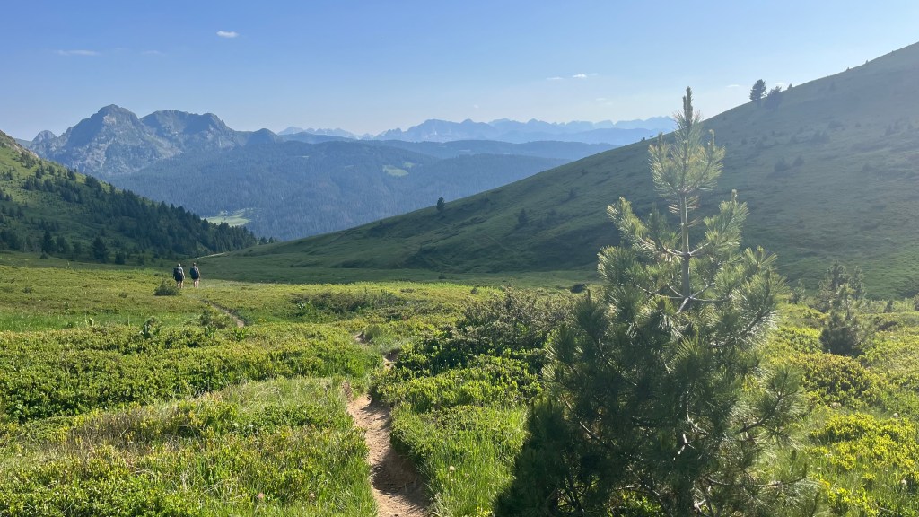
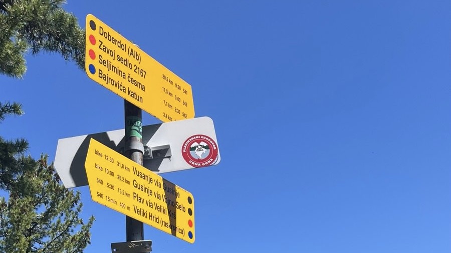
Day 9 – 24 June 2025: Plav to Vusanje
Distance: 24.75 km | Elevation gain: 1,316 m | Moving time: 5h 57m | Average pace: 14:26/km | Average speed: 4.2km/hr
Pastries & peaks
We set off early from our hotel, eager to hit the bakery in Plav as soon as it opens at 7am. It’s a great call: everything there is fresh and unbelievably cheap: Alisha and Ellen go back for seconds while I nurse a coffee at the cafe across the road, and then duck up to the supermarket for my second breakfast, comprising a banana and a protein shake.
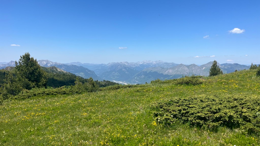
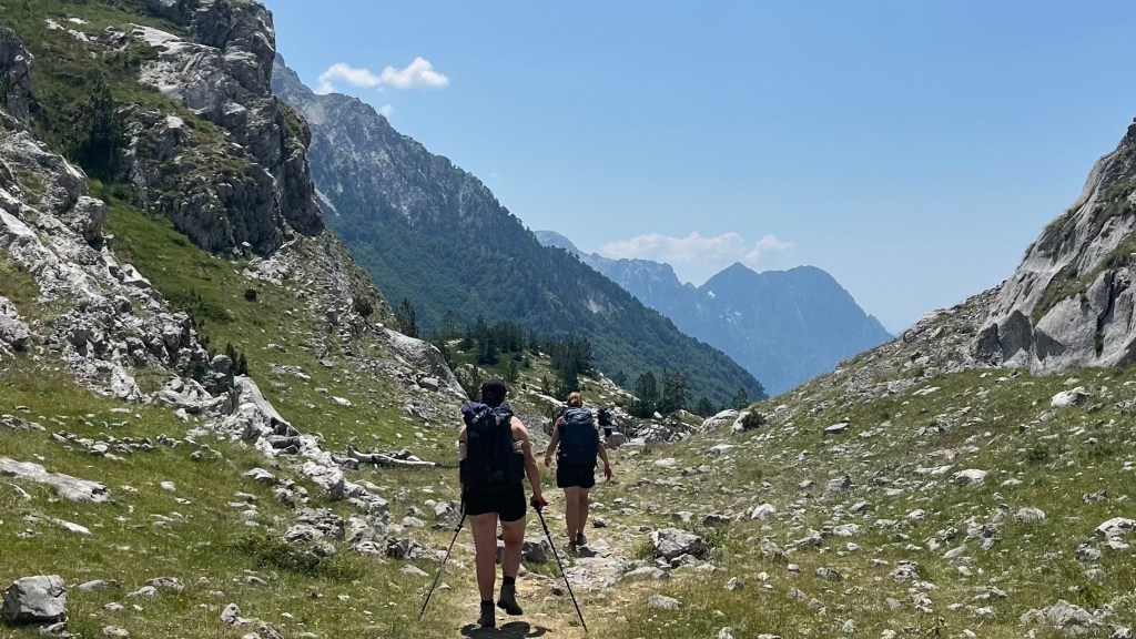
The trail out of Plav began along a shady jeep track, gradually rising over the town. The incline slowly steepened, until it left the track and became much more like the usual fare: straight up through the forest. We emerged into a sunlit meadow, full of wildflowers and delivering a beautiful view of the mountains. We didn’t rest long, though: the day was warming up, and we could see other hikers making their way up the next steep incline.
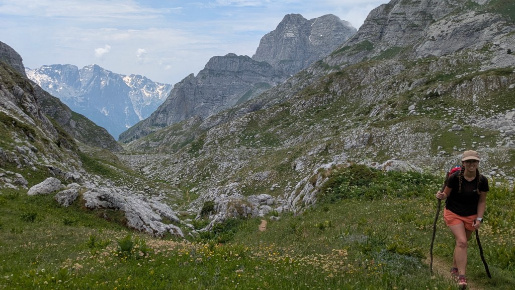
That next climb was mentally tough, but at least it offered us glimpses of the panorama we’d be rewarded with at the top. Once there, we rested a while in the shade, catching our breath. An enjoyable ridgeline walk followed, as the mountains slowly revealed themselves to us, stretching endlessly into the horizon. We stopped to take them in, and to inhale our lunches.
As we descended, Prollospit Pass, which we’d crossed on day 2, came into view, a reminder of how far we’d come since then. We could feel the increasing heat as we lost elevation, and were grateful to come across an unexpected guesthouse serving refreshments. We paused there for while, cooling off in the shade and allowing our legs to reset before the final stretch to Vusanje.
The trail soon levelled out and turned to asphalt, and we knew we were almost there. A few cows crossed our path, and then we turned the final corner to reveal our guesthouse, which was of course up a hill. Alisha and Ellen made the questionable decision to sprint up to it; I settled for a steadier pace. Drinks, showers, laundry and a quiet afternoon of recovery, overlooking tomorrow’s mountains, closed out the day.
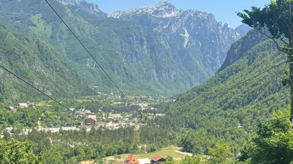
Day 10 – 25 June 2025: Vusanje to Theth
Distance: 22.12 km | Elevation gain: 973 m | Moving time: 5h 54m | Average pace: 16:02/km | Average speed: 3.7km/hr
Full circle finale
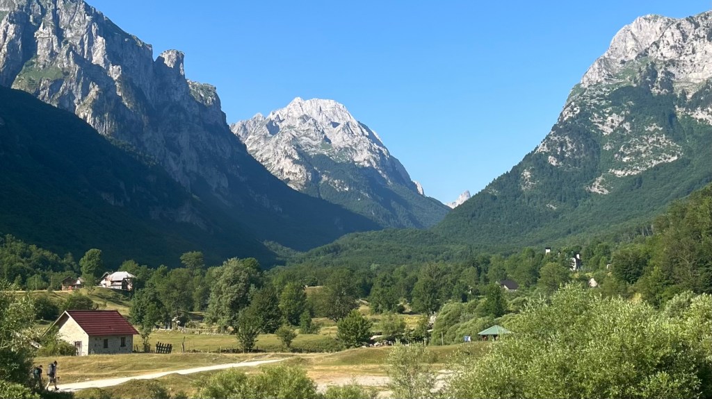
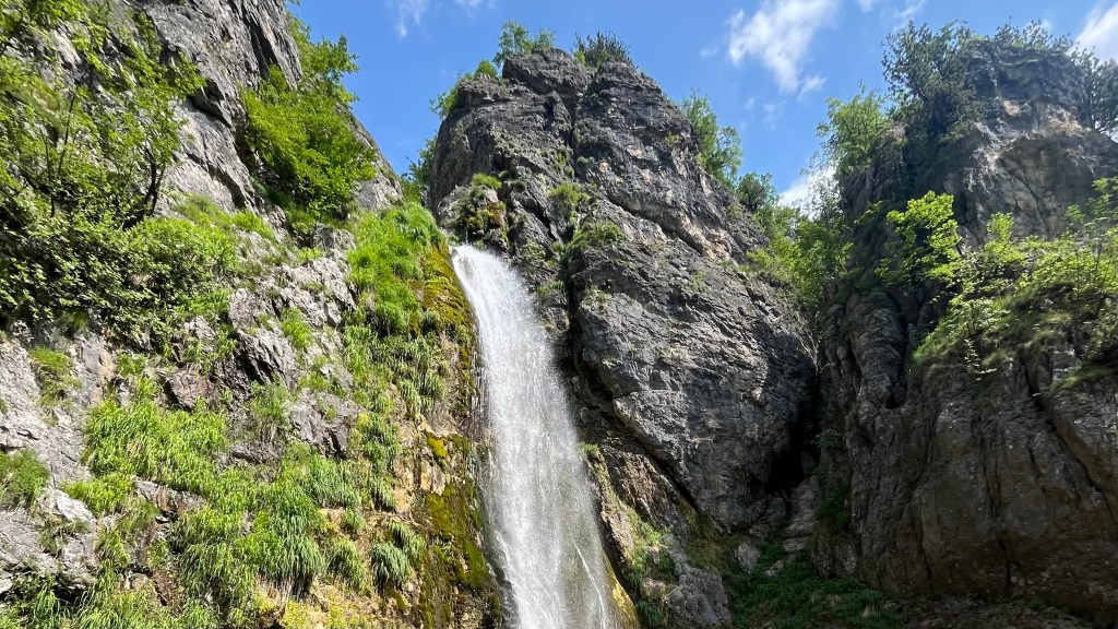
Breakfast at our guesthouse was a treat: fresh, homemade honey drizzled over bread, plus fried eggs and a few other small delights to fuel our final day. By 8am we were on trail, stopping briefly by an unusually angled waterfall before entering the wide valley surrounded by sheer and dramatic peaks.
The morning walk was gentle, and our first ascent was shaded by forest; we still managed to work up a sweat, though. But the views when we emreged more than made up for it. We bustled along the next valley, eager to overtake an organised group, and began the next incline, heading for a saddle that turned out to be a false summit; the true pass was still a while away. Refuelling was essential, so I stopped for a quick break while the others went ahead. At the pass, we sat for lunch with other hikers, several of whom we’d encountered on the journey before. It was nice to share the camaraderie on this final stretch.
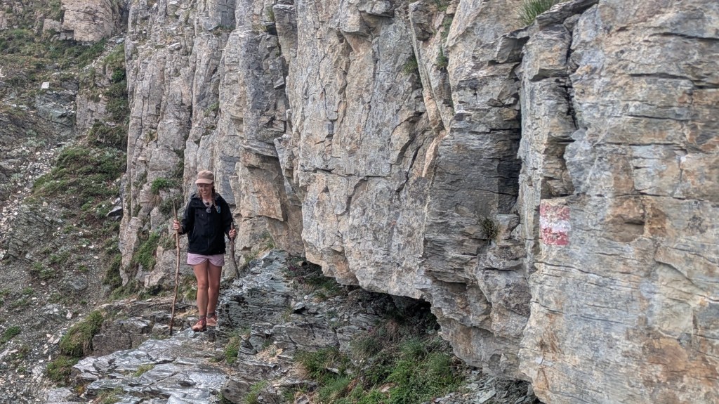
Then the final descent began. It was the most brutal of the entire trail; loose rocks and steep turns, with enough exposure to make you pay close attention to where you put your feet. The sun beat down on us, but with no trees or water sources to offer relief our only option was to push on. At least the scenery was incredible: pink wildflowers framed the mountains, rock formations kept us captivated, and I even caught a glimpse of a hummingbird moth in flight.
Finally we reached a small stream and regrouped. A brief stop at a guesthouse for a motivational Coke, and then we were making the final approach to Theth. The landmarks and buildings started to look familiar, and we marked the end of our adventure appropriately: pizza and beers in the garden of the main restaurant.
Day 11 – 26 June 2025: Theth Side Missions
Victory lap: Blue Eye bliss
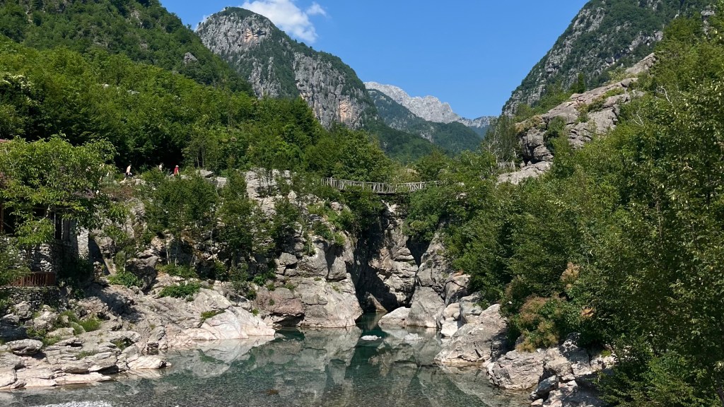
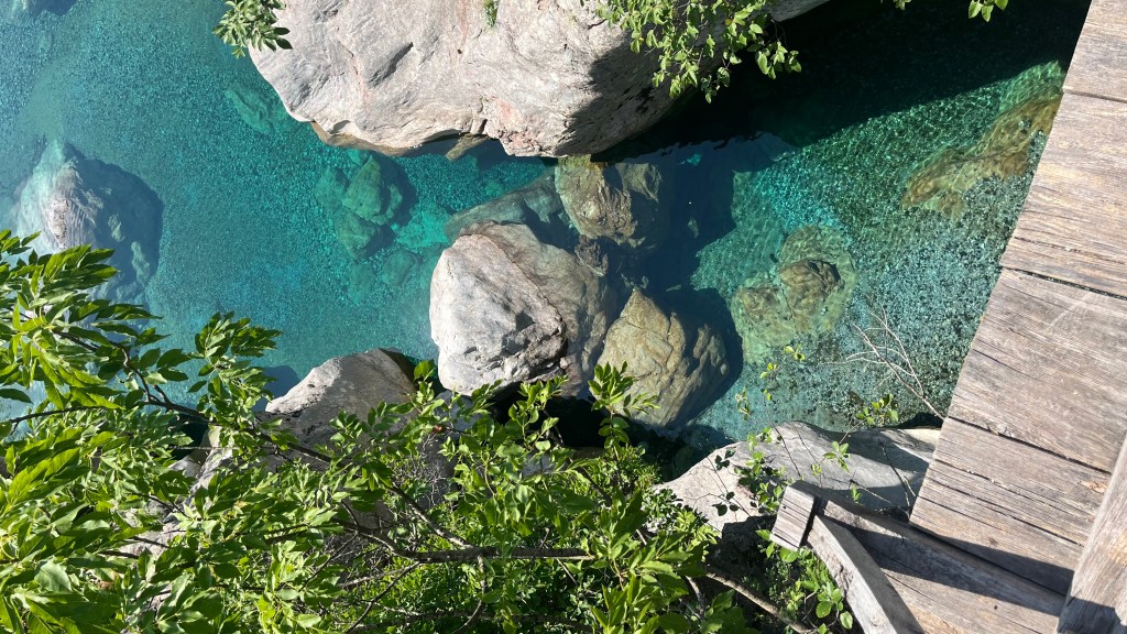

Officially finished with the trail, we took a slower start to the morning. After breakfast at our guesthouse we wandered up to the main village restaurant for a coffee, and by 9am we were piling into the “bus” (a jeep) for a leisurely ride to the Blue Eye. As we passed hikers making the way out there under their own steam, we were grateful to be escaping the heat and the traffic.
From our drop-off point in [village], the hike to the Blue Eye was relatively gentle in comparison to our usual morning climb. The Eye itself was a deep, icy blue, with almost surreal clarity. We descended to a rock landing where others were already gathered, taking in the view and braving the waters. Alisha and Ellen both managed a dip, but for me the cold was a complete shock to the system and I retreated to sunbathe on the rocks amongst the flittering butterflies.
We soon grew tired of the crowd, and made our way back to a more tranquil swimming spot we’d spotted on the hike in. I still couldn’t bring myself to go for a dip as we lazed about for a good while. When hunger started to set in we made a move back towards [village], and claimed a table at a bustling restaurant.
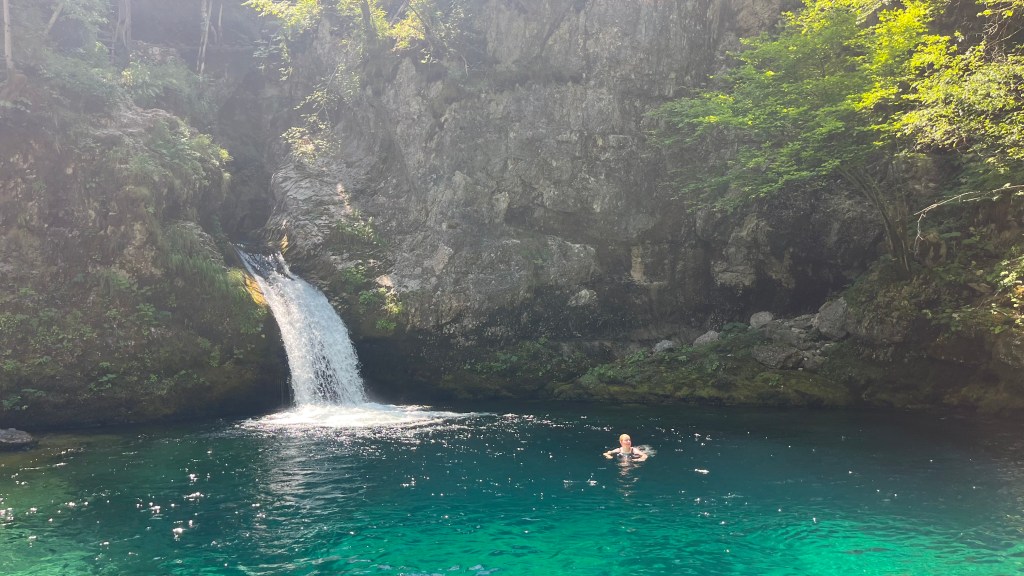
After eating our fill, we parted ways: Ellen and Alisha headed back to Theth in the “bus”, while I chose to take a wander to Grunas Waterfall. The sun was relentless, but could be tempered by dipping down to a stream where I dunked my hat and refilled my water bottle repeatedly. Thankfully, the climb up to the waterfall itself was shaded, and the water spraying off it in the wind was almost too chilly. I sat and enjoyed the view as I cooled off, before making my way back to Theth.
After a shower, I reconvened with Ellen and Alisha for a relaxing evening at a restaurant overlooking the river. More pizza and beer brought a peaceful close to our final day in the mountains.
Day 12 – 26 June 2025: Theth to Tirana
The home stretch begins

With the only bus out of Theth scheduled to arrive at 11am, we had a lovely slow morning. We whiled away the time in the main cafe, catching up on photo sharing, stoking up on snacks, and reminiscing on our favourite parts of the trip.
The bus ride back was unexpectedly rough. The mountain roads, the heat of the day and the driver’s refusal to use the aircon left several of us feeling queasy. We were all grateful for a brief comfort stop at a roadside cafe. When we set off again, the aircon was on and we all breathed a sigh of relief: perfectly timed to soothe as we drove through a field of lavender.
We again switched buses mid-journey, and though the second leg wasn’t luxurious at least we had a seat. We swung by another bus stop in Shkodër before departing, where there was a long line of hopeful travellers waiting for a free seat.
When we finally made it to Tirana, the afternoon and evening were a delight. We had a late lunch and then made our way to the bazaar before heading to our hostel. After showers and a quick supermarket run, we found a small restaurant where the food was simple, cheap, and perfectly satisfying; a local beer rounded off the meal. We lingered late into the evening, wandering lazily through a couple of other establishments, before turning in. It was a gentle, restorative way to close out our time in the Balkans, soaking in the city’s relaxed atmosphere and the generosity and kindness of the locals.
Want More?
Curious about the practical side of the trail? Check out my Peaks of the Balkans: How-To post for route info and planning tips.

Leave a reply to Peaks of the Balkans: How-To – Thru Horizons Cancel reply