Following ancient paths across chalk and limestone hills, the South Downs Way is one of England’s National Trails. Stretching over 160km from Winchester to Eastbourne in the south of the country, it offers an easily accessible escape into nature, quiet and peaceful yet never too far from villages, transport or a pub.
I section-hiked the trail in September 2025. For a closer look at the on-the-ground experience, head over to my South Downs Way: Trail Journal post.
- Quick Facts
- Map & Elevation Profile
- Preparation
- Accommodation
- Gear List
- Possible Stages
- On-Trail Practicalities
- Side Missions & Connecting Trails
- Hiking as a Solo Woman
- Want More?
Quick Facts
| Distance | 160 km |
| Elevation gain & loss | + 3,700 m / – 3,720 m |
| Days to complete | 8-9 |
| Best season | Spring to Autumn |
| Trailheads | Winchester; Eastbourne |
| Recommended direction | W2E |
Map & Elevation Profile
Preparation
Trailheads & getting there
The trail starts in Winchester and ends in Eastbourne, both of which are easily accessible by train from London.
Direction to Walk
The trail can be walked in either direction, although the general wisdom seems to be to start in Winchester and build up your trail legs to finish on the cliffs above the Seven Sisters on the approach to Eastbourne. However, I started in Eastbourne and headed towards Winchester, and was very thankful after some long days to see the landscape flattening out rather than getting hillier.
Season to Walk
Any time of year suits the South Downs Way, but it’s most popular between Spring (April) and October (Autumn). In summer the Way plays host to a lot of organised events, so if you dislike crowds maybe try for shoulder season.
Accommodation
Beds & bunks
You’ll find hotels, pub stays and B&Bs aplenty on this trail. Some of the bigger cities also have hostels. This trail is one of the most popular in the country, so booking ahead is recommended.
Camping
Wild camping is not permitted in England, but check out the commercial campsite guide on the South Downs Way website. I didn’t camp this trail, but based on my experience with long trails elsewhere in the UK I’d anticipate that pitches for 1-2P tents generally wouldn’t need to be booked in advance; but this is worth double checking.
Gear List
If you’re staying in accommodation, as I was, all you need is:
- 25L backpack (or even smaller)
- 1 set hiking clothes (you might like to bring a second set, for washing/drying)
- 3x socks and underwear
- PJs
- Town clothes (optional)
- Warm layers (fleece, puffer)
- Rain layers
- Sunglasses, hat
- Trail runners or hiking shoes
- Electronics
- Toiletries & first aid
- Water bottle(s) & snacks
It can get quite windy at the top of the downs, so a windbreaker probably wouldn’t go amiss. You might also like to consider trekking poles to help save your knees.
If you’re camping, obviously you’ll need to add your tent and sleep system. You could bring a cooking system, or rely on what’s provided at the commercial campsites.
Possible Stages
A highlight of the South Downs Way is that it’s never too far from a village; lots of them are peppered within a kilometre or two of the trail. This table lists the more common stages for the trail, but many of these stages can be broken up further using off-trail village accommodations.
| Place | Distance from previous (km) (E2W) | Distance from previous (km) (W2E) |
|---|---|---|
| Winchester | 0 | 19.3 |
| Exton | 19.3 | 20.9 |
| Buriton | 20.9 | 17.7 |
| Cocking (a short detour off-trail) | 17.7 | 19.3 |
| Amberley | 19.3 | 20.9 |
| Upper Beeding | 20.9 | 32.2 |
| Kingston-near-Lewes | 32.2 | 17.7 |
| Alfriston | 17.7 | 19.3 |
| Eastbourne | 19.3 | 0 |
On-Trail Practicalities
Finding Your Way
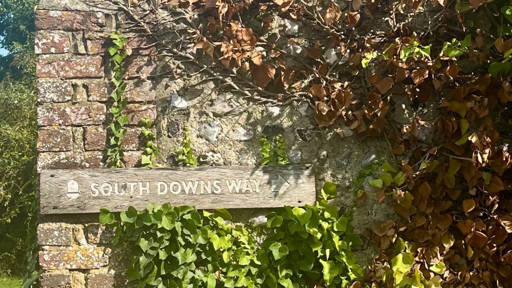
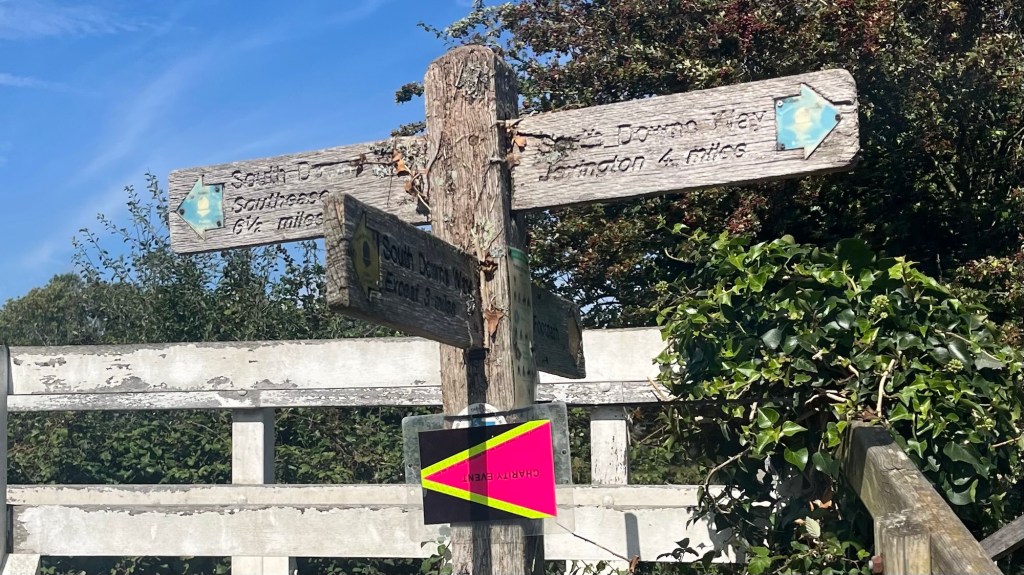
Trail Markings
National Trails’ upside down acorn guides you along this trail. Signage was excellent and frequent, although there are always a few crossroads where a GPX file comes in handy just in case.
Maps & GPX
If you want paper maps, you’ll need to look into Ordnance Survey Explorer OL34 and OL35. Or try their handy app, instead. I used the GPX file made available by National Trails (here), and added it to my Garmin Explore app.
Guidebooks & Resources
There is plenty of literature on this trail; you’ll be overwhelmed by choice. You don’t need a guidebook for this trail (I didn’t use one, and was fine), but if you’re interested then Cicerone and Trailblazer are well-known brands.
Food & Water
The trail passes through or close to several villages and towns, where there’s usually a cafe and/or a pub. Some of the larger villages also have supermarkets. However, many of these villages are slightly off trail, so it’s probably worth at least bringing your lunch and snacks with you for the day.
I took a 1L water bottle and it never ran dry, although I wasn’t hiking in the height of summer; if you are, definitely bring more water capacity as there isn’t a great deal of shade. There were a few taps available for refills near cafes and other amenities. I don’t recall there being any natural sources; I wouldn’t recommend drinking from them in any event, and certainly not without a strong filter, given most of the trail traverses farming land.
On-Trail Transport
The South Downs Way lies entirely within a national park, but it’s still one of the most accessible National Trails. Train stations are on trail in Winchester, Amberley, Southease and Eastbourne. Bus services run to most of the villages nearby, although check the timetable – several don’t run or have only limited service on Sundays.
Money Matters
As with most hikes in England, card is accepted pretty much everywhere. I didn’t carry cash and was never caught short.
Side Missions & Connecting Trails
The South Downs Way lies entirely within the South Downs National Park, which is home to over 3,000km of hiking trails. There’s no shortage of things to do here! The most common side-trips of the trail include the Devil’s Dyke viewpoint (accessed between Upper Beeding and Kingston-near-Lewes), and the coastal alternative over the Seven Sisters cliffs on the approach to Eastbourne. If you’re thinking about extending your trail, or changing things up, look into The Monarch’s Way (from Winchester), The Serpent Trail or the Wealdway (both near Alfriston).
If you’re interested in history and culture, Arundel Castle (from Amberley) and Lewes Castle (from Kingston-near-Lewes) are just a few kilometres off trail; or check out some of the famous chalk hillside carvings such as the Long Man of Wilmington (keep an eye out for signs for the Long Man trail after Windover Hill, between Alfriston and Jevington) and the Litlington White Horse (from Alfriston). Of course, pretty much every village on or nearby the trail will offer a quintessential English pub experience; while the larger towns will have plenty of opportunity for entertainment and dining out.
Hiking as a Solo Woman
I felt super safe at all times on this trail. It’s very popular, and as you near villages or attractions you’ll come across many people out for day hikes on the trail. Phone reception is good throughout, and the trail doesn’t go through any sketchy areas. This would be a great first long-distance trail.
Want More?
Check out my South Downs Way: Trail Journal post for stories and snapshots from the trail.

Leave a reply to South Downs Way: Trail Journal – Far Horizon Trails Cancel reply