8 days, 259 kilometres, 2,875 metres of elevation gain. I section-hiked the trail between July and September 2025: here’s the journey, day-by-day.
Thinking about tackling the trail yourself? Check out my Saxon Shore Way: How-To post.
- The Stats
- Trail Journal
- Day 1 – 5 July 2025: Gravesend to Rochester
- Day 2 – 6 July 2025: Rochester to Swale
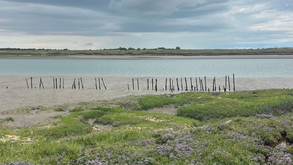
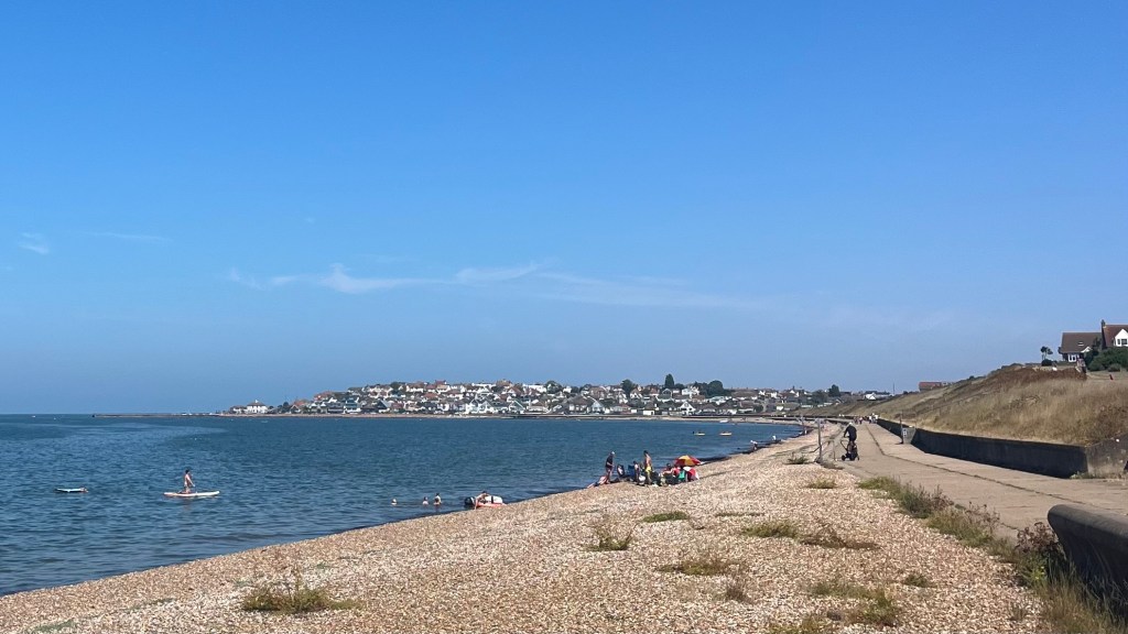
- Day 3 – 12 July 2025: Swale to Faversham
- Day 4 – 13 July 2025: Faversham to Herne Bay
- Day 5 – 20 July 2025: Herne Bay to Sandwich
- Day 6 – 26 July 2025: Sandwich to Folkestone
- Day 7 – 27 July 2025: Folkestone to Hamstreet
- Day 8 – 28 September 2025: Hamstreet to Hastings
- Want More?
The Stats
Disclaimer, in case you’re using these stats to help plan your own trip: I had a couple of issues with my Garmin recordings on this trail, especially on days 4 and 7. In this post I’ve input both what my Garmin recorded, and what I believe to be more accurate. I’ve used the latter to calculate total distances, but excluded these from calculations of moving time, average pace and average speed on day 4.
Trip Summary
- Start date: 5 July 2025
- Days hiked: 8
- End date: 28 September 2025
Distance & Elevation
- Total distance: 288.87 km
- Average distance/day: 36.11 km
- Total elevation gain & loss: + 3,215 m / – 3,142 m
- Average elevation gain & loss / day: + 402 m / – 393 m
Time & Pace
- Total moving time: 57 h 9 m
- Average moving time / day: 7 h 8 m
- Average moving pace: 11:52km/hr
- Average speed: 5.05km/hr
Budget (ex gear)
| Category | Total (£) | Breakdown |
|---|---|---|
| Accommodation | 17.50 | Campsite Day 6 |
| Food | – | I didn’t keep track of what I spent on food. In large part it’ll depend on whether you bring it from home, buy from a supermarket, or splurge on proper sit-down meals. |
| On-trail transport | 164.50 | London Blackfriars to Gravesend (3.65); Rochester to London Blackfriars return (10); Swale to London Victoria (8.35); London St Pancras to Swale (10.90); Faversham to London Victoria return (20.10); Herne Bay to London Victoria (11.55); London Victoria to Herne Bay (9.70); Sandwich to London St Pancras (13.45); London St Pancras to Sandwich (13.45); Ham Street to London St Pancras (28.60); London St Pancras to Ham Street (15.85); Hastings to London Victoria (18.90) |
| TOTAL | 182 | Average / day: £22.75 |
Trail Journal
Day 1 – 5 July 2025: Gravesend to Rochester
Distance: 35.03 km | Elevation gain: 339 m | Moving time: 6h 59m | Average pace: 11:58/km | Average speed: 5.02km/hr
Grey skies, gold wheat


I step off the train at Gravesend into a classic English morning: grey everywhere. Second breakfast and snacks for the day were procured at a nearby Tesco, and then I took a quick detour to the statue of Pocahontas that marks her final resting place.
The Saxon Shore Way doesn’t both with an official starting terminus, so neither did I: I was on my way. The first few kilometres were urban and industrial; not quite what I expected, or wanted. The overcast sky did nothing to help.
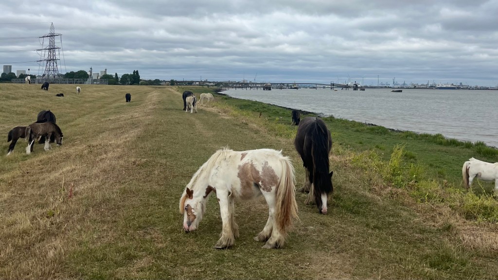
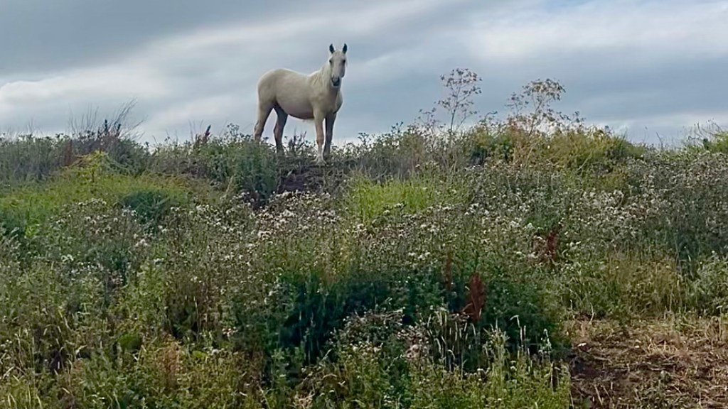
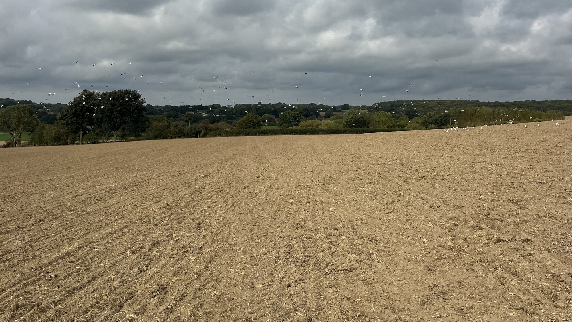
But once the trail broke free of Gravesend’s outskirts, suddenly there were wide-open skies, a horizon of fields and river, and a small her of ponies who were completely unperturbed by my presence. Spring still lingered in the form of late blossoms, bumblebees, butterflies and ladybirds. I wandered through a field of dusty bronze wheat, swaying hypnotically in the breeze.
Navigation got creative in the afternoon. One junction turned out to be an overgrown drainage ditch lined with blackberries and nettles. Another soon afterwards offered the same fate. Rerouting around meant some bonus kilometres today; but at least these detours along the roads made for fast going.
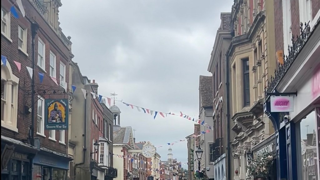
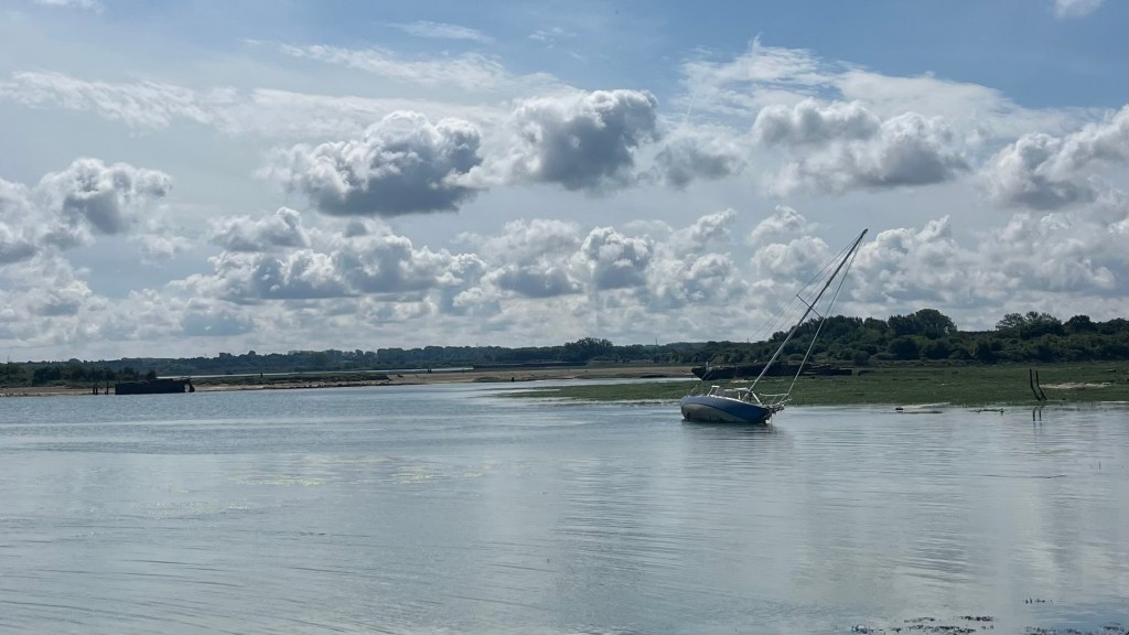
Rochester finally appeared, across a stretch of stony foreshore. The urban approach to the city was much more pleasant than this morning’s, and the high street was bustling as I arrived at 4pm. I celebrated the end of day 1 with a stop for a sandwich and coffee, to stave away the hunger on the train back to London.
Day 2 – 6 July 2025: Rochester to Swale
Distance: 37.76 km | Elevation gain: 306 m | Moving time: 8h 15m | Average pace: 13:07/km | Average speed: 4.58km/hr
Orchards & overgrowth
Rochester is delightfully quiet at 8.30am on a Sunday, the British all committed to their “not before 10am” approach to life. A quick loop around the castle leads me back to the Saxon Shore Way, and the morning’s walk is more urban than expected as I wind my way through towns that have sprawled together. The wander through Victoria Gardens softens the blow, and by the time I reach the waterfront the sun decides to clock in, instantly improving morale.
My pace picks up along the shoreline stretch as pavement gives way to gravel. After a brief stop at Riverside Country Park, the apparently inevitable occurs: another overgrown path. This one is at least possible to push through, at the small price of a couple of nettle stings. The trail makes up for it with a surprising abundance of fruit orchards I wasn’t expecting to see; there were apples yesterday, pears today.
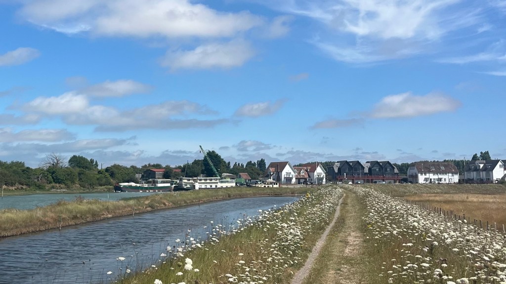
I take a wrong turn near a fishing lake, missing the unmarked path through long grass the first time and having to backtrack. More fields, and the ones filled with golden wheat officially become my favourite part of the Way. Least favourite: yet another impassable wall of vegetation. I try to reroute through Iwade, but this turns out to be a dead end. Naturally, it then begins raining and I haven’t brought my rain jacket (isn’t it summer??) so I shelter under a tree for the worst of it. Then I backtrack and bushwhack onto the path once more.
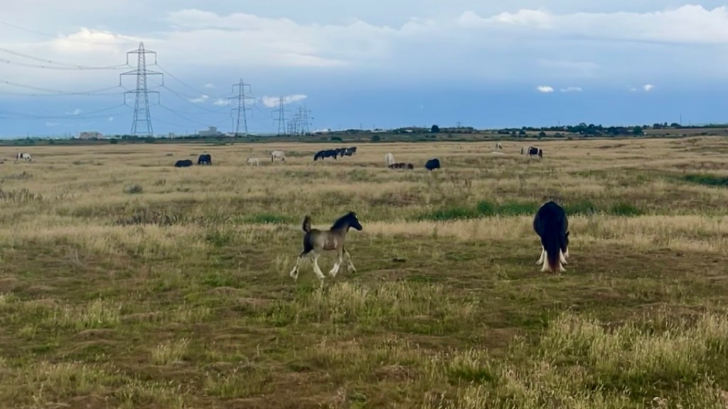
The weather oscillates as I arrive at the shore again, after weaving through more farmland. More ponies appear, and I pause to watch foals bounding around on their new legs. A bridge appears in the distance, which means I’m close to the end of today’s stretch; and yet the station still seems so far away. Of course, as soon as I arrive the rain sets in again and with nowhere else to shelter I do my best to curl into the corner of a bus stop until my train finally arrives and I collapse gratefully into a comfortable seat.
Day 3 – 12 July 2025: Swale to Faversham
Distance: 36.43 km | Elevation gain: 275 m | Moving time: 6h 59m | Average pace: 11:30/km | Average speed: 5.22km/hr
Sunshine & skeletons
Back at Swale a week later, and I’m greeted by an entirely different world: blazing sunshine, sparking water, and grass so green it almost glimmers. Somehow, within twenty minutes I’ve managed to wander off-track yet again. But in my defence, the “correct” path is barely even visible; overgrown, unloved and clearly someone’s dumping ground for unwanted junk. It’s eerie, and I’m thankful today is sunny as I hustle to quickly leave it behind.
A stretch of forgettable road walking, which I spend chatting with a friend from home, delivers me to Sittingbourne. The trail doesn’t actually enter the town, but I do because I have for the umpteenth time lost the charging case for my earbuds. There’s no way I’ll be left to my own thoughts today after the week I’ve had at work, so I detour to Sainsbury’s to pick up some new earbuds. And naturally also walk out with some snacks.
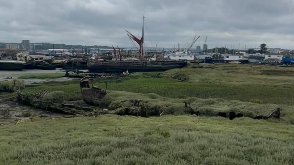
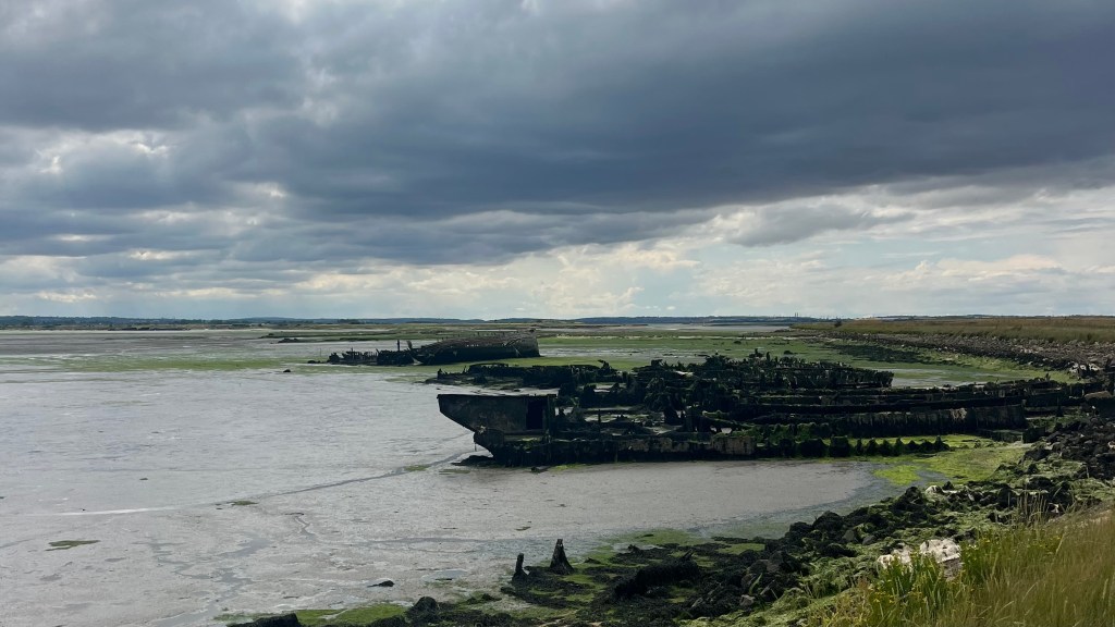
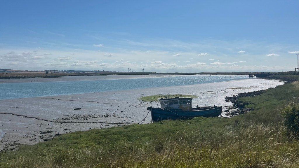
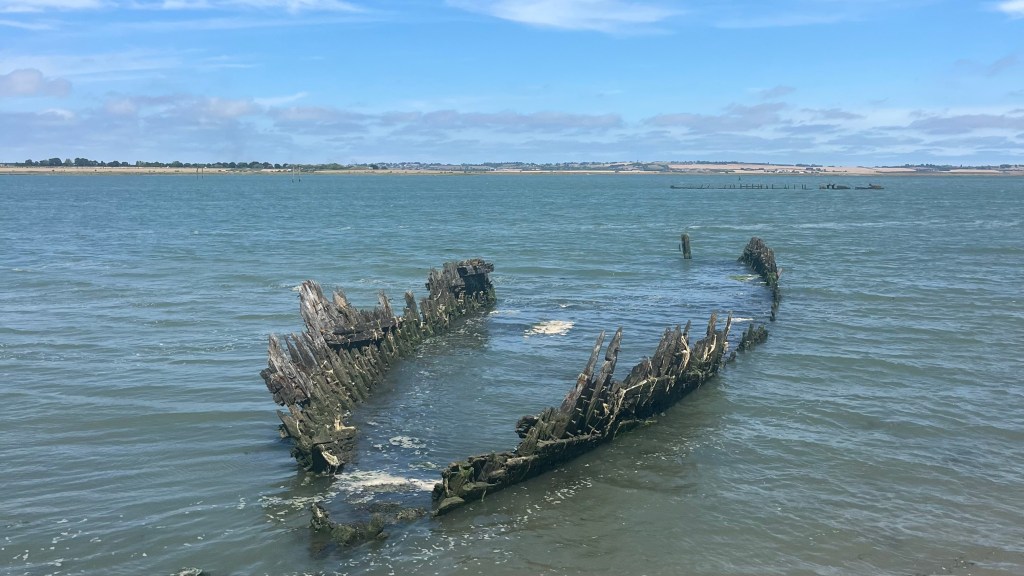
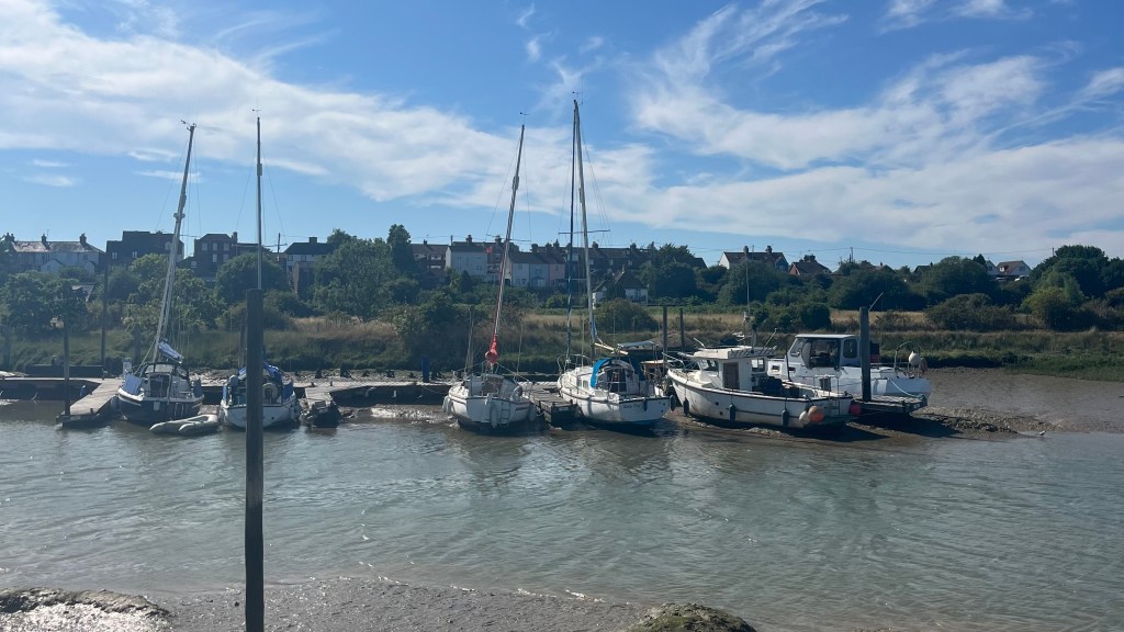
More urban walking eventually gives way to open views across the water, punctuated by the now-familiar sight of abandoned boat skeletons. While the first few added a touch of Romantic charm, their frequency has become a sad reminder that humans rudely leave their marks everywhere.
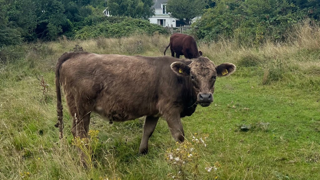
As I near Faversham the trail cuts through a field occupied by a group of teenage calves who are testing their independence by straying far from mum. Until they spot me approaching, and sprint back to the herd with comic urgency. I end Faversham with another snack resupply at the local supermarket, to tide me over on the train.
Day 4 – 13 July 2025: Faversham to Herne Bay
Distance: 19.29 km (recorded; plus ~5.25km unrecorded)* | Elevation gain: 11 m | Moving time: 3h 49m | Average pace: 11:52/km | Average speed: 5.05 km/hr
Sun arrived, train didn’t
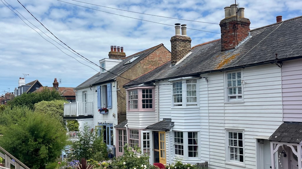
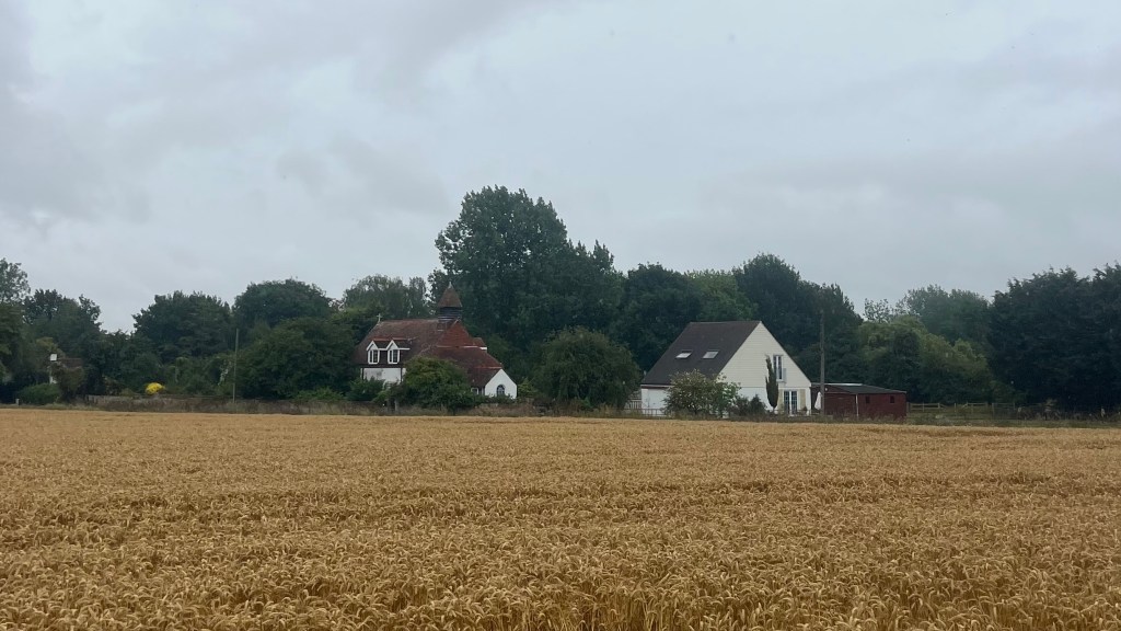
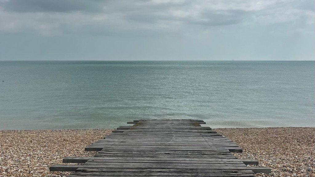
Today’s section ends at the first proper beach on the Way, though of course yesterday’s sunshine has disappeared without a trace. I step off the train at Faversham into a miserable grey morning and decide a coffee is an essential mood-booster. The town is charming, ancient buildings line its uneven streets offering plenty of fodder for my imagination.
About an hour in I have a horrible realisation: my Garmin hasn’t connected, and it thinks I’m still at the station. I’m torn between “Strava or it didn’t happen” versus a pre-booked train ticket from Herne Bay. My purse wins and I continue without the evidence.
Most of the morning is spent atop a levee bank, which I have mostly to myself except for a couple of sheep hiding in the long grass. Just before noon the sun finally peeks through, transforming the landscape into something alive. There’s some quick “beach” walking along the stones on the outskirts of Whitstable. The town is positively humming with foot traffic, so I simply duck into a supermarket for snacks and press on towards Herne Bay, ignoring the rest of town.
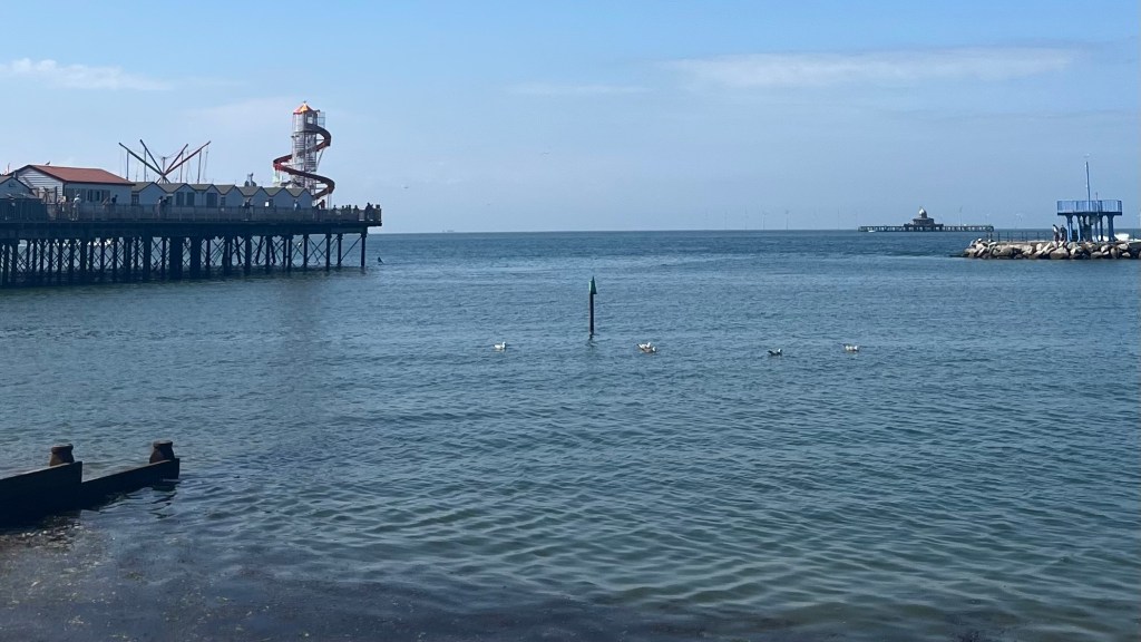
The concrete underfoot is tough, but makes for a fast pace. Here, too, it’s busy: parents, prams and pups all out to enjoy the summer sun. I arrive at the Herne Bay beach and soak up some sun before heading to the train station. But the timetable has turned to chaos: an earlier train struck a van, and the line to London is essentially inoperable. The internet tells me to wait for the next service, but if the line is closed I don’t like my chances. Remembering a “long way”, I take a risk and head to Ramsgate. Changing there pays off: boarding the end carriage, I nab one of the last seats and my tired feet have the chance to rest on the way back to London.
Day 5 – 20 July 2025: Herne Bay to Sandwich
Distance: 32.30 km | Elevation gain: 175 m | Moving time: 6h 43m | Average pace: 12:29/km | Average speed: 4.81km/hr
Coastal dreams, inland reality
I chose the Saxon Shore Way expecting coastal summer vibes, but the weather seems determined not to deliver. From Herne Bay a friend and I set off into another grim morning, coffee in hand. The weather was uncomfortable: simultaneously too hot for rain gear and yet too drizzly not to wear it.
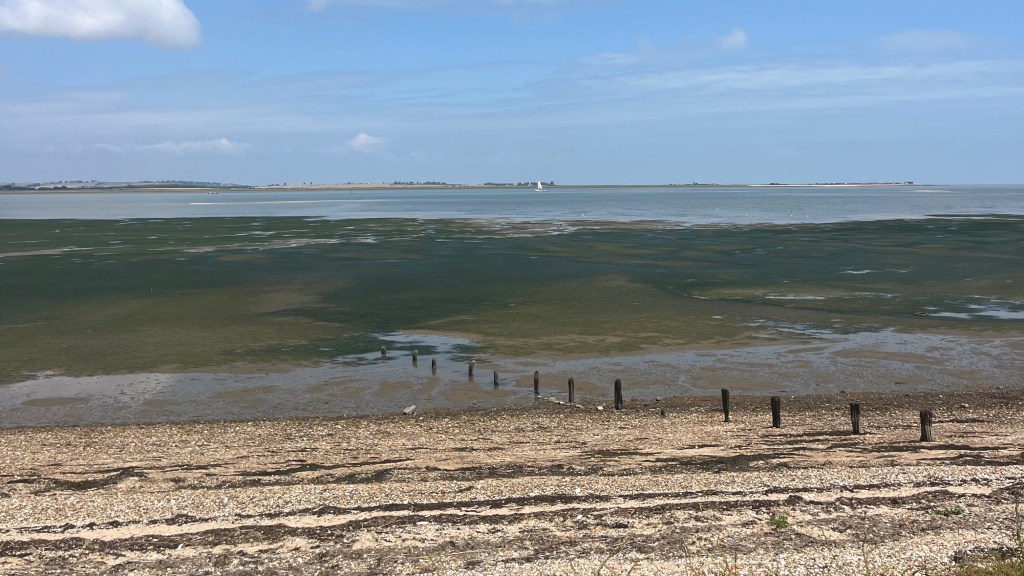
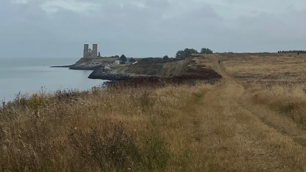
After the first stretch of trail delivered us to Reculver and the remains of St Mary’s Abbey, the path swung inland and suddenly I was grateful for the gloomy day. Or, more specifically, glad not to waste a sunshiny day on this inland section. Fields stretched in every direction, my favourites of course being the wheat. There was also more mud than I expected for summer; down south at this time of year it normally hardens into clay or chalk so stuff you’d swear it was concrete.
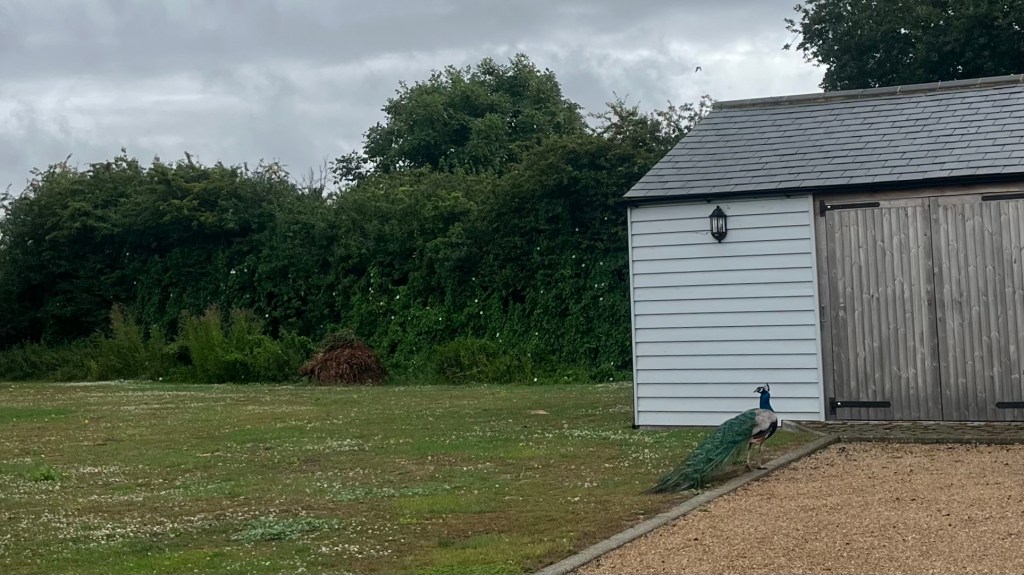
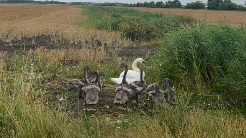
Birdlife was out to entertain along the way: a peacock strutted around someone’s back garden, and a mama goose honked warnings at her teenagers as we approached. For something different, we then pass through a field of corn and for a few minutes I felt like I was back on the Camino.
The rain became something to celebrate just outside Plucks Gutter, giving us the perfect excuse for a late lunch pub stop. By the time we left, the sun had returned, making the raindrops glisten on the long, wet grass we spend the afternoon traversing. The final approach through Sandwich unfolded into a gentle garden stroll, a meandering riverside path delivering us to the station.
Day 6 – 26 July 2025: Sandwich to Folkestone
Distance: 40.24 km | Elevation gain: 683 m | Moving time: 8h 9m | Average pace: 12:09/km | Average speed: 4.94km/hr
Sunkissed scenery
This weekend I’m doing something different: a proper break from London with a night of camping just outside Folkestone. Arriving back in Sandwich, weighted down by a pack full of camping gear, I fuel up for a long day with a second breakfast and a coffee.
A bit of roadwalking followed by a golf course lead me to the sea once more, at Sandwich Bay. The weather can’t decide what to do, and the ocean mirrors it, flipping from dull grey to vibrant blue in seconds.
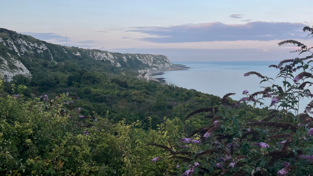
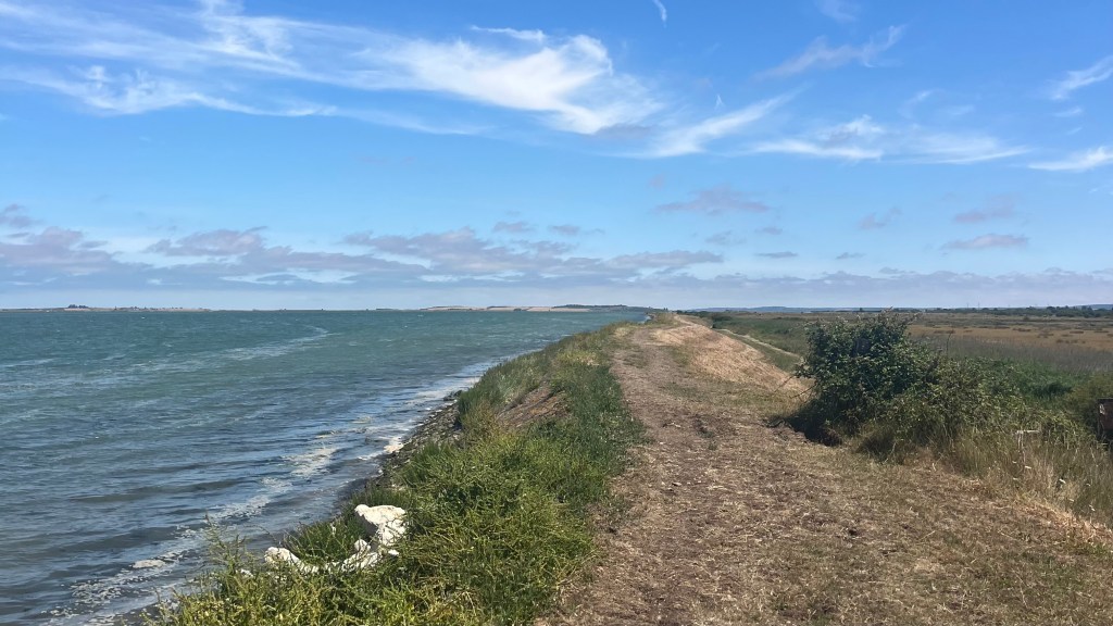
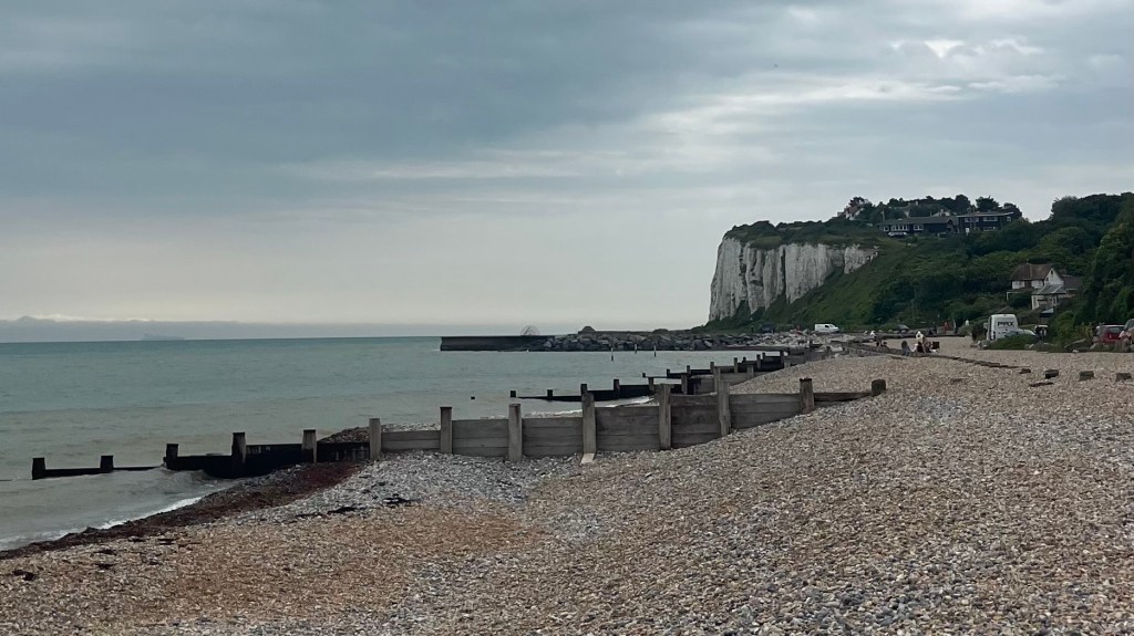
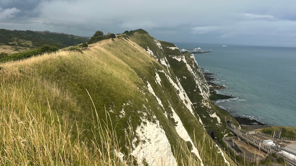
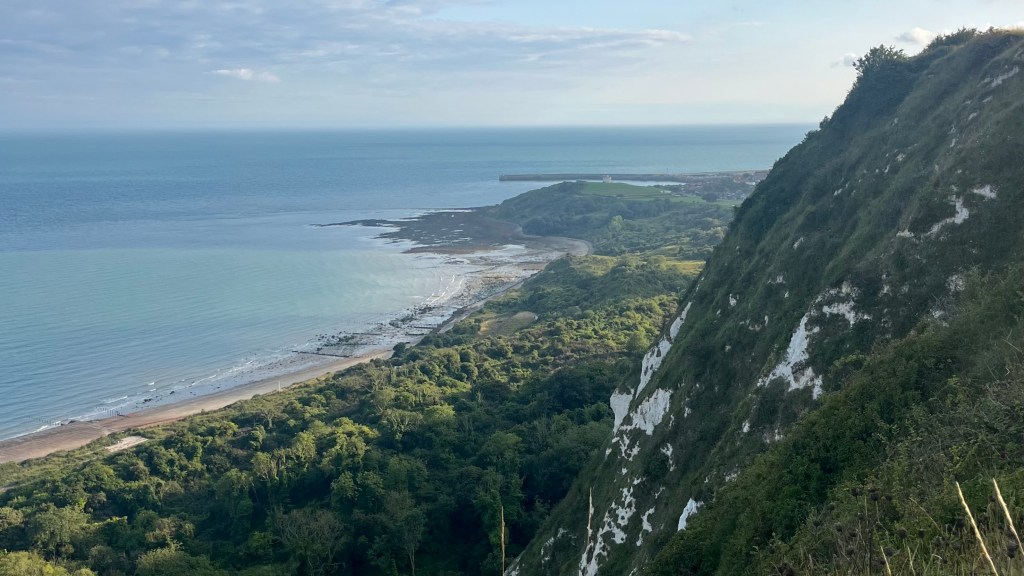
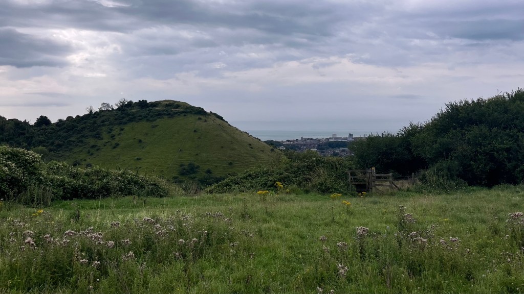
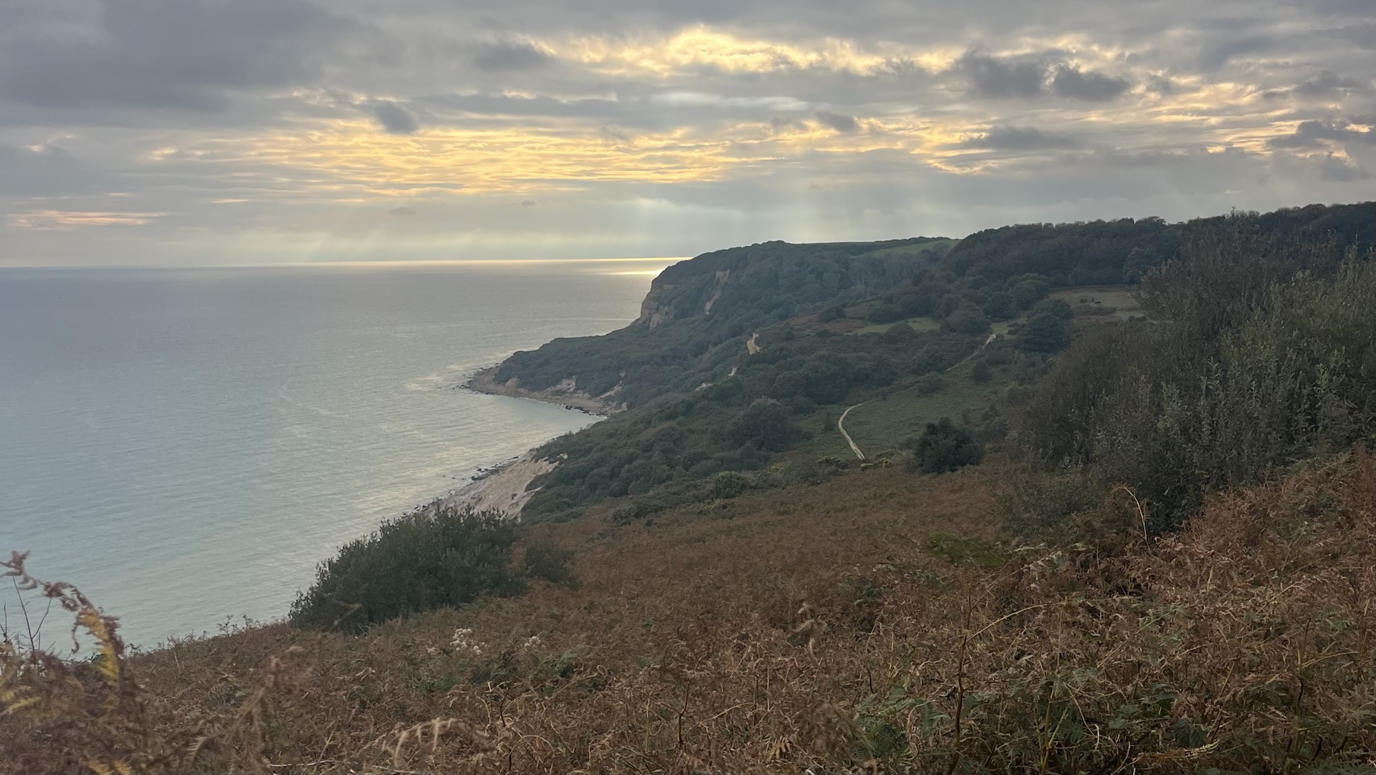
Deal comes into view, awake but quiet. I sail through and then drop down onto a beach, catching my first glimpse of the area’s famous white cliffs. A flight of stairs brings me through a thicket of trees onto the clifftop and along a path of rolling ups and downs. Wind whooshes through the long grass and seabirds play in the updrafts. Down to another beach, then back up the cliffs again, I take a break to reenergise with a soft drink at South Foreland Lighthouse while families launch kites into the sky.
After that, the path fills with people and the Dover cliffs fly by as I do my best to dodge traffic jams. The trail takes me briefly into the city, along the foreshore beside the highway of traffic departing the ferry docks. A steep set of stairs greets me on the other end of town, and as I make it to the top the drizzle begins, forcing me to pull out my rain poncho. Naturally, as soon as I’ve pulled it on the rain stops. I remove it quickly; it’s too hot, and no doubt I look quite strange.
The sun reappears, highlighting the cliffs, grass and sky in a stunning contrast. By the time I glimpse Folkestone’s outskirts the sun is slipping low in the sky, casting long shadows across forest and ocean. I initially miss the turnoff to my campsite, then double back and tackle a steep and slippery descent. I arrive just as the sky blushes pink and the cliffs glow in the sunset, a tranquil end to the most beautiful day on trail.
Day 7 – 27 July 2025: Folkestone to Hamstreet
Distance: 51.68 km (recorded; but I think it was more like ~45km) | Elevation gain: 743 m | Moving time: 7h 33m | Average pace: 10:07/km | Average speed: 6km/hr
Cliffs & castles

Although I have another massive day ahead, I linger at the campsite. WiFi and coffee; self-explanatory. I soon muster up the drive to return back up to the cliffs, setting off into yet another grey morning. The hills here look like cartoons: perfect little bumps rising from the fields. Green fields stretch endlessly, and the trail seems to follow the line of an old fortification; the evidence is more observable on my map than on the ground. I cross paths several times with a bikepacker. He checks in with me for directions, his phone out of juice. I’m glad that my legs seem to be able to keep up with the pace of a bike.
By late morning, a pale sun appears. I traverse a military training zone with ominous warnings about straying from the path, and stop at the top of a hill for a brief refuel. As I set off again, I realise I’ve already reached Etchinghill. The path to Hamstreet sends me through forest and then field, which all seem to pass in a blink.
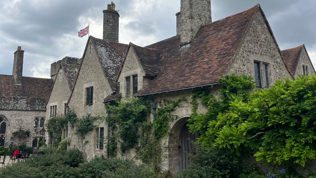
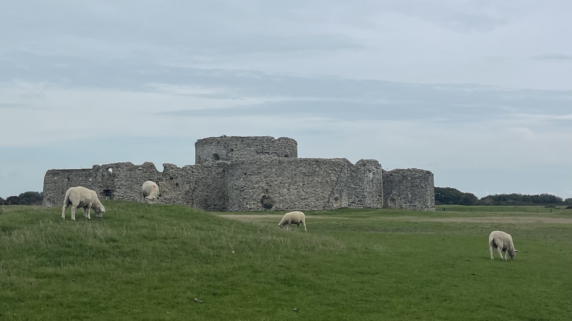
At Lympne, a fair is underway and I’m tempted to stop in; but then I come across the castle and I snag a table there, instead. After a light lunch, I continue; I marvel at the flat countryside that unfolds, and suddenly it’s no wonder that there’s a castle here.
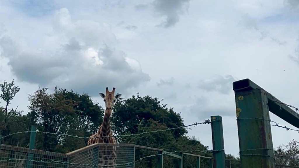
Past a zoological park, I get some news from Australia that makes me want to end the day ASAP. But there are no buses on Sunday, so I must walk to Hamstreet nevertheless. I give up on the trail, and opt for the road which gives me a faster pace.
Day 8 – 28 September 2025: Hamstreet to Hastings
Distance: 42.82 km | Elevation gain: 683 m | Moving time: 8h 42m | Average pace: 12:11/km | Average speed: 4.92km/hr
Stubble & sunset
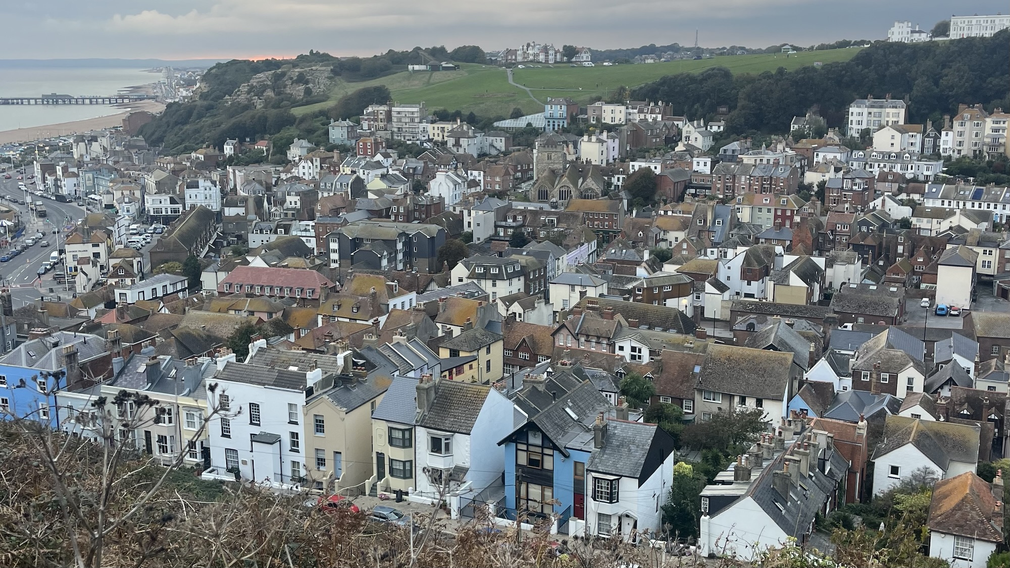
This last stretch of the Saxon Shore Way has been hanging over me, as life has gotten in the way. I set off from Hamstreet station into late summer fields; the wheat has been harvested now, leaving only stubble, and sheep eye me suspiciously as I pass.
As I wind through a vineyard, followed by a picturesque village, I chat on the phone to a friend from home. Just outside Rye, a closed footpath forces a detour, but I am informed by a brusque sign that my chosen detour is not a public footpath. Road walking it is.
I make my way quickly through Rye; the trail is familiar ground now, as I’ve walked this last section before. At first, the familiarity is nice: I can check my map less frequently and go off memory. But soon this final stretch starts to seem interminable. I get off track around the Nature Reserve, on autopilot following anther walking group who, it turns out, are not doing the same trail. I start to chide myself for the silly error, and then figure that the bonus kilometres are enough of a punishment already.
Hastings remains stubbornly out of sight as I trample up and down steep stairs that I had hoped my memory was exaggerating. The sun drops low in the sky, directly in my eyes, and for once I’m grateful for the clouds that roll in to temper its strength. The trail feels interminably long, but it’s one of the most gorgeous sections so perhaps it’s my fault for lingering at photo stops.
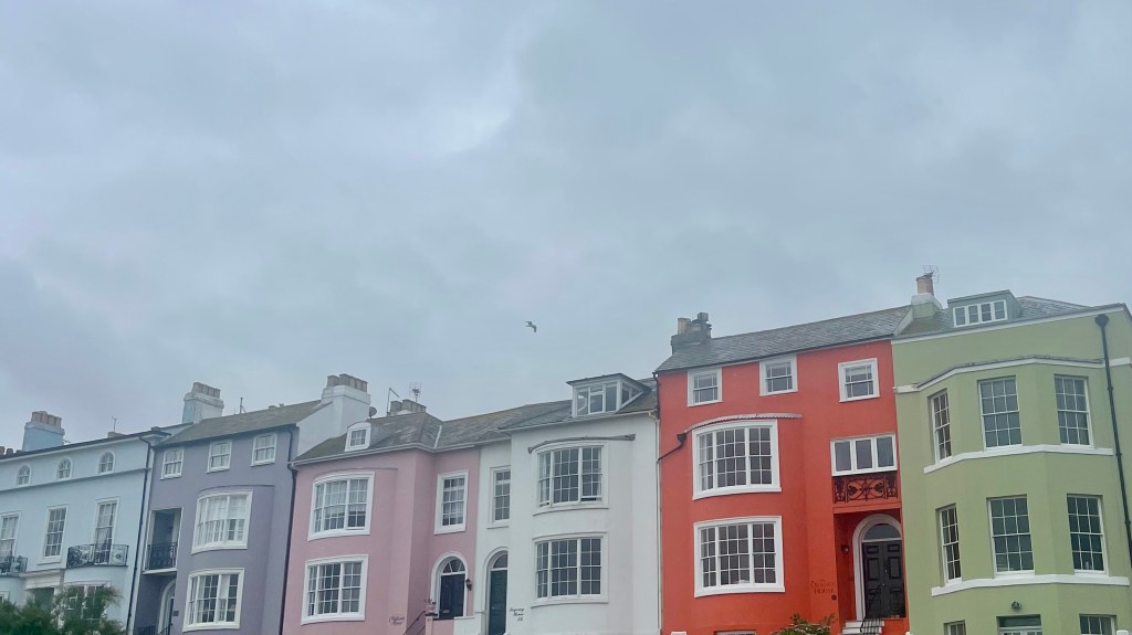
Finally, glimpses of the town appear as a bright slash of pink sunset blazes through the cloud cocer. I hustle down and then up through town, towards Hastings Castle and the official end of the trail. It’s closed, but I suppose that’s not surprising at 6pm on a Sunday. I dash towards the station, but miss the train by a hair. No matter, I take myself back into town for a giant pizza and a large coke to celebrate the end of trail.
Want More?
Curious about the practical side of the trail? Check out my Saxon Shore Way: How-To post for route info and planning tips.

Leave a comment