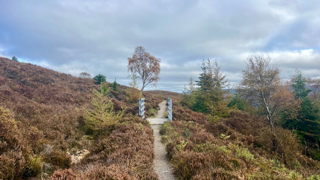
Ancient fault lines, Highland history and engineering ingenuity: the Great Glen Way is a 120 km Scottish Great Trail catering to almost every interest. It follows the Great Glen, a natural corridor dividing Highlands and Lowlands, long used by clans, traders and armies. Castles and fortifications mark its contested borderland past, while the Caledonian Canal and traces of an old railway hint at its 19th‑century importance as a vital transport route.
I thru-hiked the trail in October 2025. All information on this page was current at that time.
More interested in an on-the-ground report? Head over to my Great Glen Way: Trail Journal for stats, snaps and stories from my time on the trail.
- Trail Overview
- Logistics
- Accommodation
- Possible Stages
- Gear List
- On-Trail Practicalities
- Side Missions & Connecting Trails
- Hiking as a Solo Woman
- Want More?
Trail Overview
Quick Facts
| Distance | 120 km |
| Elevation gain | 2,200 m (high route) |
| Days to complete | 5-7 |
| Best season | May to September |
| Trailheads | Fort William, Inverness |
| Recommended direction | NOBO |
Map & Elevation Profile
Logistics
Trailheads & Getting There
The trailheads are located in Fort William in the south and Inverness in the north. Both are stops on the Caledonian Sleeper Train. Otherwise, other rail connections are also available: Inverness offers easy access to Aberdeen, Edinburgh and London; while Fort William connects to Glasgow, and from there to most major cities in the UK. Bus connections to major cities are also on offer from companies like CityLink Scotland, Flixbus and Megabus.
Direction to Walk
The trail can be walked in either direction; however Fort William also happens to be an outdoor adventure hub and the end of the West Highland Way – those interested in undertaking a longer challenge may wish to spend some more time in the town, or connect the two trails.
Season to Walk
The main hiking season runs from May to September, where hikers can take advantage of longer days and mild weather to enjoy the best of the trail and Scottish hospitality. A potential downside is the prevalence of the Scottish midge during these warmer months.
Shoulder and off-seasons are good options for those looking to avoid an overcrowded trail, although services and facilities along the trail may be limited as many close for the off-season. Daylight is also very limited, meaning less time for enjoying daylight views and more time walking under a headlamp.
Accommodation
Beds & bunks
Hotels, B&Bs, pubs and hostels are frequent along the route, and many cater specifically to hikers. They tend to book out early, so plan ahead especially if walking during the main hiking season. Note that many accomodation providers will shut or offer reduced services during the shoulder and off seasons.
Camping
Wild camping is permitted everywhere in Scotland, but make sure to adhere to the Scottish Outdoor Access Code and Leave No Trace principles. I stayed in accommodation on this trail, but remember spotting some great campsites along Loch Lochy and the forested ascent along the high route from Fort Augustus.
Paid camping is available at most stage ends, including Fort William (Glen Nevis Caravan & Camping Park), Gairlochy (Gairlochy Holiday Park), Invermoriston (Inver Coille Camping & Glamping), Drumnadrochit (Loch Ness Bay Camping), Inverness (Bught Caravan Park & Campsite).
Possible Stages
This table shows the distances when travelling along the high route alternatives, which were added to the trail following feedback from hikers, to introduce scenic diversions along the rugged mountaintops that line the Glen. The alternatives are available between Fort Augustus and Invermoriston, Invermoriston and Drumnadrochit, and Drumnadrochit and Inverness – all add only 1 or 2 kilometres onto the traditional stages and are well worth the additional mileage and elevation gain.
| Place | Distance from previous (km) (NOBO) | Distance from previous (km) (SOBO) |
|---|---|---|
| Fort William | 0 | 17 |
| Gairlochy | 17 | 20.7 |
| Laggan | 20.7 | 17 (from Fort Augustus) 9 (from Invergarry) |
| Invergarry* | 9 | 12 |
| Fort Augustus | 17 (from Laggan) 12 (from Invergarry) | 12 |
| Invermoriston | 12 | 6.9 |
| Altsigh* | 6.9 | 16.1 |
| Drumnadrochit | 16.1 | 12.5 |
| Abriachan* | 12.5 | 19 |
| Inverness | 19 | 0 |
* These villages require a short detour off trail. In the case of Invergarry, you’ll be following the northern bank of Loch Oich instead of the southern bank where the official trail lies.
Looking for realistic daily stages to help with planning? My Great Glen Way: Trail Journal post breaks down my hike by daily distance, elevation gain, moving time and average pace.
Gear List
I stayed in hostels, which meant I could travel light:
- 25L backpack (smaller would also work)
- 2x merino shirt and athletic leggings (1 set for hiking; 1 for travel/evening wear)
- 3x socks and underwear
- PJs
- Fleece, puffer jacket and rain jacket (I used all three for warmth in mid-October)
- Sunglasses, hat, buff
- Trail runners
- Lightweight towel (needed for hostels; or you could pay to rent one)
- Electronics
- Toiletries & first aid
- 1L water bottle, assorted snacks
This is absolutely everything I needed: if you’re staying in accommodation you don’t need more. Some trekking poles probably would have helped with my knee pain (a lingering overuse injury), but I did manage the trail without them. If you’re planning on camping, you’ll need to add at least a tent (obviously!), sleep system and cooking system.
I was hiking in autumn, so remember to adapt for warmth if hiking later in the season, or if heading out in the warmer months bring cooler clothes (and perhaps a set of “town clothes”), more water capacity, and midge defences.
On-Trail Practicalities
Finding Your Way
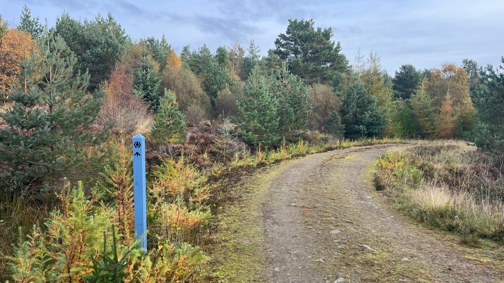
Trail Markings
The Great Trails Thistle, which usually appears on light blue wooden poles. The trail and its current diversions are exceptionally well marked on the ground; I don’t think I ever had to refer to my GPX file to check the correct path.
Maps & GPX
I downloaded a GPX file of the trail, available from Walk Highlands. There were some slight discrepancies between the file and what’s on the ground, but the on the ground marking was so good it didn’t matter.
Guidebooks and Resources
I didn’t use a guide for this trail, and felt no need for one. The trail is extremely well maintained, and even offers information boards in many sections. A brief overview of some of the main stages are available via the Highland Council.
Food & Water
Most villages on trail offer pubs and cafes – some notable exceptions being Gairlochy and Laggan (although accommodations may provide guest meals). The Great Glen Hostel at Laggan had a range of small conveniences behind the reception desk if you’re in a pinch. Supermarkets or small grocery stores are available in Fort William, Fort Augustus, Drumnadrochit and Inverness.
You’ll be able to fill your water bottle in most villages along the way, even if just passing through and not staying the night. Otherwise, the trail follows the Caledonian Canal and the banks of three lochs for most of the way; this water must be treated before drinking.
On-Trail Transport
Trains are only available in Fort William and Inverness. However, limited bus services connect many of the villages along the trail. Services are infrequent, so plan ahead.
Money Matters
I had no need for cash on this trail, card was accepted everywhere. For a breakdown of what I spent on trail, see my Great Glen Way: Trail Journal.
Side Missions & Connecting Trails
There are a couple of worthy side missions along the trail, the best of which is a summit of Ben Nevis, the tallest mountain in Scotland and the UK, accessible from Fort William. There are many scenic and historical detours and alternatives from the trail itself, including the high routes, Urquhart Castle (from Drumnadrochit), Fort Augustus Abbey, and the Clan Cameron Museum (between Gairlochy and Laggan). Hikers could also consider taking the South Loch Ness Trail, along the east bank of Loch Ness (instead of the west bank taken by the Great Glen Way).
For those interested in extending their trip, the West Highland Way has trailheads in Fort William and Milngavie (check out my WHW Trail Journal and How-To).
Hiking as a Solo Woman
I had no concerns hiking this trail as a solo woman. It’s exceptionally well maintained, and runs through several villages and larger towns. There were plenty of day hikers around these hubs, and I came across a few thru-hikers, although not many. Mobile phone reception is excellent along pretty much the entire trail.
Want More?
Check out my Great Glen Way: Trail Journal post for stats, stories and snapshots from the trail.

Leave a reply to Great Glen Way: Trail Journal – Amelia vdRijt Cancel reply