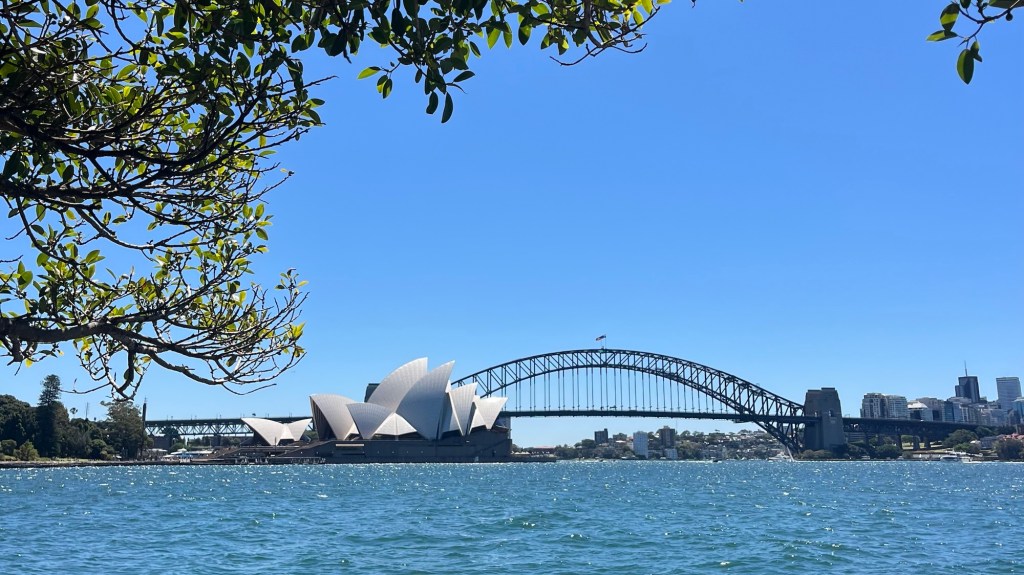
The relatively new (opened in 2019) Bondi to Manly Walk links two of Australia’s most iconic beaches via 80km of clifftops, coves, bushland and points of cultural and historical interest. It’s an approachable urban long-distance route with consistently spectacular views of sea and city.
I section-hiked the trail in November 2025. All information on this page and in my Trail Journal was current at that time. For a closer look at the on-the-ground experience, head over to my Bondi to Manly Walk: Trail Journal post for my stats, photos and gear list.
- Quick Facts
- Map & Elevation Profile
- Preparation
- On-Trail Practicalities
- Side Missions & Connecting Trails
- Hiking as a Solo Woman
- Want More?
Quick Facts
| Distance | 80 km |
| Elevation gain & loss | + 1,950 m / – 1,670 (NOBO) |
| Days to complete | 2-8 |
| Best season | Autumn (March-May); Spring (September – November) |
| Trailheads | Bondi Beach; Manly Beach |
| Recommended direction | NOBO |
Map & Elevation Profile
Preparation
Trailheads & getting there
The entire walk lies within Sydney, so reaching either terminus is simple:
- South – Bondi Beach: regular buses.
- North – Manly Beach: ferry or bus.
Use Google Maps or Transport NSW’s Trip Planner.
Direction to Walk
You can walk the route in either direction; the views are excellent both ways.
Going NOBO adds a bit of novelty: finishing at Manly means you have the opportunity to enjoy a ferry ride back to the CBD.
I also recommend walking NOBO because the northern half of the trail has more shade and dirt track and less exposure to the sun and pavement, which is kinder on the body. It seems that NOBO also results in slightly less elevation gain than SOBO.
Season to Walk
This is a year-round trail. Summer days can be extremely hot, so plan shorter stages and start early. Winter is cool, but a comfortable walking temperature.
Accommodation
Beds & Bunks
Accommodation is plentiful: hostels, hotels and AirB&Bs are dotted along the entire route. You can thru-hike with your gear, but unless you’re specifically seeking a thru-hike experience there’s no real advantage to carrying a full pack. Instead, why not base yourself somewhere central (I’d recommend around the CBD / North Sydney) and commute to/from sections each day.
Camping
Camping is not permitted along the trail, and commercial campsites aren’t readily available in the urban areas the trail traverses. You’ll need to arrange accommodation to complete this route.
Gear List
I like to travel as light as possible, so for a section hike in early November I took:
- Running vest
- 100mL sunscreen
- Lip balm
- Snacks (add lunch if you don’t want to buy it)
- 1L water capacity
- Headphones
- Power bank
I wore a UPF 50 shirt, shorts, cap and road running shoes. Road running shoes are good for the pavement pounding you’ll be doing; on the north side of the trail you may find trail runners more comfortable. Take extra layers in cooler seasons.
Possible Stages
As an urban walk, this is a choose-your-own-adventure. Stop and start wherever and whenever you like. For inspiration, the Bondi to Manly Walk website and app offer suggested 2-8 day itineraries; or you can simply walk until you’re tired and then find the nearest bus stop.
On-Trail Practicalities
Finding Your Way
Trail Markings
Look for the black and yellow Aboriginal whale symbol. Signage style and frequency seems to vary by local council area, isn’t fully reliable, and is easy to miss amongst all the spectacular views: use an app or map if you want to stay strictly on the official route. I encountered one diversion, which was clearly marked and easy to follow.
Maps & GPX
The free Bondi to Manly Walk app is a goldmine: it includes navigation, points of interest and accompanying notes, public bathrooms, water fountains, and more. Downsides: it seems to be quite battery-hungry, and the trail line sits directly over your blue dot, so it can be hard to spot where you are. But once you get used to this quirk, it’s a great tool.
You can also download and print paper maps from the official website.
Guidebooks & Resources
Physical guidebooks can be purchased from the Bondi to Manly Walk website. But the app provides everything you need.
Food & Water
This is an urban walk: cafes, shops and water fountains are everywhere. You’ll have to find your own way to cafes and shops; but water fountains are marked on the app.
On-Trail Transport
Public transport is never far away. At most, a 10-15 minute walk to a bus stop may be required – use Google Maps or Trip Planner.
Money Matters
Card and cash are both accepted everywhere.
Leaderboard
If you complete the entire trail in one go (or have the incredible stamina required to yo-yo it), you can submit your Strava record to the Bondi to Manly Walk website to be added to the all-time leaderboard.
Side Missions & Connecting Trails
The app is packed with points of interest, many of which are worth spending extra time exploring.
Sydney also has a huge network of coastal tracks, so if you want to extend your walk the options are endless. For a seriously big challenge, check out the Sydney Harbour & Coast Walk, a 1,290 km trail network put together by The Walking Volunteers.
Hiking as a Solo Woman
This is one of the safest trails I’ve ever completed: it avoids sketchy areas, passes through some of Sydney’s wealthiest suburbs, has excellent mobile coverage and is heavily used by locals. Public transport makes it easy to bail out at any point. It’s a great first solo long-distance trail.
Want More?
Check out my Bondi to Manly Walk: Trail Journal for stats, stories and snapshots from the trail.

Leave a reply to Bondi to Manly Walk: Trail Journal – Amelia vdRijt Cancel reply