This post originally appeared on The Trek. Read it here!
Day 29 – 12 June 2026: Hiker Clown Car, Limo Edition
📍 Mile 534.9 | 🥾 39.35 km | ⛰️ +1,369m / -1,098m
With only 6 miles to Hikertown it was tempting to sleep in; but the threat of another hot day was good motivation to get going sooner than later. Even so, the trail nearly killed me. There was way too much uphill considering I was already basically down on the desert flats.
But I finally crashed down into Hikertown, which is kind of famous for being a bit sketchy. In the bright light of day, though, I thought it was fine. I chatted easily with the three other hikers there until, to our collective surprise, a limo pulled up and out popped a bunch of other hikers who had arrived earlier this morning and had already been down to Neemach Market. They joined our chat, as did a handful of other hikers who wandered in as the day progressed.
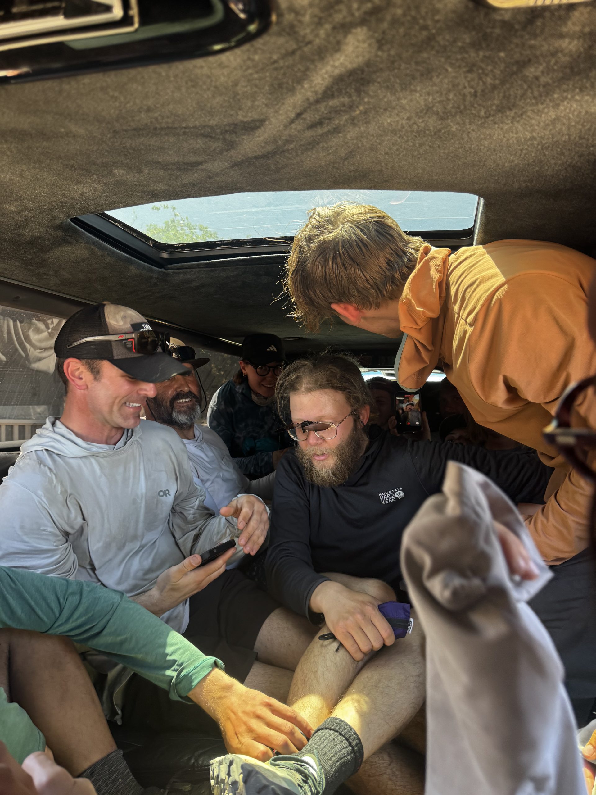
Late morning, the limo was ready to ferry us all down to the market once again. We somehow squeezed 16 hikers into an 8 person vehicle. It was stifling hot, and sweat was soon rolling down all faces. Resupply at the market was impossible: I couldn’t even get a bag of candy. As a consolation prize I bought myself a burger and coke, before jumping back in the limo and doing some much needed bucket laundry back at Hikertown.
The mercury hit 37 Celsius (99 Fahrenheit) and stayed there for the better part of the afternoon and early evening. People started to head out from around 7pm; I set off at 7.30. The sun was well on its way to setting and the air did feel a lot cooler without the sun directly beating down on me.
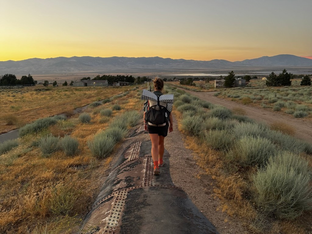
After a little road walking I made it to The Aqueduct itself, a prominent pipe in the ground, which you can walk on. I thought the rounded camber would be the hardest part about walking it; instead, it was the rows of spikes, every single one of which I could feel through my minimalist Altra Lone Peaks. Still, the views from the pipe were better than those from the neighbouring road, so I persisted.
My first few miles were under a sunset that faded from golden pink to indigo, stars slowly beginning to wink. There was no moon, which was disappointing; its illumination would’ve been very welcome. Instead I had to make do with my headlamp. I walked for two hours without headphones but then I had to dig them out. I chose an upbeat playlist to keep my pace high; my energy was already fading and I wasn’t even halfway to the first place I’d consider stopping: the faucet 17 miles from Hikertown.
About an hour after that I caught up with a couple of hikers taking a break where there was meant to be a trail sign. None of us could find it, though. I continued on, but something compelled me to check FarOut. And thank god I did; turns out I was off trail and should’ve taken a right where the trail sign was meant to be. I doubled back, furious about the bonus distance even though it was less than a mile.
The last hour was tough. The trail started going uphill on incredibly sandy terrain that ruined my pace and flow. I was tired and growing cranky. But I was extra appreciative when the trail levelled out and became less sandy. Soon I was at the faucet, where I quickly filled up and then picked a campsite beneath the wind turbines. They were loud, but it was almost 2am and nothing could stop me from falling asleep as soon as I was horizontal.
Day 30 – 13 June 2026: Best. Siesta. Ever.
📍 Mile 549.0 | 🥾 23.05 km | ⛰️ +1,309m / -387m
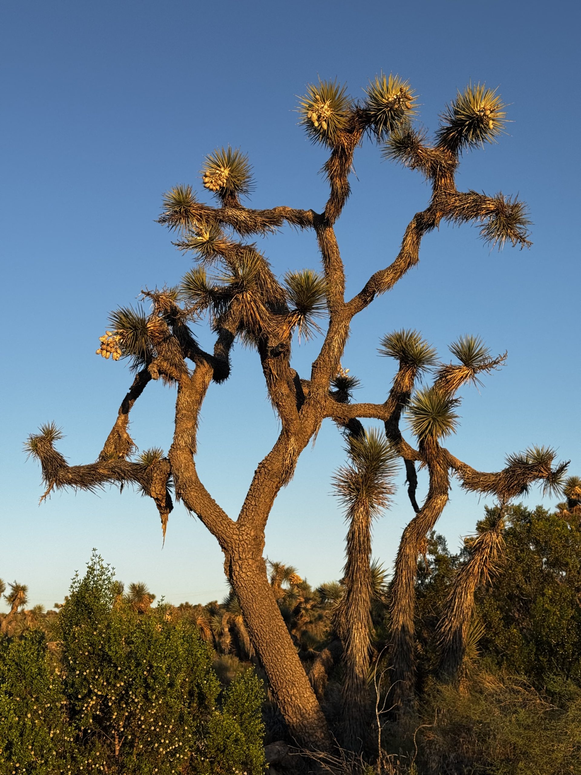
My alarm went off at 5am. I snoozed it a few times but knew it was important to get up and move in order to beat the heat. I made a double serve of coffee and was on my way. The first little but of trail was flat and I ate breakfast as I walked. It was a gorgeous morning, bright peach, rose, gold and blue as the sun rose, illuminating the white wind turbines and green spikes of Joshua trees.
Despite the coffee, my brain never really came online. I was walking in a daze. My goal was to make it to the next water source, and ideally the water source after that before I siestaed. But when the incline started and I was dropping in sweat at 8am, I decided to stop for siesta at the first source.
9am to 4pm. That’s how long I siestaed. I fully fell asleep on my ⅛ inch mat in the shade of a tree by a creek. I was exhausted. I honestly didn’t want to leave at 4pm, but I didn’t have enough food to camp at the creek. Onwards it was.
I was still in a daze as I set off. The trail was uphill and it felt like hard work, but there was a light breeze keeping me cool at least. Then the shadows grew long as the sun set and the temperature was more pleasant. I arrived at the water cache around 8pm, where other dazed-looking hikers were preparing dinner. I chatted to them briefly before quickly pitching my tent, downing dinner and hitting the sack.
Day 31 – 14 June 2026: Feeling Steppy
📍 Mile 563.2 | 🥾 23.57 km | ⛰️ +552m / -991m
I slept a solid eight hours, despite my massive siesta yesterday. The 10 miles of hiking to the road were thankfully mostly downhill and passed quickly. When I came across other hikers all our chat was about how we had – or hadn’t – survived The Aqueduct, and what we were most looking forward to in town.
I ran into Analog, who had made the same mistake as I had and continued straight instead of turning right. Except without a phone to check FarOut, he’d had to set up camp and wait until morning to figure out where he was and how to get back to trail. We decided to team up to HERO – hike in, eat, resupply and out – Tehachapi.
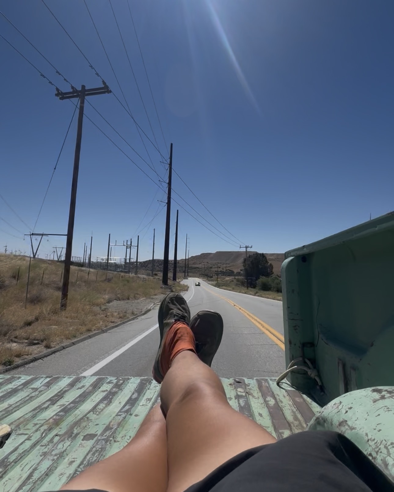
It took us a little while to get a hitch, but when we did it was in the back of an old pickup truck that didn’t have a tray door. We clung to the sides, hoping not to slide out as the truck picked up speed. When another car turned a corner and started driving behind us the driver laughed, which made us laugh and wave. She waved back.
We were dropped at Burger Broz, where we wasted no time heading inside for breakfast. Then we headed across the road to Walmart for resupply. It was overwhelming. But I made it through and sat outside with Analog and another Aussie hiker we’d run into in store as we repacked our resupply.
A trail angel arrived to help us out with showers and laundry before we got back on trail. It was incredible to be clean, and even more incredible to be loved on by his gorgeous, very pregnant, Australian shepherd. When we were done, he drove us back to trail and refused all offers of payment. A true angel.
We hiked back to the water cache before the highway. It was only 6pm but the next water source was 8 miles away, and camping near it was impossible; we’d have to go further. But after sitting for all of 10 minutes we both got a bit restless; “feeling steppy”, as Analog put it. I scoured the FarOut comments and found some potential campsites 5 miles ahead. Perfect. We set off into the afternoon heat.
When we arrived at the campsites, we discovered that the only good spot was already occupied. But after a few minutes hunting around we found a couple of suitably flat spots where we could cowboy. That’d do just fine.
Day 32 – 15 June 2026: Camel Up
📍 Mile 591.2 | 🥾 44.98 km | ⛰️ +1,518m / -1,413m
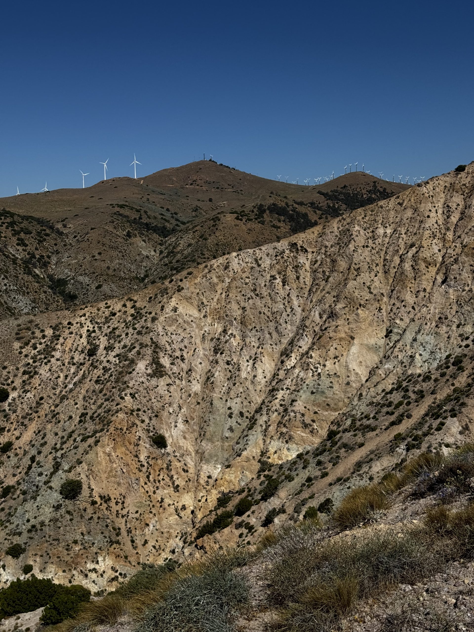
3 miles of downhill walking to the water cache was a nice, easy introduction to the day. I made it across a set of train tracks mere seconds before the boom gate started to lower and a train flew past. It was a long one, I was glad it wouldn’t hold me up.
At the water cache I gave Analog the details on the next water sources. I don’t like dry camping in the desert, but the next water source was only 17 miles away – at this stage, that’s a short day. And Analog and I had set ourselves the challenge of reaching Kennedy Meadows South, the end of the desert, in 5 days and without resupplying in Ridgecrest. Big days were necessary, but water carries in this section were long. To add to the challenge, we were walking into a heat wave.
It didn’t take long for the day to warm up, but luckily there was a good breeze to help keep me cool. And as I climbed higher the temperature did seem to drop a little. Suddenly the landscape began to shift; boulders appeared, and not long after that the hills turned red and rocky. It reminded me a lot of the Red Hills area in the Richmond Ranges on Te Araroa.
Once the elevation gain was out of the way the trail wound pleasantly along a contour line, dipping in and out of the hills, until I arrived at Golden Oaks Spring. Analog and three other hikers were already there, all planning on dry camping the next stretch, which was a 20 mile water carry unless we wanted to go over a mile off trail to a spring. I resolved to challenge myself and try dry camping. I had an early dinner, camel-ed up on three litres of water, and headed out with another four litres in my pack.
When I’d looked at the elevation profile I’d thought it was trending downhill. But it didn’t feel like that. Maybe thanks to the weight of my pack with a close to full resupply and so much water. Bu early evening I could feel my pace dropping further and further. And I started to feel a bit of tenderness in my Achilles. Maybe thanks to my pack weight. It’s also probably time for some new shoes; these ones will have done 700 miles by the time I reach Kennedy Meadows.
I started hunting for campsites but there weren’t any. The trail was cut into the hillside. Finally, just as the sun was setting and its final rays streamed in bursts of pink through the purple outlines of the mountains, I spotted a campsite. I wanted to cowboy, but it was too windy. I pitched quickly, and fell asleep easily.
Day 33 – 16 June 2026: Dry Camping is THE WORST
📍 Mile 617.1 | 🥾 42.26 km | ⛰️ +1,402m / -1,411m
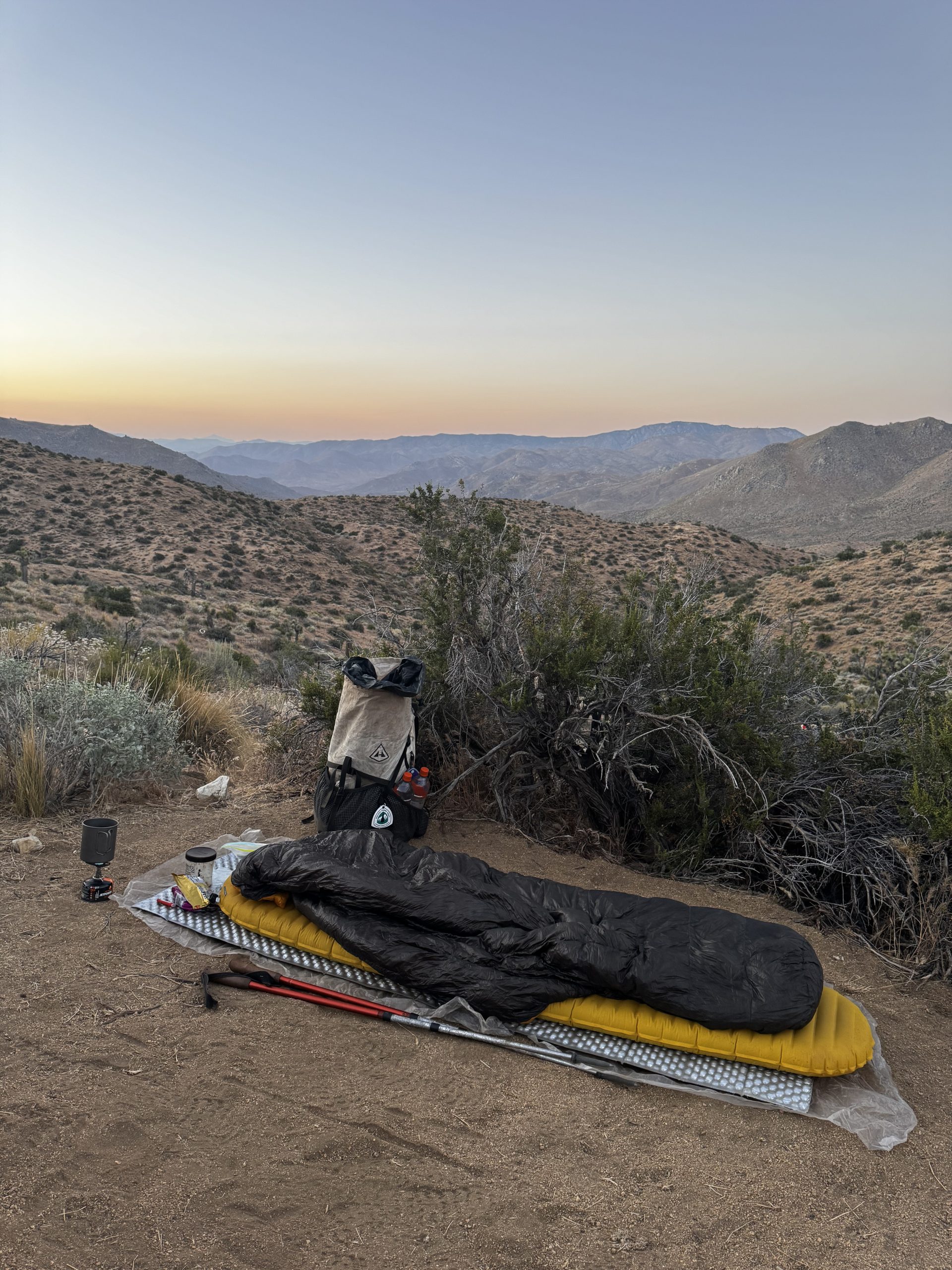
I didn’t sleep well, and was bleary eyed as I broke camp and began hiking. I’d accidentally bought caffeinated electrolytes in Tehachapi, but this turned out to be a good thing. This way, I could hydrate and come online at the same time, using less water.
After downing my first litre I started rationing the water. I had 13 miles to the next on-trail water source. It was hillier than I’d have liked. Unusually, for the PCT, there were a couple of sections where the trail just went straight uphill – normally it twists and turns and sends you along switchbacks. The grade of these straight sections wasn’t steep, but it still felt disproportionately hard.
My sole focus was on making it to the next water source. I paid almost no attention to the landscape. By the time I arrived at the final obstacle before the spring – a dirt road that presented me with a steep climb – I had only a few mouthfuls of water left and was feeling a tad dehydrated. The road took it almost entirely out of me, and when I finally reached the spring I forced a litre through my filter as quickly as I could and slammed it back easily. I didn’t really even have to pause for breath.
It was only 11.30 but I decided it was a good idea to stop for a break. There were more regular water sources in the next stretch but I was feeling tired. I laid out on my foam mat and managed to actually fall asleep. Normally I just relax at siesta.
When I headed out once again the trail undulated a little bit but then started to head downhill. And even better, there was shade! FarOut said I was in a section of Sequoia National Forest and I was ecstatic about it. It was lovely and calm and tranquil, and it felt like I had the place all to myself. Not to mention the trees smelled amazing.
I emerged from the forest into a boulder field which was just as captivating as the forest had been. I crossed a road and wound along the hillside for several miles, spotting a fox along the way. He kept a careful eye on me from a safe distance as I passed.
Arriving at the next water cache, I laughed aloud. There was SO MUCH water there. It was like a desert miracle. And there were also a couple of good campsites, which hadn’t been mentioned on FarOut. I was all too happy to call it a day there. Analog arrived soon afterwards and we ate dinner as the sun set, remarking on how remote this section of trail has felt compared to most of the rest of the desert. The only sounds were birds and the occasional plane. No wind turbines, no traffic, hardly any other hikers. It was a welcome change.
Day 34 – 17 June 2026: Cowboy Convert
📍 Mile 645.0 | 🥾 46.04 km | ⛰️ +1,677m / -1,166m
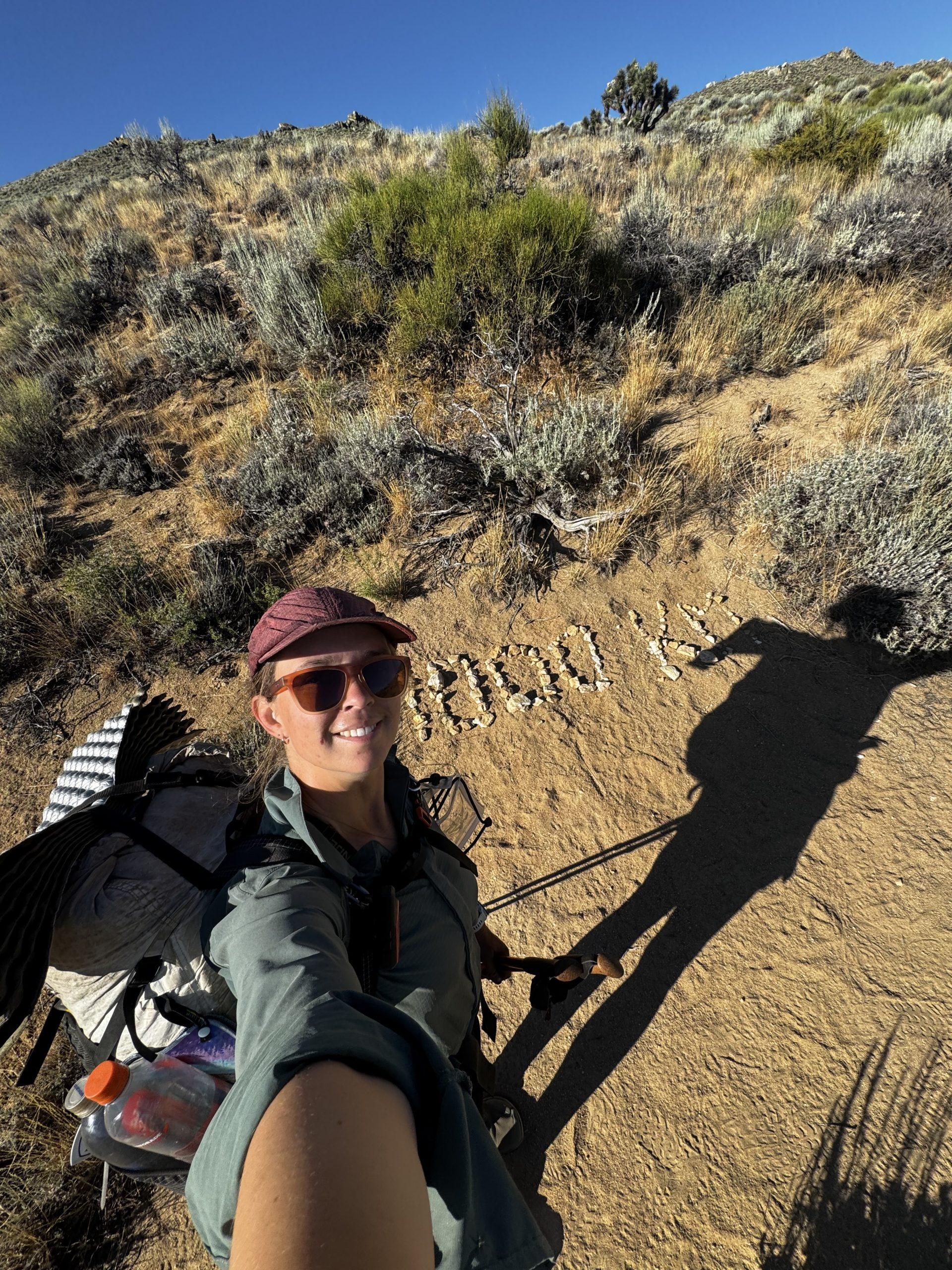
I’ve been enjoying cowboy camping so far because it makes breaking camp much quicker and easier. But last night I enjoyed cowboy camping for cowboy camping’s sake. I was entranced by the sky as it faded from tangerine to indigo and the twinkling stars emerged. I almost didn’t want to go to sleep.
It probably helped that there was no wind last night, but that wasn’t the case this morning. It was annoying, so it was easy enough to convince myself to get up and moving. The trail was entirely exposed to the sun so I was glad to be tackling it in the morning.
Analog and I leapfrogged each other all morning as we stopped for snack breaks, took advantage of the shade offered by Joshua trees, or admired the views. Together we crested a saddle and the views of the valley below opened up: today’s jaw dropping moment. Everything was purple and blue and pink, not the colours you ordinarily think of when you imagine the desert, but I loved it.
I caught a glimpse of the next bit of trail. Straight uphill. And when I got there it was even worse; the trail was super sandy, which made hiking efficiently difficult. The hill itself turned out to be fine but the extra resistance from the sand was frustrating. I chugged away at it and eventually reached the ridgeline, which again had fantastic views. Everything since Tehachapi has been a stunning section of trail. It already feels like a really nice finale to the desert.
There were some top tier shady trees at the next water cache, so after filling up my bottles I hid beneath one for siesta. And again fell asleep. Clearly the trail is starting to take its toll.
At 3pm I began the next section, which involved a decent climb totally exposed to the sun. I paused to sign a trail register and almost burned my hands on the hot metal box. Once again, the terrain didn’t lend itself to efficient hiking; but instead of sand it was millions of tiny pebbles. The climb was slow, and a false summit was frustrating. The true summit and a section of ridgeline made up for all the hard work, though.
Later, I found myself in a wooded area once again. It wasn’t as spectacular as Sequoia had been, but the shade was still welcome. By the time I arrived at a dirt road the worst heat of the day had passed and I was feeling energetic, motivated to make it to McIver’s Cabin and Spring.
When I arrived at the cabin, though, it was a little spooky. Totally deserted, all the doors and windows open. No one else around. I hadn’t seen a single person other than Analog today, actually, which was very unusual. The cabin was also a little off trail, so I decided to save myself the extra distance in the morning by hiking back to trail this evening, setting up camp in the first flat spot I found. As the sunset washed the sky in pink I could just make out the white match sticks of the windmills I’d hiked beneath just a couple of days ago.
Day 35 – 18 June 2026: Desert Nostalgia
📍 Mile 675.3 | 🥾 48.76 km | ⛰️ +1,747m / -1,656m
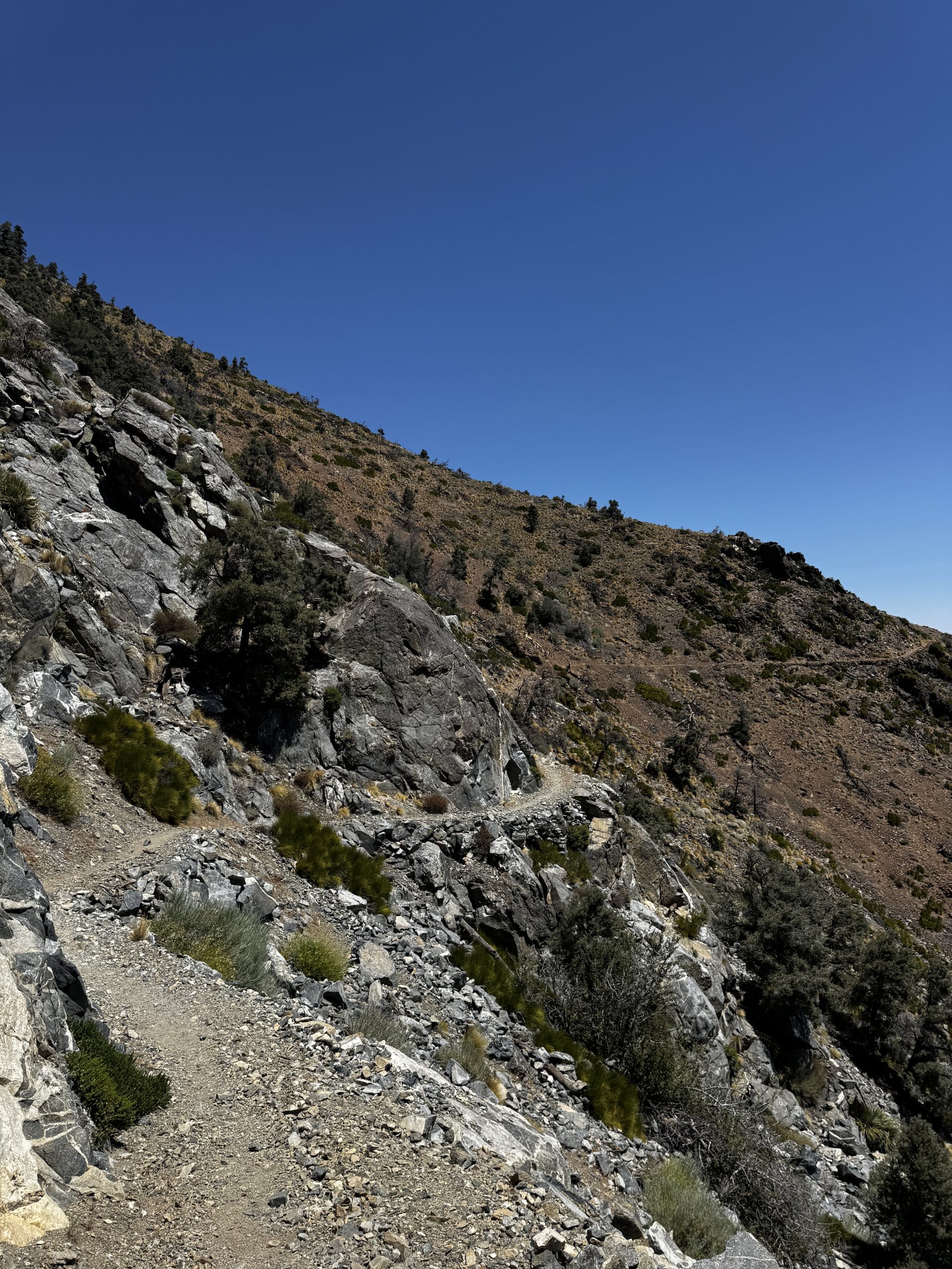
Between the wind and my pack falling on my feet – which I was too lazy to get up and move – I’d slept terribly. It was a slow start to the morning. The gently undulating terrain felt much tougher than it actually was; I was very pleased when it started winding down to the highway, and I could make quick work of it.
I filled my water bottles at the cache, crossed the highway, and began climbing uphill once again. It was a beautiful landscape of desert valley and mountains. But I was keen to escape the heat of the day, so I was hustling up the switchbacks as fast as I could. I spotted plenty of hikers ahead of me, a stark contrast to yesterday.
Once I arrived at the first ridge the walking became easier, the temperature was cooler and there was some good shade. The views were to the western hills, until the trail crossed to the eastern side and slowly a sweeping view of the desert opened up. It was glorious and something told me it was probably my last view of the desert. I turned a corner where the white stone of the Sierra contrasted dramatically with the red desert hills. I slowed my pace to savour it, and couldn’t help but get a little nostalgic. I’ve absolutely loved the desert, it’s been far more beautiful than I expected. I won’t miss the water carries, though.
I crossed back to the western side and began descending downhill. It grew warmer as I dropped in elevation and I started rationing water. But then I came upon an ice cold stream directly on trail that wasn’t marked on FarOut. It felt like a godsend. I filled up, dipped my hat in the water, and pressed on, uphill once again.
The climb wasn’t difficult, but the heat sapped all the energy from me. Unusually, there was no wind today, so I didn’t even have that relief. I’d decided to dry camp again tonight, so I could hopefully make it to Kennedy Meadows South before burgers stopped being served tomorrow. So at the last stream I took a long break to make dinner, fill up on water, and dip my hat once again. One last climb remained.
It was 6.30pm and the shadows were growing longer and the day was getting cooler, perfect conditions for a climb. Near the top there was a little bush bashing which made me slightly cranky, but I finally emerged on a ridge with a gorgeous view of the valley at sunset. Of course, although there’d been no wind all day, that particular spot was in the blast zone. The next campsites were in 2 more miles, which I just didn’t have in me. Fortunately, there were some trees that offered good protection from the brunt of the wind, and I managed to do a pretty excellent pitch of my Durston X-Mid, if I do say so myself.


Leave a Reply